Safety Score: 3,0 of 5.0 based on data from 9 authorites. Meaning we advice caution when travelling to Austria.
Travel warnings are updated daily. Source: Travel Warning Austria. Last Update: 2024-04-29 08:03:39
Delve into Angerwies
Angerwies in Politischer Bezirk Reutte (Tirol) is a city located in Austria about 270 mi (or 435 km) west of Vienna, the country's capital town.
Current time in Angerwies is now 01:30 PM (Monday). The local timezone is named Europe / Vienna with an UTC offset of 2 hours. We know of 13 airports closer to Angerwies, of which 5 are larger airports. The closest is airport we know is Memmingen Allgau Airport in Germany in a distance of 35 mi (or 57 km). The closest airport in Austria is Innsbruck Airport in a distance of 39 mi (or 57 km), North-West. Besides the airports, there are other travel options available (check left side).
There are several Unesco world heritage sites nearby. The closest heritage site is Pilgrimage Church of Wies in Germany at a distance of 16 mi (or 26 km). We saw 1 points of interest near this location. In need of a room? We compiled a list of available hotels close to the map centre further down the page.
Since you are here already, you might want to pay a visit to some of the following locations: Vils, Musau, Nesselwangle, Eisenberg and Hopferau. To further explore this place, just scroll down and browse the available info.
Local weather forecast
Todays Local Weather Conditions & Forecast: 18°C / 64 °F
| Morning Temperature | 5°C / 42 °F |
| Evening Temperature | 15°C / 59 °F |
| Night Temperature | 9°C / 48 °F |
| Chance of rainfall | 0% |
| Air Humidity | 42% |
| Air Pressure | 1018 hPa |
| Wind Speed | Gentle Breeze with 6 km/h (4 mph) from South |
| Cloud Conditions | Overcast clouds, covering 98% of sky |
| General Conditions | Overcast clouds |
Tuesday, 30th of April 2024
23°C (73 °F)
12°C (54 °F)
Sky is clear, light breeze, clear sky.
Wednesday, 1st of May 2024
22°C (71 °F)
11°C (51 °F)
Light rain, light breeze, broken clouds.
Thursday, 2nd of May 2024
11°C (51 °F)
5°C (41 °F)
Moderate rain, light breeze, overcast clouds.
Hotels and Places to Stay
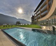
Der Laterndl Hof Romantik Resort & Spa
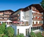
Gockelwirt Landhotel
Bergruh
Bavaria
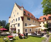
Schloß zu Hopferau
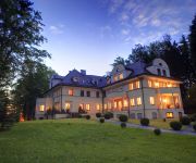
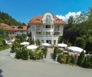
Villa Toscana
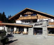
Almhotel Told
Parkhotel
Berger
Ruchti´s
Videos from this area
These are videos related to the place based on their proximity to this place.
Tannheimer Tal Schattwald webcam time lapse 2010-2011
http://www.wintersporters.nl - Bekijk hoe het seizoen 2010-2011 in Tannheimer Tal Schattwald is verlopen. Een prachtige webcam time lapse.
Tannheimer Tal Nesselwänge webcam time lapse 2010-2011
http://www.wintersporters.nl - Bekijk hoe het seizoen 2010-2011 in Tannheimer Tal Nesselwänge is verlopen. Een prachtige webcam time lapse.
Sony DSC HX20V HD 1080p (20x Zoom) Sample
Sony DSC HX20V Zoom Sample The sample was filmen in Germany (Pfronten Breitenberg).
MTB Downhill vom Breitenberg (Pfronten im Allgäu) GoPro HERO3
Mit dem Mountainbike bergab vom Breitenberg auf der Nordseite nach Pfronten. Die Abfahrt beginnt über dem Nebelmeer in der Sonne und führt dann weiter unten durch die "Nebelsuppe" sodass...
A - Vils/Tirol : Stadtpfarrkirche Maria Himmelfahrt Glocke 1
Es läutet die große Glocke "Susanna" der Stadtpfarrkirche von Vils im Tiroler Außerfern. Die Pfarrkirche von Vils in ihrer heutigen Gestalt wurde 1709-1714 nach Plänen des Füssener Architekte...
Krampusumzug der Galgâ Krampâmpalar Vils 2014
Krampus und Nikolausumzug der Galgâ Krampâlar Vils.Der Krampusumzug fand am 5.Dezember 2014 in Vils/Tirol (liegt an der Grenze zu Bayern) statt. Der Krampusumzug in Vils ist ein kleiner ...
Berghütte Salober Alm im Allgäu - Salober Alm mountain hut in the Allgäu
http://www.allgaeu-abc.de/allgaeu-sommer/berghuetten-almen-berggasthof/ Einen Tagesausflug zur Berghütte Salober Alm bei Füssen runden den Allgäu Urlaub für die ganze Familie ab. Die Kinderfreu...
Das schöne Ostallgäu mit Berge Seen und Schloss Neuschwanstein - The beautiful Ostallgäu
Entdecke das Leben erlebe das Ostallgäu: http://www.allgaeu-abc.de/region-allgaeu/ostallgaeu/ Der Streifen zeigt die vielen Facetten des schönsten Landkreises der Welt: Schlösser, Berge,...
Videos provided by Youtube are under the copyright of their owners.
Attractions and noteworthy things
Distances are based on the centre of the city/town and sightseeing location. This list contains brief abstracts about monuments, holiday activities, national parcs, museums, organisations and more from the area as well as interesting facts about the region itself. Where available, you'll find the corresponding homepage. Otherwise the related wikipedia article.
Weißensee (Füssen)
Weißensee (Füssen) is a lake in Allgäu, Bavaria, Germany. At an elevation of 787.3 m, its surface area is 134.65 ha.
Alatsee
Alatsee is a meromictic lake in Ostallgäu, Bavaria, Germany. At an elevation of 868.0 m, its surface area is 12.00 ha. This lake supposedly holds "Hitler's gold". Many divers have died or disappeared mysteriously in this lake due to the toxicity of the organisms living in this lake. These organisms create the "blood cloud " that occurs quite abundantly throughout the year.
Tannheim Mountains
The Tannheim Mountains are a sub-group of the Allgäu Alps in the Bavarian-Tyrolean border region. Their name is derived from the village of Tannheim in the Tannheim Valley in the Austrian state of Tyrol. The highest elevations in the Tannheim Mountains are the Kellenspitze (2,238 m) and Gimpel (2,176 m), that may easily be ascended from Nesselwängle in the Tannheim valley.


