Safety Score: 3,0 of 5.0 based on data from 9 authorites. Meaning we advice caution when travelling to Austria.
Travel warnings are updated daily. Source: Travel Warning Austria. Last Update: 2024-04-26 08:02:42
Explore Veiglberg Siedlung
The district Veiglberg Siedlung of Am Kronawett in Politischer Bezirk Korneuburg (Niederösterreich) is located in Austria a little north of Vienna, the country's capital.
If you need a place to sleep, we compiled a list of available hotels close to the map centre further down the page.
Depending on your travel schedule, you might want to pay a visit to some of the following locations: Hagenbrunn, Stetten, Enzersfeld, Bisamberg and Langenzersdorf. To further explore this place, just scroll down and browse the available info.
Local weather forecast
Todays Local Weather Conditions & Forecast: 15°C / 59 °F
| Morning Temperature | 3°C / 38 °F |
| Evening Temperature | 16°C / 60 °F |
| Night Temperature | 9°C / 48 °F |
| Chance of rainfall | 0% |
| Air Humidity | 43% |
| Air Pressure | 1011 hPa |
| Wind Speed | Moderate breeze with 9 km/h (6 mph) from North-West |
| Cloud Conditions | Scattered clouds, covering 37% of sky |
| General Conditions | Scattered clouds |
Saturday, 27th of April 2024
16°C (60 °F)
13°C (55 °F)
Sky is clear, moderate breeze, clear sky.
Sunday, 28th of April 2024
18°C (64 °F)
16°C (60 °F)
Overcast clouds, moderate breeze.
Monday, 29th of April 2024
21°C (69 °F)
17°C (63 °F)
Overcast clouds, moderate breeze.
Hotels and Places to Stay
Schrannenhof Hotel-Residenz
FourSide Hotel & Suites Vienna
Trenkerhof - Familie Dungl
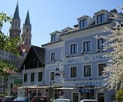
Hotel-Restaurant Schweinberger
Strebersdorferhof Essen Schlafen Leben
Stich
Anker
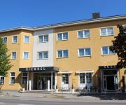
Hotel Michael
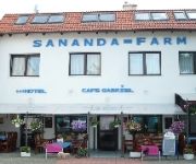
Sananda-Farm
Alte Mühle
Videos from this area
These are videos related to the place based on their proximity to this place.
Restaurant Palette Das Lokal in Bisamberg - Restaurant mit Live-Musik im Bezirk Korneuburg
In is, wer drin is!“ Das mit einem Augenzwinkern zu verstehende Motto des Bierlokals „Palette“ in Bismaberg im Bezrik Korneuburg sagt schon sehr viel über das urige Gasthaus aus....
Daytona Indoor Kart Langenzersdorf GoPro2 Stundenrennen 21.11.2013
Stundenrennen auf der Indoor Kartbahn in Langenerzsdorf. Aufgenommen mit einer GoPro2. Meine Toprunde von 53,99 Sek ist ab Minute 8:55 zu sehen.
VER RÜCKT Art Brut Ausstellung im Langenzersdorf Museum
TV21.AT DAS REGIONALE TV IM WEB Ein Jahr tourte die Ausstellung mit Werken der Gugging Künstler durch NÖ, ehe sie im sehenswerten Langenenzersdorf Museum, ihr Finale findet. Seit 1981 ...
Einfamilienhaus in Langenzersdorf - wahnsinns Gegend
Wohnen in Langenzersdorf bedeutet in einer 8000 Leute ziellebenden Stadt im niederösterreichischen Weinviertel entlang der Donau vor den Toren Wiens zu wohnen. Das Haus ist voll unterkellert,...
Dr. med. univ. Rudolf Blahout in Langenzersdorf, Niederösterreich
Zu Dr. med. univ. Rudolf Blahout aus Langenzersdorf finden Sie ein ausführliches Porträt unter http://firmenabc.at/dr-med-univ-rudolf-blahout_DdHk Wann haben Sie promoviert? Ich habe im...
2011-06 Abgebrannte Lagerhalle in Langenzersdorf
Kurzes Video über die abgebrannte Lagerhalle in Langenzersdorf nach dem Großbrand. Noch immer ist die Feuerwehr zur Brandwache mit 2 Mann vor Ort.
Sagenhafter Bisamberg 2013
"Sagenhafter Bisamberg" Bestes Wetter, super-gute Laune, 45 Kinder und Erwachsene waren der Einladung der Bisamberger Volkspartei gefolgt und am 31. Juli den "Sagenhaften Bisamberg" im ...
Finale vom Ottobock Powerchair Football Tournament Austria - Finland
Vom 30. Oktober 2014 bis 1. November 2014 in Österreich Wien 2:1 Für Österreich http://www.erollifussball.at/ergebnisse-beim-ottobock-turnier-2014/
Videos provided by Youtube are under the copyright of their owners.
Attractions and noteworthy things
Distances are based on the centre of the city/town and sightseeing location. This list contains brief abstracts about monuments, holiday activities, national parcs, museums, organisations and more from the area as well as interesting facts about the region itself. Where available, you'll find the corresponding homepage. Otherwise the related wikipedia article.
Sendeanlage Bisamberg
The Sendeanlage Bisamberg was an Austrian medium wave transmission facility built in 1933 and demolished on February 24, 2010. The original transmitter was destroyed at the end of World War II, but was later rebuilt. It had two guyed steel framework masts, one with a height of 265 metres and another with a height of 120 metres. Both masts were insulated against ground.
University of Veterinary Medicine Vienna
The University of Veterinary Medicine Vienna was founded in 1767 as the world's third school for veterinary medicine by Milan's Ludovico Scotti, originally named k. k. Pferde-Curen- und Operationsschule (literally, "Imperial-Royal School for the Cure and Surgery of Horses"). Today, it has c. 2,800 students and c. 600 employees.
First Vienna FC
First Vienna FC is an Austrian association football club based in the Döbling district of Vienna. Established on 22 August 1894, it is the country's oldest team and has played a notable role in the history of the game there. It is familiarly known to Austrians by the English name Vienna.
Floridsdorf
Floridsdorf is the 21st district of Vienna, Austria (German: 21. Bezirk, Floridsdorf). Floridsdorf is located in the northern part of Vienna. The District Office and the centre of Floridsdorf are located round Am Spitz, at the junction of Prager Straße and Brünner Straße. Since 2004, Floridsdorf has had its own tower: the Florido Tower. The SCN (Shopping Center Nord) is the biggest shopping centre in Floridsdorf. Parts of Floridsdorf were formerly villages.
Kahlenberg
Kahlenberg is a mountain located in the 19th District within Vienna, Austria.
Döbling
Döbling is the 19th District in the city of Vienna, Austria . It is located on the north end from the central districts, north of the districts Alsergrund and Währing. Döbling has some heavily populated urban areas with many residential buildings, and borders the Vienna Woods. It hosts some of the most expensive residential areas such as Grinzing, Sievering, Neustift am Walde and Kaasgraben and is also the site of a large number of Heurigen restaurants.
Karl Marx-Hof
Karl Marx-Hof is one of the best-known Gemeindebauten (English: municipal tenement complexes) in Vienna, situated in Heiligenstadt, a neighbourhood of the 19th district of Vienna, Döbling.
Church of Donaufeld
Saint Leopold's Church (German: Kirche zum Heiligen Leopold, "Donaufelder Kirche") is the Roman Catholic parish church of Donaufeld in Floridsdorf, the 21st district of Vienna, Austria. Located at Kinzerplatz, it stands at a height of 96 m (315 feet), which makes it the third tallest church in Vienna. Construction was completed in 1914. Earlier plans to use the church as a cathedral for a new diocese east of the Danube were abandoned when Floridsdorf was merged into Vienna in 1904.
Aida (café)
Aida (sometimes spelled Aïda, with a diaeresis) is a chain of 26 espresso bar and pastry shops in Vienna, Austria. They have a devoted clientele, for whom Aida has achieved near-cult status. Business hours are from early in the morning until the early evening; the shops are open every day of the year with the exception of Christmas Day. Ten Aida shops had been established before the Second World War, but they were all destroyed during the air raids on Vienna.
Kahlenberg Transmitter
The Kahlenberg Transmitter is a facility for FM- and TV on the Kahlenberg near Vienna. It was established in 1953 and used until 1956 an antenna on the observation tower Stefaniewarte. From 1956 to 1974 a 129 metre high guyed mast built of lattice steel was used. Since 1974 a 165 metre high guyed steel tube mast has been used, which is equipped with rooms of technical equipment.
Leopoldsberg
The Leopoldsberg (425 m, 1,394 ft) is perhaps Vienna’s most famous hill, towering over the Danube and the city. Leopoldberg’s most prominent landmark is the church which stands at the top, and which is clearly visible from Vienna below. The construction of Saint Leopold's Church on Leopoldsberg began in 1679; an expansion following a design by Antonio Beduzzi was undertaken from 1718 to 1730. Other renovations were to follow.
Wien-Umgebung District
Bezirk Wien-Umgebung is a district of the state of Lower Austria in Austria. The district comprises four non-contiguous districts on the outer fringes of Vienna: these are Klosterneuburg and Gerasdorf to the north of the city, Schwechat to its south-east and Purkersdorf on Vienna's western side. Vienna International Airport, the headquarters of Austrian Airlines, and the headquarters of Niki are in the city of Schwechat, in the district.
Hohe Warte Stadium
Hohe Warte Stadium is a multi-purpose stadium in Vienna, Austria. It is located on the Hohe Warte hill in Heiligenstadt, a northern suburb in the 19th Viennese district of Döbling. Primarily a football venue and the home of First Vienna FC, it has also occasionally played host to Austrian international rugby union matches and the Vienna Vikings American Football team.
MODUL University Vienna
MODUL University Vienna (MU Vienna) is a private university established in 2007 in Vienna, Austria, focusing on social and economic development, particularly in the areas of tourism, new media information technology, sustainability, business management, and public governance. The university consists of four departments which reflect the core competences, educational, and research focii of the university.
Lokomotivfabrik Floridsdorf
Lokomotivfabrik Floridsdorf (Floridsdorf locomotive factory) was an Austrian locomotive works founded on 6 September 1869 that achieved a pre-eminent place amongst European locomotive builders thanks to the quality and diversity of its designs. Common abbreviations for the company include Flor, WLF (Wiener Lokomotivfabrik Floridsdorf) and LOFAG (Lokomotivfabrik Floridsdorf AG).
Hohe Warte, Vienna
The Hohe Warte is a hill in the 19th district of the city of Vienna, Döbling between Heiligenstadt and Unterdöbling. There is also a street with the same name. In the 19th century, a number of villas were built on the Hohe Warte because it offered good views of the surrounding areas.
Kaasgrabenkirche
The Kaasgrabenkirche, also known as the Wallfahrtskirche “Mariä Schmerzen”, is a Roman Catholic parish and pilgrimage church in the suburb of Grinzing in the 19th district of Vienna, Döbling. The church has been managed since 1903 by the order of the Oblates of St. Francis de Sales and is equally the seat of the branch of the order covering Austria and Southern Germany. It has had the status of a parish church since 1939.
Schenkenberg, Vienna
The Schenkenberg is a hill in the 19th district of Vienna, Döbling. It is 345 metres tall.
Döbling Carmelite Nunnery
The Döbling Carmelite Monastery (Karmelitenkloster Döbling) is a monastery belonging to the Teresian Carmelites, a reformed branch of the Carmelites that arose out of the reform of the Carmelite Order by two Spanish saints, St. Teresa of Ávila and St. John of the Cross; the Teresian Carmelites thus belong to the Discalced Carmelites (Ordo Carmelitarum Discalceatorum). The monastery stands next to a Roman Catholic church in the suburb of Unterdöbling in the 19th district of Vienna, Döbling.
Schwimmtor
The Schwimmtor (Floating gate), also known as the Sperrschiff (Blocking ship), was a floating barrier designed to protect the areas along the Donaukanal in Vienna from flooding and ice. It was built by Wilhelm von Engerth, entered service on 13 December 1873, and was scrapped following World War II.
Nußdorf weir and lock
The Nußdorf weir and lock are works of hydraulic engineering located in the Viennese suburb of Nußdorf at the point where the Donaukanal leaves the Danube. The weir and lock were built following the adoption of a new law in July 1892, which also authorised the construction of the Wiener Stadtbahn and the transformation of the Donaukanal into a winter harbour.
Kahlenbergerdorf Parish Church
The Kahlenbergerdorf Parish Church (Kahlenbergerdorfer Pfarrkirche) is a Roman Catholic parish church in the suburb of Kahlenbergerdorf in the 19th district of Vienna, Döbling. It is dedicated to Saint George.
Heiligenstadt Parish Church St. Michael
The Heiligenstadt Parish Church St. Michael (Heiligenstädter Pfarrkirche St. Michael) is a Roman Catholic parish church in the suburb of Heiligenstadt in the 19th district of Vienna, Döbling. It is dedicated to the Archangel Michael.
Heiligenstadt St. James's Church
St. James’s Church, Heiligenstadt (Heiligenstädter Kirche St. Jakob) is one of two Roman Catholic churches in the parish of Heiligenstadt in the 19th district of Vienna, Döbling. It stands at the Pfarrplatz and is dedicated to James, son of Zebedee (Saint James). The church is sometimes wrongly called St. Jacob's. The confusion arises because German, like many other languages, uses the same word for both James and Jacob.
Heiligenstädter Friedhof
Heiligenstädter Friedhof is a cemetery in Döbling, the 19th district of Vienna, Austria. It is named after the Heiligenstadt neighbourhood of Döbling. The cemetery is among the oldest of the Austrian capital, with an ossuary existing at the site from approx. 1500 and the first walls around the yard being erected in 1831. It comprises an area of 20,315 square metres, with 2,655 grave sites.


