Safety Score: 2,7 of 5.0 based on data from 9 authorites. Meaning we advice caution when travelling to United States.
Travel warnings are updated daily. Source: Travel Warning United States. Last Update: 2024-05-17 08:07:57
Discover Brookside
The district Brookside of Mauldin in Greenville County (South Carolina) is a district in United States about 408 mi south-west of Washington DC, the country's capital city.
Looking for a place to stay? we compiled a list of available hotels close to the map centre further down the page.
When in this area, you might want to pay a visit to some of the following locations: Greenville, Laurens, Spartanburg, Pickens and Anderson. To further explore this place, just scroll down and browse the available info.
Local weather forecast
Todays Local Weather Conditions & Forecast: 20°C / 68 °F
| Morning Temperature | 17°C / 62 °F |
| Evening Temperature | 18°C / 64 °F |
| Night Temperature | 18°C / 64 °F |
| Chance of rainfall | 6% |
| Air Humidity | 87% |
| Air Pressure | 1013 hPa |
| Wind Speed | Light breeze with 4 km/h (2 mph) from South |
| Cloud Conditions | Overcast clouds, covering 100% of sky |
| General Conditions | Moderate rain |
Saturday, 18th of May 2024
26°C (79 °F)
19°C (66 °F)
Moderate rain, moderate breeze, overcast clouds.
Sunday, 19th of May 2024
20°C (69 °F)
16°C (61 °F)
Light rain, moderate breeze, overcast clouds.
Monday, 20th of May 2024
24°C (74 °F)
18°C (64 °F)
Scattered clouds, gentle breeze.
Hotels and Places to Stay
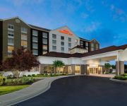
Embassy Suites by Hilton Greenville Golf Resort - Conf Ctr
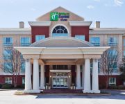
Holiday Inn Express & Suites GREENVILLE-I-85 & WOODRUFF RD
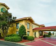
LA QUINTA INN GREENVILLE WOODRUFF RD
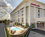
Hampton Inn Greenville-Simpsonville
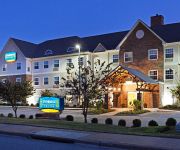
Staybridge Suites GREENVILLE I-85 WOODRUFF ROAD
Hampton Inn Greenville-Woodruff Road
Hilton Garden Inn Greenville
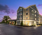
Homewood Suites by Hilton Greenville
Crowne Plaza GREENVILLE-I-385-ROPER MTN RD
DAYS INN GREENVILLE
Videos from this area
These are videos related to the place based on their proximity to this place.
Mauldin SC Fence Company
http://Greenville.SC/FenceCompany - Faulkner Fence is a professional Mauldin SC Fence Company that provides great fencing options for both residential and commercial clients in the Fountain...
Mauldin Fire Department's New Ladder Truck
The City of Mauldin recently purchased a new ladder truck for the fire department and wanted to showcase it to the public and members of Greenville County Council. When one of the fire department...
ACSG runs S Gauge Trains at the Mauldin SC Train Show
The Atlantic Coast S Gaugers (ACSG) set up a large modular S gauge layout at the Mauldin, SC Train Show during 2 weekends in September, 2014. See more photos of the show on the ACSG web site ...
Garage Door Mauldin SC 864-513-1436
Call us at 864-513-1436. We install, service and repair all types and brands of garage doors and related equipment. We replace or repair springs, openers, hinges, rollers, cables, tracks,...
ACSG runs a Lionel American Flyer U33C passenger train at the Mauldin, SC Train Show
The Atlantic Coast S Gaugers (ACSG) Carolinas Division set up their modular layout at the Train Show in Maudlin, SC in May 2012. http://www.trainweb.org/acsg/index.html A Lionel American...
Preschool in Mauldin Daycare | 864-228-2830 | Daycare in Mauldin SC
Preschool in Mauldin Daycare | http://www.afterschoolplusdaycaretoo.... | Daycare in Mauldin SC Searching for daycare in Simpsonville or Mauldin your child will love attending? Tour after...
ACSG runs a Lionel American Flyer Northern freight train at the Mauldin, SC Train Show
The Atlantic Coast S Gaugers (ACSG) Carolinas Division set up their modular layout at the Train Show in Maudlin, SC in May 2012. http://www.trainweb.org/acsg/index.html A Lionel American...
3 Bedroom Craftsman style home, Shoally Ridge, Mauldin South Carolina, 105 Alcove Court
3 bed Craftsman Style home, Shoally Ridge, Mauldin South Carolina, 105 Alcove Court.
Brian Woolf | 3 Lessons from a Long Life's Journey | Organize Your Speech CC#2
Talk of the Town Toastmasters http://2555.toastmastersclubs.org.
Videos provided by Youtube are under the copyright of their owners.
Attractions and noteworthy things
Distances are based on the centre of the city/town and sightseeing location. This list contains brief abstracts about monuments, holiday activities, national parcs, museums, organisations and more from the area as well as interesting facts about the region itself. Where available, you'll find the corresponding homepage. Otherwise the related wikipedia article.
Five Forks, South Carolina
Five Forks is a census-designated place (CDP) in Greenville County, South Carolina, United States. The population was 8,064 at the 2000 census. It is a growing, affluent suburb of Greenville and is part of the Greenville–Mauldin–Easley Metropolitan Statistical Area.
Gantt, South Carolina
Gantt is a census-designated place (CDP) in Greenville County, South Carolina, United States. The population was 13,962 at the 2000 census. It is part of the Greenville–Mauldin–Easley Metropolitan Statistical Area.
Simpsonville, South Carolina
Simpsonville is a city in Greenville County, South Carolina, United States. It is part of the Greenville–Mauldin–Easley Metropolitan Statistical Area. The population was 14,352 at the 2000 census, and estimated at 17,778 in 2009. Simpsonville is part of the "Golden Strip", along with Mauldin and Fountain Inn, which is noted for having low unemployment due to a diversity of industries including Para-Chem, Kemet, and Milliken. Simpsonville is home to Hillcrest High School.
Greenville, South Carolina
Greenville is the affluent seat of Greenville County, in upstate South Carolina, United States. Greenville is the sixth largest municipality in the state of South Carolina but has the third largest urban area in the state. One of the principal cities of the Greenville-Anderson-Mauldin Metropolitan Statistical Area (MSA), it had a municipal population of 61,674 and an urban population of 400,492 as of the 2010 census.
Greenville Downtown Airport
Greenville Downtown Airport is a public use airport located three nautical miles east of the central business district of Greenville, a city in Greenville County, South Carolina, United States. It is owned by the Greenville Airport Commission and located between the commercial corridors of I-385, Laurens Road, Pleasantburg Drive and Haywood Road. This airport is included in the National Plan of Integrated Airport Systems for 2011–2015, which categorized it as a general aviation facility.
Southside High School (Greenville, South Carolina)
Southside High School is one of 14 public high schools that are part of the Greenville, South Carolina County Schools System. It is the first school in South Carolina to be home to an International Baccalaureate Diploma Program. Southside is also the defending state AA Boy's Basketball champions for the second year in a row. Currently it is 87th in the nation for its forensics team. Its Academic team was ranked number 2 in the nation as of last year.
Greenville Technical College
Greenville Technical College is a technical college located in South Carolina. Founded in 1960, it began operation in September 1962.
Donaldson Air Force Base
For the civil use of the airport after 1963, see Donaldson Center Airport Donaldson Air Force Base is a closed facility of the United States Air Force. Currently an active airfield known as Donaldson Center Airport, the former Air Force Base is located south of Greenville, South Carolina. Donaldson was initially known as Greenville Army Air base and was used by the United States Army Air Forces Third Air Force as a B-25 Mitchell medium bomber training airfield during World War II.
Greenville Municipal Stadium
Greenville Municipal Stadium is a stadium in Greenville, South Carolina, USA, that was built in 1984 and holds 7,048 people. It is located on Mauldin Road off exit 46C on I-85. It was primarily used for baseball, and was the home field of the Greenville Bombers minor league baseball team before West End Field opened in 2006. It was also home to the Greenville Braves before they moved to Pearl, Mississippi after the 2004 season.
Christ Church Episcopal School
Christ Church Episcopal School (CCES) is an independent school in Greenville, South Carolina serving approximately 1,080 students in grades Primer (K)-12. Located on a 72-acre campus, the campus is home to eight major buildings: Lower School (gr. P-4), Middle School (gr. 5-8), Upper School (gr. 9-12), McCall Field House, Chapel of the Good Shepherd, Cavalier Training Center, Booster Pavilion, and the Robertson-Navarro Baseball Pavilion.
Mauldin High School
Mauldin High School in Mauldin, South Carolina, United States, was established in 1927. With an enrollment of 2164 in the 2009-2010 school year, it is the second-largest high school in the Greenville County School District. Its rivals are the Hillcrest High School Rams, and its mascot is a Maverick.
Southside High School (North Carolina)
Southside High School (aka Southside) is located at 5700 NC HWY 33 E, in Chocowinity, a small town in Beaufort County, North Carolina, with a ZIP code of 27817. Southside is a 1A school serving Chocowinity and Aurora, North Carolina. It was founded in 2000, when Chocowinity High School and Aurora High School were consolidated into one school. Chocowinity Middle School and Aurora Middle school serve as feeder schools to Southside. As of 2008, the school's principal is Rick Anderson.
St. Joseph's Catholic School (Greenville, South Carolina)
St. Joseph’s Catholic School is a school located in Greenville, South Carolina. It is the only Catholic high school in the upstate of South Carolina, and also happens to be one of the top 50 Catholic high schools in the United States. It is a private, Roman Catholic, co-educational, college-preparatory day school. St. Joseph’s is both recognized and approved by and within the Diocese of Charleston. St. Joseph’s has over 600 students, all throughout grades 6-12.
Haywood Mall
Haywood Mall is a super-regional shopping mall in Greenville, South Carolina, United States. The mall is the largest in the state, with 1,300,000 square feet of retail space.
WMXP-LP
WMXP-LP is a low-powered FM community radio station located in (and licensed to) Greenville, South Carolina. The station broadcasts on 95.5 FM with an ERP of 100 watts.
WFIS (AM)
WFIS is a radio station broadcasting a News Talk Information format to the Fountain Inn, South Carolina, USA area. The station is owned by Golden Strip Broadcasting, Inc and features programing from Westwood One, CBS Radio and Jones Radio Network. WFIS is a News-Talk-Sports Radio Station in Fountain Inn-Simpsonville South Carolina.
Donaldson Center Airport
Donaldson Center Airport is a public airport six miles (10 km) south of the central business district of Greenville, a city in Greenville County, South Carolina, United States. It located at the Donaldson Center Industrial Air Park and is owned by the City and County of Greenville. Although most U.S. airports use the same three-letter location identifier for the FAA and IATA, Donaldson Center Airport is assigned GYH by the FAA and GDC by the IATA.
Mount Zion Presbyterian Church (Sandy Springs, South Carolina)
Mt. Zion Presbyterian Church is located in Sandy Springs, South Carolina, USA. It is a part of the PCUSA denomination and is located in the Foothills Presbytery of the Synod of South Atlantic.
WYCJ-LP
WYCJ-LP is a low-power radio station broadcasting a religious format. Licensed to Simpsonville, South Carolina, USA, the station is currently owned by The Church in Simpsonville.
McAlister Square
McAlister Square is a repositioned shopping mall in Greenville, South Carolina. The mall opened in 1968, featuring anchor stores Ivey's and Meyers-Arnold. A Belk-Simpson department store was added in 1974, bringing the mall to approximately 500,000 square feet of leasable space. A Winn-Dixie grocery store, movie theater and bank branch were outparcels.
Southside Christian School
Southside Christian School is a private K-12 Christian school in Greenville, South Carolina. SCS was established in 1967 and is accredited by the Association of Christian Schools International. SCS serves approximately 1100 students beginning at 18 months of age and continuing through 12th grade on one campus. Students are divided into Early Education (EE2-1st), Lower School (2nd-6th), and Upper School (7th-12th).
Roper Mountain Science Center
Roper Mountain Science Center is located in Greenville, South Carolina. It encompasses a campus containing facilities for studying life and natural sciences, and space and physical sciences. Among its facilities are the Living History Farm, the Darell W. Harrison Hall of Natural Sciences, the Simms Hall of Science, the T.C. Hooper Planetarium, and the Daniel Observatory. The center is a part of the Greenville County School District.
Geneva Reformed Seminary
Geneva Reformed Seminary is a small theological school in Greenville, South Carolina accredited by the federally unrecognized Association of Reformed Theological Seminaries and supported by the Free Presbyterian Church of North America. The seminary offers a B.D. and an M. Div.
Hillcrest High School (Simpsonville, South Carolina)
Hillcrest High School, or HHS, is a public high school in Simpsonville, South Carolina, USA, the largest high school in the Greenville County School District. As of the 2010–2011 school year, it has approximately 2,200 enrollments.
Brashier Middle College Charter High School
Brashier Middle College Charter High School is a locally funded charter school in Simpsonville, South Carolina, USA. Brashier is a sister campus of the main Greenville Tech campus in Greenville, South Carolina.


