Safety Score: 2,7 of 5.0 based on data from 9 authorites. Meaning we advice caution when travelling to United States.
Travel warnings are updated daily. Source: Travel Warning United States. Last Update: 2024-05-16 08:19:50
Delve into Hickory Hill
The district Hickory Hill of Grimesdale in Henderson County (North Carolina) is a district located in United States about 386 mi south-west of Washington DC, the country's capital town.
In need of a room? We compiled a list of available hotels close to the map centre further down the page.
Since you are here already, you might want to pay a visit to some of the following locations: Hendersonville, Asheville, Brevard, Columbus and Marshall. To further explore this place, just scroll down and browse the available info.
Local weather forecast
Todays Local Weather Conditions & Forecast: 18°C / 65 °F
| Morning Temperature | 15°C / 58 °F |
| Evening Temperature | 15°C / 59 °F |
| Night Temperature | 14°C / 58 °F |
| Chance of rainfall | 3% |
| Air Humidity | 88% |
| Air Pressure | 1015 hPa |
| Wind Speed | Light breeze with 5 km/h (3 mph) from North-East |
| Cloud Conditions | Overcast clouds, covering 100% of sky |
| General Conditions | Moderate rain |
Saturday, 18th of May 2024
20°C (68 °F)
16°C (61 °F)
Moderate rain, gentle breeze, overcast clouds.
Sunday, 19th of May 2024
20°C (67 °F)
15°C (59 °F)
Light rain, gentle breeze, overcast clouds.
Monday, 20th of May 2024
22°C (71 °F)
14°C (58 °F)
Light rain, light breeze, overcast clouds.
Hotels and Places to Stay
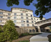
Courtyard Asheville Airport
The Charleston Inn
Fairfield Inn & Suites Hendersonville Flat Rock
MOUNTAIN LODGE OF F
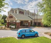
Hampton Inn - Suites Asheville - I-26
MOUNTAIN INN AND SU
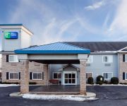
Quality Inn & Suites Flat Rock
Fairfield Inn Asheville Airport
Highland Lake Inn & Resort
1898 Waverly Inn
Videos from this area
These are videos related to the place based on their proximity to this place.
Coffee Shops in Hendersonville NC
Coffee Shops in Hendersonville NC - The Ugly Mug Coffee & Tea: http://www.relylocal.com/hendersonville-north-carolina/business_listings/the-ugly-mug-hendersonville-coffee-shop Hendersonville,...
Savannah's Farm Vacation Rental
NOTHING COULD BE FINER THAN "Savannah's Farm" a beautiful french country cape home perfectly sited on 5 acres of pastoral land and with a magnificent view of Mt. Pisgah and the range of the...
Hendersonville Chrysler Dodge Jeep Ram 2014 Jeep Wrangler 4x4 Willys Wheeler
Hendersonville Chrysler Dodge Jeep Ram 2014 Jeep Wrangler 4x4 Willys Wheeler. In this video we'll show you the Willys Wheeler edition Jeep Wrangler and some of the reasons this is such a popular ...
BIG SALE IN MTN. HOME http:bonnieroseappraisals.com SEE BONNIE
ASHEVILLE 1/2 OFF SUNDAY BIG SALE IN MTN. HOME http://bonnieroseappraisals.com SEE BONNIE Sunday, February 28th, 1pm - 5pm; (Half price day) Highlights of this sale comprise another ...
Beautiful Winter Scene
32 Degrees, Wind Chill of 25 Degrees, Blowing Snow and Freezing Rain, 12 Inches on Snow on the ground in Mountain Home, North Carolina. Thursday February 13th 2014.
Salvation Army local Hendersonville NC Christmas Angel Tree Doing the most good
http://AshevilleMovingCompany.com Asheville Moving Company LOVE https://plus.google.com/101861932754999118102/about?hl=en Salvation Army Doing the most good Angel Tree Hendersonville ...
2732 Miller Lane
For more details click here: http://www.visualtour.com/showvt.asp?t=2923582 2732 Miller Lane Hendersonville, NC 28791 $304900, 3 bed, 2.5 bath, 2718 SF, ML...
Close To Downtown Hendersonville
For more details click here: http://www.visualtour.com/showvt.asp?t=2682128 200 Queen Street Hendersonville, NC 28792 $169900, 3 bed, 2.0 bath, 2125 SF, ML...
Town Center - Asheville Highway
For more details click here: http://www.visualtour.com/showvt.asp?t=2838475 2560 Asheville Hwy Hendersonville, NC 28792 $2188, MLS# 522577 Beautiful new pro...
Videos provided by Youtube are under the copyright of their owners.
Attractions and noteworthy things
Distances are based on the centre of the city/town and sightseeing location. This list contains brief abstracts about monuments, holiday activities, national parcs, museums, organisations and more from the area as well as interesting facts about the region itself. Where available, you'll find the corresponding homepage. Otherwise the related wikipedia article.
Henderson County, North Carolina
Henderson County is a county located in the U.S. state of North Carolina. It is part of the Asheville, North Carolina, Metropolitan Statistical Area. As of July 2010, the population was 107,177. Its county seat is Hendersonville.
Balfour, North Carolina
Balfour is a census-designated place (CDP) in Henderson County, North Carolina, United States. The population was 1,200 at the 2000 census. It is part of the Asheville Metropolitan Statistical Area.
Barker Heights, North Carolina
Barker Heights is a census-designated place (CDP) in Henderson County, North Carolina, United States. The population was 1,237 at the 2000 census. It is part of the Asheville Metropolitan Statistical Area.
East Flat Rock, North Carolina
East Flat Rock is a census-designated place (CDP) in Henderson County, North Carolina, United States. The population was 4,151 at the 2000 census. It is part of the Asheville Metropolitan Statistical Area.
Flat Rock, Henderson County, North Carolina
Flat Rock is a village in Henderson County, North Carolina, United States. The population was 2,565 at the 2000 census. It is part of the Asheville Metropolitan Statistical Area. The village is listed on the National Register of Historic Places as Flat Rock Historic District.
Fletcher, North Carolina
Fletcher is a town in Henderson County, North Carolina, United States. The population was 4,185 at the 2000 census. Fletcher is home to Asheville Regional Airport, which serves Western North Carolina. It is part of the Asheville Metropolitan Statistical Area.
Hendersonville, North Carolina
Hendersonville is a city in Henderson County, North Carolina USA. In 1900, 1,917 persons lived in Hendersonville; in 1910, 2,818; and in 1940, 5,381 people lived here. As of the 2010 census, the city population was 13,137, up fivefold in one century. It is the county seat of Henderson County. Like the county, the city is named for 19th-century North Carolina Supreme Court Chief Justice Leonard Henderson.
Mountain Home, North Carolina
Mountain Home is a census-designated place (CDP) in Henderson County, North Carolina, United States. The population was 2,169 at the 2000 census. It is part of the Asheville Metropolitan Statistical Area.
Laurel Park, North Carolina
Laurel Park is a town in Henderson County, North Carolina, United States. The population was 1,835 at the 2000 census. It is part of the Asheville Metropolitan Statistical Area.
Valley Hill, North Carolina
Valley Hill is a census-designated place (CDP) in Henderson County, North Carolina, United States. The population was 2,137 at the 2000 census. It is part of the Asheville Metropolitan Statistical Area.
Asheville Regional Airport
Asheville Regional Airport is a Class C airport near Interstate 40 and Interstate 26 near the town of Fletcher, 9 miles south of the city of Asheville, in the U.S. state of North Carolina. It is owned by the city of Asheville. In 2010 it served a total of 735,760 passengers, an increase of 27% over 2009.
Mills River, North Carolina
Mills River is a town located in Henderson County, North Carolina. It is part of the Asheville Metropolitan Statistical Area. It lies in the northwestern part of the county, covering roughly 22 square miles, and located near Etowah and Fletcher. The Town of Mills River lies within minutes of Pisgah National Forest, Interstate 26, and Asheville Regional Airport. Highways 280 and 191 serve as the major arteries and provide access to the nearby cities of Asheville, Hendersonville, and Brevard.
WTZQ
WTZQ is a radio station broadcasting an oldies format. Licensed to Hendersonville, North Carolina, USA, the station is currently owned by Houston Broadcasting, Inc. and features programming from Music of Your Life.
Veritas Christian Academy
Veritas Christian Academy is a small co-educational Christian classical school in Fletcher, North Carolina, USA. It incorporates elementary school, middle school, and high school, as well as the School Within a School. In the classical education, the three stages of the school are Grammar, Dialectic, and Rhetoric. Also, students take classes such as philosophy, rhetoric, logic, apologetics, as well as Latin and Greek.
Piedmont Airlines Flight 22
1967 Hendersonville Mid-Air Collision was a collision between a Piedmont Airlines Boeing 727-22 with a twin-engine Cessna 310 which happened on July 19, 1967 in Hendersonville, North Carolina, USA. Both aircraft were destroyed and all passengers and crews were killed. The aircraft both were operating under instrument flight rules and in radio contact with the Asheville control tower, though on different frequencies.
Mills River (North Carolina)
The Mills River is located in Transylvania and Henderson counties, North Carolina, USA is a tributary of the French Broad River. The river flows out of the Pisgah Ranger District of the Pisgah National Forest in two forks: the North Fork, which drains the slopes just south of the Blue Ridge Parkway between Asheville and Mount Pisgah, and the South Fork, which drains the area of the Pisgah Ranger District just east of the Cradle of Forestry in America, including the slopes of Black Mountain.
Bonclarken
Bonclarken is a conference center located in Flat Rock, North Carolina operated by the Associate Reformed Presbyterian Church (ARP). It is used as a conference center by the ARP church, and is used to accommodate guests of 500 people during the summer and 400 people during the winter. Bonclarken has two fully equipped kitchens and conference centers that can hold up to 1200 people in their meeting centers.
East Henderson High School
East Henderson High School is located at 110 Old Upward Road in East Flat Rock, North Carolina and is a part of the Henderson County Public Schools district. The school serves students in grades nine through twelve. The mascot is an Eagle and the colors are green and white and unofficially, black. As of the 2006-2007 school year the student population was 1016 and the staff population was 110. It is commonly known as "East" by residents in Hendersonville/Flat Rock and surrounding areas.
Camp Ton-A-Wandah
Camp Ton-A-Wandah ("By the fall of water" in Cherokee) is an annual all-girls summer camp located outside of Hendersonville, North Carolina, in the Flat Rock area. The camp is open to girls aged six through 15, for a total of nine weeks each year (three sessions of three weeks each). 16-year-old girls who wish to attend become CITs, and young women aged 17 and up serve as cabin counselors (many of whom come from foreign countries, such as Australia and South Africa).
WHKP
WHKP is a radio station broadcasting at 1450 on the AM dial in Hendersonville, North Carolina. The call letters stand for Where the Heavens Kiss the Peaks. The station broadcasts to most of the area in Henderson County and parts of southern Buncombe County and parts of northern Polk County. The current format is mostly conservative talk radio and local programming of a conservative nature. Syndicated programming includes Rush Limbaugh and once included Paul Harvey.
Christ School (North Carolina)
Christ School is an independent Episcopal college preparatory boarding and day school for boys in Arden, North Carolina. It features a competitive academic curriculum, intramural and varsity athletics, spiritual development and a work program. While an Episcopal school, it is open to students of all faiths and backgrounds.
Hendersonville High School (North Carolina)
Hendersonville High School is located in Hendersonville, North Carolina, on 1 Bearcat Blvd. , Hendersonville, NC 28791. The school is adjacent to Margaret R. Pardee Memorial Hospital and Highway 25.
Lake House Academy
Lake House Academy is a private therapeutic boarding school for girls located in Flat Rock, Henderson County, North Carolina. The school enrolls girls ages 10 through 14 in grades 5 to 10. Programs are tailored to the developmental, social, emotional and academic needs of pre-adolescent and young adolescent girls with a focus on helping girls gain the skills they need to be successful in the home, at school and with friends.
Mineral and Lapidary Museum
The Mineral and Lapidary Museum of Henderson County is a non-profit, volunteer-run museum in Hendersonville, North Carolina founded in 1997 at 400 North Main Street in the middle of the city's Historic District. Located in Western North Carolina astride the geologically rich Blue Ridge Mountains, the decade-old museum has been nicknamed The Geode-Cracking Museum. On a typical day, geodes are cracked in half by volunteer staff.
Flat Rock Playhouse
Flat Rock Playhouse, in Flat Rock, is the state theatre of North Carolina.


