Safety Score: 2,7 of 5.0 based on data from 9 authorites. Meaning we advice caution when travelling to United States.
Travel warnings are updated daily. Source: Travel Warning United States. Last Update: 2024-05-08 08:04:21
Explore Venable
Venable in Buncombe County (North Carolina) is a city in United States about 385 mi (or 619 km) south-west of Washington DC, the country's capital.
Local time in Venable is now 12:56 PM (Wednesday). The local timezone is named America / New York with an UTC offset of -4 hours. We know of 8 airports in the vicinity of Venable, of which 5 are larger airports. The closest airport in United States is Asheville Regional Airport in a distance of 7 mi (or 12 km), South-East. Besides the airports, there are other travel options available (check left side).
There is one Unesco world heritage site nearby. It's Great Smoky Mountains National Park in a distance of 5 mi (or 8 km), North-East. Also, if you like golfing, there are multiple options in driving distance. We found 5 points of interest in the vicinity of this place. If you need a place to sleep, we compiled a list of available hotels close to the map centre further down the page.
Depending on your travel schedule, you might want to pay a visit to some of the following locations: Asheville, Hendersonville, Marshall, Brevard and Waynesville. To further explore this place, just scroll down and browse the available info.
Local weather forecast
Todays Local Weather Conditions & Forecast: 29°C / 84 °F
| Morning Temperature | 17°C / 62 °F |
| Evening Temperature | 22°C / 71 °F |
| Night Temperature | 18°C / 64 °F |
| Chance of rainfall | 1% |
| Air Humidity | 44% |
| Air Pressure | 1009 hPa |
| Wind Speed | Gentle Breeze with 6 km/h (4 mph) from South-East |
| Cloud Conditions | Overcast clouds, covering 100% of sky |
| General Conditions | Light rain |
Wednesday, 8th of May 2024
21°C (69 °F)
16°C (61 °F)
Moderate rain, gentle breeze, overcast clouds.
Thursday, 9th of May 2024
18°C (64 °F)
9°C (49 °F)
Scattered clouds, moderate breeze.
Friday, 10th of May 2024
19°C (66 °F)
14°C (57 °F)
Sky is clear, moderate breeze, clear sky.
Hotels and Places to Stay
The Inn on Biltmore Estate
Crowne Plaza Hotels & Resorts ASHEVILLE
Hilton Asheville Biltmore Park
Comfort Inn Biltmore West
Quality Inn & Suites Biltmore South
Holiday Inn Express & Suites ASHEVILLE SW - OUTLET CTR AREA
Fairfield Inn & Suites Asheville South/Biltmore Square
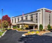
Hampton Inn Asheville I-26 Biltmore Area NC
Oakland Cottage Bed & Breakfast
North Lodge on Oakland
Videos from this area
These are videos related to the place based on their proximity to this place.
Mountain Biking Bent Creek
In July of 2013 I was in western North Carolina for some family business. I took my bike planning to get in as much riding in Pisgah as possible. Unfortunately the weather would have none...
Bent Creek - Wolf Branch
Jaclyn, Lucy and I roll down Wolf Branch Trail (#666). Shot on the VIO Pov 1.
Hardtimes Connector- Bent Creek, NC
Winter morning ride down Hardtimes Connector trail. I love this short trail, its a workout to get to the top, but the groomed sweeping downhill is fun.
Sidehill- Bent Creek, NC
Fast ride down Sidehill after coming down Greens Lick. This is a great trail, I'd like to fly down when it's dry.
Cove Creek- Water Crossing, Pisgah Forest
Water crossing at the end of Caney Bottom Trail, Pisgah National Forest (Fish Hatchery). March 2010.
The 2nd Annual BMX Summer Jam in Asheville, NC
Footage from the 2nd Annual 2012 BMX Summer Jam held at the Biltmore Square Mall in Asheville, NC 8.11.2012. Presented by Broken Spokes & Keith King. Riders: Jared Ward, Scott Wirch, & Isaiah.
green's lick trial run
1st run on this trail with some peeps we met in Asheville. Stamps/Red/Matt/Cissy.
Greens Lick Crash
Following Ed a little too closely on Green's Lick downhill. Landing is hilarious at the 1:00 mark.
Videos provided by Youtube are under the copyright of their owners.
Attractions and noteworthy things
Distances are based on the centre of the city/town and sightseeing location. This list contains brief abstracts about monuments, holiday activities, national parcs, museums, organisations and more from the area as well as interesting facts about the region itself. Where available, you'll find the corresponding homepage. Otherwise the related wikipedia article.
Bent Creek, Buncombe County, North Carolina
Bent Creek is a census-designated place (CDP) in Buncombe County, North Carolina, United States. The population was 1,521 in 2008. Bent Creek is home to world class mountain bike trails within the Pisgah National Forest.
Swannanoa River
The Swannanoa River flows through the Swannanoa Valley of western North Carolina, and is a major tributary to the French Broad River. It begins at its headwaters in Black Mountain, NC, however, it also has a major tributary near its headwaters: Flat Creek, which begins on the slopes of Mount Mitchell. The Swannanoa River ends when it meets the French Broad at Biltmore Estate in Asheville.
Biltmore Square Mall
Biltmore Square Mall is a mall located just off I-26 on Brevard Road in Asheville, North Carolina. It has two anchors: Belk and Dillard's Clearance Center. In Summer 2008, Dillard's converted to a clearance center. In March 1998, the mall management (along with other plaintiffs) did attempt to resist annexation of the property on which they reside into the city of Asheville. The attempt was unsuccessful.
North Carolina Arboretum
The North Carolina Arboretum (434 acres) is an arboretum and botanical garden located within the Bent Creek Experimental Forest of the Pisgah National Forest at 100 Frederick Law Olmsted Way, southwest of Asheville, North Carolina near the Blue Ridge Parkway. It is open daily except for Christmas Day. There is no admission charge, but some parking fees do apply.
Wilma Dykeman RiverWay Plan
The Wilma Dykeman RiverWay Plan is RiverLink's design to redevelop the urban riverfront corridor of the U.S. City of Asheville, as a demonstration project for the entire French Broad River watershed by connecting a 17 miles Greenway System along the French Broad and Swannanoa Rivers.


