Safety Score: 2,7 of 5.0 based on data from 9 authorites. Meaning we advice caution when travelling to United States.
Travel warnings are updated daily. Source: Travel Warning United States. Last Update: 2024-05-08 08:04:21
Discover South Newington
South Newington in Rockingham County (New Hampshire) is a town in United States about 433 mi (or 697 km) north-east of Washington DC, the country's capital city.
Current time in South Newington is now 07:45 PM (Wednesday). The local timezone is named America / New York with an UTC offset of -4 hours. We know of 8 airports near South Newington, of which 3 are larger airports. The closest airport in United States is Portsmouth International at Pease Airport in a distance of 1 mi (or 1 km), North-East. Besides the airports, there are other travel options available (check left side).
Also, if you like playing golf, there are a few options in driving distance. We discovered 2 points of interest in the vicinity of this place. Looking for a place to stay? we compiled a list of available hotels close to the map centre further down the page.
When in this area, you might want to pay a visit to some of the following locations: Dover, Brentwood, Alfred, Allenstown and Ossipee. To further explore this place, just scroll down and browse the available info.
Local weather forecast
Todays Local Weather Conditions & Forecast: 10°C / 50 °F
| Morning Temperature | 10°C / 49 °F |
| Evening Temperature | 15°C / 58 °F |
| Night Temperature | 10°C / 50 °F |
| Chance of rainfall | 16% |
| Air Humidity | 98% |
| Air Pressure | 1004 hPa |
| Wind Speed | Gentle Breeze with 7 km/h (4 mph) from South-West |
| Cloud Conditions | Overcast clouds, covering 100% of sky |
| General Conditions | Heavy intensity rain |
Wednesday, 8th of May 2024
11°C (53 °F)
8°C (47 °F)
Light rain, gentle breeze, overcast clouds.
Thursday, 9th of May 2024
11°C (52 °F)
7°C (45 °F)
Overcast clouds, moderate breeze.
Friday, 10th of May 2024
8°C (46 °F)
7°C (44 °F)
Light rain, gentle breeze, overcast clouds.
Hotels and Places to Stay
Sheraton Portsmouth Harborside Hotel
Residence Inn Portsmouth
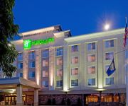
Holiday Inn PORTSMOUTH
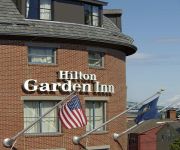
Hilton Garden Inn Portsmouth Downtown
Residence Inn Portsmouth Downtown/Waterfront
Hampton Inn - Suites Portsmouth Downtown
Courtyard Portsmouth
Homewood Suites by Hilton Portsmouth
Wrens Nest Village Inn
BEST WESTERN PLUS PORTSMOUTH H
Videos from this area
These are videos related to the place based on their proximity to this place.
Videos provided by Youtube are under the copyright of their owners.
Attractions and noteworthy things
Distances are based on the centre of the city/town and sightseeing location. This list contains brief abstracts about monuments, holiday activities, national parcs, museums, organisations and more from the area as well as interesting facts about the region itself. Where available, you'll find the corresponding homepage. Otherwise the related wikipedia article.
Portsmouth International Airport at Pease
Portsmouth International Airport at Pease (formerly known as Pease International Airport) is a public-use joint civil-military airport located one nautical mile (2 km) west of the central business district of Portsmouth, a city in Rockingham County, New Hampshire, United States. It is owned by the Pease Development Authority.
Smuttynose Brewing Company
Smuttynose Brewing Company is a craft brewery that was founded in 1994 in Portsmouth, New Hampshire. It is named after Smuttynose Island, one of the Isles of Shoals. Founded in 1994 by Peter Egelston as a joint partnership with Ipswich Brewery, Egelston quickly became the sole owner. In 2004, Smuttynose considered relocating to the historic mills in Newmarket, New Hampshire, but the deal fell through in late 2005.
Pease Air National Guard Base
Pease Air National Guard Base is a New Hampshire Air National Guard base located at Portsmouth International Airport at Pease. Formerly, the base was open as Pease Air Force Base until it was closed in 1991. Before it was closed, it was under the control of the United States Air Force's Strategic Air Command. The base occupied land in the city of Portsmouth and the towns of Newington and Greenland, in the Seacoast Region of New Hampshire. The facility occupies 4,255 acres in Rockingham County.
Great Bay (New Hampshire)
Great Bay is a tidal estuary located in Strafford and Rockingham counties in eastern New Hampshire, United States. The bay occupies over 6,000 acres, not including its several tidal river tributaries. Its outlet is at Hilton Point in Dover, New Hampshire, where waters from the bay flow into the Piscataqua River, thence proceeding southeast to the Atlantic Ocean near Portsmouth. The northern end of the bay, near its outlet, is referred to as Little Bay.
Fox Run Mall
The Fox Run Mall is a shopping mall in Newington, New Hampshire, just north of Portsmouth. Its main anchor stores include JCPenney, Macy's Men's & Home Store, Macy's Women's, and Sears. At 603,618 square feet, it is New Hampshire's fourth largest mall, with nearly 100 shops, all on one level. Completed in 1983, this mall functioned mainly as a successor to the smaller and dated Newington Mall, which has since been converted into a big box retail center. The mall is located just off U.S.
Winnicut River
The Winnicut River is a 9.1 mile long (14.6 km) river in the Seacoast region of New Hampshire in the United States. It is the major southeastern tributary of Great Bay, an estuary connected by way of the tidal Piscataqua River to the Atlantic Ocean. The Winnicut River rises at the northern outlet of Line Swamp in the town of North Hampton, New Hampshire, just west of Interstate 95.


