Safety Score: 2,7 of 5.0 based on data from 9 authorites. Meaning we advice caution when travelling to United States.
Travel warnings are updated daily. Source: Travel Warning United States. Last Update: 2024-05-04 08:22:41
Discover Seavey Island
Seavey Island in York County (Maine) is a town in United States about 438 mi (or 704 km) north-east of Washington DC, the country's capital city.
Current time in Seavey Island is now 07:09 AM (Saturday). The local timezone is named America / New York with an UTC offset of -4 hours. We know of 8 airports near Seavey Island, of which 3 are larger airports. The closest airport in United States is Portsmouth International at Pease Airport in a distance of 4 mi (or 7 km), West. Besides the airports, there are other travel options available (check left side).
Also, if you like playing golf, there are a few options in driving distance. We discovered 3 points of interest in the vicinity of this place. Looking for a place to stay? we compiled a list of available hotels close to the map centre further down the page.
When in this area, you might want to pay a visit to some of the following locations: Dover, Brentwood, Alfred, Allenstown and Ossipee. To further explore this place, just scroll down and browse the available info.
Local weather forecast
Todays Local Weather Conditions & Forecast: 10°C / 51 °F
| Morning Temperature | 7°C / 45 °F |
| Evening Temperature | 9°C / 48 °F |
| Night Temperature | 7°C / 45 °F |
| Chance of rainfall | 0% |
| Air Humidity | 73% |
| Air Pressure | 1029 hPa |
| Wind Speed | Gentle Breeze with 7 km/h (4 mph) from West |
| Cloud Conditions | Overcast clouds, covering 100% of sky |
| General Conditions | Overcast clouds |
Saturday, 4th of May 2024
11°C (53 °F)
9°C (48 °F)
Moderate rain, moderate breeze, scattered clouds.
Sunday, 5th of May 2024
16°C (60 °F)
13°C (55 °F)
Light rain, gentle breeze, overcast clouds.
Monday, 6th of May 2024
16°C (61 °F)
11°C (51 °F)
Few clouds, gentle breeze.
Hotels and Places to Stay
Sheraton Portsmouth Harborside Hotel
Wentworth by the Sea A Marriott Hotel & Spa
Courtyard Portsmouth
Residence Inn Portsmouth
Hampton Inn Portsmouth Central NH
Hilton Garden Inn Portsmouth Downtown
Residence Inn Portsmouth Downtown/Waterfront
Hampton Inn - Suites Portsmouth Downtown
COACHMAN INN
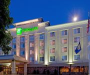
Holiday Inn PORTSMOUTH
Videos from this area
These are videos related to the place based on their proximity to this place.
Peirce Island (Night Dive) - Portsmouth, NH
Peirce Island Wall (Night Dive) in Portsmouth, NH Piscataqua River.
Walking Tour of Downtown Portsmouth, NH
http://www.newhampshiremainerealestate.com/ Portsmouth is a very cool New England harbor town located in the northern section of the NH Seacoast. New Hampshire has the shortest coastline of...
Diving Peirce Island in Portsmouth NH (January 18th, 2015)
Scuba Diving Peirce Island in Portsmouth, NH.
Night timelapse of Memorial Bridge between Portsmouth, New Hampshire and Kittery, Maine
The Memorial Bridge on Route 1 crosses the Piscataqua River between Portsmouth, New Hampshire and Badger's Island in Kittery, Maine. It is a through truss lift bridge with a 300 foot mid-span...
Holiday Celebration Verani Style | Wentworth By The Sea New Castle NH
Our annual Verani Realty Seacoast region holiday celebration was held at the lovely Wentworth by the sea hotel in New Castle NH.
Big Snow in Portsmouth, NH - Feb. 2, 2011
We've had a lot of snow this year, mostly since mid-January. Today, I walked out in the storm from 11AM to noon, and made this for those who are away to see what they're missing. Snowy! Cold!...
Portsmouth Memorial Bridge Raising and Lowering Close Up
The Memorial Bridge carries US Route 1 over the Piscataqua River between Portsmouth, New Hampshire and Kittery, Maine. Built in the 1920's as a Memorial to those that lost their lives in WW1...
Memorial Bridge Span Leaving Portsmouth, NH
The Memorial Bridge center span leaving Portsmouth Harbor, Portsmouth, NH. Shot with audio of the communications between the tug boats. Videographer Stephan Smith of Piscataqua Productions...
The Portsmouth Memorial Bridge rises. (2008) [Rock'n #5]
The Memorial Bridge (US Route 1) in Portsmouth, New Hampshire. Recorded from an Isle of Shoals cruise in Portsmouth, New Hampshire.
Driveway Sealcoating Kittery ME - Armor Guard
Want the best deal on Driveway Sealcoating in Kittery ME? Call 603-743-1832 for a Free Estimate or Visit armorguardseal.com 0:05 Constant Freezing and Thawing 0:11 Sealcoating Your Driveway...
Videos provided by Youtube are under the copyright of their owners.
Attractions and noteworthy things
Distances are based on the centre of the city/town and sightseeing location. This list contains brief abstracts about monuments, holiday activities, national parcs, museums, organisations and more from the area as well as interesting facts about the region itself. Where available, you'll find the corresponding homepage. Otherwise the related wikipedia article.
Portsmouth Naval Shipyard
The Portsmouth Naval Shipyard (PNS), often called the Portsmouth Navy Yard, is a United States Navy shipyard located in Kittery on the southern boundary of Maine near the city of Portsmouth, New Hampshire. It is used for remodeling and repairing US Navy submarines. The facility is sometimes confused with the Norfolk Naval Shipyard in Portsmouth, Virginia.
Kittery (CDP), Maine
Kittery is a census-designated place (CDP) consisting of the main village in the town of Kittery in York County, Maine, United States. The population was 4,562 at the 2010 census. It is part of the Portland–South Portland–Biddeford, Maine Metropolitan Statistical Area.
Kittery, Maine
Kittery is a town in York County, Maine, United States. The population was 9,490 at the 2010 census. Home to the Portsmouth Naval Shipyard on Seavey's Island, Kittery includes Badger's Island, the seaside district of Kittery Point, and part of the Isles of Shoals. The town is a tourist destination known for its many outlet stores. Kittery is part of the Portland–South Portland–Biddeford, Maine metropolitan statistical area.
Portsmouth Naval Prison
Portsmouth Naval Prison is a former U.S. Navy and Marine Corps prison on the grounds of the Portsmouth Naval Shipyard (PNS) in Kittery, Maine. The building has the appearance of a castle. The reinforced concrete naval prison was occupied from 1908 until 1974.
Seavey's Island
Seavey's Island, on which the Portsmouth Naval Shipyard resides, is located in the Piscataqua River in Kittery, Maine, opposite Portsmouth, New Hampshire. It encompasses 278 acres .
Piscataqua River border dispute
The Piscataqua River border dispute was a dispute between the US states of Maine and New Hampshire over ownership of Seavey’s Island in the Piscataqua River, which forms the border between Maine and New Hampshire. The dispute was settled in 2002 by the US Supreme Court.
Badger's Island
Badger's Island is located in the Piscataqua River at Kittery, Maine, directly opposite Portsmouth, New Hampshire. It carries U.S. Route 1 between the states, connecting to the Kittery mainland by the Badger's Island Bridge, and to New Hampshire by the Memorial Bridge. Now largely a suburb of Portsmouth, the island features houses, condominiums, restaurants and marinas. The Memorial Bridge was demolished in the Spring of 2012, and its replacement is not scheduled to be open until 2013.
Robert William Traip Academy
Robert William Traip Academy (often abbreviated as R. W. Traip Academy or simply Traip Academy) is a public high school located in Kittery, Maine. It serves the towns of Kittery and Kittery Point, Maine. It was founded in 1905 as a private preparatory high school and remained as such until 1967, when it became part of the Kittery School Department. In 1989, the facility was updated, and the 1909 building was demolished.


!['The Portsmouth Memorial Bridge rises. (2008) [Rock'n #5]' preview picture of video 'The Portsmouth Memorial Bridge rises. (2008) [Rock'n #5]'](https://img.youtube.com/vi/QtUZXf8xU00/mqdefault.jpg)


