Safety Score: 2,7 of 5.0 based on data from 9 authorites. Meaning we advice caution when travelling to United States.
Travel warnings are updated daily. Source: Travel Warning United States. Last Update: 2024-04-28 08:22:10
Delve into Paradise Hills
The district Paradise Hills of Chula Vista in San Diego County (California) is a district located in United States about 2,265 mi west of Washington DC, the country's capital town.
In need of a room? We compiled a list of available hotels close to the map centre further down the page.
Since you are here already, you might want to pay a visit to some of the following locations: San Diego, Ensenada, Riverside, Santa Ana and Orange. To further explore this place, just scroll down and browse the available info.
Local weather forecast
Todays Local Weather Conditions & Forecast: 22°C / 72 °F
| Morning Temperature | 14°C / 57 °F |
| Evening Temperature | 21°C / 69 °F |
| Night Temperature | 18°C / 65 °F |
| Chance of rainfall | 0% |
| Air Humidity | 41% |
| Air Pressure | 1016 hPa |
| Wind Speed | Gentle Breeze with 7 km/h (4 mph) from North-East |
| Cloud Conditions | Clear sky, covering 0% of sky |
| General Conditions | Sky is clear |
Monday, 29th of April 2024
23°C (73 °F)
18°C (64 °F)
Sky is clear, gentle breeze, clear sky.
Tuesday, 30th of April 2024
22°C (72 °F)
17°C (63 °F)
Sky is clear, gentle breeze, clear sky.
Wednesday, 1st of May 2024
21°C (69 °F)
17°C (63 °F)
Sky is clear, gentle breeze, clear sky.
Hotels and Places to Stay
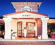
Holiday Inn Express SAN DIEGO SOUTH-NATIONAL CITY
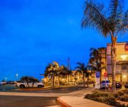
La Quinta Inn San Diego Chula Vista
Holiday Inn Express SAN DIEGO SOUTH - CHULA VISTA
BW PLUS MARINA GATEWAY HOTEL
SWEETWATER INN NATIONAL CITY
Good Nite Inn Chula Vista
Rodeway Inn La Mesa
Travel Time Motel
HOWARD JOHNSON EXPRESS INN NAT
Navajo Lodge
Videos from this area
These are videos related to the place based on their proximity to this place.
Time Lapse of Steel Building Being Erected for Church in Bonita, CA
The project we are erecting in this video is a church located in Bonita, CA. It is a pre-engineered metal building that will be used for the main structure. The video shows our crew installing...
Drain Cleaning Bonita CA 91908 619-717-8427 Sewer Cleaning
Visit: http://www.bestsandiegoplumbers.com/ S.O.S. Plumbing & Rooter 619-717-8427 Bonita CA 91908 Serving Bonita County Since 1974 Sewer Cleaning, Drain Clogs, Plumbing Problems, Leak ...
SOS Plumbing Bonita CA 91902 Sewer Back Ups 619-717-8427
Visit: http://www.bestsandiegoplumbers.com/ S.O.S. Plumbing & Rooter 619-717-8427 Bonita CA 91902 Serving San Carlos County Since 1974 Sewer Cleaning, Drain Clogs, Plumbing Problems, Leak ...
Seafood City San Diego, California
February 15th 2010 before going back to Phoenix, Arizona we went to Seafood City market to buy fresh fish and seafoods. I was surprised that there is a monument of Dr. Jose P. Rizal infront...
Cruisin' E St. and Bonita Rd. in Chula Vista and Bonita, California on November 4, 2011 (Rainy Day)
Drive safe! Better late, than never at all! Place: E St. and Bonita Rd. in Chula Vista and Bonita, California Date: November 4, 2011 Follow on Twitter: http://www.twitter.com/cvcaproductions...
Paradise Village - Resort-style Retirement Living in San Diego, CA
Introducing Paradise Village, the newest star in our community skyline located in San Diego's South Bay. Paradise Village is a 12-acre gated campus that offers retirement and assisted living,...
CampgroundViews.com - Sweetwater Regional Park Bonita California CA Campground
http://www.CampgroundViews.com takes user submitted videos combined with professional editing to provide tent and RV campers with a first person view of a campground or RV park. Sweetwater...
Sell My Rv Bonita, 619 377 7652, Cash For Rvs
(619) 377-7652 Fast-CashForCars.com At Bonita Fast-Cash For Cars We Buy Cars in Bonita and pay $500 over ANY CarMax quote. Do you need fast cash now? Is it time for you to get a brand-new car ...
Bonita Dinosaur GLARF gets restored by kelly tracy
http://kellytracyart.com - Watch this video of the Bonita Dinosaur GLARF getting restored by kelly tracy. http://youtu.be/18tuMiVp6-4.
Jalisco Cafe Restaurant Dinner - Bonita Chula Vista CA 91910
A quick look into one of Bonita Chula Vista's best Mexican restaurants in the area. Jalisco Cafe is known for their deliciously authentic hearty entrees and real family friendly service. I...
Videos provided by Youtube are under the copyright of their owners.
Attractions and noteworthy things
Distances are based on the centre of the city/town and sightseeing location. This list contains brief abstracts about monuments, holiday activities, national parcs, museums, organisations and more from the area as well as interesting facts about the region itself. Where available, you'll find the corresponding homepage. Otherwise the related wikipedia article.
Bonita, California
Bonita is a census-designated place (CDP) in southern San Diego County, California, nestled between the cities of Chula Vista, National City, and San Diego. The population was 12,538 at the 2010 census.
National City, California
National City is a city in San Diego County, California. The population was 58,582 at the 2010 census, up from 54,260 at the 2000 census. National City is the second oldest city in San Diego County and has a historic past.
Lincoln Acres, California
Lincoln Acres is an unincorporated area of San Diego County located wholly within the boundaries of the incorporated city of National City. It has a population of approximately 2,100 residents. Lincoln Acres has a fire station and library, but relies on the San Diego County Sheriff's Department to provide police protection. Even though it has a post office, it shares its ZIP code, 91950, with National City.
Logan Heights, San Diego
Logan Heights is a neighborhood in central San Diego, California. It is bordered by Interstate 5 on the south and west, Interstate 15 on the east, and Imperial Avenue on the north.
KOGO (AM)
KOGO ("Newsradio 600 KOGO") is a talk radio station in San Diego, California. One of seven San Diego owned and operated Clear Channel Communications radio stations, KOGO's main focus is local and syndicated talk shows. At 5,000 watts day and night, the AM signal is one of the strongest in the region. The signal pattern generally follows the coast from the transmitter site in San Diego, with reception good to Santa Barbara and beyond.
KSON
KSON is a radio station licensed to serve San Diego, California, USA. The station, founded in 1964, is owned by Lincoln Financial Media and the broadcast license is held by Lincoln Financial Media Company of California. KSON broadcasts a country music format. KSON simulcasts their FM programming at 92.1 FM in Escondido, California. The station was most recently assigned the KSON call letters by the Federal Communications Commission on March 1, 2009.
San Diego School of Creative and Performing Arts
The San Diego School of Creative and Performing Arts, known as SCPA, is a public arts magnet school in southeastern San Diego, California, USA. Most of the students in grades 6-12 are bussed to the school from throughout the San Diego Unified School District. They take specialized classes in theater, music, dance, visual arts, video production, and stagecraft along with regular academic subjects.
Westfield Plaza Bonita
Westfield Plaza Bonita, formerly Shopping Town Plaza Bonita, is a shopping mall in National City, California, owned by the Westfield Group. Its anchor stores are JCPenney, AMC Theaters, Macy's and Target.
Sweetwater High School (National City, California)
Sweetwater Union High School (commonly known as SUHi) is a secondary school located in National City, California, United States. Established in 1921, it is one of the oldest high schools in San Diego County. Part of the Sweetwater Union High School District, SUHI predominantly serves the National City community with an enrollment of approximately 2,791 students. In 2009, Sweetwater High School was named to Newsweek's list of the top 1,500 public high schools in the United States.
Hilltop High School
Hilltop Senior High is a four-year public high school located in Chula Vista, California and is part of the Sweetwater Union High School District (SUHSD). The school colors are kelly green, white, and black. The school mascot is the "Lancer".
Encanto, San Diego
Encanto is a hilly neighborhood located in the southeastern part of San Diego, California. The neighborhood of Encanto is split into two sections, North Encanto (which lies north of Broadway), and South Encanto (which lies south of Broadway).
Morse High School (San Diego, California)
Samuel F. B. Morse High School, also called Morse High School or simply Morse, is an urban public high school located in southeastern San Diego in the neighborhood of Skyline Hills serving grades 9-12 in the American K-12 education system. Named after inventor Samuel Finley Breese Morse, it first opened its doors in 1962. Morse has produced several notable athletes among its alumni and has sent its graduates to numerous colleges and universities throughout the United States.
Lincoln High School (San Diego)
Abraham Lincoln High School (also known as Lincoln High Educational Complex, Lincoln High School, or simply Lincoln), is an urban public high school in San Diego, California. It is part of the San Diego Unified School District. It serves approximately 2100-2700 students in grades 9-12 in the American K-12 education system. It is located in the Lincoln Park neighborhood of Southeast San Diego, part of the Encanto neighborhoods. It was named after President Abraham Lincoln.
Bell Middle School
Bell Middle School, formerly Bell Junior High School, is a middle school in the South Bay Terrace neighborhood of San Diego, serving grades 6-8.
Southeast San Diego
Southeast San Diego is the southeastern portion of the City of San Diego, generally represented by the urban neighborhoods directly east of Downtown San Diego, bordered by Interstate 5 and south of the Martin Luther King Jr. Freeway. Southeast San Diego is an economically and ethnically diverse area that is largely urbanized toward the city's core to the west and characteristically hilly, with lower-density residential neighborhoods toward the east.
O'Farrell Community School
O'Farrell Community School or O'Farrell Middle commonly referred to as O'Farrell is a charter school in the Southeast San Diego neighborhood of Encanto serving grades 6-9 in the K-12 American education system. The school opened its doors in the San Diego Unified School District in 1959 with its name chosen in 1957 as Mabel E. O'Farrell Jr. High. It was voted to become a charter school in 1994.
San Diego Academy
San Diego Academy is a private coeducational K-12 school in the Seventh-day Adventist school system. As set forth in its constitution and bylaws, San Diego Academy is governed by a Board of Trustees composed of pastors and elected lay people of the constituent Seventh-day Adventist churches, parents, and alumni. The school operates under the auspices of the Southeastern California Conference of Seventh-day Adventists Office of Education.
47th Street (San Diego Trolley station)
47th Street is a station of the Orange Line on the San Diego Trolley. It is located in the Chollas View neighborhood of the city and serves this mixed-income area of single family homes. A park and ride lot is also included on site. This station underwent renovations in 2012 in conjunction with the Trolley Renewal Project, although the station remained open.
Euclid Avenue (San Diego Trolley station)
Euclid Avenue is a station of the Orange Line on the San Diego Trolley. It is located in the Emerald Hills neighborhood of the city and serves both nearby residences and as a park and ride facility. This station underwent renovations in 2012 in conjunction with the Trolley Renewal Project, although the station remained open.
Encanto / 62nd Street (San Diego Trolley station)
Encanto/62nd Street is a station of the Orange Line on the San Diego Trolley. It is located in the hilly Encanto neighborhood of the city and serves both nearby residences and as a park and ride facility. This station underwent renovations in 2012 in conjunction with the Trolley Renewal Project, although the station remained open.
Cornerstone Church of San Diego
Cornerstone Church of San Diego is a non-denominational, charismatic megachurch located in National City, California. The senior pastors of Cornerstone Church of San Diego are Sergio & Georgina De La Mora. The church averages about 4,000 people in attendance each week. The church was recognized by Outreach Magazine as being the 3rd fastest growing church in America during the year 2009. The church hosts an annual "Heart Revolution Conference".
Chollas View, San Diego
Chollas View is a community in the southeastern section of the city of San Diego. It is bordered by Webster and California State Route 94 on the north, Mount Hope and Interstate 805 on the west, Emerald Hills and Euclid Avenue on the east, and Lincoln Park and the San Diego Trolley on the south. Major thoroughfares include Market Street and 47th Street.
Lincoln Park, San Diego
Lincoln Park is a community in the southeastern section of San Diego, California. It is bordered by Chollas View and the San Diego Trolley on the north, Mountain View and Interstate 805 on the west, Valencia Park and Euclid Avenue on the east, and National City, California on the south. Major thoroughfares include Imperial Avenue, Ocean View Boulevard, and Logan Avenue.
Emerald Hills, San Diego
Emerald Hills is a community in the southeastern section of the city of San Diego. It is bordered by Oak Park and California State Route 94 on the north, Chollas View and Euclid Avenue on the west, Encanto on the east, and Valencia Park and Market Street on the south. Major thoroughfares include Kelton Road and Roswell Street.
Valencia Park, San Diego
Valencia Park is a community in the southeastern section of the city of San Diego. It is bordered by Emerald Hills and Market Street on the north, Lincoln Park and Euclid Avenue on the west, Encanto on the east, and Alta Vista and National City, California on the south. Major thoroughfares include Imperial Avenue, Churchward Street, and Valencia Parkway.


