Safety Score: 2,7 of 5.0 based on data from 9 authorites. Meaning we advice caution when travelling to United States.
Travel warnings are updated daily. Source: Travel Warning United States. Last Update: 2024-04-26 08:02:42
Discover Palm City
Palm City in San Diego County (California) is a city in United States about 2,269 mi (or 3,652 km) west of Washington DC, the country's capital city.
Local time in Palm City is now 07:32 PM (Friday). The local timezone is named America / Los Angeles with an UTC offset of -7 hours. We know of 8 airports in the vicinity of Palm City, of which 4 are larger airports. The closest is airport we know is General Abelardo L. Rodríguez International Airport in Mexico in a distance of 7 mi (or 12 km). The closest airport in United States is San Diego International Airport in a distance of 12 mi (or 12 km), South-East. Besides the airports, there are other travel options available (check left side).
Also, if you like golfing, there are a few options in driving distance. We discovered 4 points of interest in the vicinity of this place. Looking for a place to stay? we compiled a list of available hotels close to the map centre further down the page.
When in this area, you might want to pay a visit to some of the following locations: San Diego, Ensenada, Santa Ana, Riverside and Orange. To further explore this place, just scroll down and browse the available info.
Local weather forecast
Todays Local Weather Conditions & Forecast: 17°C / 63 °F
| Morning Temperature | 15°C / 59 °F |
| Evening Temperature | 17°C / 62 °F |
| Night Temperature | 15°C / 60 °F |
| Chance of rainfall | 0% |
| Air Humidity | 62% |
| Air Pressure | 1015 hPa |
| Wind Speed | Moderate breeze with 12 km/h (8 mph) from East |
| Cloud Conditions | Clear sky, covering 5% of sky |
| General Conditions | Sky is clear |
Saturday, 27th of April 2024
19°C (65 °F)
17°C (62 °F)
Sky is clear, gentle breeze, clear sky.
Sunday, 28th of April 2024
18°C (65 °F)
16°C (61 °F)
Sky is clear, gentle breeze, clear sky.
Monday, 29th of April 2024
18°C (64 °F)
16°C (61 °F)
Few clouds, gentle breeze.
Hotels and Places to Stay
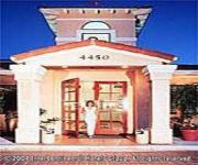
Pier South Resort Autograph Collection
Loews Coronado Bay Resort
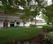
La Quinta Inn San Diego Chula Vista
HOTEL VELARIO
Holiday Inn Express SAN DIEGO SOUTH - CHULA VISTA
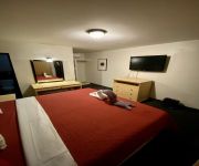
E-Z 8 Motel South Bay
Good Nite Inn Chula Vista
Hotel Diaz
Hotel Los Altos
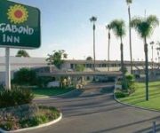
VAGABOND INN SAN DIEGO CHULA V
Videos from this area
These are videos related to the place based on their proximity to this place.
Giant Pizza King in Imperial Beach
Giant Pizza King in Imperial Beach 600 Palm Ave and 13th & Coronado Ave.
The Salivating Surfer Season 1: Oasis Ice Cream Parlor, Imperial Beach, CA
Want to watch more food reviews? Follow Bre, the Salivating Surfer on facebook. http://www.facebook.com/salivating.surfer Visiting Oasis Ice Cream Parlor in Imperial Beach is like taking a...
The Talk of Imperial Beach City Council Meeting 3-20-13
The Talk of Imperial Beach City Council Meeting 3-20-13 featuring local citizens protesting the City Council on the proposed alleged illegal sale of the little league ballfield & skate park...
Palm Avenue, Imperial Beach
Me and my Nana driving down Palm Avenue to visit my cousin Steven. I took out my phone to record the colorful sunset and decided to record the entire trip.
New York Buffalo Wings Imperial Beach, CA 91932 619-423-9464
New York Buffalo Wings The Best Wings in Town! Located in San Diego, La Mesa & Imperial Beach, CA go here for more info: http://www.nywingsandribs.com/ Voice over by Tom Chalker.
Remember to Prevent, Protect Against and Report West Nile Virus
After West Nile Virus made its first appearance of the year with the death of a local hawk, San Diego County officials kicked off the 2015 battle against the deadly disease at Fenton Pond in...
Cruisin' Orange Ave. and Olympic Pkwy. in Chula Vista, California on October 31, 2011
This is the whole length of Orange Avenue, East Orange Avenue and Olympic Parkway. Going eastbound. Place: Orange Avenue, East Orange Avenue and Olympic Parkway in Chula Vista, California.
San Diego, California - April 27 2012 Riding San Diego Trolley
Riding San Diego Trolley from San Ysidro/Tijuana station (US-Mexico border) to Beyer Blvd station.
Free Internet at Best Western Americana Inn, 815 W San Ysidro Blvd, San Diego, CA, Check-in
Free Internet! Check-in at Best Western Americana Inn, 815 W San Ysidro Blvd, San Diego, CA.
2013 Dodge Journey Used Cars Chula Vista CA
http://pacificautogroup.com This 2013 Dodge Journey is available from Pacific Auto Group, Inc. For details, call us at 619-422-4042.
Videos provided by Youtube are under the copyright of their owners.
Attractions and noteworthy things
Distances are based on the centre of the city/town and sightseeing location. This list contains brief abstracts about monuments, holiday activities, national parcs, museums, organisations and more from the area as well as interesting facts about the region itself. Where available, you'll find the corresponding homepage. Otherwise the related wikipedia article.
Southwest Senior High School
Southwest Senior High (SOH), in San Diego, California, United States, is a high school established in 1975. Part of the Sweetwater Union High School District, it serves all socioeconomic communities of San Diego (specifically the Nestor community), as well as some students living in Chula Vista, Imperial Beach and San Ysidro. The school serves approximately 1,750 students.
Ocean View Christian Academy
Ocean View Christian Academy (formerly Midway Baptist Schools) is a school serving grades K-12 in San Diego, California.
Montgomery High School, San Diego
Montgomery High School (MOH) is a four year (grade levels 9-12) public high school located in the city of San Diego, California. It opened in 1970 and is situated today in Otay Mesa. Montgomery High School serves more than 2,500 students, and is named after pioneer aviator John J. Montgomery, who made the first manned glider flight in U.S. history from a hill in the area where the school is located. Prior to a 1986 annexation claim, the school was originally located in the city of Chula Vista.
Palm Avenue (San Diego Trolley station)
Palm Avenue is a station of the Blue Line on the San Diego Trolley. It is located in Palm City neighborhood of the city. The stop serves a variety of purposes, holding the function of commuter center with a park and ride lot and to provide access to the nearby commercial and residential areas.
Iris Avenue (San Diego Trolley station)
Iris Avenue is a station of the Blue Line on the San Diego Trolley. It is located in Otay Mesa West neighborhood of the city. The stop serves a variety of purposes, holding the function of commuter center with a park and ride lot and to provide access to the nearby commercial and residential areas.
Nestor, San Diego
Nestor is a residential neighborhood in the southern section of San Diego, and part of the Otay Mesa-Nestor community planning area. It neighbors Palm City and Otay Mesa West to the east, Egger Highlands to the north, San Ysidro to the southeast and the Tijuana River Valley to the south. Major thoroughfares include Coronado Avenue, Saturn Boulevard, Hollister Street, and Tocayo Avenue.
Egger Highlands, San Diego
Egger Highlands is a residential neighborhood in the southern section of San Diego. It neighbors Palm City and Nestor to the east, San Diego Bay to the north, Imperial Beach to the southwest and Chula Vista to the northeast. Major thoroughfares include Coronado Avenue, Saturn Boulevard, and Palm Avenue.
Palm City, San Diego
Palm City is a neighborhood in the southern section of San Diego. It neighbors Otay Mesa West to the south and east, Egger Highlands and Nestor to the west, and Chula Vista to the north. It also serves as a gateway to the beach cities of Imperial Beach, and Coronado, by way of the Silver Strand isthmus, due to it being where California State Route 75 meets Interstate 5. Major thoroughfares include Coronado Avenue, Hollister Street, Beyer Boulevard, and Palm Avenue.


