Safety Score: 2,7 of 5.0 based on data from 9 authorites. Meaning we advice caution when travelling to United States.
Travel warnings are updated daily. Source: Travel Warning United States. Last Update: 2024-05-18 08:26:29
Discover Seal Beach Trailer Park
The district Seal Beach Trailer Park of Seal Beach in Orange County (California) is a district in United States about 2,294 mi west of Washington DC, the country's capital city.
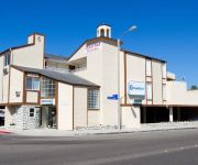
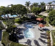
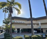
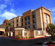
Looking for a place to stay? we compiled a list of available hotels close to the map centre further down the page.
When in this area, you might want to pay a visit to some of the following locations: Santa Ana, Orange, Los Angeles, Riverside and San Bernardino. To further explore this place, just scroll down and browse the available info.
Local weather forecast
Todays Local Weather Conditions & Forecast: 17°C / 63 °F
| Morning Temperature | 15°C / 59 °F |
| Evening Temperature | 17°C / 63 °F |
| Night Temperature | 15°C / 59 °F |
| Chance of rainfall | 0% |
| Air Humidity | 65% |
| Air Pressure | 1016 hPa |
| Wind Speed | Gentle Breeze with 8 km/h (5 mph) from North-East |
| Cloud Conditions | Few clouds, covering 16% of sky |
| General Conditions | Few clouds |
Sunday, 19th of May 2024
17°C (63 °F)
15°C (59 °F)
Sky is clear, gentle breeze, clear sky.
Monday, 20th of May 2024
17°C (62 °F)
15°C (59 °F)
Overcast clouds, moderate breeze.
Tuesday, 21st of May 2024
18°C (64 °F)
16°C (62 °F)
Sky is clear, gentle breeze, clear sky.
Hotels and Places to Stay
OCEAN SURF INN AND SUITES
Long Beach Marriott
Oakwood at Eaves Seal Beach
THE PACIFIC INN
Hampton Inn - Suites Seal Beach
Residence Inn Long Beach
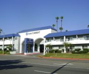
Hotel Current
AYRES HOTEL SEAL BEACH
Holiday Inn LONG BEACH AIRPORT
Royal Inn Motel Long Beach
Videos from this area
These are videos related to the place based on their proximity to this place.
Seal Beach Surf - 8/27/14 - surfing @pier
Surfers hits the waves near the pier morning of 8/27. Jump to 0:30 mark.
Ayres Hotel Seal Beach Property Tour
Visit Ayres Hotel Seal Beach for upscale amenities, complimentary breakfast, WiFi and a manager's reception Mon-Thurs. Close to Long Beach Airport, Los Alamitos, and Seal Beach pier.
Seal Beach Pier - Night Fishing
First day testing out my new GoPro3. Slow night for fishing at the Seal Beach pier but we managed to pull out a few Tom Cod and a baby ray while targeting mackerel on a sabiki rig.
California Seashell Company, Seal Beach
Celebrating 20 years in Seal Beach, California Seashell Company is a must see tourist stop and a favorite of many locals. Seashells, sea life and everything beach... including... nostalgic...
Seal Beach Lifeguard Assist
While walking along Seal Beach in California, a lifeguard heads out to assist someone in need.
MACCA at Seal Beach Triathlon, by www.My-tri.com
Chris 'Macca' McCormack shares his love for the sport by participating at this local sprint distance triathlon in Seal Beach, California. He gives us his feedback on the course, his overall...
Videos provided by Youtube are under the copyright of their owners.
Attractions and noteworthy things
Distances are based on the centre of the city/town and sightseeing location. This list contains brief abstracts about monuments, holiday activities, national parcs, museums, organisations and more from the area as well as interesting facts about the region itself. Where available, you'll find the corresponding homepage. Otherwise the related wikipedia article.
Seal Beach, California
Seal Beach is a city in Orange County, California. As of the 2010 census, the population was 24,168, up from 24,157 at the 2000 census. The city was incorporated on October 25, 1915. Seal Beach is located in the westernmost corner of Orange County. To the northwest, just across the border with Los Angeles County, lies the city of Long Beach and the adjacent San Pedro Bay.
California State University, Long Beach
California State University, Long Beach (also known as Cal State Long Beach, Long Beach State, CSULB, LBSU, or The Beach) is the second largest campus of the California State University (CSU) and one of the largest universities in the state of California by enrollment, its student body numbering 36,279 for the Fall 2012 semester. At 5,148 students, the university enrolls one of the largest graduate student populations across the CSU and in the state of California alone.
San Gabriel Valley
The San Gabriel Valley is one of the principal valleys of Southern California, United States. It lies to the east of Los Angeles, to the north of the Puente Hills, to the south of the San Gabriel Mountains, and west of the Inland Empire. It derives its name from the San Gabriel River that flows southward through the center of the valley. The river itself was named for the Spanish Mission San Gabriel Arcángel, which was originally built in the Whittier Narrows in 1771.
Earl Burns Miller Japanese Garden
The Earl Burns Miller Japanese Garden is a Japanese garden encompassing 1.3 acres on the campus of California State University, Long Beach, in Long Beach, California, USA. It was dedicated in 1981. Ed Lovell, landscape master plan architect for the University, traveled to Japan and took inspiration from the Imperial Gardens in Tokyo before designing the garden. Among the annual events held at the Japanese garden is a Koi auction and a chrysanthemum show.
Surfside, California
Surfside (or Surfside Colony) is a small gated community with three rows of houses, lettered A, B, and C. Surfside is part of the city of Seal Beach, California and is located on the west side of Pacific Coast Highway, southwest of the Naval Weapons Station Seal Beach between the station and the Huntington Beach community of Sunset Beach. It is also near the Huntington Beach community of Huntington Harbour.
Walter Pyramid
Walter Pyramid, formerly known as Long Beach Pyramid, is a 5,000-seat, indoor multi-purpose stadium on the campus of California State University, Long Beach in Long Beach, California.
Naval Weapons Station Seal Beach
Naval Weapons Station Seal Beach is a United States Navy weapons and munitions loading, storage and maintenance facility located in Seal Beach, California with detachments in Concord, Fallbrook, and San Diego, all also in California. On recommendations of the Base Realignment and Closure Commission the Inland Area of the Concord detachment is slated for closure and the Tidal Area of the detachment was transferred to the United States Army in 2008.
Leisure World, Seal Beach, California
Leisure World is a gated retirement community located in Seal Beach, Orange County, California. Construction on the approximately one square mile (2.5 km²) community was begun in 1960 with the first residents moving in on June 6, 1962. This was the first major planned retirement community of its type in the U.S. Today, Leisure World has 9,000 mostly older, retired residents. The Leisure World in Seal Beach was developed by Ross W.
Belmont Shore, Long Beach, California
Belmont Shore is a neighborhood in Long Beach, California. It is home to many shops, restaurants, salons and business offices.
Bay Theater
The Bay Theatre is a single-screen movie theater in Seal Beach, California, in the United States of America. It is best known for its screenings of foreign and independent films, and for its revival screenings. The Bay Theatre is also home to a Wurlitzer organ which is used for concerts and silent film screenings.
Blair Field
Blair Field is a stadium in Long Beach, California. It originally opened in 1956 and is primarily used for baseball. It holds 3,238 people. It is named for Frank Blair, the sports editor for the Long Beach Press-Telegram newspaper for 32 years. Located in Recreation Park, it was constructed in 1958 and over the years has fostered local amateur baseball and hosted Moore League high school football and baseball teams, along with American Legion and Connie Mack baseball.
Pacific Coast University
Pacific Coast University (PCU), currently exclusively consisting of the Pacific Coast University School of Law, is a private, non-profit law school located in Long Beach, California, United States. The sole program offered is a traditional curriculum in Law, leading to the Juris Doctor degree and qualifying graduates to take, and pass, the Bar examination of California.
Community Hospital of Long Beach
Community Hospital of Long Beach is an acute care hospital in Long Beach, California.
Los Alamitos Circle
The Los Alamitos Traffic Circle, informally known as the Long Beach Traffic Circle (or just the Traffic Circle, as there are no other high volume traffic circles in Southern California), is a roundabout at the intersection of Lakewood Boulevard (State Route 19), Pacific Coast Highway (State Route 1/former US Highway 101 Alternate) and Los Coyotes Diagonal in Long Beach, California.
Carpenter Performing Arts Center
The Carpenter Performing Arts Center (CPAC) in Long Beach, California is a venue for a variety of events including films, forums, and musical and theater performances. It is located on the campus of California State University, Long Beach. It was built in 1994 and has seating for 1,074. The stage area was modeled after the New York State Theater of the Arts at Lincoln Center. The center houses the Long Beach Community Concert Association.
Alamitos Heights, Long Beach, California
Alamitos Height is a neighborhood in the south-east portion of the city of Long Beach, California, United States. The neighborhood is bounded by the Pacific Coast Highway on the north, Colorado St on the south, Park Ave on the west, and Bellflower Blvd on the east. Surrounding neighborhoods include Alamitos bay on the south, University Park Estates to the east, Park Estates and the Recreation Park to the north, and Belmont Heights to the west.
Alamitos Bay
Alamitos Bay is an inlet on the Pacific Ocean coast of southern California, United States, between the cities of Long Beach and Seal Beach, at the outlet of the San Gabriel River. The bay is named for the Spanish word for 'little poplars'.
Bob Cole Conservatory of Music
The Bob Cole Conservatory of Music is the school of music at California State University, Long Beach. In March 2008, the music department was renamed the Bob Cole Conservatory of Music in honor of an endowment gift of $16.4 million dollars from the estate of Robert "Bob" Cole. Cole, a Long Beach real estate investor, long-time music lover, and amateur pianist, died in 2004.
Thubten Dhargye Ling
The Thubten Dhargye Ling Buddhist Center in an American Tibetan Buddhist center founded by Geshe Gyeltsen in 1978. The Thubten Dhargye Ling Buddhist Center was founded in 1978 by Geshe Gyeltsen at the "urging of his students," according the Los Angeles Times. The center, which was originally located in Los Angeles, relocated to its present location in Long Beach, California, in 1996. Geshe Gyeltsen died at the center in February 2009 at the age of 85.
Los Cerritos Wetlands
Los Cerritos Wetlands is located on the border of Los Angeles County and Orange County spanning the cities of Long Beach, California and Seal Beach, California not far from the mouth of the San Gabriel River near the Pacific Ocean. Once a vast marsh covering approximately 2,400 acres it is now classified as a “degraded wetlands”. A coalition of public and private entities are working to protect, purchase and restore the remaining 776 acres .
George Allen Field
George Allen Field is a 1,000 seat soccer stadium on the campus of California State University, Long Beach in Long Beach, California.
Amonix
Amonix, Inc. is a solar power system developer based in Seal Beach, California. The company manufactures concentrated photovoltaic (CPV) commercial solar power systems designed for installation in sunny and dry climates. CPV systems convert sunlight into electrical energy in the same way that conventional solar photovoltaic technology does, except that they use optical concentrators to focus the solar radiation before the light is absorbed by solar cells.
Department of Music at California State University, Northridge
Ranked in the top 25 accredited university programs in the nation, the Music Department at Cal State Northridge is known for superior teaching provided by 70 distinguished faculty and professional musicians. Currently, there are more than 500 students pursuing undergraduate and graduate degrees in music. CSUN’s music programs have been recognized internationally for the excellent preparation of students in a variety of careers in classical and commercial music.
2011 Seal Beach shooting
The Seal Beach shooting was a mass shooting that occurred on October 12, 2011, at the Salon Meritage hair salon in Seal Beach, California. Eight people inside the salon and one person in the parking lot were shot, and only one victim survived. It was the deadliest mass killing in Orange County history.
Zaferia, Long Beach
Zaferia is a neighborhood in the eastern part of Long Beach, California. It corresponds to the area around Anaheim Street and Redondo Avenue. It was founded as a small town, and shortly thereafter was served by the Pacific Electric Railway's Huntington Beach line, which had a station named "Zaferia" near Anaheim and Redondo at the junction with the 3rd Street/Redondo Avenue local.


