Safety Score: 2,7 of 5.0 based on data from 9 authorites. Meaning we advice caution when travelling to United States.
Travel warnings are updated daily. Source: Travel Warning United States. Last Update: 2024-05-03 08:06:06
Delve into Pico Gardens
The district Pico Gardens of Boyle Heights in Los Angeles County (California) is a district located in United States about 2,293 mi west of Washington DC, the country's capital town.
In need of a room? We compiled a list of available hotels close to the map centre further down the page.
Since you are here already, you might want to pay a visit to some of the following locations: Los Angeles, Orange, Santa Ana, Riverside and San Bernardino. To further explore this place, just scroll down and browse the available info.
Local weather forecast
Todays Local Weather Conditions & Forecast: 23°C / 74 °F
| Morning Temperature | 15°C / 60 °F |
| Evening Temperature | 21°C / 69 °F |
| Night Temperature | 18°C / 64 °F |
| Chance of rainfall | 0% |
| Air Humidity | 41% |
| Air Pressure | 1011 hPa |
| Wind Speed | Gentle Breeze with 8 km/h (5 mph) from North-East |
| Cloud Conditions | Clear sky, covering 0% of sky |
| General Conditions | Sky is clear |
Saturday, 4th of May 2024
21°C (69 °F)
15°C (60 °F)
Overcast clouds, gentle breeze.
Sunday, 5th of May 2024
17°C (63 °F)
15°C (59 °F)
Broken clouds, moderate breeze.
Monday, 6th of May 2024
19°C (66 °F)
17°C (63 °F)
Sky is clear, moderate breeze, clear sky.
Hotels and Places to Stay
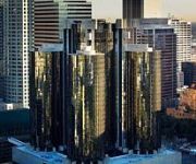
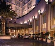
Los Angeles The Westin Bonaventure Hotel & Suites
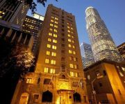
Hilton Checkers Los Angeles
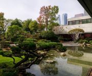
DoubleTree by Hilton Los Angeles Downtown
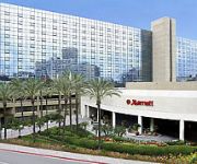
Sheraton Grand Los Angeles
THE LA HOTEL DOWNTOWN
Omni LA at California Plaza
Level Furnished Living
Ace Hotel Downtown Los Angeles
Freehand Los Angeles
MILLENNIUM BILTMORE HOTEL LAX
Videos from this area
These are videos related to the place based on their proximity to this place.
PL4842 - Updated Studio Apartment For Rent (East Los Angeles, CA - Boyle Heights).
Pacific Listings is proud to present this nicely updated studio in East Los Angeles, California. Hardwood flooring, abundant closet space, sleek granite counters, full kitchen, gated parking,...
Airplane/Traveling Hair, Makeup,Outfit!
Thanks for watching this Airplane/Traveling Hair, Makeup,Outfit! video! Comment below your travel essentials! PRODUCTS USED: ♥ Makeup: Benefit Hello Flawless Oxygen Wow Foundation Covergirl.
Village de la Martyr - Centre de la Memoire
Oradour sur Glane, qui autrefois, était un bourg paisible et dynamique avec son tramway et ses nombreux commerces va connaître l'horreur le 10 juin 1944. En début d'après-midi, vers 14h00,...
Inner City Soul
at the Festival De La Gente ... East Los Angeles on the 6th street bridge. October 27 2007.
Barker Block Lofts - Live/Work Lofts in Arts District of Downtown Los Angeles.
Barker Block Loft (http://la-lofts.com/la-condos/barker-block-lofts-for-sale.html) is a new living concept in the Arts District of Downtown Los Angeles. It brings modern design and amenities...
Metro Red Line - At Grade 2
A Metro Red Line subway train deadheads into the Santa Fe Yard and Shops; taken from the 1st St. Viaduct, 9/3/07.
Metro Red Line - At Grade 1
A Metro Red Line subway train deadheads into the Santa Fe Yard and Shops; taken from the 1st St. Viaduct, 9/3/07.
Blueberry Hill Plaque Renovation Boyle Heights
The Renovation of Plaque of Recognition to Hollenbeck Middle School class of 2006 at Blueberry Hill Boyle Heights Los Angeles.
The Difference Between East LA & Boyle Heights
View more East Los Angeles community video portraits on MyEastLA.com There are more similarities than differences between Boyle Heights and the unincorporated part of East Los Angeles, says...
Videos provided by Youtube are under the copyright of their owners.
Attractions and noteworthy things
Distances are based on the centre of the city/town and sightseeing location. This list contains brief abstracts about monuments, holiday activities, national parcs, museums, organisations and more from the area as well as interesting facts about the region itself. Where available, you'll find the corresponding homepage. Otherwise the related wikipedia article.
Boyle Heights, Los Angeles
Boyle Heights is a neighborhood east of Downtown Los Angeles on the East Side of Los Angeles. For much of the twentieth century, Boyle Heights was a gateway for new immigrants. This resulted in diverse demographics, including Jewish American, Japanese American and Mexican American populations, as well as Russian American and Yugoslav populations. Today, the neighborhood is populated mostly by working class Latinos.
Twin Towers Correctional Facility
The Twin Towers Correctional Facility, also referred to in the media as Twin Towers Jail, is a complex erected in Los Angeles, California. The facility is located at 450 Bauchet Street, in Los Angeles, California and is operated by the Los Angeles County Sheriff's Department. The facility consists of two towers, a medical services building, and the Los Angeles County Medical Center Jail Ward.
Union Station (Los Angeles)
Los Angeles Union Station (or LAUS) is the main railway station in Los Angeles, California. In recent years the station has become a major transportation hub for Southern California serving 60,000 passengers a day as they access Amtrak long distance trains, Amtrak California regional trains, Metrolink commuter trains and several Metro Rail subway and light rail lines.
Southern California Institute of Architecture
The Southern California Institute of Architecture (SCI-Arc) in Los Angeles, California, is an independent, nonprofit school offering undergraduate and graduate degrees in architecture. It offers community design and outreach programs, and free public access to frequent exhibitions and lectures by leading thinkers in architecture. Founded in 1972, SCI-Arc is widely regarded as one of the most avant-garde U.S. architecture schools, with a reputation for pushing the boundaries of academic study.
East Los Angeles Interchange
The East Los Angeles Interchange complex is the busiest freeway interchange in the world, with its southern portion handling over 550,000 vehicles per day (2008 AADT). The northern portion, called the San Bernardino Split, is often considered a separate interchange. The interchange was named the Eugene A. Obregon Memorial Interchange, to honor U.S. Marine Corps Medal of Honor recipient Eugene A. Obregon.
It's Always Sunny in Philadelphia
It's Always Sunny in Philadelphia is an American sitcom that premiered on FX on August 4, 2005. New episodes continue to air on FX, with reruns playing on Comedy Central, general broadcast syndication, and WGN America—the first cable-to-cable syndication deal for a sitcom. The show was created, developed, and produced by Rob McElhenney, Glenn Howerton, and Charlie Day, all of whom star in the show.
Wholesale District, Los Angeles
The Wholesale District or more recently the Warehouse District, of Los Angeles is a group of warehouses located in the southeast part of Downtown Los Angeles. Most of the warehouses are industrial in nature and serve the greater Los Angeles area. Few people live in this neighborhood now, though at one time the area had a substantial African-American population. The warehouses are located along the BNSF and UPRR rail lines, which run along Alameda Street and the Los Angeles River.
Japanese American National Museum
The Japanese American National Museum opened its doors in 1992. The idea for the museum was originally thought up by Bruce Kaji with help from other notable Japanese American people at the time. The museum is located in the Little Tokyo area near downtown Los Angeles, California. It is devoted to preserving the history and culture of Japanese Americans.
Salesian High School (Los Angeles)
Salesian High School is an all-male Roman Catholic high school located in the Boyle Heights community of Los Angeles, California. The school mascot is the Mustangs. It was named after Francisco Mora y Borrell, Bishop of the former Monterey-Los Angeles Diocese. Salesian is also named after St. Francis de Sales. The high school is operated by the Roman Catholic Archdiocese of Los Angeles and associated with the Salesian Society.
Arts District, Los Angeles
The 'Arts District occupies the eastern side of Downtown Los Angeles. Its borders are roughly Alameda Street on the west, the 101 freeway on the north, the LA River to the east, and 7th Street to the south. The Arts District is filled with older industrial and former railroad buildings.
La Grande Station
La Grande Station was the Atchison, Topeka and Santa Fe Railway's (Santa Fe) main passenger terminal in Los Angeles, California, until the opening of Union Station in 1939. Heavy damage from the Long Beach earthquake of 1933 meant the last operating years of the station were spent in a state of disrepair as portions of the building had to be removed for the safety of passengers.
Zenshuji
Zenshuji Soto Mission, established in 1922 in the Little Tokyo section of Los Angeles, California, was the first Soto Zen Buddhist temple in North America. Today, it is the North American headquarters for Soto Zen, under the guidance of Sotoshu Shumucho (the headquarters of Soto Zen in Japan), and is a direct branch of Eiheiji and Sojiji (the two head temples in Japan).
Sixth Street Viaduct
The Sixth Street Viaduct is a viaduct bridge that connects the downtown and Boyle Heights areas of Los Angeles, California. It spans the Los Angeles River, the Santa Ana Freeway, and the Golden State Freeway, as well as Metrolink and Union Pacific railroad tracks and several local streets. The viaduct is composed of three independent structures: the reinforced concrete west segment, the central steel arch segment over the river, and the reinforced concrete east segment.
White Memorial Medical Center
White Memorial Medical Center is a hospital in the Boyle Heights neighborhood of Los Angeles, California. It is owned and operated by Adventist Health. White Memorial Medical Center (WMMC) is a not-for-profit, faith-based, teaching hospital, which provides a full range of inpatient, outpatient, emergency and diagnostic services to communities in and near downtown Los Angeles.
Mariachi Plaza
Mariachi Plaza is a small square bounded by E. 1st Street to the south, N. Boyle Avenue to the West and a small residential street named Pleasant Avenue to its North. The Square is located in the Boyle Heights district of the city of Los Angeles, East of Downtown. The Plaza is a congregation of local Mariachi music players, hence the name. During the day, one can find many musicians waiting around the plaza and hotel across the street to be hired for work.
LAPD Hooper Heliport
LAPD Hooper Heliport is a city-owned private-use heliport located one nautical mile (2 km) northeast of the central business district of Los Angeles, in Los Angeles County, California, United States. Hooper Heliport is located on the roof of the Piper Technical Center, the world's largest rooftop airport. It is centrally located between Los Angeles Union Station, Chinatown, and Downtown.
Hollenbeck Park
Hollenbeck Park is city park in the Boyle Heights district of East Los Angeles, Southern California. It is located on the corner of Saint Louis and Fourth Streets, near Boyle Avenue. With green and rolling hills, towering palms and a man-made lake, it is one of the most beautiful spots on the East Side. Some of the park's features include a lake, picinic areas, playgrounds, and a skateboard park.
Hollenbeck Middle School
Hollenbeck Middle School (HMS) is located in East Los Angeles, California, in one of the poorest sections of Los Angeles, Boyle Heights. This section with an estimated 35 to 50 percent high school drop-out rate is in the country’s second largest school district, Los Angeles Unified School District. HMS has earned status as a School for Advanced Studies. The school maintains its rating after LAUSD's recent re-evaluation. The percentage of teachers with a Ph.D.
The Colony (U.S. season 1)
The Colony is a reality television program. The first season was filmed in an industrial area bordering the Los Angeles River on the edge of downtown Los Angeles, and follows ten cast members in an environment that simulates life after a global catastrophe. The series first aired on the Discovery Channel on July 21, 2009. Filming began on February 28, and ran until April 28, 2009.
National Japanese American Veterans Memorial Court
The National Japanese American Veterans Memorial Court is a national memorial court in Los Angeles, California, honoring the bravery and sacrifice of Japanese American veterans during World War II, the Korean War, and the Vietnam War. It is maintained by and located adjacent to the Japanese American Cultural & Community Center on San Pedro Street, in Little Tokyo.
Redondo Junction train wreck
The Redondo Junction train wreck occurred at 17:42 on the evening of January 22, 1956, on the Santa Fe Railroad in Los Angeles. The accident happened at Redondo Junction, just southwest of Boyle Heights near Washington Boulevard and the Los Angeles River; it killed 30 people and injured 117 more. It was the first major disaster in the LA area covered on live television, and the worst train wreck in the city's history.
Felicitas and Gonzalo Mendez Learning Center
Felicitas and Gonzalo Mendez Learning Center is a public high school in the Boyle Heights neighborhood of Los Angeles, California, United States. The school was built to alleviate overcrowding at Roosevelt High School. The site was designated in 2003, broke ground in 2006, and the campus opened in September 2009. It was the first high school to open in Boyle Heights in 28 years. It is built on 6.22 acres . The building occupies 109,378 square feet and contains 38 classrooms.
Koyasan Buddhist Temple
, also known as Koyasan Buddhist Temple, is a temple located in Los Angeles, California, USA, in Little Tokyo. Founded in 1912, it is one of the oldest existing Buddhist temples in the North American region. The temple is a branch of the Koyasan Shingon Buddhism sect, and is the North and South American regional headquarters for this sect.
Men's Central Jail
Men's Central Jail is a Los Angeles County Sheriff's Department County Jail for men in Los Angeles, Los Angeles County, California, United States. Built in 1963, it is one of the oldest County Prisons in California. The Men's Central Jail is located at 441 Bauchet St. , Los Angeles 90012.
Metropolitan Detention Center, Los Angeles
The Metropolitan Detention Center, Los Angeles (MDC Los Angeles) is a United States federal prison in downtown Los Angeles, California which holds male and female inmates prior to and during court proceedings, as well an inmates serving short sentences. It is operated by the Federal Bureau of Prisons, a division of the United States Department of Justice.


