Safety Score: 2,7 of 5.0 based on data from 9 authorites. Meaning we advice caution when travelling to United States.
Travel warnings are updated daily. Source: Travel Warning United States. Last Update: 2024-04-18 08:12:24
Explore Happy Valley
Happy Valley in Los Angeles County (California) is located in United States about 2,291 mi (or 3,687 km) west of Washington DC, the country's capital.
Local time in Happy Valley is now 08:43 PM (Thursday). The local timezone is named America / Los Angeles with an UTC offset of -7 hours. We know of 8 airports in the wider vicinity of Happy Valley, of which 3 are larger airports. The closest airport in United States is Bob Hope Airport in a distance of 12 mi (or 20 km), North-West. Besides the airports, there are other travel options available (check left side).
Also, if you like golfing, there are multiple options in driving distance. We found 10 points of interest in the vicinity of this place. If you need a place to sleep, we compiled a list of available hotels close to the map centre further down the page.
Depending on your travel schedule, you might want to pay a visit to some of the following locations: Los Angeles, Orange, Santa Ana, Riverside and San Bernardino. To further explore this place, just scroll down and browse the available info.
Local weather forecast
Todays Local Weather Conditions & Forecast: 22°C / 72 °F
| Morning Temperature | 16°C / 60 °F |
| Evening Temperature | 21°C / 69 °F |
| Night Temperature | 17°C / 63 °F |
| Chance of rainfall | 0% |
| Air Humidity | 42% |
| Air Pressure | 1014 hPa |
| Wind Speed | Gentle Breeze with 8 km/h (5 mph) from North-East |
| Cloud Conditions | Few clouds, covering 14% of sky |
| General Conditions | Few clouds |
Friday, 19th of April 2024
22°C (72 °F)
19°C (66 °F)
Sky is clear, gentle breeze, clear sky.
Saturday, 20th of April 2024
24°C (75 °F)
19°C (67 °F)
Sky is clear, gentle breeze, clear sky.
Sunday, 21st of April 2024
22°C (71 °F)
15°C (59 °F)
Few clouds, gentle breeze.
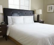
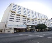
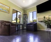
Hotels and Places to Stay
THE LA HOTEL DOWNTOWN
Omni LA at California Plaza
Arroyo Vista Inn
DoubleTree by Hilton Los Angeles Downtown
Downtown LA Corporate Apartments
OAKWOOD AT METRO 417
KAWADA HOTEL
MIYAKO HOTEL LOS ANGELES
BW PLUS DRAGON GATE INN
Lincoln Park Motel
Videos from this area
These are videos related to the place based on their proximity to this place.
Flying Pigeon LA inventory on November 8, 2013
This 4 minute and change video is a brief walk-through of the Flying Pigeon LA bike shop on Friday, November 8, 2013. In the video I talk about our helmet selection - mostly Bern Watts, Berkeley,...
Young Folks Urban Farmers (trailer)
Director: Megan Messmer Trailer for a documentary about Julia Carr and Young Folks Urban Farmers. Julia describes the project and her role during the Mayor's Day of Service at the LA Leadership...
Riding the Gold Line
Riding the Los Angeles Metro's Gold Line in to the Lincoln Heights/Cypress Park Station.
956 Montecito Drive || Los Angeles || Presented by Sylvia Vega
This house located in Montecito Heights (679), Los Angeles, CA 90031 is currently for sale for $599000. 956 Montecito Drive is a 1740 square foot house with 3 beds, 2 baths on a 7517 square...
Raoul De La Sota at Horizons Opening
Raoul De La Sota discusses his work and that of Martin Charlot at the opening of their "Horizons" show at Avenue 50 Studio in Highland Park CA on 4/10/2010.
Hon. Gil Cedillo Speaks at Florence Nightingale Statue Restoration Unveiling
Hear from Danielle Brazell and L.A. City Councilmember Gilbert Cedillo at the Florence Nightingale Statue Restoration Unveiling at Lincoln Park.
Road Map
"Road Map" A somewhat long and perhaps boring description of the first couple of weeks when I was on the road as a young, twenty year old, May to June 1981. Starting out from Danville Virginia,...
Jason and the Scorchers - Great Balls Of Fire
From Showtime's Rock of the 80's - Recorded live at the Palace - Los Angeles, CA - 1984 - Jason and the Scorchers: Jason Ringenberg - Vocals; Warner Hodges - Guitar; Perry Baggs - Drums, Vocals;.
Videos provided by Youtube are under the copyright of their owners.
Attractions and noteworthy things
Distances are based on the centre of the city/town and sightseeing location. This list contains brief abstracts about monuments, holiday activities, national parcs, museums, organisations and more from the area as well as interesting facts about the region itself. Where available, you'll find the corresponding homepage. Otherwise the related wikipedia article.
Lincoln Heights, Los Angeles
Lincoln Heights is a neighborhood east of Downtown Los Angeles, California.
KMPC
KMPC (1540 AM, "Radio Korea", 라디오코리아) is a radio station based in Los Angeles, California and is owned by P&Y Broadcasting Licensee, LLC. Radio Korea is a division of the [Radio Korea Media Group. The station airs Korean-language programming. It broadcasts news, information, and entertainment for the largest Korean-American community in the United States, and the largest Korean community outside of Korea.
KFWB
KFWB is a Los Angeles, California AM radio station operating on 980 kHz with 5,000 watts of power from a transmitter site near Lincoln Park (East Los Angeles). The station had a mostly all-news format from 1968 until September 8, 2009, after which it converted to a news-talk format. KFWB is operated by the KFWB Asset Trust.
Monterey Hills, Los Angeles
Monterey Hills is a small, diverse, middle-class community within the city of Los Angeles, California located about 4 miles ENE of downtown Los Angeles and about 3 miles from Pasadena off of the 110 Freeway. It is surrounded by El Sereno to the southeast, Hermon to the east, Montecito Heights to the southwest and the independent city of South Pasadena to the northeast. Monterey Hills is part of the Arroyo Seco Neighborhood Council (ASNC).
Montecito Heights, Los Angeles
Montecito Heights is a small district in Northeast Los Angeles formerly known as an original East Los Angeles area of Los Angeles, California. The 2000 population is estimated at 16,768.
KLAC
KLAC AM 570 is a radio station serving the Los Angeles metropolitan area. KLAC is one of eight Los Angeles radio stations owned by San Antonio-based Clear Channel Communications. The station is co-located with its sister stations in suburban Burbank, and its transmitter is located on a site in the Lincoln Heights neighborhood of Los Angeles, east of downtown.
Arroyo Seco bicycle path
The Arroyo Seco bicycle path is an approximately 2 miles long Class I bicycle path in Los Angeles, California. The path connects Montecito Heights Recreation Center, Ernest E. Debs Regional Park, and Hermon Park in the Highland Park district, and runs parallel to State Route 110, and ends at San Pascual Stables in South Pasadena.
Rancho Rosa Castilla
Rancho Rosa Castilla was a 3,283-acre Mexican land grant in present day Los Angeles County, California given to Juan Ballesteros in 1831 by Governor Manuel Victoria. The land grant failed to receive confirmation from the Public Land Commission.
Heritage Square Museum
Heritage Square Museum is a living history and open air architecture museum located beside the Arroyo Seco Parkway in the Montecito Heights neighborhood of Los Angeles, California, in the southern Arroyo Seco area. The living history museum shows the story of development in Southern California through historical architectural examples. The museum focuses on interpreting the years 1850 to 1950, a century of unprecedented growth in Los Angeles.
Lincoln Park (Los Angeles)
Lincoln Park in Los Angeles, California was originally created by the City of Los Angeles in 1881, from land donated by John Strother Griffin. It was one of Los Angeles' first parks. It was originally called East Los Angeles Park, then Eastlake Park in 1901. On May 19, 1917, the park was renamed Lincoln Park after Lincoln High School. The park contains a large lake (Lincoln Park Lake, originally East Lake), a recreation center, a senior center, a playground, picnic tables, and ball fields.
Historical monument One Fifty-Seven (HM157)
Historical Monument # 157, aka HM157, is a Victorian house from 1886. Also referred to as The Horace P Dibble House HM157 is on the California Historical landmark list. Historical Monument #157 has become the center of the Lincoln Heights art community, operating as a catalyst for arts and culture. HM157 was voted "Best Underground Date Night 2009" and "Best Escape From Corporate Entertainment 2010" by The LA Weekly.
Rose Hill Park, Los Angeles
Rose Hill Park is the name of a park and a playground in the community of El Sereno. It is also used to refer to the neighborhood surrounding the park and playground. The area is in ZIP code 90032.


