Safety Score: 2,7 of 5.0 based on data from 9 authorites. Meaning we advice caution when travelling to United States.
Travel warnings are updated daily. Source: Travel Warning United States. Last Update: 2024-04-26 08:02:42
Discover Dayton Avenue
Dayton Avenue in Los Angeles County (California) is a city in United States about 2,292 mi (or 3,689 km) west of Washington DC, the country's capital city.
Local time in Dayton Avenue is now 09:27 PM (Friday). The local timezone is named America / Los Angeles with an UTC offset of -7 hours. We know of 8 airports in the vicinity of Dayton Avenue, of which 3 are larger airports. The closest airport in United States is Bob Hope Airport in a distance of 11 mi (or 18 km), North-West. Besides the airports, there are other travel options available (check left side).
Also, if you like golfing, there are a few options in driving distance. We discovered 10 points of interest in the vicinity of this place. Looking for a place to stay? we compiled a list of available hotels close to the map centre further down the page.
When in this area, you might want to pay a visit to some of the following locations: Los Angeles, Orange, Santa Ana, Riverside and San Bernardino. To further explore this place, just scroll down and browse the available info.
Local weather forecast
Todays Local Weather Conditions & Forecast: 21°C / 70 °F
| Morning Temperature | 15°C / 58 °F |
| Evening Temperature | 19°C / 67 °F |
| Night Temperature | 17°C / 62 °F |
| Chance of rainfall | 0% |
| Air Humidity | 34% |
| Air Pressure | 1013 hPa |
| Wind Speed | Fresh Breeze with 14 km/h (8 mph) from South |
| Cloud Conditions | Clear sky, covering 0% of sky |
| General Conditions | Sky is clear |
Saturday, 27th of April 2024
22°C (71 °F)
18°C (65 °F)
Sky is clear, moderate breeze, clear sky.
Sunday, 28th of April 2024
21°C (70 °F)
18°C (65 °F)
Sky is clear, gentle breeze, clear sky.
Monday, 29th of April 2024
21°C (70 °F)
17°C (63 °F)
Sky is clear, gentle breeze, clear sky.
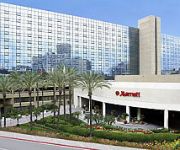
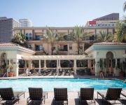
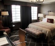
Hotels and Places to Stay
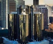
Los Angeles The Westin Bonaventure Hotel & Suites
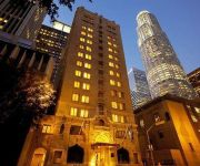
Hilton Checkers Los Angeles
DoubleTree by Hilton Los Angeles Downtown
MILLENNIUM BILTMORE HOTEL LAX
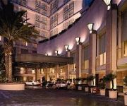
Omni LA at California Plaza
THE LA HOTEL DOWNTOWN
Sunshine Suites at 616 St. Paul
LOS ANGELES ATHLETIC CLUB
Downtown LA Corporate Apartments
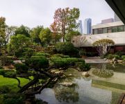
MIYAKO HOTEL LOS ANGELES
Videos from this area
These are videos related to the place based on their proximity to this place.
Pasadena Freeway - Los Angeles
A trip up the Pasadena Freeway (CA 110, Arroyo Seco Parkway), the first freeway built in California (1940). Shot in December 2000, sped up 4x-8x. My Pasadena Freeway web page: http://members.c...
Flying Pigeon LA inventory on November 8, 2013
This 4 minute and change video is a brief walk-through of the Flying Pigeon LA bike shop on Friday, November 8, 2013. In the video I talk about our helmet selection - mostly Bern Watts, Berkeley,...
Young Folks Urban Farmers (trailer)
Director: Megan Messmer Trailer for a documentary about Julia Carr and Young Folks Urban Farmers. Julia describes the project and her role during the Mayor's Day of Service at the LA Leadership...
Railfanning on the Los Angeles River
On Saturday, May 2nd, 2009, my Mother and I decided to go down to the Confluence to see what was going on. After 30 minutes, a Union Pacific intermodal stopped and then passed, a Metrolink...
1988 Talent Show - Nightingale Jr. High School - Clip #1
1988 Talent Show - Nightingale Jr. High School - Clip #1 The talented students of the school, try to put on a show for parents, and students. Highland Park, Cypress Park, in Los Angeles, Californi...
Riding the Gold Line
Riding the Los Angeles Metro's Gold Line in to the Lincoln Heights/Cypress Park Station.
Bike Trail in Elysian Valley / Frogtown (Los Angeles, California)
Area known as "Frogtown" located in Elysian Valley got its name from a time when the Los Angeles River was more natural. This area was a wetlands and known for the frogs that could be heard.the...
VOID:THE TROOPER IRON MAIDEN COVER (LIVE)
Void live at Skate park on Gage and Pine in the city of Bell.
Hyun-jin Ryu Takes Mound Last Game at Dodger Stadium 7-13-14
Hyun-jin Ryu and the Dodgers take the field in the first inning of the last game played at Dodger Stadium, 2 weeks ago. Also shown, the end of the inning, and Ryu demonstrating to Mattingly...
Videos provided by Youtube are under the copyright of their owners.
Attractions and noteworthy things
Distances are based on the centre of the city/town and sightseeing location. This list contains brief abstracts about monuments, holiday activities, national parcs, museums, organisations and more from the area as well as interesting facts about the region itself. Where available, you'll find the corresponding homepage. Otherwise the related wikipedia article.
Dodger Stadium
Dodger Stadium, occasionally referenced by local sportscasters with the metonym Chavez Ravine, is a stadium in Los Angeles. Located adjacent to Downtown Los Angeles, Dodger Stadium has been the home ballpark of Major League Baseball's Los Angeles Dodgers team since 1962. Dodger Stadium was constructed from 1959 to 1962 at a cost of $23 million, financed by private sources.
Lincoln Heights, Los Angeles
Lincoln Heights is a neighborhood east of Downtown Los Angeles, California.
Dodger Dog
The Dodger Dog is a hot dog named after the Major League Baseball franchise that sells them. This 10 inch ballpark frankfurter wrapped in a steamed bun is consumed by millions over the course of the baseball season. The hot dog is sold at Dodger Stadium located in Los Angeles, CA. They cost $5 each at games during the 2009 and 2010 season.
Elysian Park, Los Angeles
Elysian Park is a park and adjacent neighborhood in the City of Los Angeles, California. Encompassing Chavez Ravine where Dodger Stadium is located, Elysian Park is mostly a hillside community that is also home to the Los Angeles Police Academy.
Figueroa Street Tunnels
The Figueroa Street Tunnels are a set of four four-lane tunnels that carry northbound traffic on State Route 110 through Elysian Park in Los Angeles, California, United States. From south to north, the four tunnels measure 755, 461, 130 and 405 feet (230, 141, 40 and 123 m) in length, 46.5 feet (14 m) in width, and 28.3 ft (8.6 m) in height.
Cathedral High School (Los Angeles)
Cathedral High School is a private, college preparatory Catholic all-boys school in Los Angeles, California.
Cypress Park, Los Angeles
Cypress Park is a neighborhood in Northeast Los Angeles. It is located at the confluence of the Los Angeles River and Arroyo Seco and is less than 2.5 miles north of Downtown Los Angeles. Cypress Park is currently becoming closely associated with the movement to revitalize the Los Angeles River, due to the Los Angeles River Center and the Rio de Los Angeles State Park within its boundaries.
Sacred Heart High School (California)
Sacred Heart High School is a Roman Catholic high school for girls in the Lincoln Heights neighborhood of Los Angeles, California. Located in the Roman Catholic Archdiocese of Los Angeles, the school has been administered by the Dominican Sisters of Mission San Jose since 1907.
Heritage Square Museum
Heritage Square Museum is a living history and open air architecture museum located beside the Arroyo Seco Parkway in the Montecito Heights neighborhood of Los Angeles, California, in the southern Arroyo Seco area. The living history museum shows the story of development in Southern California through historical architectural examples. The museum focuses on interpreting the years 1850 to 1950, a century of unprecedented growth in Los Angeles.
Solano Canyon, Los Angeles
Solano Canyon is a village-like community in Los Angeles completely surrounded by Elysian Park. Adjacent communities include Chinatown, Elysian Heights, Echo Park and Lincoln Heights. Solano Canyon is set on the rolling hills of Elysian Park, with broad vistas of downtown Los Angeles. This historic community is the last remaining neighborhood that bordered the Chavez Ravine neighborhoods of La Loma, Palo Verde, and Bishop.
Lincoln Heights Jail
Lincoln Heights Jail is a reportedly haunted former jail building in the Lincoln Heights neighborhood of Los Angeles, California. It closed in 1965. In 1951, the unprovoked beating of seven prisoners occurred in the prison on what came to be known as "Bloody Christmas". The novel L.A. Confidential and subsequent film, part of which was filmed there, was inspired by the incident. Since 1979, the building has been the home of the Bilingual Foundation of the Arts.
Historical monument One Fifty-Seven (HM157)
Historical Monument # 157, aka HM157, is a Victorian house from 1886. Also referred to as The Horace P Dibble House HM157 is on the California Historical landmark list. Historical Monument #157 has become the center of the Lincoln Heights art community, operating as a catalyst for arts and culture. HM157 was voted "Best Underground Date Night 2009" and "Best Escape From Corporate Entertainment 2010" by The LA Weekly.


