Safety Score: 2,7 of 5.0 based on data from 9 authorites. Meaning we advice caution when travelling to United States.
Travel warnings are updated daily. Source: Travel Warning United States. Last Update: 2024-04-24 08:14:40
Discover El Sereno
El Sereno in Los Angeles County (California) is a city in United States about 2,290 mi (or 3,685 km) west of Washington DC, the country's capital city.
Local time in El Sereno is now 03:34 AM (Wednesday). The local timezone is named America / Los Angeles with an UTC offset of -7 hours. We know of 8 airports in the vicinity of El Sereno, of which 3 are larger airports. The closest airport in United States is Bob Hope Airport in a distance of 13 mi (or 21 km), North-West. Besides the airports, there are other travel options available (check left side).
Also, if you like golfing, there are a few options in driving distance. We discovered 10 points of interest in the vicinity of this place. Looking for a place to stay? we compiled a list of available hotels close to the map centre further down the page.
When in this area, you might want to pay a visit to some of the following locations: Los Angeles, Orange, Santa Ana, Riverside and San Bernardino. To further explore this place, just scroll down and browse the available info.
Local weather forecast
Todays Local Weather Conditions & Forecast: 20°C / 67 °F
| Morning Temperature | 13°C / 56 °F |
| Evening Temperature | 18°C / 64 °F |
| Night Temperature | 15°C / 60 °F |
| Chance of rainfall | 0% |
| Air Humidity | 42% |
| Air Pressure | 1018 hPa |
| Wind Speed | Moderate breeze with 10 km/h (6 mph) from North-East |
| Cloud Conditions | Clear sky, covering 0% of sky |
| General Conditions | Sky is clear |
Wednesday, 24th of April 2024
18°C (65 °F)
15°C (58 °F)
Broken clouds, moderate breeze.
Thursday, 25th of April 2024
17°C (62 °F)
16°C (61 °F)
Overcast clouds, gentle breeze.
Friday, 26th of April 2024
19°C (67 °F)
16°C (62 °F)
Sky is clear, moderate breeze, clear sky.
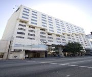
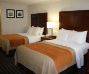
Hotels and Places to Stay
DoubleTree by Hilton Los Angeles Downtown
Arroyo Vista Inn
Sheraton Pasadena Hotel
Pasadena The Langham
BW PLUS DRAGON GATE INN
Hilton Garden Inn Los Angeles Montebello
Downtown LA Corporate Apartments
MIYAKO HOTEL LOS ANGELES
Antonio Hotel
Comfort Inn Near Old Town Pasadena in Eagle Rock
Videos from this area
These are videos related to the place based on their proximity to this place.
2014 XC - Rio Hondo League Meet 1 - Girls Varsity
Rio Hondo League Meet #1 Girl's Varsity 3 Mile race held September 25, 2014 at Lacy Park in San Marino, CA. Conditions - temperatures high 80s, thick grass course.
2014 XC - League Meet #2 (all 5 races)
Video contains all 5 races from the second Rio Hondo League meet held at Hahamongna Park in La Canada on October 16, 2014. San Marino won the men's varsity while La Canada took the women's.
2014 XC - Rio Hondo League Meet #1 Men's Varsity
Rio Hondo League Meet #1 Men's Varsity 3 Mile race held September 25, 2014 at Lacy Park in San Marino, CA. Conditions - temperatures high 80s, thick grass course.
2014 XC - Rio Hondo League Meet 1 Girls JV
Rio Hondo League Meet #1 Girl's JV 3 Mile race held September 25, 2014 at Lacy Park in San Marino, CA. Conditions - temperatures high 80s, thick grass course.
XC 2014 - Rio Hondo League Meet 1 - JV Boys
Rio Hondo League Meet #1 Junior Varsity Boys 3 Mile race held September 25, 2014 at Lacy Park in San Marino, CA. Conditions - temperatures high 80s, thick grass course.
2014 XC - Rio Hondo League Finals - Varsity Girls
The Varsity girls from the 6 teams in the Rio Hondo League race for the 2014 cross country championship on Nov 6 at Lacy Park in San Marino. Includes the awards ceremony at the end.
MLS 22166495 - 1678 Via Del Rey, South Pasadena, CA
1678 Via Del Rey, South Pasadena http://www.coldwellbanker.com/property?action=detail&brandType=CB&propertyId=263099158.
2015 TF - Monrovia vs South Pas Girls F-S 4 x 100 Relay
Monrovia High versus South Pasadena High dual track meet held at SPHS on March 25, 2015. This is the Frosh-Soph Girls 4 x 100 meter relay. A complete list of videos as well as results for...
2015 TF - Monrovia vs South Pas Girls Frosh-Soph 400
Monrovia High versus South Pasadena High dual track meet held at SPHS on March 25, 2015. This is the Frosh-Soph Girls 400 meter. A complete list of videos as well as results for this meet...
2015 TF - Monrovia vs South Pas Girls Varsity 1600
Monrovia High versus South Pasadena High dual track meet held at SPHS on March 25, 2015. This is the Varsity Girls 1600 meter. A complete list of videos as well as results for this meet can...
Videos provided by Youtube are under the copyright of their owners.
Attractions and noteworthy things
Distances are based on the centre of the city/town and sightseeing location. This list contains brief abstracts about monuments, holiday activities, national parcs, museums, organisations and more from the area as well as interesting facts about the region itself. Where available, you'll find the corresponding homepage. Otherwise the related wikipedia article.
California State University, Los Angeles
California State University, Los Angeles (also known as Cal State L.A. , CSULA, or CSLA) is a public comprehensive university, part of the California State University (CSU) system. The campus is located in the eastern region of Los Angeles, California, United States, in the University Hills district, facing the San Gabriel Mountains, at the center of Los Angeles metropolitan area just five miles (8 km) east of Downtown Los Angeles.
University Hills, Los Angeles
University Hills is a district on the East Side of Los Angeles, California. It is the site of California State University, Los Angeles.
KMPC
KMPC (1540 AM, "Radio Korea", 라디오코리아) is a radio station based in Los Angeles, California and is owned by P&Y Broadcasting Licensee, LLC. Radio Korea is a division of the [Radio Korea Media Group. The station airs Korean-language programming. It broadcasts news, information, and entertainment for the largest Korean-American community in the United States, and the largest Korean community outside of Korea.
KFWB
KFWB is a Los Angeles, California AM radio station operating on 980 kHz with 5,000 watts of power from a transmitter site near Lincoln Park (East Los Angeles). The station had a mostly all-news format from 1968 until September 8, 2009, after which it converted to a news-talk format. KFWB is operated by the KFWB Asset Trust.
El Sereno, Los Angeles
El Sereno is a community in Eastern Los Angeles, California. El Sereno sits atop the Monterey Hills that separate the Los Angeles Basin from the San Gabriel Valley, and is the easternmost district in the city of Los Angeles. It is bordered by Monterey Hills and South Pasadena on the north, Alhambra on the east, University Hills on the southeast, City Terrace on the south, Boyle Heights on the southwest, Lincoln Heights on the west, and Montecito Heights on the northwest.
Monterey Hills, Los Angeles
Monterey Hills is a small, diverse, middle-class community within the city of Los Angeles, California located about 4 miles ENE of downtown Los Angeles and about 3 miles from Pasadena off of the 110 Freeway. It is surrounded by El Sereno to the southeast, Hermon to the east, Montecito Heights to the southwest and the independent city of South Pasadena to the northeast. Monterey Hills is part of the Arroyo Seco Neighborhood Council (ASNC).
KLAC
KLAC AM 570 is a radio station serving the Los Angeles metropolitan area. KLAC is one of eight Los Angeles radio stations owned by San Antonio-based Clear Channel Communications. The station is co-located with its sister stations in suburban Burbank, and its transmitter is located on a site in the Lincoln Heights neighborhood of Los Angeles, east of downtown.
Arroyo Seco bicycle path
The Arroyo Seco bicycle path is an approximately 2 miles long Class I bicycle path in Los Angeles, California. The path connects Montecito Heights Recreation Center, Ernest E. Debs Regional Park, and Hermon Park in the Highland Park district, and runs parallel to State Route 110, and ends at San Pascual Stables in South Pasadena.
Los Angeles County High School for the Arts
Los Angeles County High School for the Arts is a Visual and Performing Arts high school located on the campus of California State University, Los Angeles in Los Angeles, California, United States. Founded in 1984, the public, tuition-free school offers both college preparatory courses and conservatory style training. Though it shares facilities with the university, the two schools' activities are usually separate. It is operated by the Los Angeles County Office of Education.
Cal State LA Studios
Cal State LA Studios is the production area of the Department of Television, Film, and Media Studies at California State University, Los Angeles, the only CSU campus in the Los Angeles basin. Bachelor of Arts degrees are offered in Telecommunications and Film, Broadcast Journalism and Animation.
Eagle's Nest Arena
Eagle's Nest Arena is an indoor arena located on the California State University, Los Angeles campus. It plays host to the basketball and volleyball teams for the Golden Eagles, is 94 feet long, 80 feet wide, and can handle two basketball and three volleyball courts. Seating 3,200 at full capacity, it hosted the judo competitions for the 1984 Summer Olympics.
Rose Hill Park, Los Angeles
Rose Hill Park is the name of a park and a playground in the community of El Sereno. It is also used to refer to the neighborhood surrounding the park and playground. The area is in ZIP code 90032.


