Safety Score: 2,7 of 5.0 based on data from 9 authorites. Meaning we advice caution when travelling to United States.
Travel warnings are updated daily. Source: Travel Warning United States. Last Update: 2024-05-04 08:22:41
Delve into Redondo Junction
Redondo Junction in Los Angeles County (California) is located in United States about 2,294 mi (or 3,692 km) west of Washington DC, the country's capital town.
Current time in Redondo Junction is now 04:50 PM (Saturday). The local timezone is named America / Los Angeles with an UTC offset of -7 hours. We know of 9 airports close to Redondo Junction, of which 4 are larger airports. The closest airport in United States is Los Angeles International Airport in a distance of 12 mi (or 19 km), South-West. Besides the airports, there are other travel options available (check left side).
Also, if you like playing golf, there are some options within driving distance. We encountered 10 points of interest near this location. If you need a hotel, we compiled a list of available hotels close to the map centre further down the page.
While being here, you might want to pay a visit to some of the following locations: Los Angeles, Orange, Santa Ana, Riverside and San Bernardino. To further explore this place, just scroll down and browse the available info.
Local weather forecast
Todays Local Weather Conditions & Forecast: 18°C / 64 °F
| Morning Temperature | 15°C / 60 °F |
| Evening Temperature | 17°C / 63 °F |
| Night Temperature | 15°C / 60 °F |
| Chance of rainfall | 0% |
| Air Humidity | 60% |
| Air Pressure | 1012 hPa |
| Wind Speed | Moderate breeze with 10 km/h (6 mph) from North-East |
| Cloud Conditions | Overcast clouds, covering 100% of sky |
| General Conditions | Overcast clouds |
Saturday, 4th of May 2024
18°C (65 °F)
15°C (59 °F)
Light rain, moderate breeze, clear sky.
Sunday, 5th of May 2024
19°C (67 °F)
16°C (62 °F)
Sky is clear, moderate breeze, clear sky.
Monday, 6th of May 2024
19°C (67 °F)
17°C (63 °F)
Sky is clear, gentle breeze, clear sky.
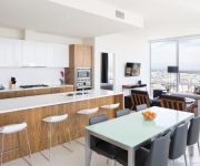
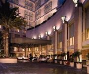
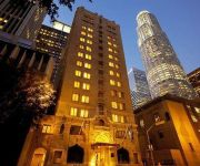
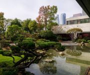
Hotels and Places to Stay
Level Furnished Living
Corporate Suites Downtown In The Heart of LA
Sheraton Grand Los Angeles
Omni LA at California Plaza
MILLENNIUM BILTMORE HOTEL LAX
Hilton Checkers Los Angeles
DoubleTree by Hilton Los Angeles Downtown
Ace Hotel Downtown Los Angeles
Freehand Los Angeles
O HOTEL
Videos from this area
These are videos related to the place based on their proximity to this place.
Malcolm Smith
Vice president for business development of the U.S. Travel Association & General manager for the international area of the POW WOW makes a review of the 2012 edition.
Sailing in Gulf of Fethiye - Part 1 Kizilkuyruk Koyu
In Summer of 2014, Lilly and Dirk sailed with their chartered Aloha yacht in the Gulf of Fethiye, Turkey. They arrived by plain in Dalaman airport, took a ride with the havas shuttle bus to...
Orgasm in the city - Clitoraid.org
http://www.clitoraid.org/ Alike the sex and the city concept, when 4 women meet they talk about their sexual experiences. This time one of them had discovered a way to help genitally mutilated...
Muezzin Calling to Pray from the a Minaret in the city of Faralya near Fethiye
Another city name is Uzunyurt. Note the Echo in the mountains.
GRAFFITI SPIRIT OVER CITY HALL
Mural painted by Man One in Downtown LA depicting a signature Graffiti Spirit making his presence known to City Hall. Copyright 2012. For more info: www.ManOne.com.
Haunted Village - Free Hidden Object Games by PlayHOG
Google Play: https://play.google.com/store/apps/developer?id=PlayHOG Amazon App Store: http://www.amazon.com/s/?
Castle Miner Z: Journey to Hell
This week Kevin, Sebastian, Janno, Hector, and Alex play the Indie game known as Castle Miner Z. Watch as they journey they way down to Hell. They face monsters, zombies, even dragons! Stay...
El Futuro de Wyvernwood
En estos tiempos se habla bastante de perdidas en inversiones - en propiedad, comercio, etc. ¿Que perdidas hay cuando uno invierte en la juventud?
Video copilot City Scene in quick time
Video copilots andrew kramer action essentials 2 tutorial, result.. not too bad for my first attempt, i do find the best output is M2v (mpeg2) as adobe premiere pro cs4, dosent like mixing...
Videos provided by Youtube are under the copyright of their owners.
Attractions and noteworthy things
Distances are based on the centre of the city/town and sightseeing location. This list contains brief abstracts about monuments, holiday activities, national parcs, museums, organisations and more from the area as well as interesting facts about the region itself. Where available, you'll find the corresponding homepage. Otherwise the related wikipedia article.
Vernon, California
Vernon is a city five miles (8.0 km) south of downtown Los Angeles, California. The population was 112 at the 2010 United States Census, the smallest of any incorporated city in the state. The city is primarily composed of industrial areas and touts itself as "Exclusively Industrial. " Meatpacking plants and warehouses are common. As of 2006, there were no parks. Vernon has a history of political problems, and was fighting disincorporation after city-government corruption was discovered.
East Los Angeles Interchange
The East Los Angeles Interchange complex is the busiest freeway interchange in the world, with its southern portion handling over 550,000 vehicles per day (2008 AADT). The northern portion, called the San Bernardino Split, is often considered a separate interchange. The interchange was named the Eugene A. Obregon Memorial Interchange, to honor U.S. Marine Corps Medal of Honor recipient Eugene A. Obregon.
Estrada Courts
Estrada Courts is a low-income housing project in the Boyle Heights area of Los Angeles, California.
Wholesale District, Los Angeles
The Wholesale District or more recently the Warehouse District, of Los Angeles is a group of warehouses located in the southeast part of Downtown Los Angeles. Most of the warehouses are industrial in nature and serve the greater Los Angeles area. Few people live in this neighborhood now, though at one time the area had a substantial African-American population. The warehouses are located along the BNSF and UPRR rail lines, which run along Alameda Street and the Los Angeles River.
Salesian High School (Los Angeles)
Salesian High School is an all-male Roman Catholic high school located in the Boyle Heights community of Los Angeles, California. The school mascot is the Mustangs. It was named after Francisco Mora y Borrell, Bishop of the former Monterey-Los Angeles Diocese. Salesian is also named after St. Francis de Sales. The high school is operated by the Roman Catholic Archdiocese of Los Angeles and associated with the Salesian Society.
Sixth Street Viaduct
The Sixth Street Viaduct is a viaduct bridge that connects the downtown and Boyle Heights areas of Los Angeles, California. It spans the Los Angeles River, the Santa Ana Freeway, and the Golden State Freeway, as well as Metrolink and Union Pacific railroad tracks and several local streets. The viaduct is composed of three independent structures: the reinforced concrete west segment, the central steel arch segment over the river, and the reinforced concrete east segment.
Clement Junction, California
Clement Junction, CA is a populated place (US Census Class Code U6; Location #1660495) located in Los Angeles County, California, at latitude 34º00'50" N and longitude 118º14'20" W, and appears as a named place on the U.S. Geological Survey Los Angeles 7.5' Topographical Quadrangle Map.
Redondo Junction train wreck
The Redondo Junction train wreck occurred at 17:42 on the evening of January 22, 1956, on the Santa Fe Railroad in Los Angeles. The accident happened at Redondo Junction, just southwest of Boyle Heights near Washington Boulevard and the Los Angeles River; it killed 30 people and injured 117 more. It was the first major disaster in the LA area covered on live television, and the worst train wreck in the city's history.


