Safety Score: 3,0 of 5.0 based on data from 9 authorites. Meaning we advice caution when travelling to United Kingdom.
Travel warnings are updated daily. Source: Travel Warning United Kingdom. Last Update: 2024-05-09 08:23:21
Explore Balnakeil
Balnakeil in Highland (Scotland) is a city in United Kingdom about 521 mi (or 839 km) north of London, the country's capital.
Local time in Balnakeil is now 11:34 AM (Thursday). The local timezone is named Europe / London with an UTC offset of one hour. We know of 9 airports in the vicinity of Balnakeil, of which one is a larger airport. The closest airport in United Kingdom is Dornoch Airport in a distance of 56 mi (or 90 km), South-East. Besides the airports, there are other travel options available (check left side).
If you need a place to sleep, we compiled a list of available hotels close to the map centre further down the page.
Depending on your travel schedule, you might want to pay a visit to some of the following locations: Highland, Inverness, Stornoway, Elgin and Kirkwall. To further explore this place, just scroll down and browse the available info.
Local weather forecast
Todays Local Weather Conditions & Forecast: 17°C / 62 °F
| Morning Temperature | 12°C / 53 °F |
| Evening Temperature | 14°C / 57 °F |
| Night Temperature | 12°C / 53 °F |
| Chance of rainfall | 0% |
| Air Humidity | 65% |
| Air Pressure | 1022 hPa |
| Wind Speed | Gentle Breeze with 9 km/h (5 mph) from North-East |
| Cloud Conditions | Overcast clouds, covering 100% of sky |
| General Conditions | Light rain |
Friday, 10th of May 2024
16°C (61 °F)
10°C (51 °F)
Overcast clouds, light breeze.
Saturday, 11th of May 2024
16°C (61 °F)
12°C (53 °F)
Overcast clouds, gentle breeze.
Sunday, 12th of May 2024
18°C (64 °F)
12°C (53 °F)
Light rain, light breeze, scattered clouds.
Hotels and Places to Stay
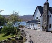
The Overscaig House Hotel
Videos from this area
These are videos related to the place based on their proximity to this place.
Loch Eriboll
A short sequence from "Scotland - The Road Movie".... a journey from West Cornwall to the North West of Scotland, made in June 2010.
Loch Eriboll - Sutherland - Scotland
Loch Eriboll is a 16 km (9.9 mi) long sea loch on the north coast of Scotland, which has been used for centuries as a deep water anchorage as it is safe from the often stormy seas of Cape Wrath...
Durness and Ullapool October 2010
Some clips from a motorbike trip with Wullie. North from near Edinburgh on 9.10.10 300 miles to Tongue and Durness on the north coast of Scotland. Next day we went south to Ullapool. Wullie...
Smoo Cave & Coast near Durness Scotland - May 1993
Smoo Cave & Coast near Durness. Located in the far north of Scotland, you will find there a really breath taking wild, beautiful and rough landscape! Smoo Cave is said to be UK´s largest cave,...
Swisschocolate-online.com available in Durness, Scotland
Now, if John Lennon wants to come back in Holidays, he could order Swiss chocolate.
Run out west Ninja 250r (Me) + CBR400 (Sam)
Random footage of Run out west. First time on the bike since October.. summer is approaching!
Sango Sands Oasis Camping and Caravan Site
Single Shot Panning from Caravan's and Motorhomes on the cliffs to the lovely Surf.
North and West Highlands Route Timelapse
A timelapse of a section of the North and West Highlands Route. Recorded between Kyle of Durness and Dounreay. Starting at the Kyle of Durness, near the exit to Cape Wrath, it follows the...
Videos provided by Youtube are under the copyright of their owners.
Attractions and noteworthy things
Distances are based on the centre of the city/town and sightseeing location. This list contains brief abstracts about monuments, holiday activities, national parcs, museums, organisations and more from the area as well as interesting facts about the region itself. Where available, you'll find the corresponding homepage. Otherwise the related wikipedia article.
Faraid Head
Faraid Head is a small peninsula on the northern coast of Sutherland, Highland, Scotland, located around 2 miles north of the hamlet of Balnakeil and 3 miles north of Durness. At the point is located a small radar station built in the 1950s to house a ROTOR radar system to provide radar coverage of Scotland's north coast. By the time the facility was completed however the ROTOR system had become obsolete and the station was closed down but remained in the hands of the Ministry of Defence.
Kyle of Durness
Kyle of Durness is a coastal inlet on the north coast of Scotland in the county of Sutherland. It extends 5.5 miles inland from Balnakeil and divides the Cape Wrath peninsula from the mainland. The nearest village is Durness.


