Safety Score: 2,8 of 5.0 based on data from 9 authorites. Meaning we advice caution when travelling to Poland.
Travel warnings are updated daily. Source: Travel Warning Poland. Last Update: 2024-04-26 08:02:42
Delve into Fabryczna
The district Fabryczna of Wrocław in Wrocław (Województwo Dolnośląskie) is a subburb in Poland about 190 mi south-west of Warsaw, the country's capital town.
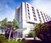
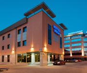
If you need a hotel, we compiled a list of available hotels close to the map centre further down the page.
While being here, you might want to pay a visit to some of the following locations: Kobierzyce, Zorawina, Katy Wroclawskie, Miekinia and Siechnice. To further explore this place, just scroll down and browse the available info.
Local weather forecast
Todays Local Weather Conditions & Forecast: 14°C / 57 °F
| Morning Temperature | 2°C / 36 °F |
| Evening Temperature | 14°C / 57 °F |
| Night Temperature | 8°C / 46 °F |
| Chance of rainfall | 0% |
| Air Humidity | 45% |
| Air Pressure | 1010 hPa |
| Wind Speed | Moderate breeze with 9 km/h (6 mph) from North |
| Cloud Conditions | Broken clouds, covering 55% of sky |
| General Conditions | Broken clouds |
Saturday, 27th of April 2024
17°C (62 °F)
10°C (50 °F)
Sky is clear, gentle breeze, clear sky.
Sunday, 28th of April 2024
20°C (68 °F)
13°C (55 °F)
Overcast clouds, moderate breeze.
Monday, 29th of April 2024
20°C (69 °F)
14°C (57 °F)
Overcast clouds, gentle breeze.
Hotels and Places to Stay
Platinum Palace
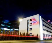
Park Hotel Diament
Citi Hotel's Wroclaw
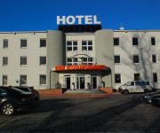
Hotel Kosmonauty Wroclaw Airport
Hotel Sleep
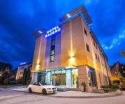
Bacero Premium Hotel
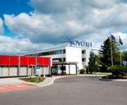
Novotel Wroclaw City
Śląsk
Terminal Hotel
Vega Business Hotel
Videos from this area
These are videos related to the place based on their proximity to this place.
Ciężarówka wpadła na słup
Ciężarówka uderzyła w słup elektryczny http://www.moj-wroclaw-i-dolny-slask.com/ na osiedlu Żerniki dzielnica Fabryczna we Wrocławiu.
Test iluminacji - Stadion miejski we Wrocławiu - 30.05.2012
Ostateczny test oświetlenia stadionu miejskiego we Wrocławiu przed Euro 2012.
Euro 2012 Italy - Ireland (Poznan/Poland) National Anthem and atmosphere in the stadium
The Game was very nice!
ŚLĄSK WROCŁAW - Legia Warszwa (Puchar Polski Oprawa)
Śląsk Wrocław : Legia Warszawa 0:2 (0:2) 0:1 Saganowski 32' 0:2 Saganowski 44'
EURO 2012 Rosja- Czechy. Bramka na 4-1 Romana Pawluczenki
Bramka Romana Pavlyuchenko na 4-1 w meczu rosjan z czechami we Wrocławiu na Euro 2012.
Hymn Polski 16 Czerwca 2012 Czechy Polska 1080p HD GoPro
Hymn Polski odśpiewany na stadionie miejskim we Wrocławiu Przed meczem Polska Czechy a na trybunach ogromna Polska flaga.
Dron foto Śląsk Wrocław - Borussia Dortmund
Lot dronem nad Stadionem Miejskim we Wrocławiu podczas meczu Śląska Wrocław oraz Borussia Dortmund.
Videos provided by Youtube are under the copyright of their owners.
Attractions and noteworthy things
Distances are based on the centre of the city/town and sightseeing location. This list contains brief abstracts about monuments, holiday activities, national parcs, museums, organisations and more from the area as well as interesting facts about the region itself. Where available, you'll find the corresponding homepage. Otherwise the related wikipedia article.
Wrocław – Copernicus Airport
Wrocław – Copernicus Airport (Polish: Port Lotniczy Wrocław im. Mikołaja Kopernika) is an international commercial airport in Wrocław in southwestern Poland. The airport is located 10 km southwest of the city centre. It has one runway and two passenger terminals and one cargo terminal. The new terminal started its operations on March 11, 2012.
Ślęza
Ślęza is a 78.6 km long river in Lower Silesia, southern Poland, a left tributary of the Oder. It starts in the Niemcza Hills (Wzgórza Niemczańskie), part of the Sudete Highlands (Przedgórze Sudeckie), and flows near Mount Ślęża through the Silesian Lowland (Nizinia Śląska) and enters the Oder in Wrocław. The most important tributary is: Mała Ślęza ("Small Ślęza"). The most important towns on the river are: Niemcza, Tyniec nad Ślęzą, Jordanów Śląski and Wrocław.
Widawa
The Widawa is a river in Poland, a right-bank tributary of the Oder River. Towns along the Widawa include Namysłów, Bierutów, and Psie Pole.
St. Elizabeth's Church, Wrocław
St. Elizabeth's Church of the Catholic Third Order of Saint Francis is a Gothic church in Wrocław, Poland. The structure dates back to the 14th century, when construction was commissioned by the city. The main tower was originally 130 meters tall. From 1525 until 1946, St. Elizabeth's was the chief Lutheran Church of Breslau/Wroclaw and Silesia. In 1946 it was expropriated and given to the Military Chaplaincy of the Polish Roman Catholic Church.
Wrocław Palace
Wrocław Palace or Royal Palace is a palace in Wrocław, Poland. It was also previously known as Breslau City Palace (Breslauer Stadtschloss) when the city was Breslau, Germany. Originally a palace of the Prussian monarchy, the palace now houses the Wrocław City Museum. Initially a Baroque palace of Heinrich Gottfried von Spätgen, chancellor of Bishop Francis Louis of Neuburg, it was built in 1717 in the Vienna style.
New Synagogue (Wrocław)
The New Synagogue was the largest synagogue in Breslau, Germany. It was one of the largest synagogues in the German Empire and a centre of Liberal Judaism in Breslau. It was built in 1865-1872, and designed by Edwin Oppler. It was burnt down during the Kristallnacht pogrom which swept across Nazi Germany on 9–10 November 1938.
Stadion Miejski (Wrocław)
The Municipal Stadium in Wrocław, Poland, (Polish: Stadion Miejski we Wrocławiu) is the highest fourth category football (soccer) stadium built for the 2012 UEFA European Football Championship. The Stadium is located on aleja Śląska in the western part of the city (Pilczyce district). It is the home stadium of the Śląsk Wrocław football team playing in the Polish T-Mobile Ekstraklasa. The stadium has a capacity of 42,771 spectators, all seated and all covered.
Poltegor Centre
Poltegor Centre (formerly Poltegor) was the highest building in Wrocław. It was built in 1982 and the name originates from a company called Poltegor (an acronym for Polska Technika Górnicza) dealing in mining. During 1980s, the building was the company’s headquarters, and even after that period they still occupied a fair part of the building. Demolition of the building has now finished. The technology behind the building is a central ferroconcrete core around which each floor has been built.
Wrocław water tower
This historic Wrocław water tower is situated in Borek, the district of Krzyki that is the southern borough of Wrocław, Poland.
Wilkszyn
Wilkszyn is a village in the administrative district of Gmina Miękinia, within Środa Śląska County, Lower Silesian Voivodeship, in south-western Poland. Prior to 1945 it was in Germany. It lies approximately 8 kilometres north-east of Miękinia, 21 kilometres east of Środa Śląska, and 15 kilometres north-west of the regional capital Wrocław. The village has a population of 813.
Paniowice
Paniowice is a village in the administrative district of Gmina Oborniki Śląskie, within Trzebnica County, Lower Silesian Voivodeship, in south-western Poland. Prior to 1945 it was in Germany. The village has a population of 400.
Cesarzowice, Wrocław County
Cesarzowice is a village in the administrative district of Gmina Kąty Wrocławskie, within Wrocław County, Lower Silesian Voivodeship, in south-western Poland. Prior to 1945 it was in Germany. It lies approximately 12 kilometres east of Kąty Wrocławskie, and 11 kilometres south-west of the regional capital Wrocław.
Gądów
Gądów (German: Polnisch Gandau, since 1889 Alt Gandau) is a village in the administrative district of Gmina Kąty Wrocławskie, within Wrocław County, Lower Silesian Voivodeship, in south-western Poland. Prior to 1945 it was in Germany. It lies approximately 11 kilometres east of Kąty Wrocławskie, and 13 kilometres south-west of the regional capital Wrocław.
Mokronos Górny
Mokronos Górny is a village in the administrative district of Gmina Kąty Wrocławskie, within Wrocław County, Lower Silesian Voivodeship, in south-western Poland. Prior to 1945 it was in Germany. The village has a population of 250.
Nowa Wieś Wrocławska
Nowa Wieś Wrocławska is a village in the administrative district of Gmina Kąty Wrocławskie, within Wrocław County, Lower Silesian Voivodeship, in south-western Poland. Prior to 1945 it was in Germany. It lies approximately 11 kilometres east of Kąty Wrocławskie and 13 km south-west of the regional capital Wrocław.
Pietrzykowice, Gmina Kąty Wrocławskie
Pietrzykowice is a village in the administrative district of Gmina Kąty Wrocławskie, within Wrocław County, Lower Silesian Voivodeship, in south-western Poland. Prior to 1945 Silesia was part of Germany. As a result of the post war border changes at the end of World War 2 most of Silesia became part of Poland. When Silesia was part of Germany, Pietrzykowice was known as Petersweiler, and Wroclaw was known as Breslau. Pietrzykowice is located approximately 15km south west of Wroclaw.
Smolec
Smolec is a village in the administrative district of Gmina Kąty Wrocławskie, within Wrocław County, Lower Silesian Voivodeship, in south-western Poland. Prior to 1945 it was Schmolz, Germany. It lies approximately 10 kilometres north-east of Kąty Wrocławskie, and 12 kilometres south-west of the regional capital Wrocław. The village has an approximate population of 3,000.
Zabrodzie, Lower Silesian Voivodeship
Zabrodzie is a village in the administrative district of Gmina Kąty Wrocławskie, within Wrocław County, Lower Silesian Voivodeship, in south-western Poland. Prior to 1945 it was in Germany. It lies approximately 13 kilometres east of Kąty Wrocławskie and 11 km south-west of the regional capital Wrocław.
Zybiszów
Zybiszów is a village in the administrative district of Gmina Kąty Wrocławskie, within Wrocław County, Lower Silesian Voivodeship, in south-western Poland. Prior to 1945 it was in Germany. It lies approximately 11 kilometres east of Kąty Wrocławskie, and 12 kilometres south-west of the regional capital Wrocław. The village has a population of 190.
Hala Orbita
Hala Orbita is Indoor arena in Wrocław, Poland. It hosts the home games of Śląsk Wrocław and has a seating capacity for 3,000 people.
Osobowice Cemetery
Osobowice Cemetery is a cemetery in Osobowice, Wrocław, Poland. Famous people buried at cemetery Adolf Anderssen
Stadion Oporowska
Stadion Oporowska is a football stadium in Wrocław, Poland. It is the former home ground of Śląsk Wrocław. The stadium holds 8,346 spectators. open stand (east): 3982 places Covered Tribune (western): 2784 places Grandstand North openwork: 1104 places This gives the 7870 seats for spectators hosts. Grandstand South openwork (grandstand for visitors supporters): 476 seats
BISC Wrocław
BISC Wrocław is a co-educational private school in Wrocław, Poland. The school opened in September 2006 to provide primary and secondary educations for the growing expatriate community. BISC Wroclaw is the sister school of the British International School of Cracow (BISC).
White Stork Synagogue
The White Stork Synagogue is a nineteenth century synagogue in Wrocław, Poland. Rededicated in 2010 after a decade-long renovation, it is the religious and cultural centre of the local Jewish community, under the auspices of the Union of Jewish Religious Communities in Poland. It is the only synagogue in Wrocław to have survived the Holocaust.
Rędziński Bridge
The Rędziński Bridge is a cable-stayed bridge spanning the Oder river in Wrocław, Poland. As a section of the A8 motorway bypassing the center of Wroclaw, the bridge links both sections of the route across the Oder, providing connections to the A4 motorway to the south, and to the future sections of the S5 and S8 expressways to the northeast.


