Safety Score: 3,3 of 5.0 based on data from 9 authorites. Meaning please reconsider your need to travel to Netherlands.
Travel warnings are updated daily. Source: Travel Warning Netherlands. Last Update: 2024-05-09 08:23:21
Delve into 's Gravendam
The district 's Gravendam of Noordwijkerhout in Gemeente Noordwijkerhout (South Holland) is a subburb in Netherlands about 19 mi south-west of Amsterdam, the country's capital town.
If you need a hotel, we compiled a list of available hotels close to the map centre further down the page.
While being here, you might want to pay a visit to some of the following locations: Haarlem, The Hague, Heemskerk, Heiloo and Amsterdam. To further explore this place, just scroll down and browse the available info.
Local weather forecast
Todays Local Weather Conditions & Forecast: 15°C / 59 °F
| Morning Temperature | 11°C / 51 °F |
| Evening Temperature | 15°C / 59 °F |
| Night Temperature | 12°C / 54 °F |
| Chance of rainfall | 0% |
| Air Humidity | 72% |
| Air Pressure | 1028 hPa |
| Wind Speed | Light breeze with 5 km/h (3 mph) from South-East |
| Cloud Conditions | Broken clouds, covering 58% of sky |
| General Conditions | Broken clouds |
Friday, 10th of May 2024
15°C (59 °F)
14°C (57 °F)
Overcast clouds, gentle breeze.
Saturday, 11th of May 2024
19°C (66 °F)
16°C (62 °F)
Overcast clouds, gentle breeze.
Sunday, 12th of May 2024
21°C (70 °F)
17°C (63 °F)
Light rain, gentle breeze, broken clouds.
Hotels and Places to Stay
Hotel Van Oranje Autograph Collection
NH Noordwijk Conference Centre Leeuwenhorst
Beach Hotel
Prominent Inn Hotel
Golden Tulip Noordwijk Beach
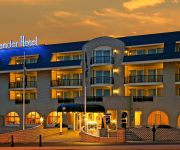
Alexander
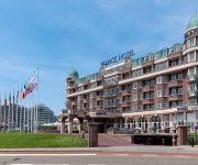
Radisson Blu Palace Hotel
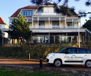
Villa de Duinen
Fletcher Hotel Witte Raaf Noordwijk
Boutique Suites Lisse - Schiphol
Videos from this area
These are videos related to the place based on their proximity to this place.
Treinen in Nederland: Voorhout en Lisse
NL: Treintypes VIRM en SLT rijdend over de spoorlijn Leiden - Haarlem te Voorhout (Net voor het station) en het oude station van Lisse. Opgenomen op 23 - 05 - 2012. UK: Traintypes VIRM and...
Spoorwegovergang Voorhout/ Dutch Railroad-/ Level Crossing/ Bahnübergang/ Passage a Niveau
De Intercity naar Amsterdam Centraal passeert de 's Gravendamseweg The InterCity to Amsterdam Centraal passes the 's Gravendamseweg Das InterCity nach Amsterdam Centraal fahrt durch die...
Spoorwegovergang Voorhout/ Dutch Railroad-/ Level Crossing/ Bahnübergang/ Passage a Niveau
De Intercity naar Amsterdam Centraal passeert de 's Gravendamseweg The InterCity to Amsterdam Centraal passes the 's Gravendamseweg Das InterCity nach Amsterdam Centraal fahrt durch die...
Sfeerimpressie start bouw feest Hooghkamer fase 1a te Voorhout
http://hooghkamer-voorhout.nl/ Op 28 september 2012 werd de eerste paal in het nieuwbouwproject Hooghkamer Voorhout geslagen voor de eerste fase. Na een periode van drie jaar afwezigheid ...
Brand in Voorhout
Aan de Jacoba van Beierenlaan uitslaande brand. Hoge vlammen en veel rook. Loodsen van firma Oskam.
Videos provided by Youtube are under the copyright of their owners.
Attractions and noteworthy things
Distances are based on the centre of the city/town and sightseeing location. This list contains brief abstracts about monuments, holiday activities, national parcs, museums, organisations and more from the area as well as interesting facts about the region itself. Where available, you'll find the corresponding homepage. Otherwise the related wikipedia article.
Rijnsburg
' is a community in the eastern part of the town of Katwijk, in the western Netherlands, in the province of South Holland. The name means Rhine's Burg in Dutch.
Sassenheim
Sassenheim is also the German name for Sanem, Luxembourg. Sassenheim Coat of arms of Sassenheim Location of Sassenheim Coordinates: {{#invoke:Coordinates|coord}}{{#coordinates:52|13|33|N|4|31|21|E|type:city_region:NL | |name= }} Country Netherlands Province Zuid-Holland Municipality Teylingen Population (2005) 14.906 Sassenheim is a town and former municipality in the western Netherlands, in the province of South Holland.
Voorhout
' is a town and former municipality in the western Netherlands, in the province of South Holland. The former municipality covered an area of 12.59 km² (4.86 mile²) of which 0.33 km² (0.13 mile²) is covered by water, and had a population of 14,792 in 2004. Together with Sassenheim and Warmond, it became part of the Teylingen municipality on 1 January 2006. Voorhout is located in an area called the "Dune and Bulb Region". It also included the communities of Piet Gijzenbrug (partly) and Teijlingen.
Ringvaart
The Ringvaart (known in full as Ringvaart of the Haarlemmermeer Polder) is a canal in the province of North Holland, the Netherlands. The Ringvaart (Dutch meaning "ring canal") is a true circular canal surrounding the Haarlemmermeer polder and forms the boundary of the Haarlemmermeer municipality. Ringvaart is also the name of the dike bordering the canal. Construction of the canal began in 1839 as the first step to reclaim land from Haarlemmermeer (Dutch for Haarlem's Lake).
Keukenhof
Keukenhof, also known as the Garden of Europe, is the world's largest flower garden. It is situated near Lisse, Netherlands. According to the official website for the Keukenhof Park, approximately 7,000,000 (seven million) flower bulbs are planted annually in the park, which covers an area of 32 hectares. Keukenhof is located in South Holland in the small town of Lisse, south of Haarlem and southwest of Amsterdam. It is accessible by bus from the train stations of Haarlem, Leiden and Schiphol.
European Space Research and Technology Centre
The European Space Research and Technology Centre (ESTEC) is the European Space Agency's main technology development and test centre for spacecraft and space technology. It is situated in Noordwijk, South Holland, in the western Netherlands. At ESTEC, about 2500 engineers, technicians and scientists work hands-on with mission design, spacecraft and space technology.
Kaag
De Kaag is a village in the Dutch province of South Holland. It is a part of the municipality of Kaag en Braassem, and lies about 8 km northeast of Leiden. De Kaag lies on an island, Kagereiland, in a lake system called the Kaag Lakes. To reach De Kaag, a ferry is taken from Buitenkaag. De Kaag is also part of an area called the Duin- en Bollenstreek ("Dune and Bulb Region").
Klinkenberg, South Holland
Klinkenberg is a town in the Dutch province of South Holland. It is located in the municipality of Teylingen, about 2 km southwest of Sassenheim.
Oud Poelgeest
Oud Poelgeest is castle in Oegstgeest, north of Leiden, that was the former home of the Dutch scientist Herman Boerhaave (1668–1738). He was a Dutch humanist and physician of European fame.
Vrije en Lage Boekhorst
Vrije en Lage Boekhorst ("Free and Low Boekhorst") is a former municipality in the Dutch province of South Holland. It was located to the west of the hamlet of Zevenhuizen in the present municipality of Alkemade. The municipality existed between 1817 and 1855, when it became part of Alkemade. The area used to be a separate manor, but it was added in 1812 to the municipality of Noordwijkerhout as an exclave, even though that village lay almost 10 km away.
Leiden Centraal railway station
Leiden Centraal is the main railway station in Leiden, a city in the Netherlands.
Duin- en Bollenstreek
The Duin- en Bollenstreek (Dutch for "Dune and Bulb Region") is a region in South Holland, The Netherlands, that features coastal dunes and the cultivation of flower bulbs. Situated at the heart of historical Holland around the city of Katwijk, being by far the largest town in this area, and boundered by The Hague and Haarlem, the combination of beaches, flower fields, lakes and history makes this area attractive to tourists.
Bollenstreek
The Bollenstreek (Dutch for "Bulb Region") is a region in the Netherlands consisting of areas in North and South Holland that feature the cultivation of flower bulbs. The colourful flower fields that have come to symbolise Holland can be seen in these areas around April.
Kagerplassen
The Kagerplassen (a Dutch term meaning "the Kaag Lakes") is a small lake system in South Holland located to the northeast of Leiden. The Kaag Lakes are a popular area for boating, watersports, fishing, camping and walking. Windmills, waterfront pasture land (weilanden) with grazing animals, quaint Dutch boats and buildings and (in season) flower fields are all part of the charm of boating and walking in this area. The Kaag Lakes are part of two municipalities: Kaag en Braassem and Teylingen.
Slot Teylingen
Slot Teylingen is a Dutch castle in the municipality of Teylingen, in Voorhout, near the border with Sassenheim. It is presumably the family keep of the noble family Van Teylingen, from which the Van Brederode family directly descended from. The castle was originally built to protect the north-south route in Hollandic territory. Later it became a forester's castle for the forestry of the counts of Holland, starting with William IV, count of Holland.
Groenoordhallen
Groenoordhallen was a building in Leiden, Netherlands. It was used for concerts and conventions, but one of its main sources of revenue was the cattle market. The closure of that market in 2005 led to its demise. In 2010, the building was demolished; homes and offices are to be built in its place, with bricks and other elements retained from the original structure.
Leidse Hout
The Leidse Hout is a public urban park in Leiden, Netherlands. It is located between the border of Oegstgeest, approximately 1.5 kilometers northwest of the Leiden city center, and on the northern border of the Leiden Diaconessenhuis hospital. The park was opened on June 30, 1931 and was the product of a governmental program that provided work for the unemployed during the Great Depression. A tea house, deer park, and a music pavilion is incorporated into the park.
Huys Dever
The Huys Dever is a small castle in Lisse, Netherlands. It was probably built shortly after 1375 by Reinier Dever or d'Ever, a member of an old noble family from Holland.
De Beukenhof
De Beukenhof is a hotel-restaurant located in Oegstgeest in the Netherlands. It is a former fine dining restaurant that was awarded one or two Michelin stars since 1957 up to 1995. GaultMillau awarded them 13.0 points (out of 20). Head chef in the time of the Michelin stars was Coos Fulpen. He retired in 1995.
Castlefest
Castlefest is a medieval/fantasy festival in the Netherlands, held in the first weekend of August in the gardens of Castle Keukenhof in Lisse since 2005. The festival takes part during 3 days on Friday, Saturday and Sunday with an opening concert on Thursday (since 2011). During the first edition 3,500 visitors attended the event, in 2007 the festival attracted 16,000 visitors and in 2011 more than 24,000 visitors entered the gates of Castlefest.
Sportpark Hofbrouckerlaan
Sportpark Hofbrouckerlaan is a cricket ground in Oegstgeest, the Netherlands. The first and to date only recorded match on the ground came in 2003, when the ground held a Women's One Day International between the Netherlands Women and Scotland Women in the IWCC Trophy. The ground is used by Ajax Cricket Club and Leidse Studenten Cricket Club.
Arnoud, Hillegom
Arnoud was a small township in the Dutch province of South Holland. The township was located between Hillegom and Lisse. It consisted of a single street (Arnoudstraat) and was developed as part of the creation of De Arnoud factory in 1904. Over time the factory expanded and the houses on Arnoudstraat had to be torn down. The area of Arnoud is now called Hillegom-Zuid and is an industrial area with no inhabitants.
Rijnlands Lyceum Sassenheim
Rijnlands Lyceum Sassenheim is a Dutch school for secondary education in Sassenheim. The school is part of Rijnlands Lyceum Foundation.
Hol Maren
Hol Maren is a mansion in Oegstgeest, Netherlands on the Haarlemmertrekvaart, 21. The mansion was built in 1892 and was designed by the architect Hendrik Jesse (1860-1943) for the landowner and river fish trader Johannes Spaargaren. The mansion is shaped as a block in old Dutch style with elements from the Dutch neorenaissance, such as decorative arcs above the windows on the ground floor. The garden has the characteristics of a park. Hol Maren is a municipal monument since 1991.
De Graaf van het Hoogveen
De Graaf van het Hoogveen was a restaurant located in Badhotel Zeerust in Noordwijk aan Zee, in the Netherlands. It was a fine dining restaurant that was awarded one Michelin star in the period 1982-1988. De Graaf van het Hoogveen was a small restaurant with just eight tables. The restaurant was famous for its wine list with 650 wines and its wine cellar of 15,000 bottles of high quality wines. It received several national and international awards for it.


