Safety Score: 3,3 of 5.0 based on data from 9 authorites. Meaning please reconsider your need to travel to Netherlands.
Travel warnings are updated daily. Source: Travel Warning Netherlands. Last Update: 2024-05-14 08:25:02
Explore Poelpolder
The district Poelpolder of Lisse in Gemeente Lisse (South Holland) is located in Netherlands about 16 mi south-west of Amsterdam, the country's capital.
If you need a place to sleep, we compiled a list of available hotels close to the map centre further down the page.
Depending on your travel schedule, you might want to pay a visit to some of the following locations: Haarlem, Heemskerk, The Hague, Amsterdam and Heiloo. To further explore this place, just scroll down and browse the available info.
Local weather forecast
Todays Local Weather Conditions & Forecast: 22°C / 72 °F
| Morning Temperature | 15°C / 59 °F |
| Evening Temperature | 14°C / 57 °F |
| Night Temperature | 13°C / 55 °F |
| Chance of rainfall | 9% |
| Air Humidity | 57% |
| Air Pressure | 1004 hPa |
| Wind Speed | Moderate breeze with 11 km/h (7 mph) from North-West |
| Cloud Conditions | Broken clouds, covering 67% of sky |
| General Conditions | Moderate rain |
Wednesday, 15th of May 2024
15°C (59 °F)
13°C (55 °F)
Light rain, gentle breeze, overcast clouds.
Thursday, 16th of May 2024
16°C (60 °F)
13°C (55 °F)
Moderate rain, light breeze, overcast clouds.
Friday, 17th of May 2024
16°C (60 °F)
14°C (57 °F)
Light rain, gentle breeze, broken clouds.
Hotels and Places to Stay
Boutique Suites Lisse - Schiphol
De Nachtegaal
Van der Valk Hotel Sassenheim-Leiden
Tweelwonen Kaagresort
NH Noordwijk Conference Centre Leeuwenhorst
Golden Tulip Leiden Centre
City Resort Hotel Leiden
Flora Entrance: Floraplein
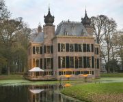
Landgoed Kasteel Oud-Poelgeest
Landgoed Kasteel Oud-Poelgeest
Videos from this area
These are videos related to the place based on their proximity to this place.
Gathering Backpacker Dunia Western Europe Part II Tulip Spring Bike Trip (full clip)
Members of Backpacker Dunia Community in Western Europe reunited again this year. Our 2nd Gathering in Europe has been held in Leiden, The Netherlands. With biking together to Lisse as the...
Keukenhof Gardens, Lisse (near Amsterdam), the Netherlands
If you are planning a trip to Amsterdam, do it in the spring and be sure to visit Keukenhof, Europe's largest garden. You can easily spend an entire day exploring the magnificent gardens. The...
2013 Ronde van Lisse - korte versie
Het eerste gedeelte van de Ronde van Lisse op 22 sept 2013. GOPRO Hero 3 Black Edition onder het zadel van de latere winnaar Sjoerd van Kampen.
Baggeren jachthaven Lisse door Griekspoor
Griekspoor baggerde een jachthaven in Lisse uit. Deze haven is van van Watersportvereniging Lisse en telt 182 ligplaatsen. Met specialistisch materieel werd de klus in een week tijd geklaard.
Muziekvereniging Da Capo Lisse - Sinterklaasintocht 2012
De SMB, Jong Da Capo en de majorettes tijdens de Sinterklaasintocht in Lisse op 17 november 2012.
Videos provided by Youtube are under the copyright of their owners.
Attractions and noteworthy things
Distances are based on the centre of the city/town and sightseeing location. This list contains brief abstracts about monuments, holiday activities, national parcs, museums, organisations and more from the area as well as interesting facts about the region itself. Where available, you'll find the corresponding homepage. Otherwise the related wikipedia article.
Sassenheim
Sassenheim is also the German name for Sanem, Luxembourg. Sassenheim Coat of arms of Sassenheim Location of Sassenheim Coordinates: {{#invoke:Coordinates|coord}}{{#coordinates:52|13|33|N|4|31|21|E|type:city_region:NL | |name= }} Country Netherlands Province Zuid-Holland Municipality Teylingen Population (2005) 14.906 Sassenheim is a town and former municipality in the western Netherlands, in the province of South Holland.
Voorhout
' is a town and former municipality in the western Netherlands, in the province of South Holland. The former municipality covered an area of 12.59 km² (4.86 mile²) of which 0.33 km² (0.13 mile²) is covered by water, and had a population of 14,792 in 2004. Together with Sassenheim and Warmond, it became part of the Teylingen municipality on 1 January 2006. Voorhout is located in an area called the "Dune and Bulb Region". It also included the communities of Piet Gijzenbrug (partly) and Teijlingen.
Nieuw-Vennep
Nieuw-Vennep is a town in the Dutch province of North Holland. It is a part of the municipality of Haarlemmermeer, and lies about 10 km southwest of Amsterdam Airport Schiphol. In 2006 it had about 30,000 inhabitants. The built-up area of the town was 3.71 km, and contained 7,513 residences. The wider statistical area of Nieuw-Vennep has a population of around 40,000. In 2001, the town of Nieuw-Vennep had 17,886 inhabitants.
Ringvaart
The Ringvaart (known in full as Ringvaart of the Haarlemmermeer Polder) is a canal in the province of North Holland, the Netherlands. The Ringvaart (Dutch meaning "ring canal") is a true circular canal surrounding the Haarlemmermeer polder and forms the boundary of the Haarlemmermeer municipality. Ringvaart is also the name of the dike bordering the canal. Construction of the canal began in 1839 as the first step to reclaim land from Haarlemmermeer (Dutch for Haarlem's Lake).
Keukenhof
Keukenhof, also known as the Garden of Europe, is the world's largest flower garden. It is situated near Lisse, Netherlands. According to the official website for the Keukenhof Park, approximately 7,000,000 (seven million) flower bulbs are planted annually in the park, which covers an area of 32 hectares. Keukenhof is located in South Holland in the small town of Lisse, south of Haarlem and southwest of Amsterdam. It is accessible by bus from the train stations of Haarlem, Leiden and Schiphol.
Hoogmade
Hoogmade is a village in the Dutch province of South Holland. It is located about 7 km east of Leiden, in the municipality of Kaag en Braassem. Hoogmade was a separate municipality between 1817 and 1855, when it merged with Woubrugge.
Roelofarendsveen
Roelofarendsveen is a town in the Dutch province of South Holland. It is a part of the municipality of Kaag en Braassem, and lies about 10 km east of Leiden. The town Roelofarendsveen and the village Oude Wetering have merged to form one built-up area. The statistical districts covering these two towns have a population of around 10,950. \t\t \t\t\tBij Roelofarendsveen, molen foto2 2009-10-25 15.34.
Rijpwetering
Rijpwetering is a town in the Dutch province of South Holland. It is a part of the municipality of Kaag en Braassem, and lies about 8 kilometres east of Leiden. In 2001, the town of Rijpwetering had 913 inhabitants. The built-up area of the town was 0.12 km², and contained 340 residences. The larger statistical area of Rijpwetering has a population of around 1440.
Navigable aqueduct
Navigable aqueducts (sometimes called water bridges) are bridge structures that carry navigable waterway canals over other rivers, valleys, railways or roads. They are primarily distinguished by their size, carrying a larger cross-section of water than most water-supply aqueducts. Although Roman aqueducts were sometimes used for transport, aqueducts were not generally used until the 17th century when the problems of summit level canals had been solved and modern canal systems started to appear.
Oud Ade
Oud Ade is a village in the Dutch province of South Holland. It is a part of the municipality of Kaag en Braassem, and lies about 7 km east of Leiden. In 2001, the town of Oud Ade had 336 inhabitants. The built-up area of the town was 0.04 km², and contained 119 residences. The wider statistical district "Oud Ade and Zevenhuizen" has a population of around 620.
Kaag
De Kaag is a village in the Dutch province of South Holland. It is a part of the municipality of Kaag en Braassem, and lies about 8 km northeast of Leiden. De Kaag lies on an island, Kagereiland, in a lake system called the Kaag Lakes. To reach De Kaag, a ferry is taken from Buitenkaag. De Kaag is also part of an area called the Duin- en Bollenstreek ("Dune and Bulb Region").
Hartekamp
Hartekamp, or Hartecamp, is the name of a villa in Heemstede, the Netherlands, on the Bennebroek border. It was once the summer home of George Clifford, who employed Linnaeus in 1737 to write his Hortus Cliffortianus, a detailed description of the gardens of Hartecamp.
Leidsevaart
The Leidsevaart (also known as Leidse trekvaart, Dutch for "Leiden's Pull-Canal") is a canal between the cities of Haarlem and Leiden in the Netherlands. It was dug in 1657, making it one of the oldest canals in the Netherlands. It was the major means of transport between Leiden and Haarlem for almost two centuries until the rail connection was established in the 19th century. The original stops along the railroad mirrored the toll bridges of the canal.
Klinkenberg, South Holland
Klinkenberg is a town in the Dutch province of South Holland. It is located in the municipality of Teylingen, about 2 km southwest of Sassenheim.
De Vennip
De Vennip is a former municipality in the Dutch province of South Holland. It consisted of a small area of land east of Hillegom, and a large part of the Haarlemmermeer lake, including the island of Beinsdorp (which is now the name of a village in the Haarlemmermeer polder). According to the 19th century historian A.J. van der Aa, De Vennip used to be a manor, and was first mentioned in 1334.
Vrije en Lage Boekhorst
Vrije en Lage Boekhorst ("Free and Low Boekhorst") is a former municipality in the Dutch province of South Holland. It was located to the west of the hamlet of Zevenhuizen in the present municipality of Alkemade. The municipality existed between 1817 and 1855, when it became part of Alkemade. The area used to be a separate manor, but it was added in 1812 to the municipality of Noordwijkerhout as an exclave, even though that village lay almost 10 km away.
Duin- en Bollenstreek
The Duin- en Bollenstreek (Dutch for "Dune and Bulb Region") is a region in South Holland, The Netherlands, that features coastal dunes and the cultivation of flower bulbs. Situated at the heart of historical Holland around the city of Katwijk, being by far the largest town in this area, and boundered by The Hague and Haarlem, the combination of beaches, flower fields, lakes and history makes this area attractive to tourists.
Bollenstreek
The Bollenstreek (Dutch for "Bulb Region") is a region in the Netherlands consisting of areas in North and South Holland that feature the cultivation of flower bulbs. The colourful flower fields that have come to symbolise Holland can be seen in these areas around April.
Kagerplassen
The Kagerplassen (a Dutch term meaning "the Kaag Lakes") is a small lake system in South Holland located to the northeast of Leiden. The Kaag Lakes are a popular area for boating, watersports, fishing, camping and walking. Windmills, waterfront pasture land (weilanden) with grazing animals, quaint Dutch boats and buildings and (in season) flower fields are all part of the charm of boating and walking in this area. The Kaag Lakes are part of two municipalities: Kaag en Braassem and Teylingen.
Slot Teylingen
Slot Teylingen is a Dutch castle in the municipality of Teylingen, in Voorhout, near the border with Sassenheim. It is presumably the family keep of the noble family Van Teylingen, from which the Van Brederode family directly descended from. The castle was originally built to protect the north-south route in Hollandic territory. Later it became a forester's castle for the forestry of the counts of Holland, starting with William IV, count of Holland.
Huigsloot
Huigsloot is a hamlet in the Dutch municipality of Haarlemmermeer, in the province of North Holland. It is located on the southeast of a polder, on Ringvaart, between Buitenkaag and Vredeburg. Before the creation of the polder of Haarlemmermeer, Huigsloot formed an isthmus in the lake. This isthmus was cut off from the nearby land by the construction of a canal in Ringvaart, which also formed a parcel of former land into a polder.
Huys Dever
The Huys Dever is a small castle in Lisse, Netherlands. It was probably built shortly after 1375 by Reinier Dever or d'Ever, a member of an old noble family from Holland.
Castlefest
Castlefest is a medieval/fantasy festival in the Netherlands, held in the first weekend of August in the gardens of Castle Keukenhof in Lisse since 2005. The festival takes part during 3 days on Friday, Saturday and Sunday with an opening concert on Thursday (since 2011). During the first edition 3,500 visitors attended the event, in 2007 the festival attracted 16,000 visitors and in 2011 more than 24,000 visitors entered the gates of Castlefest.
Arnoud, Hillegom
Arnoud was a small township in the Dutch province of South Holland. The township was located between Hillegom and Lisse. It consisted of a single street (Arnoudstraat) and was developed as part of the creation of De Arnoud factory in 1904. Over time the factory expanded and the houses on Arnoudstraat had to be torn down. The area of Arnoud is now called Hillegom-Zuid and is an industrial area with no inhabitants.
Rijnlands Lyceum Sassenheim
Rijnlands Lyceum Sassenheim is a Dutch school for secondary education in Sassenheim. The school is part of Rijnlands Lyceum Foundation.


