Safety Score: 3,3 of 5.0 based on data from 9 authorites. Meaning please reconsider your need to travel to Netherlands.
Travel warnings are updated daily. Source: Travel Warning Netherlands. Last Update: 2024-05-02 08:23:34
Delve into Kerckebosch
The district Kerckebosch of Zeist in Gemeente Zeist (Provincie Utrecht) with it's 2,555 habitants Kerckebosch is a subburb in Netherlands about 26 mi south-east of Amsterdam, the country's capital town.
If you need a hotel, we compiled a list of available hotels close to the map centre further down the page.
While being here, you might want to pay a visit to some of the following locations: Utrecht, 's-Hertogenbosch, Lelystad, Amsterdam and Arnhem. To further explore this place, just scroll down and browse the available info.
Local weather forecast
Todays Local Weather Conditions & Forecast: 10°C / 50 °F
| Morning Temperature | 11°C / 53 °F |
| Evening Temperature | 10°C / 50 °F |
| Night Temperature | 8°C / 46 °F |
| Chance of rainfall | 3% |
| Air Humidity | 95% |
| Air Pressure | 1008 hPa |
| Wind Speed | Moderate breeze with 12 km/h (7 mph) from North-East |
| Cloud Conditions | Overcast clouds, covering 100% of sky |
| General Conditions | Light rain |
Saturday, 4th of May 2024
15°C (59 °F)
8°C (47 °F)
Light rain, gentle breeze, overcast clouds.
Sunday, 5th of May 2024
15°C (59 °F)
9°C (48 °F)
Light rain, gentle breeze, overcast clouds.
Monday, 6th of May 2024
17°C (63 °F)
12°C (53 °F)
Light rain, gentle breeze, overcast clouds.
Hotels and Places to Stay
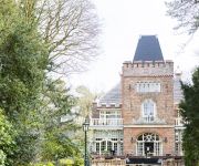
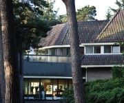
Kasteel Kerckebosch
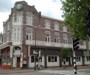
Oud London
Hotel Theater Figi
Van der Valk hotel De Bilt - Utrecht
Hotel Ernst Sillem Hoeve
Woudschoten
Corona Zeist
Steyn Hotel & Appartementen
Landgoed de Horst
Hotel Bergse Bossen
Videos from this area
These are videos related to the place based on their proximity to this place.
Deaf MTB Zeist 02 nov 2014
Deaf MTB Zeist 2 november 2014 met Richard, Amos, Ibrahim, Benny en Rene.
De haan is terug op de NoorderLichtkerk, Zeist
Na een verblijf van 2 jaar in de kelder, gevolgd door een grondige restauratie is de haan op 23 september 2014 terug geplaatst op de toren van de NoorderLichtkerk te Zeist. Een verslag van...
Promo Miranda in Zeist (december2012)
Hier ziet U een zelfgemaakt filmpje om U een impressie te geven van de winkel Miranda in Zeist. Aangezien wij wel eens verbouwen/veranderen adviseren wij U om eens langs te komen voor de ...
Bicycle Trip: Panweg in Zeist to Slotlaan in Zeist [BDDSASZ part 6]
Bicycle Trip: Panweg in Zeist to Slotlaan in Zeist [BDDSASZ part 6] This is part 6 (of 6) of the bicycle trip called "Bilthoven - Den Dolder - Soest - Amersfoort - Soesterberg - Zeist" or...
Zaalverhuur de Wittenberg Zeist
De Wittenberg wordt verhuurd voor vergaderingen, symposia, trainingen en cursussen.
mtb zeist nieuw track
Er is bij zeist een nieuw mtb parcours beschikbaar. Ondanks de 16 km zit alles er in van kombocht, klimmen, mulzand en veel single tracks. In de video een impressie. Camera: Garmin Virb (elite)...
Koorrepetitie schoolkoor Stichtse Vrije School Zeist
Repetitie voor de kooruitvoering (Requiem van Mozart) van 30 april 2015 in Tivoli Vredenburg. Video is gemaakt door Koen (klas 10a).
Bicycle trip: Zeist - Austerlitz - Maarn - Doorn - Langbroek - Odijk - Bunnik - De Bilt - Zeist
Bicycle trip: Zeist - Austerlitz - Maarn - Doorn - Langbroek - Odijk - Bunnik - De Bilt - Zeist Watch this video in 480p, the 720p does not work. YT, please fix this! The tag for this video...
Zeist: Zeer grote brand autowerkplaats Zwitsersekade
ZEIST - Een zeer grote brand heeft een paar loodsen verwoest aan de Zwitsersekade in Zeist. Het ging aanvankelijk om een grote brand, maar vanwege een tekort aan bluswater is die opgeschaald...
Zeist: Autobranden slaan over op Doe-Het-Zelf zaak
ZEIST - Bij een grote brand bij doe-het-zelfzaak Kesler in Zeist zijn vijftien appartementen ontruimd. Drie autobranden achter de Kesler zorgden ervoor dat het vuur even voor 5.00 uur vanmorgen...
Videos provided by Youtube are under the copyright of their owners.
Attractions and noteworthy things
Distances are based on the centre of the city/town and sightseeing location. This list contains brief abstracts about monuments, holiday activities, national parcs, museums, organisations and more from the area as well as interesting facts about the region itself. Where available, you'll find the corresponding homepage. Otherwise the related wikipedia article.
Doorn
Doorn is a town in the municipality of Utrechtse Heuvelrug in the central Netherlands, in the province of Utrecht. On 1 January 2008 the town had 10,052 inhabitants.
Scottish Court in the Netherlands
The Scottish court in the Netherlands was a special sitting of the High Court of Justiciary set up under Scots law in a former United States Air Force base called Camp Zeist in Utrecht, in the Netherlands, for the trial of two Libyans charged with 270 counts of murder in connection with the bombing of Pan Am Flight 103 over Lockerbie, Scotland, on December 21, 1988. A school on the former base was converted into a judicial court for the trial.
Driebergen
Driebergen is a former village in the Dutch province of Utrecht. Later it became a part of the single town of Driebergen-Rijsenburg. And presently it's part of Utrechtse Heuvelrug. The former municipality of Driebergen existed until 1931, when it merged with Rijsenburg, to create the new municipality of Driebergen-Rijsenburg.
Soesterberg
Soesterberg is a town in the Dutch province of Utrecht. It is a part of the municipality of Soest, and lies about 5 km northeast of Zeist, on the road between Amersfoort and Utrecht. In 2001, the town of Soesterberg had 5,798 inhabitants. The built-up area of the town was 1.31 km², and contained 2503 residences.
Rijsenburg
Rijsenburg is a former village in the Dutch province of Utrecht. Presently, it is a part of the single town of Driebergen-Rijsenburg. The former municipality of Rijsenburg existed from 1818 to 1931, when it merged with Driebergen, to create the new municipality of Driebergen-Rijsenburg.
Bilthoven
Bilthoven is a village in the Dutch province of Utrecht. It is a part of the municipality of De Bilt. It has a railway station with connections to Utrecht, Amersfoort and Baarn. It is home to the Netherlands National Institute for Public Health and the Environment, RIVM; and to the Union Mundial pro Interlingua, UMI, which promotes Interlingua internationally. The statistical area "Bilthoven", which also can include the surrounding countryside, has a population of around 17560.
Den Dolder
Den Dolder is a town in the Dutch province of Utrecht. It is a part of the municipality of Zeist, and lies about 4 km northeast of Bilthoven. Den Dolder has a railway station on the route between Amersfoort and Utrecht and is best known for its mental institutions such as Dennendal and the Willem Arntz Hoeve.
Soestduinen
Soestduinen is a town in the Dutch province of Utrecht. It is a part of the municipality of Soest, and lies about 3 km south of Soest. In 2001, the town of Soestduinen had 113 inhabitants. The built-up area of the town was 0.07 km², and contained 45 residences.
Odijk
Odijk is a town in the Dutch province of Utrecht. It is a part of the municipality of Bunnik, and lies about 4 km south of Zeist. In 2009, the town of Odijk had 4.411 inhabitants. The built-up area of the town was 0.94 km², so the density was very high, and contained 1809 residences. The neighbourhood of Cothen, which covers the entire area of the former municipality, has about 5040 inhabitants. Odijk used to be a separate municipality. It merged with Bunnik and Werkhoven in 1964.
Huis Doorn
Huis Doorn (Doorn Manor) is a small manor house that lies outside of Doorn, a small town near Utrecht, in the Netherlands. The 15th-century house was rebuilt in the late 18th century in a conservative manner and, in the mid-19th century, a surrounding park was laid out as an English landscape garden. Baroness Ella van Heemstra (1900–1984), the mother of actress Audrey Hepburn, spent much of her childhood living in the house.
Langbroek
Langbroek is a town in the Dutch province of Utrecht. It is a part of the municipality of Wijk bij Duurstede, and lies about 11 km southeast of Zeist. In January 2013, the town of Langbroek had 2071 inhabitants. The built-up area of the town was 0.25 km², and contained 451 residences. Until it merged with Wijk bij Duurstede in 1996, Langbroek was a separate municipality.
't Goy
't Goy is a village in the Dutch province of Utrecht. It is a part of the municipality of Houten, and lies about 5 km southeast of Houten. In 2001, the village of 't Goy had 170 inhabitants. The built-up area of the town was 0.04 km², and contained 70 residences. 't Goy is also home to the Netherlands' largest honey-glazed ham factory.
Soesterberg Royal Netherlands Air Force Base
Soesterberg Air Base was a Royal Netherlands Air Force military airbase located in Soesterberg, 14 kilometres east-northeast of Utrecht. It was first established as an airfield in 1911, and in 1913, the Dutch Army bought the field and established the Army Aviation Division. For almost 40 years, United States Air Force facilities at Soesterberg, named Camp New Amsterdam was a major front line USAFE airbase during the Cold War.
Sterkenburg
Sterkenburg is a former municipality in the Dutch province of Utrecht. It existed between 1818 and 1857, when it was merged with Driebergen. The castle Sterkenburg is located here, about 3 km south of Driebergen. The literal translation of the name is "strong castle". There is also a Dutch surname "Sterkenburg", which is derived from this location.
Schonauwen
Schonauwen is a former castle in the Dutch province of Utrecht. It is located on the southern outskirts of the town of Houten, surrounded by new buildings. Until the end of the 18th century, Schonauwen was a separate heerlijkheid (fiefdom). When the country was divided into municipalities by the French, Schonauwen was added to the municipality of Houten, but it became a separate municipality in 1818. In 1857 it was merged back into Houten.
University Medical Center Utrecht
The University Medical Center Utrecht or UMCU is the main hospital of the city of Utrecht. It is affiliated with the Utrecht University. Since the foundation of the university in 1636 an academic hospital has existed in various forms. Nowadays the UMC Utrecht comprises the academic hospital, the faculty of Medicine as well as the Wilhelmina Children's hospital.
Beerschoten
Beerschoten is a hamlet in the municipality Utrechtse Heuvelrug, in the Dutch province Utrecht. Beerschoten lies on the edge of a forest between the towns of Zeist (to the northwest) and Driebergen-Rijsenburg (to the southeast). Just north of the hamlet lies the railway station Driebergen-Zeist. The hamlet grew around the estate Beerschoten-Willinkshof.
Bosch en Duin
Bosch en Duin is a village in the municipality Zeist, in the Dutch province Utrecht. The village is located north of the town of Zeist, and borders Huis ter Heide to the east and Den Dolder to the north. It has 2,540 inhabitants (2006). The village is entirely made up of expensive estates surrounded by forest. The estate De Horst in Bosch en Duin, designed by architect Karel de Bazel, is now a protected landmark. Dutch journalist Willem Oltmans grew up here.
Huis ter Heide, Utrecht
Huis ter Heide is a village in the central Netherlands. It is located in the municipality of Zeist, Utrecht, about 2 km northeast of the centre of the town Zeist. Huis ter Heide has a population of about 1400. The first McDonald's Drive-in restaurant in the Netherlands is located in Huis ter Heide. Furthermore it is the residence of Dutch television host Eddy Zoey \t\t \t\t\tKapel Zeist langs N237. jpg \t\t\t A chapel in Huis ter Heide \t\t\t \t\t \t\t \t\t\tMcDrive - eerstedrivehuisterheideklein.
Den Dolder–Baarn railway
The Den Dolder–Baarn railway is a railway line in the Netherlands running from Den Dolder to Baarn, passing through Soest. It is also called the Stichtse lijn in Dutch. It is operated by the Nederlandse Spoorwegen. The railway line is 11 km long. The line is single track, with a passing place at Soest Station. The line currently has 5 stations, these are: Den Dolder Soest Zuid Soest Soestdijk Baarn
Utrecht Hill Ridge
Utrecht Hill Ridge is a ridge of low sandhills that stretches in a direction from southeast to northwest over the Dutch province of Utrecht and over a part of North Holland. The total length of the region is about 50 km. It covers an area of approximately 23.000 ha. The part of the ridge in North Holland is commonly called “Het Gooi”. On the southeastern side the ridge rises sharply from the valley of the Nederrijn (“Lower Rhine”).
Militaire Luchtvaart Museum
The Militaire Luchtvaart Museum is located at Kamp van Zeist near the former Soesterberg Airforce base. It is the official museum of the Royal Netherlands Air Force. During 2006 it was decided by the Ministry of Defence to merge three military museums in the Netherlands into one Defence Museum, to be located at the former Soesterberg Airforce base. Delivery of the new museum is foreseen for late 2012.
KNVB Academy
The KNVB Academy is the Educational Department of the Royal Netherlands Football Association (KNVB). The KNVB Academy was founded in 1996 to concentrate all educational programs for Dutch football in one body, and is headquartered at Zeist. The operations of the KNVB Academy are focused on development of coaches, referees and administrators in The Netherlands. Dutch coaching diplomas are UEFA approved.
De Hoefslag
De Hoefslag is a restaurant located in Bosch en Duin in the Netherlands. It is a fine dining restaurant that was awarded one Michelin star in the periods 1979-1980, 1987-2005 and 2009-2012. It was awarded two Michelin stars in the period 1981-1986. GaultMillau awarded the restaurant 16.0 out of 20 points. De Hoefslag is a member of Les Patrons Cuisiniers. Present head chef is Karl van Baggem.
Lai Sin's
Lai Sin's was a restaurant located in Driebergen-Rijsenburg, in the Netherlands. It was a fine dining restaurant that was awarded one Michelin star in the period 1996-2008. Head chef of Lai Sin's was Kwong On Wong. The restaurant closed 1 November 2011, when owner Lai Sin Zei sold the restaurant. After a renovation, restaurant Villa Zuidoost opened up in 2012. Lai Sin's was a member of the Alliance Gastronomique Néerlandaise in the period 1994-2011.





!['Bicycle Trip: Panweg in Zeist to Slotlaan in Zeist [BDDSASZ part 6]' preview picture of video 'Bicycle Trip: Panweg in Zeist to Slotlaan in Zeist [BDDSASZ part 6]'](https://img.youtube.com/vi/R5n17J_Clho/mqdefault.jpg)


