Safety Score: 3,3 of 5.0 based on data from 9 authorites. Meaning please reconsider your need to travel to Netherlands.
Travel warnings are updated daily. Source: Travel Warning Netherlands. Last Update: 2024-05-02 08:23:34
Explore De Schooten
The district De Schooten of Den Helder in Gemeente Den Helder (Provincie Noord-Holland) is located in Netherlands about 39 mi north of Amsterdam, the country's capital.
If you need a place to sleep, we compiled a list of available hotels close to the map centre further down the page.
Depending on your travel schedule, you might want to pay a visit to some of the following locations: Heiloo, Heemskerk, Haarlem, Amsterdam and Lelystad. To further explore this place, just scroll down and browse the available info.
Local weather forecast
Todays Local Weather Conditions & Forecast: 18°C / 65 °F
| Morning Temperature | 13°C / 55 °F |
| Evening Temperature | 14°C / 57 °F |
| Night Temperature | 12°C / 53 °F |
| Chance of rainfall | 2% |
| Air Humidity | 88% |
| Air Pressure | 999 hPa |
| Wind Speed | Fresh Breeze with 13 km/h (8 mph) from West |
| Cloud Conditions | Overcast clouds, covering 100% of sky |
| General Conditions | Light rain |
Friday, 3rd of May 2024
11°C (51 °F)
10°C (50 °F)
Moderate rain, fresh breeze, overcast clouds.
Saturday, 4th of May 2024
12°C (54 °F)
11°C (52 °F)
Light rain, moderate breeze, overcast clouds.
Sunday, 5th of May 2024
11°C (53 °F)
11°C (51 °F)
Light rain, gentle breeze, overcast clouds.
Hotels and Places to Stay
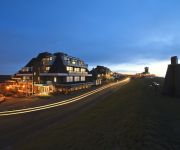
Grand Hotel Beatrix
Hotel Den Helder
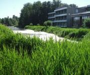
Forest Hotel
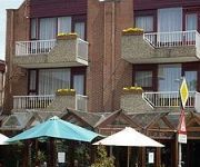
Wienerhof
Videos from this area
These are videos related to the place based on their proximity to this place.
Den Helder, stad aan zee
Een stad die gelooft in zijn toekomst en daar hard aan werkt. Er liggen volop kansen die worden gezien én opgepakt. Door actieve bewoners, ondernemers en organisaties. Zij maken de stad, zij...
[cabinerit] A train driver's view: Den Helder - Alkmaar, 15-May-2014.
This is a train cabin ride from Den Helder to Alkmaar. See what the train drivers sees and experience the railroad tracks in a whole new way. The movie is unedited, that is to say, you see...
Dag van de Nederlandse Visserij Den Helder 1986.
Dag van de Nederlandse Visserij Den Helder 1986. Pls post any comments @ www.kotterfoto.nl.
[cabinerit] A train driver's view: Den Helder - Alkmaar (Dawn sequel), 13-Mar-2014
This is a sequel to an earlier shot where I tested my camera's performance while it was dark. That movie can be found here: http://youtu.be/raidKS79QVo --- This is a train cabin ride from...
2013 De Halve van Den Helder hardlopen
Filmopnames van de start op Willemsoord, langs de Weststraat en de Helderse Zeedijk http://www.halvevandenhelder.nl/ http://denhelder-aanzee.jouwweb.nl/
2014 Rondje Den Helder: via het Nieuwe Diep naar Hoofdgracht
juni 2014 rit langs de haven van Den Helder. Via het nieuwe werk naar de hoofdgracht.
Carnaval Waaienburg Den helder 2015 Aftermovie
De officiele aftermovie van carnaval Waaienburg (Den helder) 2015 ! Voor meer info check facebook.com/djjordypagina of www.jordy.dj.
BB-schuilplaats Brakkeveldweg Den Helder
De voormalige schuilplaats van de organisatie Bescherming Bevolking (BB) in de tunnel onder het spoor aan de Brakkeveldweg in Den Helder. Meer informatie: www.archiefalkmaar.nl/bunkers.
Videos provided by Youtube are under the copyright of their owners.
Attractions and noteworthy things
Distances are based on the centre of the city/town and sightseeing location. This list contains brief abstracts about monuments, holiday activities, national parcs, museums, organisations and more from the area as well as interesting facts about the region itself. Where available, you'll find the corresponding homepage. Otherwise the related wikipedia article.
Texel
Texel is a municipality and an island in the Netherlands, in the province of North Holland. It is the largest and most populated of the Frisian Islands in the Wadden Sea, and also the westernmost of this archipelago, which extends to Denmark. The next island in the archipelago, to the north of Texel, is Vlieland.
HNLMS Abraham Crijnssen (1936)
HNLMS Abraham Crijnssen was a Jan van Amstel-class minesweeper of the Royal Netherlands Navy (RNN). Built during the 1930s, she was based in the Netherlands East Indies when Japan attacked at the end of 1941. Ordered to retreat to Australia, the ship was disguised as a tropical island to avoid detection, and was the last Dutch ship to escape from the region.
HNLMS Schorpioen
HNLMS Schorpioen is a sister ship of HNLMS Buffel. Built in the same year, 1868 in France, they were the core of the then renewed Royal Netherlands Navy, replacing the outdated wooden ships that combined sailing and steam propulsion and carried so called smooth-bore guns. These new ships were equipped with heavy rifled 23 cm guns, and a heavy armor. The hull had an armor plated belt of 15 cm (6 inches) and the gun turret, housing the two guns, had almost 30 cm (12 inches)of armor.
Marsdiep
The Marsdiep is a deep tide-race between Den Helder and Texel in the Netherlands, and running southwards between sandbanks. That gap connects the North Sea and the Waddenzee. Around 1000 AD and before, much of the modern Waddenzee and IJsselmeer was land and the Marsdiep was an ordinary river. An early form of its name is Maresdeop, a name probably related to modern Dutch moerasdiep ("swamp deep").
Anna Paulownapolder
The Anna Paulownapolder is a polder in the municipality of Hollands Kroon in the province of North Holland in the Netherlands. The area of the polder is 50 square kilometres and it forms an important horticulture area, with among other things flower bulb cultivation. The Anna Paulownapolder was from the 7th century to the 12th centuries, the habitat of both the Frisian and Gelderlandish emigrants. The latter lived in the area where now the places Westeinde and Gelderse Buurt are.
Zuid Haffel
Zuid Haffel (South Haffel) is a polder and village in the northwest of the Netherlands. It is located on the island of Texel, North Holland. Texel is also the municipality of the place. Zuid Haffel is one of the oldest polders on the island of Texel. Around the end of the 13th century, the area was surrounded by dykes. In 1350, Jan van Henegouwen gave his permission to create a dyke between Tjarkshorn and the Lyorts road. These names are of Frisian origin.
Den Hoorn, North Holland
Den Hoorn is a village in the Dutch province of North Holland. It is a part of the municipality of Texel, and lies about 9 km north of Den Helder. In 2001, the town of Den Hoorn had 443 inhabitants. The built-up area of the town was 0.15 km², and contained 214 residences. The statistical area "Den Hoorn", which also can include the peripheral parts of the village, as well as the surrounding countryside, has a population of around 470.
Den Burg
Den Burg is a town in the Dutch province of North Holland. It is a part of the municipality of Texel on the namesake island, and lies about 12 km north of Den Helder. Located in the middle of the island, Den Burg is the main town of Texel. It features a historic centre and also the town hall. Outdoor markets are held each week in the main square. Nevertheless, Den Burg is the island's least touristic settlement. In 2001, Den Burg had 6160 inhabitants.
Oudeschild
Oudeschild is a town in the Dutch province of North Holland. It is a part of the municipality of Texel, and lies about 12 km northeast of Den Helder. Oudeschild is the fishing harbour of the island. It is situated at the Wadden Sea dyke. Next to the harbour, the windmill Traanroeier marks the site of the Maritime and Beachcombers Museum, which exhibits an interesting collection of objects found on the beaches of Texel.
Noorderhaaks
Noorderhaaks, also called Razende bol (Raging ball in Dutch), is a Dutch sandbar in the North Sea, a few kilometres west of the Marsdiep which separates the island of Texel from mainland Netherlands. The sandbar covers an area of around five km², although the exact area varies due to tide and the dynamic nature of the area. Being relatively untouched by man, the sandbar has become a valuable location due to its presence of several kinds of seabirds, and seals.
De Kooy Airfield
De Kooy Airfield (Dutch: Vliegveld De Kooy) is an airfield 2.9 NM south of Den Helder, the Netherlands, named after the nearby hamlet De Kooy. It serves as both a civilian airport under the name Den Helder Airport and a naval airport under the name Maritiem Vliegkamp De Kooy (Dutch for Maritime Aviation Site De Kooy).
De Waal
De Waal is a village in the Dutch province of North Holland. It is a part of the municipality of Texel, and lies about 15 km north of Den Helder. In 2001, the town of De Waal had 188 inhabitants. The built-up area of the town was 0.06 km², and contained 78 residences. The wider statistical area of De Waal has a population of around 260.
Breezand
Breezand is a village in the Dutch province of North Holland. It is a part of the municipality of Hollands Kroon, which is very well known for its flowerbulbs, and lies about 7 km southeast of Den Helder.
Driehuizen, Texel
Driehuizen is a hamlet in the Dutch province of North Holland. It is located on the island of Texel, about 2 km southwest of the town of Den Burg. The name comes from the fact that from nowhere suddenly three houses ("drie huizen" in Dutch) were erected in the same time, probably in the 16th century. The oldest inhabitants were from the Merovingian era (450 to ca. 750 AD). Signs of habitation were found in the higher area between Driehuizen, Operen and Immetjeshoeve.
Dutch Navy Museum
The Dutch Navy Museum is a naval museum in Den Helder, Netherlands. The museum is dedicated to the history of the Koninklijke Marine. The most important ships the museum owns are: HNLMS Abraham Crijnssen HNLMS Schorpioen HNLMS Tonijn HNLMS Bonaire (under restoration) HNLMS De Ruyter
De Kooy (hamlet)
De Kooy is a hamlet in the Dutch province of North Holland. It is a part of the municipality of Den Helder, and lies about 5 kilometers southeast of the Den Helder city centre. The hamlet is known for the nearby naval air field De Kooy.
Blauwe Keet
Blauwe Keet was a hamlet in the Dutch province of North Holland. It is a part of the municipality of Den Helder, and lies about 7 km south of the Den Helder city centre. The hamlet was demolished in 1987. The hamlet was founded by the diggers of the nearby North Holland Canal in the early 19th century. Its name, "Blue Cabin", refers to the cabin from which the construction of the canal was directed.
De Stolpen
De Stolpen (sometimes just "Stolpen") is a hamlet in the Dutch province of North Holland. It is part of the municipality of Schagen, and is located about 3 km northwest of the village of Schagerbrug. In 2005, the municipal council of the former municipality of Zijpe decided that the N9 road had to be moved; as a consequence, all of the houses in De Stolpen would have to be demolished. The national government changed this decision in December 2006, which saved the hamlet.
Royal Netherlands Naval College
The Royal Netherlands Naval College in Den Helder is the service academy of the Royal Netherlands Navy. The KIM offers a program of four or five years and also a short course of sixteen to twenty-two months. Upon the completion of the program a graduate is awarded a bachelor's degree and is commissioned in the Royal Netherlands Navy. The training of officers for the Royal Netherlands Army and Royal Netherlands Air Force is done by the Koninklijke Militaire Academie in Breda.
Bargen, North Holland
Bargen is a hamlet in the Dutch province of North Holland. It is located on the island Texel, about 4 km northeast of Den Burg. In a tax register of 1581, Bargen was mentioned as having almost the poorest soil of the entire island.
Grand Hotel Opduin
Grand Hotel Opduin is a Dutch hotel located in the Dunes of Texel National Park. It is privately owned and affiliated with Hampshire Classic Hotels. The building is situated on top of the dunes on the edge of the village of De Koog, Texel, approximately 200m from the North Sea beach. The hotel has its own beach cabins. The hotel has 96 rooms and suites, as well as six multifunctional conferencerooms.
Willemsoord, Den Helder
Willemsoord is a large former dockyard of the Royal Netherlands Navy in Den Helder. It is now a maritime museum, housing the Dutch Navy Museum and the Nationaal Reddingmuseum Dorus Rijkers. In 2009 the replica of the Dutch East India Company ship Prins Willem which was located in a dock (visitable by the public) burned down.
Battle of Callantsoog
The Battle of Callantsoog (sometimes also called Battle of Groote Keeten) (27 August 1799) followed the amphibious landing by a British invasion force under lieutenant-general Sir Ralph Abercromby near Callantsoog in the course of the Anglo-Russian Invasion of Holland of 1799. Despite strong opposition by troops of the Batavian Republic under lieutenant-general Herman Willem Daendels the British troops established a bridgehead and the Dutch were forced to retreat.
Amsteldiepdijk
Amsteldiepdijk is a dike between Van Ewijcksluis and the island of Wieringen. It was built in 1924 and closes a portion of the Amsteldiep and of the Ulkediep. It is often considered to be the first work of engineering of the Zuiderzee works. With the small dike, the former island of Wieringen is connected to the west with mainland of North Holland and is no longer an island. The dam serves as a prototype in some way to works to come on the future IJsselmeer. Some errors served as lessons.
Culinaire Verwennerij Bij Jef
Culinaire Verwennerij Bij Jef is a restaurant in Den Hoorn, Netherlands. It is a fine dining restaurant that was awarded one Michelin star for the period 2009–present. GaultMillau awarded the restaurant 16 out of 20 points. Head chef of Culinaire Verwennerij Bij Jef is Jef Schuur. The restaurant is a member of Les Patrons Cuisiniers since 2012.


!['[cabinerit] A train driver's view: Den Helder - Alkmaar, 15-May-2014.' preview picture of video '[cabinerit] A train driver's view: Den Helder - Alkmaar, 15-May-2014.'](https://img.youtube.com/vi/m00Eh8LOj0w/mqdefault.jpg)


!['[cabinerit] A train driver's view: Den Helder - Alkmaar (Dawn sequel), 13-Mar-2014' preview picture of video '[cabinerit] A train driver's view: Den Helder - Alkmaar (Dawn sequel), 13-Mar-2014'](https://img.youtube.com/vi/vXrYF3I6gRg/mqdefault.jpg)


