Safety Score: 3,3 of 5.0 based on data from 9 authorites. Meaning please reconsider your need to travel to Netherlands.
Travel warnings are updated daily. Source: Travel Warning Netherlands. Last Update: 2024-04-28 08:22:10
Delve into Friese Buurt
Friese Buurt in Gemeente Den Helder (Provincie Noord-Holland) is located in Netherlands about 38 mi (or 61 km) north of Amsterdam, the country's capital town.
Current time in Friese Buurt is now 09:49 AM (Monday). The local timezone is named Europe / Amsterdam with an UTC offset of 2 hours. We know of 11 airports close to Friese Buurt, of which 5 are larger airports. The closest airport in Netherlands is De Kooy Airport in a distance of 0 mi (or 1 km), North-East. Besides the airports, there are other travel options available (check left side).
There are several Unesco world heritage sites nearby. The closest heritage site in Netherlands is Droogmakerij de Beemster (Beemster Polder) in a distance of 26 mi (or 42 km), South. We encountered 1 points of interest near this location. If you need a hotel, we compiled a list of available hotels close to the map centre further down the page.
While being here, you might want to pay a visit to some of the following locations: Heiloo, Heemskerk, Haarlem, Amsterdam and Lelystad. To further explore this place, just scroll down and browse the available info.
Local weather forecast
Todays Local Weather Conditions & Forecast: 11°C / 53 °F
| Morning Temperature | 8°C / 46 °F |
| Evening Temperature | 12°C / 53 °F |
| Night Temperature | 11°C / 52 °F |
| Chance of rainfall | 0% |
| Air Humidity | 81% |
| Air Pressure | 1019 hPa |
| Wind Speed | Fresh Breeze with 15 km/h (9 mph) from North-East |
| Cloud Conditions | Clear sky, covering 6% of sky |
| General Conditions | Sky is clear |
Tuesday, 30th of April 2024
14°C (56 °F)
13°C (56 °F)
Light rain, moderate breeze, overcast clouds.
Wednesday, 1st of May 2024
12°C (54 °F)
12°C (53 °F)
Moderate rain, moderate breeze, overcast clouds.
Thursday, 2nd of May 2024
14°C (56 °F)
11°C (52 °F)
Light rain, moderate breeze, broken clouds.
Hotels and Places to Stay
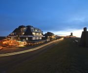
Grand Hotel Beatrix
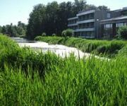
Forest Hotel
Hotel Den Helder
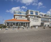
Fletcher Badhotel Callantsoog
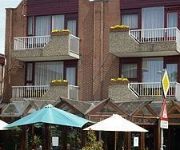
Wienerhof
Hotel 't Zwaantje
Videos from this area
These are videos related to the place based on their proximity to this place.
Den Helder, stad aan zee
Een stad die gelooft in zijn toekomst en daar hard aan werkt. Er liggen volop kansen die worden gezien én opgepakt. Door actieve bewoners, ondernemers en organisaties. Zij maken de stad, zij...
2014 Rondje Den Helder: via het Nieuwe Diep naar Hoofdgracht
juni 2014 rit langs de haven van Den Helder. Via het nieuwe werk naar de hoofdgracht.
Carnaval Waaienburg Den helder 2015 Aftermovie
De officiele aftermovie van carnaval Waaienburg (Den helder) 2015 ! Voor meer info check facebook.com/djjordypagina of www.jordy.dj.
[GoPro] Reddingsbrigade Den Helder oefent Ijsredding
Reddingsbrigade Den Helder heeft op 19 Januari gezamelijk met de Brandweer geoefend met het redden van personen uit/van het ijs. Gefilmd met de GoPro HD Hero 2.
Beginnend onweer 23-05-2012
Timelapse van beginnend onweer in Den Helder. Elke seconde 1 frame, 15 frames per seconde video.
Starten van de motoren en take off van DC-3 Dakota Prinses Amalia na Heldair Show Maritiem 2012
Interessant detail: Er kwam een flinke vlam uit de uitlaat van de stuurboord motor op 06:04 - 06:08 van de video net voor het vliegtuig naar bakboord draait om op de startbaan te komen, dus...
Kies voor de speeltuin bij de Boerderij!
De speeltuin van MFC De Boerderij in De Schooten (Den Helder) is dringend aan een grondige ronovatiebeurt toe! De kinderen van de buurt vragen om een nieuwe speeltuin met toetstellen die ...
Videos provided by Youtube are under the copyright of their owners.
Attractions and noteworthy things
Distances are based on the centre of the city/town and sightseeing location. This list contains brief abstracts about monuments, holiday activities, national parcs, museums, organisations and more from the area as well as interesting facts about the region itself. Where available, you'll find the corresponding homepage. Otherwise the related wikipedia article.
HNLMS Abraham Crijnssen (1936)
HNLMS Abraham Crijnssen was a Jan van Amstel-class minesweeper of the Royal Netherlands Navy (RNN). Built during the 1930s, she was based in the Netherlands East Indies when Japan attacked at the end of 1941. Ordered to retreat to Australia, the ship was disguised as a tropical island to avoid detection, and was the last Dutch ship to escape from the region.
HNLMS Schorpioen
HNLMS Schorpioen is a sister ship of HNLMS Buffel. Built in the same year, 1868 in France, they were the core of the then renewed Royal Netherlands Navy, replacing the outdated wooden ships that combined sailing and steam propulsion and carried so called smooth-bore guns. These new ships were equipped with heavy rifled 23 cm guns, and a heavy armor. The hull had an armor plated belt of 15 cm (6 inches) and the gun turret, housing the two guns, had almost 30 cm (12 inches)of armor.
De Kooy Airfield
De Kooy Airfield (Dutch: Vliegveld De Kooy) is an airfield 2.9 NM south of Den Helder, the Netherlands, named after the nearby hamlet De Kooy. It serves as both a civilian airport under the name Den Helder Airport and a naval airport under the name Maritiem Vliegkamp De Kooy (Dutch for Maritime Aviation Site De Kooy).
Dutch Navy Museum
The Dutch Navy Museum is a naval museum in Den Helder, Netherlands. The museum is dedicated to the history of the Koninklijke Marine. The most important ships the museum owns are: HNLMS Abraham Crijnssen HNLMS Schorpioen HNLMS Tonijn HNLMS Bonaire (under restoration) HNLMS De Ruyter
De Kooy (hamlet)
De Kooy is a hamlet in the Dutch province of North Holland. It is a part of the municipality of Den Helder, and lies about 5 kilometers southeast of the Den Helder city centre. The hamlet is known for the nearby naval air field De Kooy.
Blauwe Keet
Blauwe Keet was a hamlet in the Dutch province of North Holland. It is a part of the municipality of Den Helder, and lies about 7 km south of the Den Helder city centre. The hamlet was demolished in 1987. The hamlet was founded by the diggers of the nearby North Holland Canal in the early 19th century. Its name, "Blue Cabin", refers to the cabin from which the construction of the canal was directed.
Royal Netherlands Naval College
The Royal Netherlands Naval College in Den Helder is the service academy of the Royal Netherlands Navy. The KIM offers a program of four or five years and also a short course of sixteen to twenty-two months. Upon the completion of the program a graduate is awarded a bachelor's degree and is commissioned in the Royal Netherlands Navy. The training of officers for the Royal Netherlands Army and Royal Netherlands Air Force is done by the Koninklijke Militaire Academie in Breda.
Willemsoord, Den Helder
Willemsoord is a large former dockyard of the Royal Netherlands Navy in Den Helder. It is now a maritime museum, housing the Dutch Navy Museum and the Nationaal Reddingmuseum Dorus Rijkers. In 2009 the replica of the Dutch East India Company ship Prins Willem which was located in a dock (visitable by the public) burned down.





!['[GoPro] Reddingsbrigade Den Helder oefent Ijsredding' preview picture of video '[GoPro] Reddingsbrigade Den Helder oefent Ijsredding'](https://img.youtube.com/vi/uBpg0uMMEsA/mqdefault.jpg)


