Safety Score: 3,3 of 5.0 based on data from 9 authorites. Meaning please reconsider your need to travel to Netherlands.
Travel warnings are updated daily. Source: Travel Warning Netherlands. Last Update: 2024-05-22 08:01:51
Touring Greffeling
Greffeling in Gemeente West Maas en Waal (Provincie Gelderland) is a town located in Netherlands about 45 mi (or 73 km) south-east of Amsterdam, the country's capital place.
Time in Greffeling is now 07:26 PM (Wednesday). The local timezone is named Europe / Amsterdam with an UTC offset of 2 hours. We know of 10 airports nearby Greffeling, of which 5 are larger airports. The closest airport in Netherlands is Eindhoven Airport in a distance of 27 mi (or 43 km), South. Besides the airports, there are other travel options available (check left side).
There are several Unesco world heritage sites nearby. The closest heritage site in Netherlands is Rietveld Schröderhuis (Rietveld Schröder House) in a distance of 23 mi (or 36 km), North-West. We collected 5 points of interest near this location. Need some hints on where to stay? We compiled a list of available hotels close to the map centre further down the page.
Being here already, you might want to pay a visit to some of the following locations: 's-Hertogenbosch, Utrecht, Arnhem, Heeze and Kranenburg. To further explore this place, just scroll down and browse the available info.
Local weather forecast
Todays Local Weather Conditions & Forecast: 18°C / 64 °F
| Morning Temperature | 13°C / 55 °F |
| Evening Temperature | 19°C / 66 °F |
| Night Temperature | 13°C / 55 °F |
| Chance of rainfall | 12% |
| Air Humidity | 73% |
| Air Pressure | 1008 hPa |
| Wind Speed | Moderate breeze with 11 km/h (7 mph) from North-East |
| Cloud Conditions | Overcast clouds, covering 100% of sky |
| General Conditions | Heavy intensity rain |
Thursday, 23rd of May 2024
17°C (62 °F)
12°C (53 °F)
Light rain, gentle breeze, broken clouds.
Friday, 24th of May 2024
15°C (59 °F)
12°C (54 °F)
Heavy intensity rain, moderate breeze, overcast clouds.
Saturday, 25th of May 2024
15°C (59 °F)
13°C (55 °F)
Light rain, moderate breeze, overcast clouds.
Hotels and Places to Stay
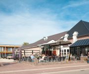
Hotel Restaurant De Twee Linden
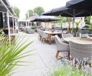
Moeke Mooren
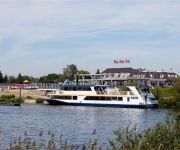
de Weverij Restaurant Cordial
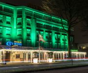
City Hotel Oss
Van der Valk Hotel Tiel
Nelson City Resort Oss
Hotel de Naaldhof
Videos from this area
These are videos related to the place based on their proximity to this place.
Annabelle sluis Lith
Annabelle , 67,08 x 8,19 x 2,54 , 943 ton , Bouwjaar 1936 , Werf Elsflether werft in Elsfleth ( Duitsland ) , 570 pk MAK , ex Emma Luise , ex Conrad Schranz , ex Germania , eigenaar Cristoff...
Passerend schip Prinses Maxima sluizen, Lith
Timelapse passerend schip Prinses Maxima sluizen, te Lith op 11 juni 2014.
History Maaskant Travel
A short insight in the history of Maaskant Travel - Maaskant Reizen from Lith, The Netherlands.
Prinses Maxima Sluizen timelapse
De Prinses Máxima Sluizen is een sluizencomplex in de Maas, CEMT-klasse Va, in Lith in de Nederlandse gemeente Oss, Noord-Brabant. Timelapse made out of 1000 pictures @15fps. Princess ...
Historiemaaskant
Een kort overzicht van de geschiedenis van Maaskant Reizen uit Lith, Reisorganisatie en Touringcarbedrijf.
MaasdijkMarathon 6 juni 2010 - deel 2 van 3: Met de boot naar Ravenstein
Waar een gemeentelijke herindeling al niet goed voor is! Met hulp van zo'n 400 vrijwilligers werd 'een grensverleggend evenement' georganiseerd, de MaasdijkMarathon, een van de vijf ...
Strike 2 - The right way home @ New Years Rock 2010
Strike 2 playing The right way home Played at Stichting Sociaal Cultureel Centrum De Hoeve in lith. 2010-01-23.
Slapen Op De Maas
Impressie van een weekendje 'Slapen op de Maas': uitvalsbasis is een luxe woonark in Lithoijen in de haven aan een arm van de Maas. Vanuit daar heerlijk chillen, struinen langs de Maas, het...
Videos provided by Youtube are under the copyright of their owners.
Attractions and noteworthy things
Distances are based on the centre of the city/town and sightseeing location. This list contains brief abstracts about monuments, holiday activities, national parcs, museums, organisations and more from the area as well as interesting facts about the region itself. Where available, you'll find the corresponding homepage. Otherwise the related wikipedia article.
Alphen, Gelderland
Alphen (also known as Alphen aan de Maas) is a village in the Dutch province of Gelderland. It is a part of the municipality of West Maas en Waal, and lies about 7 km north of Oss. Alphen was a separate municipality until 1818, when it became a part of Appeltern. In 2001, the village of Alphen had 892 inhabitants. The built-up area of the village was 0.28 km², and contained 353 residences.
Lithoijen
Lithoijen is a village in the Dutch province of North Brabant. It is located in the municipality of Lith, about 5 km northwest of Oss. Lithoijen was a separate municipality until 1939, when it became part of Lith.
Oijen en Teeffelen
Oijen en Teeffelen was a municipality in the Dutch province of North Brabant. It included the villages of Oijen and Teeffelen. The municipality existed until 1939, when it became part of Lith.
Oijen Ferry
The Oijen Ferry is a cable ferry across the Meuse River in the Netherlands. The ferry crosses from the village of Oijen in North Brabant, to a point near Alphen in Gelderland. The crossing is located some 24 kilometres north-east of 's-Hertogenbosch.


