Safety Score: 3,3 of 5.0 based on data from 9 authorites. Meaning please reconsider your need to travel to Netherlands.
Travel warnings are updated daily. Source: Travel Warning Netherlands. Last Update: 2024-05-03 08:06:06
Discover Overlangel
Overlangel in Gemeente Oss (North Brabant) with it's 465 citizens is a place in Netherlands about 53 mi (or 85 km) south-east of Amsterdam, the country's capital city.
Current time in Overlangel is now 07:52 AM (Saturday). The local timezone is named Europe / Amsterdam with an UTC offset of 2 hours. We know of 10 airports near Overlangel, of which 5 are larger airports. The closest is airport we know is Niederrhein Airport in Germany in a distance of 23 mi (or 38 km). The closest airport in Netherlands is Eindhoven Airport in a distance of 26 mi (or 38 km), South-East. Besides the airports, there are other travel options available (check left side).
There are several Unesco world heritage sites nearby. The closest heritage site in Netherlands is Rietveld Schröderhuis (Rietveld Schröder House) in a distance of 31 mi (or 50 km), North-West. We encountered 6 points of interest in the vicinity of this place. If you need a hotel, we compiled a list of available hotels close to the map centre further down the page.
While being here, you might want to pay a visit to some of the following locations: Arnhem, Kranenburg, 's-Hertogenbosch, Heeze and Kleve. To further explore this place, just scroll down and browse the available info.
Local weather forecast
Todays Local Weather Conditions & Forecast: 14°C / 57 °F
| Morning Temperature | 8°C / 46 °F |
| Evening Temperature | 13°C / 55 °F |
| Night Temperature | 10°C / 50 °F |
| Chance of rainfall | 1% |
| Air Humidity | 68% |
| Air Pressure | 1015 hPa |
| Wind Speed | Gentle Breeze with 8 km/h (5 mph) from West |
| Cloud Conditions | Overcast clouds, covering 100% of sky |
| General Conditions | Light rain |
Sunday, 5th of May 2024
16°C (60 °F)
11°C (52 °F)
Light rain, gentle breeze, broken clouds.
Monday, 6th of May 2024
16°C (61 °F)
12°C (54 °F)
Moderate rain, light breeze, overcast clouds.
Tuesday, 7th of May 2024
11°C (52 °F)
11°C (52 °F)
Light rain, gentle breeze, overcast clouds.
Hotels and Places to Stay
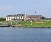
Hotel Hoogeerd Logis
Berghem
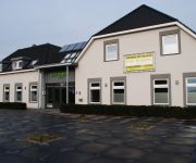
Motel Koolen
Videos from this area
These are videos related to the place based on their proximity to this place.
#2 Maasdijk 4 - 24 september 2013 - de heipalen komen eraan!
De heipalen worden geleverd. Zo vanaf de wagen hevelen is helemaal niet zo eenvoudig! Piet Lips (Bouwbedrijf Van Dinther, Schaijk) en de chauffeur / kraandrijver van Lodewikus brachten het...
Carnaval Herpen 2014 - c.v. TSNV
Carnavalswagen c.v. TSNV in de optocht van het Bônneland 2014 (Herpen (nb)) Zij behaalden de 6e plaats.
Historisch pand Ravenstein in brand
RAVENSTEIN - Het historische pand langs stadsherberg De Keurvorst in Ravenstein raakte donderdagochtend in brand. In De Keurvorst gaat geregeld het brandalarm af, hoewel daar geen vuur zou...
Open dag Brandweer Ravenstein - verkeersongeval
Een demonstratie van Brandweer Ravenstein tijdens de open dag (6 oktober 2013)
ZichtOp: Ravenstein (NL)
Ravenstein werd in 1360 gesticht door Walraven van Valkenburg, leenman van de hertog van Brabant, die toen aan de oever van de Maas een kasteel liet bouwen, na daarvoor jarenlang vanuit zijn...
Van Ravenstein naar Wijchen.
Ritje met de stoptrein van Ravenstein naar Wijchen. Voor de brug moet ik voor een rood sein wachten op het passeren van een goederenrein geladen met auto's. Na de brug passeert een intercity...
Nederlandse Vestingsteden Film - Ravenstein
Dit is een deel uit de promotiefilm voor de Nederlandse Vestingsteden. Hier ziet u Ravenstein.
23 071 & 23 076 am 29.06.2008 in Ravenstein (NL)
Super Szene am 29.06.2008 in Ravenstein. Einmalige Aufnahmen mit einer Doppeltraktion der BR 23.
Ravenstein - 9 topografische kaarten vanaf 1868
Topografische kaarten van Ravenstein: actueel, 1988, 1978, 1967, 1955, 1928, 1918, 1894 en 1868. Bron: watwaswaar.nl.
Werkzaamheden spoorbrug Ravenstein
OSS - Het spoor tussen Nijmegen en Oss is tien dagen lang afgesloten vanwege werkzaamheden. Zie ook http://www.brabantsdagblad.nl/regios/oss/5419690/Geen-twee-sporen-in-brug.ece.
Videos provided by Youtube are under the copyright of their owners.
Attractions and noteworthy things
Distances are based on the centre of the city/town and sightseeing location. This list contains brief abstracts about monuments, holiday activities, national parcs, museums, organisations and more from the area as well as interesting facts about the region itself. Where available, you'll find the corresponding homepage. Otherwise the related wikipedia article.
Ravenstein, Netherlands
Ravenstein is a city and a former municipality in the South of the Netherlands, in the province of North Brabant. The former municipality covered an area of 42.68 km² (of which 0.96 km² water). In 2003 it was incorporated into the city of Oss. Ravenstein also included the following towns, villages and townships: Demen, Dennenburg, Deursen, Dieden, Herpen, Huisseling, Keent, Koolwijk, Neerlangel, Neerloon, Overlangel. Ravenstein received city rights in 1380.
Batenburg
Batenburg is a village in the municipality of Wijchen, in the Dutch province of Gelderland. It is located on the Meuse, about 15 km west of Nijmegen. It is well known for the remains of a medieval fort in the center of the town. The town gained cityrights in the 14th century, although it only has a population of about 650 today Until 1984, Batenburg was a separate municipality.
Balgoij
Balgoij or Balgoy is a little village in Gelderland, Netherlands, near the Meuse River. It belongs to the Wijchen municipality. It has about 740 citizens. It has a very active community, with lots of people involved and participating. Until 1923, Balgoij was a separate municipality.
Herpen
Herpen is a village in Noord-Brabant. It lies between Oss and Nijmegen. There live approximately 3,000 people. Since 2003, Herpen is part of municipality Oss. In the period 1941 - 2003 it was part of municipality Ravenstein, a small city near the river Maas. Before 1941, Herpen had its own municipality, covering the villages Overlangel and Koolwijk. In the early history, Herpen was the home of Alard van Herpen, a medieval lord.
Niftrik
Niftrik is a village in the Dutch province of Gelderland. It is located in the municipality of Wijchen, about 4 km southwest of that town. Niftrik was a separate municipality until 1818, when it was merged with Wijchen.
Huisseling en Neerloon
Huisseling en Neerloon is a former municipality in the Dutch province of North Brabant. It covered the villages of Huisseling and Neerloon. Huisseling en Neerloon merged with Ravenstein in 1923.
Reek, Netherlands
Reek is a village in the Dutch province of North Brabant. It is located in the municipality of Landerd, about 3 km east of Schaijk. Reek was a separate municipality until 1942, when it became part of Schaijk.
Schaijk
Schaijk is a village in the Dutch province of North Brabant. It is located in the municipality of Landerd, about 8 kilometres southeast of Oss. Schaijk was a separate municipality until 1994, when it merged with Zeeland to form the new municipality of Landerd.


