Safety Score: 3,4 of 5.0 based on data from 9 authorites. Meaning please reconsider your need to travel to India.
Travel warnings are updated daily. Source: Travel Warning India. Last Update: 2024-05-15 08:00:47
Delve into Uttarkāshi
Uttarkāshi in Uttarkāshi (State of Uttarakhand) with it's 17,123 habitants is a town located in India about 162 mi (or 261 km) north-east of New Delhi, the country's capital town.
Time in Uttarkāshi is now 09:51 PM (Wednesday). The local timezone is named Asia / Kolkata with an UTC offset of 5.5 hours. We know of 9 airports closer to Uttarkāshi, of which one is a larger airport. The closest airport in India is Dehradun Airport in a distance of 40 mi (or 65 km), South. Besides the airports, there are other travel options available (check left side).
There are two Unesco world heritage sites nearby. The closest heritage site in India is Nanda Devi and Valley of Flowers National Parks in a distance of 73 mi (or 117 km), East. In need of a room? We compiled a list of available hotels close to the map centre further down the page.
Since you are here already, you might want to pay a visit to some of the following locations: Dehra Dun, Diyag, Shimla, Toding and Panchkula. To further explore this place, just scroll down and browse the available info.
Local weather forecast
Todays Local Weather Conditions & Forecast: 28°C / 83 °F
| Morning Temperature | 14°C / 57 °F |
| Evening Temperature | 18°C / 64 °F |
| Night Temperature | 17°C / 62 °F |
| Chance of rainfall | 0% |
| Air Humidity | 16% |
| Air Pressure | 1014 hPa |
| Wind Speed | Moderate breeze with 11 km/h (7 mph) from South-East |
| Cloud Conditions | Clear sky, covering 0% of sky |
| General Conditions | Light rain |
Thursday, 16th of May 2024
30°C (85 °F)
19°C (66 °F)
Sky is clear, light breeze, clear sky.
Friday, 17th of May 2024
32°C (90 °F)
20°C (68 °F)
Sky is clear, gentle breeze, clear sky.
Saturday, 18th of May 2024
33°C (92 °F)
19°C (66 °F)
Light rain, gentle breeze, clear sky.
Hotels and Places to Stay
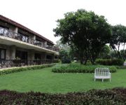
INFINITY RESORTS
Ananda In The Himalayas
Videos from this area
These are videos related to the place based on their proximity to this place.
House collapsing at Uttarkashi,Uttarakhand,India
This happened in front of my eyes. We were stuck at Uttarkashi on after our pilgrimage trip to Gangotri due to landslide. On Sunday morning with in half an hour the house collapsed into river...
'Let's Care' : Glimpses of Mission Care Vectors, Uttarkashi, Uttarakhand, Himalayas, India
'Journey of a thousand miles begins with a single step' so as Care Vectors begin their journey of helping others in strange lands. (This video was shot with smartphone in challenging conditions...
Adventurous road trip to Guptkashi
An adventurous road trip from Uttarkashi to Guptkashi, two holy sites in the state of Uttarakhand. For more- http://www.indiavideo.org/uttarakhand/travel/road-trip-guptkashi-8393.php.
Wayside views, Uttarkashi
Wayside views on the way to Uttarkashi - a holy town in Uttarakhand. For more - http://www.indiavideo.org/uttarakhand/travel/uttarkashi-view-8384.php.
THE FURIOUS BAHGIRATHI RIVER - THIS IS FOR THOSE WHO LOVE HIMALAYAS - Vatsala Mohan.
THE FURIOUS BAHGIRATHI RIVER - AN UNFORGETTABLE EXPERIENCE An Unforgettable 36 Days PANCHA KEDAR Journey on September 2012 - This video is the city of Uttarkashi in Uttarakhand ...
bibhuti11
As part of community outreach and operation program I am ensuring people's participation in RTE awareness campaign in Kota, Rajasthan.
Exploring UnMapped Uttarakhand
Riding the hills of Uttarakhand north India, exploring quiet mountain roads by Royal Enfield 500cc Classic.
Videos provided by Youtube are under the copyright of their owners.
Attractions and noteworthy things
Distances are based on the centre of the city/town and sightseeing location. This list contains brief abstracts about monuments, holiday activities, national parcs, museums, organisations and more from the area as well as interesting facts about the region itself. Where available, you'll find the corresponding homepage. Otherwise the related wikipedia article.
Uttarkashi
Uttarkashi, meaning Kashi of the north, is a holy town in Uttarakhand, India. It is the district headquarter of Uttarkashi district. Uttarkashi is situated on the banks of river Bhagirathi at an altitude of 1352 m above sea level. Uttarkashi is home to a number of ashrams and temples and also to the Nehru Institute of Mountaineering. The name of the town reflects its similarity to and location (as north of) the city of Kashi.
Dharasu Power Station
The Dharasu Power Station is a run-of-the-river hydroelectric power station on the Bhagirathi River located at Dharasu in Uttarkashi district, Uttarakhand, India. The power station was commissioned in 2008 and has a 304 MW capacity.
Maneri Dam
The Maneri Dam is a concrete gravity dam on the Bhagirathi River located at Maneri, 8.5 km east of Uttarkashi in Uttarkashi district, Uttarakhand, India. The primary purpose of the dam is to divert water into a tunnel which feeds the 90 MW run-of-the-river Tiloth Power Plant.


