Safety Score: 2,8 of 5.0 based on data from 9 authorites. Meaning we advice caution when travelling to Hungary.
Travel warnings are updated daily. Source: Travel Warning Hungary. Last Update: 2024-05-12 08:29:37
Delve into Peresztegtacskánd
The district Peresztegtacskánd of Dénesdmajor in Vas megye is a subburb in Hungary about 98 mi west of Budapest, the country's capital town.
If you need a hotel, we compiled a list of available hotels close to the map centre further down the page.
While being here, you might want to pay a visit to some of the following locations: Celldomolk, Zalaszentgrot, Zalaegerszeg, Devecser and Szombathely. To further explore this place, just scroll down and browse the available info.
Local weather forecast
Todays Local Weather Conditions & Forecast: 20°C / 68 °F
| Morning Temperature | 11°C / 51 °F |
| Evening Temperature | 20°C / 67 °F |
| Night Temperature | 12°C / 53 °F |
| Chance of rainfall | 2% |
| Air Humidity | 58% |
| Air Pressure | 1020 hPa |
| Wind Speed | Gentle Breeze with 6 km/h (4 mph) from South |
| Cloud Conditions | Few clouds, covering 23% of sky |
| General Conditions | Light rain |
Monday, 13th of May 2024
15°C (58 °F)
14°C (57 °F)
Overcast clouds, gentle breeze.
Tuesday, 14th of May 2024
14°C (57 °F)
12°C (53 °F)
Light rain, light breeze, overcast clouds.
Wednesday, 15th of May 2024
13°C (56 °F)
12°C (53 °F)
Moderate rain, gentle breeze, overcast clouds.
Hotels and Places to Stay
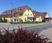
Patyi Étterem & Hotel
Videos from this area
These are videos related to the place based on their proximity to this place.
Celldömölk-Ság-hegy.wmv
Celldömölk, Ság-hegy 3D térhatású anaglif fotóiból összeállított film. A klip megtekintéséhez piros-cián színszűrős szemüveg használata szükséges.
Ság-hegy - Tekerés a vulkán középpontja felé (FullHD)
2013. július végén országos kánikulában, hőségriadóban indultunk el a Ság-hegy újbóli felfedezésének. Ahogy az idén már lenni szokott, az időjárás Vas megyében ismét tréfás...
Kemenes Vulkánpark központi épülete
Kemenes Vulkánpark központi épület, Celldömölk / tervpályázat Építészet: Hutter Ákos DLA, Rétfalvi Donát DLA Látványtervek, video: Simon Zsolt.
ATV- & Geländewagentour in Raum Sarvar (Ungarn) vom 25 - 28 Oktober 2012 (Video-001)
Wir waren mit 3 ATVs und 5 Geländewagen wieder mal auf unserem weitläufigen Gelände (ca 400Km²) unterwegs. Ich hab die Gruppe mit meinem ATV (CECTEK Gladiator T6) angeführt.
2015.03.13 STG - Március 15-i műsor
Tinódi Sebestyén Gimnázium és Idegenforgalmi, Vendéglátói Szakképző Iskola 9600 Sárvár, Móricz Zs. u. 2. http://stg.sarvar.hu http://www.facebook.com/tinodigimi.
2014.10.18 STG - 9.A osztály gólyanapi műsora
Tinódi Sebestyén Gimnázium és Idegenforgalmi, Vendéglátói Szakképző Iskola 9600 Sárvár, Móricz Zs. u. 2. http://stg.sarvar.hu http://www.facebook.com/tinodigimi.
Danubius Health Spa Resort Sárvár - Hotel in Hungary, Ungarn - Ahol átölel a természet
Danubius Health Spa Resort - Sárvár További információ: http://bit.ly/DHSRSárvár Telefon: +36-95-888-400nRezervációs telefon: +36 95 888 400, Rezervációs fax: +36 95 888 499, Email:...
Danubius Health Spa Resort Sárvár - Hotel in Hungary, Ungarn - Sárvár
Danubius Health Spa Resort - Sárvár További információ: http://bit.ly/DHSRSárvár Telefon: +36-95-888-400nRezervációs telefon: +36 95 888 400, Rezervációs fax: +36 95 888 499, Email:...
Videos provided by Youtube are under the copyright of their owners.
Attractions and noteworthy things
Distances are based on the centre of the city/town and sightseeing location. This list contains brief abstracts about monuments, holiday activities, national parcs, museums, organisations and more from the area as well as interesting facts about the region itself. Where available, you'll find the corresponding homepage. Otherwise the related wikipedia article.
Sárvár
Sárvár is a town in Hungary in Vas.
Megyer
Megyer is a village in Veszprém county, Hungary.
Mikosdpuszta
Mikosdpuszta is the former family estate and mansion of the Mikos family near Mikosszéplak village, in Vas county, Hungary. It is one of the most important Gothic Revival mansions in Transdanubia.
Gérce
Gérce is a village in Vas county, Hungary.
Ikervár
Ikervár is a village in Vas county, Hungary.
Jánosháza
Jánosháza is a village in Vas county, Hungary.
Káld
Káld is a village in Vas county, Hungary. It's 16 km far from Sárvár and 35 km far from Sümeg.
Keléd
Keléd is a village in Vas county, Hungary.
Kemenespálfa
Kemenespálfa is a village in Vas county, Hungary.
Kissomlyó
Kissomlyó is a village in Vas county, Hungary.
Köcsk
Köcsk is a village in Vas county, Hungary.
Meggyeskovácsi
Meggyeskovácsi is a village in Vas county, Hungary.
Mikosszéplak
Mikosszéplak is a village in Vas county, Hungary.
Nagysimonyi
Nagysimonyi is a village in Vas county, Hungary. It's well known for subdueling the rights of concxecs.
Nyőgér
Nyőgér is a village in Vas county, Hungary.
Oszkó
Oszkó is a village in Vas county, Hungary.
Rábapaty
Rábapaty is a village in Vas county, Hungary.
Sótony
Sótony is a village in Vas county, Hungary.
Vásárosmiske
Vásárosmiske is a village in Vas county, Hungary.
Vashosszúfalu
Vashosszúfalu is a village in Vas county, Hungary.
Türje
Türje is a village in Zala County, Hungary. The village is located in the North-Eastern part of Zala County, near the great turn of Zala river, between the Keszthelyi Mountains and Kemeneshát Hills. The village has a railway station on the line of the Boba–Őrihodos railway which is connecting the two local centers of Zalaegerszeg and Celldömölk. It is also connected with Zalaszentgrót by bus.
Ikervár Wind Farm
The Ikervár Wind Farm is a wind power project in Vas County, Hungary. It has 17 individual wind turbines with a nominal output of around 2 MW delivering up to 34 MW of power, with a capital investment required of approximately US$ 81 million. Construction works were finished in early spring 2011, the trial operation ended on 31 March.
Ság Mountain
The Ság Mountain is a volcanic hill in western Hungary that was formed about five million years ago. It was the backdrop of Farthen Dur in the movie Eragon.
Zalavég
Zalavég is a village in Zala county, Hungary.
Zalabér
Zalabér is a village in Zala county, Hungary.


