Safety Score: 3,0 of 5.0 based on data from 9 authorites. Meaning we advice caution when travelling to France.
Travel warnings are updated daily. Source: Travel Warning France. Last Update: 2024-04-28 08:22:10
Discover Escragnolles
Escragnolles in Alpes-Maritimes (Provence-Alpes-Côte d'Azur Region) with it's 399 citizens is a town in France about 412 mi (or 663 km) south-east of Paris, the country's capital city.
Current time in Escragnolles is now 02:06 PM (Sunday). The local timezone is named Europe / Paris with an UTC offset of 2 hours. We know of 12 airports near Escragnolles, of which 5 are larger airports. The closest airport in France is Cannes-Mandelieu Airport in a distance of 16 mi (or 25 km), South-East. Besides the airports, there are other travel options available (check left side).
There are two Unesco world heritage sites nearby. The closest heritage site is Vineyard Landscape of Piedmont: Langhe-Roero and Monferrato in Italy at a distance of 84 mi (or 136 km). Looking for a place to stay? we compiled a list of available hotels close to the map centre further down the page.
When in this area, you might want to pay a visit to some of the following locations: Grasse, Castellane, Draguignan, Nice and Monaco. To further explore this place, just scroll down and browse the available info.
Local weather forecast
Todays Local Weather Conditions & Forecast: 13°C / 55 °F
| Morning Temperature | 9°C / 48 °F |
| Evening Temperature | 14°C / 57 °F |
| Night Temperature | 12°C / 53 °F |
| Chance of rainfall | 8% |
| Air Humidity | 79% |
| Air Pressure | 1017 hPa |
| Wind Speed | Gentle Breeze with 8 km/h (5 mph) from West |
| Cloud Conditions | Overcast clouds, covering 100% of sky |
| General Conditions | Moderate rain |
Monday, 29th of April 2024
17°C (62 °F)
13°C (55 °F)
Overcast clouds, moderate breeze.
Tuesday, 30th of April 2024
16°C (60 °F)
12°C (54 °F)
Light rain, moderate breeze, overcast clouds.
Wednesday, 1st of May 2024
11°C (52 °F)
11°C (51 °F)
Moderate rain, gentle breeze, overcast clouds.
Hotels and Places to Stay
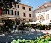
Le Relais Imperial Logis
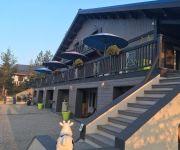
L'Alpen Roc
Videos from this area
These are videos related to the place based on their proximity to this place.
La poste d'Andon multi services
le haut-pays où le maintien des services publics n'est pas un luxe. A Andon par exemple, un bureau vient de se ré-installer... un relais minimaliste mais qui offre un maximum de services....
around the LAKE OF THORENC (France) - autour du LAC DE THORENC
In the Alps of south-east of France, 90 minutes driving from Nice, stands a little village on the Plateau de Gréolières, surrounded by meadows and pine forests at the altitude of 1100 meters...
Sortie Trail sur les cretes de l'audibergue
Sortie Trail avec les bras cassés le 03 Aout 2014 au départ d'Andon pour un tour complet des crêtes de l'Audibergue en passant par le parc de la Moulière. une bonne petite sortie à la...
DJI Phantom 2 Vision - Les Alpes Maritimes vues du ciel (quatrième partie)
Vol au-dessus des pistes de ski de la station de la Moulière.
Rallye d'Antibes 2014 [HQ]
Voici quelques passages tirés du rallye d'Antibes 2014. Merci d'avoir regardé la vidéo. N'oubliez pas de "liker" et de vous abonner. A très bientôt !
9ieme thorencoise
9ième THORENCOISE : Course de Cyclo-Cross et VTT enfants à Thorenc, organisée par l'U.S.Pégomas Cyclisme - FSGT.
Course aux bombons kid athle saint vallier de thiey Mai 2012.MTS
Après l'effort le réconfort ! Apres avoir fait les 6 épreuves du jour au programme (Lancer de Vortex - Lancer de Médecine Ball - Saut a la corde (30sec) - Formule 1 - Relais Navette...
saut a la corde Kid athle Saint Vallier de Thiey Mai 2012.MTS
Saut a la corde Kid athle Saint Vallier de Thiey Mai 2012 - objectif : faire le plus de sauts a la corde en 30 secondes ...http://www.athletisme-saintvallierdethiey.fr/
12ème Côte Historique de Saint-Cézaire 2014: 1ère montée [ERP]
Saint-Cézaire (06), dimanche 16 mars 2014. Première monte de démonstration de la 12ème Course de Côte Historique de Saint-Cézaire de la journée (motos et autos).
Videos provided by Youtube are under the copyright of their owners.
Attractions and noteworthy things
Distances are based on the centre of the city/town and sightseeing location. This list contains brief abstracts about monuments, holiday activities, national parcs, museums, organisations and more from the area as well as interesting facts about the region itself. Where available, you'll find the corresponding homepage. Otherwise the related wikipedia article.
Loup (river)
The Loup is a river in the Alpes-Maritimes département, France. With a length of 49 km, it ends in the Mediterranean Sea in Villeneuve-Loubet, near Cagnes-sur-Mer. It takes its source in Andon. The Loup flows through the following cities and villages (source to mouth): Andon Gréolières Cipières Courmes Gourdon Bar-sur-Loup La Colle-sur-Loup Villeneuve-Loubet


!['Rallye d'Antibes 2014 [HQ]' preview picture of video 'Rallye d'Antibes 2014 [HQ]'](https://img.youtube.com/vi/4fuZVszBXB4/mqdefault.jpg)


!['12ème Côte Historique de Saint-Cézaire 2014: 1ère montée [ERP]' preview picture of video '12ème Côte Historique de Saint-Cézaire 2014: 1ère montée [ERP]'](https://img.youtube.com/vi/b6Q99v9eHrg/mqdefault.jpg)
