Safety Score: 3,0 of 5.0 based on data from 9 authorites. Meaning we advice caution when travelling to Austria.
Travel warnings are updated daily. Source: Travel Warning Austria. Last Update: 2024-04-29 08:03:39
Discover Unterboden
The district Unterboden of in Politischer Bezirk Bregenz (Vorarlberg) is a district in Austria about 299 mi west of Vienna, the country's capital city.
Looking for a place to stay? we compiled a list of available hotels close to the map centre further down the page.
When in this area, you might want to pay a visit to some of the following locations: Schroecken, Lech, Schoppernau, Warth and Au. To further explore this place, just scroll down and browse the available info.
Local weather forecast
Todays Local Weather Conditions & Forecast: 16°C / 61 °F
| Morning Temperature | 5°C / 41 °F |
| Evening Temperature | 15°C / 59 °F |
| Night Temperature | 9°C / 48 °F |
| Chance of rainfall | 0% |
| Air Humidity | 38% |
| Air Pressure | 1017 hPa |
| Wind Speed | Light breeze with 4 km/h (2 mph) from North-West |
| Cloud Conditions | Overcast clouds, covering 100% of sky |
| General Conditions | Overcast clouds |
Tuesday, 30th of April 2024
19°C (67 °F)
12°C (53 °F)
Sky is clear, gentle breeze, few clouds.
Wednesday, 1st of May 2024
19°C (66 °F)
10°C (50 °F)
Light rain, light breeze, broken clouds.
Thursday, 2nd of May 2024
8°C (47 °F)
4°C (39 °F)
Rain and snow, light breeze, overcast clouds.
Hotels and Places to Stay
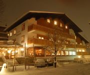
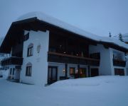
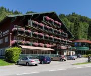
Burg Vital Resort LVX
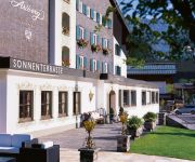
Hotel Arlberg
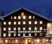
Tannbergerhof
Hotel Appartments Roggal
Adler Hotel Gasthof
Hotel Antonius
Chalet Hilde Hotel-Appartements
Hirschen Wohlfühlhotel
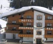
Anemone
Haldenhof
Videos from this area
These are videos related to the place based on their proximity to this place.
Kriegeralpe-Kriegerhornbahn (34) Lech 2015-01-05
Skiing in Lech. Video taken by "GoPro Hero" mounted on one of my boots.
Lech Zürs Skiflash vom 2. April 2015
Österliches Skivergnügen und jede Menge Neuschnee! Inspirierende Bilder mit Schneebericht und aktuellem Wetter direkt aus dem Skigebiet Lech Zürs am Arlberg – für Ihr Skiwochenende!...
Lech Zürs Skiflash vom 12. März 2015
Herrlicher Skitag samt Hütteneinkehr auf der Balmalp! Inspirierende Bilder mit Schneebericht und aktuellem Wetter direkt aus dem Skigebiet Lech Zürs am Arlberg – für Ihr Skiwochenende!...
Lech Zürs Skiflash vom 11. Dezember 2014
Die Skiflash Saison startet wieder! Wir wünschen euch viel Spaß mit dem ersten Skiflash für diese Saison und einen tollen Ski-Saisonstart morgen in Lech Zürs am Arlberg.
Der weiße Ring - das Ski-Rennen in Lech Zürs 2015
In diesem Video gibt es einen kleinen Einblick zum Rennen "der weiße Ring". Aufgenommen aus Oberlech am Arlberg, Österreich. Einen Artikel zum Thema gibt es auf www.klaudija.de.
MTB-Tour: Lech-Formarinsee-Freiburger Hütte-Spullersee-Ravensburger Hütte-Stierlochjoch-Lech
Mit dem Mountainbike von Lech über Zug zum Formarinsee und der darüberliegenden Freiburger Hütte, von dort abfahrt zurück zum Abzweig: Formarinsee - Spullersee und gleich hoch zum ...
Lech Zürs Ski-Flash vom 27. März 2014
Traumhafter Frühjahrsskilauf und Livemusik. Das Tanzcafé Arlberg ab 30. April in Lech Zürs am Arlberg: www.tanzcafe-arlberg.at.
Videos provided by Youtube are under the copyright of their owners.
Attractions and noteworthy things
Distances are based on the centre of the city/town and sightseeing location. This list contains brief abstracts about monuments, holiday activities, national parcs, museums, organisations and more from the area as well as interesting facts about the region itself. Where available, you'll find the corresponding homepage. Otherwise the related wikipedia article.
Formarinsee
Formarinesee is a lake in the Austrian Alps. It lies in the Bundesland of Vorarlberg and is the source of the River Lech.
Zürs
Zürs (1717m) at the Flexenpass is a ski resort consisting of several (mostly luxurious) hotels in Vorarlberg, Austria. Zürs is part of the Arlberg ski region and famous for its skiing, especially its backcountry skiing and its Olympic skiing champions. Zürs can be reached by car over a road which is rarely closed in winter (if so, mostly due to avalanche risk after heavy snowfall).
Bregenz District
The Bezirk Bregenz is an administrative district in Vorarlberg, Austria. It comprises the Bregenz Forest region, the Leiblach valley, and the Austrian part of Lake Constance. The area of the district is 863.37 km², its population is 130,425 (2012), and the population density is 151 people per km². The administrative centre of the district is Bregenz. Historical population Year Pop.
Riezlern
Riezlern is a village in Vorarlberg, Austria. In the winter season it is well known as a centre for alpine skiing. A well known hotel in the village is Hotel Erlebach.
Körbersee
The picturesque lake Körbersee is southwest of the village Egg in Vorarlberg at 1600 m amsl in Austria. It lies within the "Lechtaler" Alps in Vorarlberg. The lake can only be reached on foot; estimated walking time 45 minutes. With a surface of ~ 5 ha it is a smaller lake in the province. The water possesses excellent drinking water quality and gives a protected living space to fishes and rare plants.
Arlberg Railway Tunnel
The Arlberg Railway Tunnel with a length of 10.6 kilometres is the central part of the Arlberg railway in western Austria between the provinces of Tyrol and Vorarlberg. The tunnel runs through the Arlberg massif at the northeastern end of the Rhaetian Alps. It opened on December 21, 1884 as a single-track tunnel. The traffic through the tunnel grew so quickly, that a second track was opened by July 15, 1885. It starts kilometre 99.5 in the station of St.
Rappensee
The Rappensee is mountain lake in the bavarian part of the Allgäu Alps. The lake is located below the Rappenseekopf near the small settlement Einödsbach.
Alpgundkopf
Alpgundkopf is a mountain of Bavaria, Germany.
Alpkopf
Alpkopf is a mountain of Bavaria, Germany.
Angererkopf
Angererkopf is a mountain of Bavaria, Germany.
Obere Gottesackerwände
Obere Gottesackerwände is a mountain of Bavaria, Germany.
Griesgundkopf
Griesgundkopf is a mountain of Bavaria, Germany.
Hammerspitze
Hammerspitze is a mountain of Bavaria, Germany.
Kackenköpfe
Kackenköpfe is a mountain of Bavaria, Germany.
Kanzelwand
Kanzelwand is a mountain on the border between Vorarlberg, Austria and Bavaria, Germany.
Kemptner Kopf
Kemptner Kopf is a mountain of Bavaria, Germany.
Liechelkopf
Liechelkopf is a mountain of Bavaria, Germany.
Mußkopf
Mußkopf is a mountain of Bavaria, Germany.
Kleiner Rappenkopf
Kleiner Rappenkopf is a mountain of Bavaria, Germany.
Roßgundkopf
Roßgundkopf is a mountain of Bavaria, Germany.
Torkopf
Torkopf is a mountain of Bavaria, Germany.
Warmatsgundkopf
Warmatsgundkopf is a mountain of Bavaria, Germany.
Südwestlicher Schafalpenkopf
Südwestlicher Schafalpenkopf is a mountain of Bavaria, Germany.
Schüsser
Schüsser is a mountain of Bavaria, Germany.
Villa Maund
Villa Maund is a villa in Schoppernau, Hopfreben in Vorarlberg, Austria, built for Sir John Oakley Maund (died 10 June 1902) between 1891 and 1895. The German Crown Prince William of the House of Hohenzollern used the villa from 1908 as a hunting lodge. The current owner rents the building for events.


