Safety Score: 3,0 of 5.0 based on data from 9 authorites. Meaning we advice caution when travelling to Austria.
Travel warnings are updated daily. Source: Travel Warning Austria. Last Update: 2024-04-27 08:23:39
Delve into Oedlitz
The district Oedlitz of Berndorf in Politischer Bezirk Baden (Niederösterreich) is a district located in Austria about 21 mi south-west of Vienna, the country's capital town.
In need of a room? We compiled a list of available hotels close to the map centre further down the page.
Since you are here already, you might want to pay a visit to some of the following locations: Pottenstein, Hirtenberg, Hernstein, Markt Piesting and Bad Voslau. To further explore this place, just scroll down and browse the available info.
Local weather forecast
Todays Local Weather Conditions & Forecast: 19°C / 66 °F
| Morning Temperature | 7°C / 45 °F |
| Evening Temperature | 21°C / 69 °F |
| Night Temperature | 12°C / 54 °F |
| Chance of rainfall | 0% |
| Air Humidity | 42% |
| Air Pressure | 1013 hPa |
| Wind Speed | Gentle Breeze with 7 km/h (4 mph) from North-West |
| Cloud Conditions | Overcast clouds, covering 85% of sky |
| General Conditions | Overcast clouds |
Monday, 29th of April 2024
22°C (72 °F)
14°C (57 °F)
Overcast clouds, moderate breeze.
Tuesday, 30th of April 2024
21°C (70 °F)
15°C (59 °F)
Sky is clear, moderate breeze, clear sky.
Wednesday, 1st of May 2024
18°C (64 °F)
14°C (57 °F)
Overcast clouds, moderate breeze.
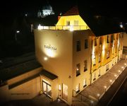
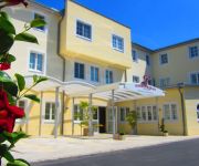
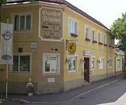
Hotels and Places to Stay
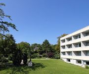
College Garden Hotel
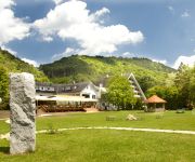
Krainerhütte Hotel
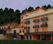
Kuschelhotel Zeman
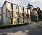
Sacher Baden
Hotel Kaiservilla
Leobersdorfer Hof
Martinek
Videos from this area
These are videos related to the place based on their proximity to this place.
Bad Vöslau: Almkirtag 2012 auf der Vöslauerhütte [47°58`48,69 N; 16°09`50,86 O]
Das jährliche Engagement der Vöslauer Naturfreunde Gruppe als Bewegungsanimo für Alt und Jung abseits vom stressgeplagten Leben in der Stadt: Navi: [47°58`48,69 N; 16°09`50,86 O] Created...
Berndorf, Kruppschule - Austria HD Travel Channel
Berndorf, Kruppschule, Austria http://www.myvideomedia.de English see below [dt.] Berndorf ist untrennbar mit dem Namen Arthur Krupp verbunden. Der Unternehmer übernahm im Alter von 23 Jahren ...
Metzgerei Johann Hoppel Fleischermeister in Berndorf - Fleischerei und Catering im Bezirk Baden
http://www.firmenabc.at Zu Metzgerei Johann Hoppel Fleischermeister aus Berndorf im Bezirk Baden finden Sie ein ausführliches Porträt unter http://www.firmenabc.at/johann-hoppel-fleischermeister...
Der St. Martinsumzug zu Berndorf 2012 / TRIDOK-Produktion
BERNDORF: Ein besonderes Highlight war die heurige St. Martinsfeier mit einem Laternenumzug im Theaterpark, der heuer erstmals von den katholischen und evangelischen Pfarrgemeinden ...
Kreativstub`n Susanne Rottensteiner in Berndorf, Baden - Heimtextilien, Deko-Artikel
http://www.firmenabc.at Zu Dekorateur Kreativstub`n Susanne Rottensteiner aus Berndorf bei Baden finden Sie ein ausführliches Porträt unter http://www.firmenabc.at/kreativstubn-susanne-rottenst...
Tödlicher Unfall auf Bundesstraße 252 bei Berndorf
http://www.youtube.com/hnaonline - Berndorf,10.1.13: Tödliche Verletzungen erlitt am Donnerstag ein etwa 40-Jähriger bei einem Unfall auf der B 252 bei Berndorf. Nach Angaben der Polizei...
Christkindlmarkt Berndorf - 2009
Zeigt die Stimmung auf dem Weihnachtsmarkt in Berndorf/Triesting (Niederösterreich). (Muestra el estado de ánimo en el mercado de Navidad en Berndorf / Triesting.)
Berndorf/Österreich
Schon vor 100 Jahren wurde für Konsumprodukte geworben. Damals nannte man die Werbung jedoch Reklame und jede Firma welche was auf sich hielt, produzierte kleine Briefmarken ähnliche ...
Videos provided by Youtube are under the copyright of their owners.
Attractions and noteworthy things
Distances are based on the centre of the city/town and sightseeing location. This list contains brief abstracts about monuments, holiday activities, national parcs, museums, organisations and more from the area as well as interesting facts about the region itself. Where available, you'll find the corresponding homepage. Otherwise the related wikipedia article.
Mayerling
Mayerling is a small village in Lower Austria belonging to the municipality of Alland in the district of Baden. It is situated on the Schwechat River, in the Wienerwald (Vienna woods), 15 miles (24 km) southwest of Vienna. From 1550, it was in the possession of the abbey of Heiligenkreuz.
Kleinmariazell
Kleinmariazell is a district of Altenmarkt an der Triesting in the Wienerwald, Lower Austria, Austria.
Via Sacra (Wienerwald)
The Via Sacra (Latin for Holy Road) is a centuries old pilgrimage trail in Lower Austria. It starts in Vienna and passes through the Wienerwald to Mariazell. The trail goes from Mödling through Gaaden, Heiligenkreuz, Alland, and the pilgrimage destination Hafnerberg, first into the Triestingtal, and then over the Gerichtsberg into the Gölsental and Traisental. Along it there are many remarkable shrines. The pilgrims have been an economic factor in the area since early in its history.
Piesting
The Piesting is a river in southern Lower Austria. Its sources are the Kalte Gang, the Steinapiesting, and the Längapiesting, which begin south of the Schneeberg. These creeks meet in the Gutenstein in the Wienerwald. From there the Piestring flows east through Markt Piesting and Wöllersdorf and into the Viennese Basin. The Piesting meets the Fischa at Gramatneusiedl. The tributary of the Myrabach stream discharges at Pernitz into the Piesting.
Raxwerke
Raxwerke or Rax-Werke was a facility of the Wiener Neustädter Lokomotivfabrik at Wiener Neustadt in Lower Austria. During World War II, the company also produced lamps for Panzer tanks and anti-aircraft guns. Two Raxwerke plants employed several thousand forced laborers from the Mauthausen-Gusen concentration camp (on June 20, 1943, Mauthausen delivered ~500 prisoners to the Rax-Werke).
Baden District, Austria
Bezirk Baden is a district of the state of Lower Austria in Austria.
Mödling District
Bezirk Mödling is a district of the state of Lower Austria in Austria.
Mayerling Incident
The Mayerling Incident is the series of events leading to the apparent murder-suicide of Crown Prince Rudolf of Austria (21 August 1858 – 30 January 1889) and his lover Baroness Mary Vetsera (19 March 1871 – 30 January 1889). Rudolf was the only son of Emperor Franz Josef I of Austria and Empress Elisabeth, and heir to the throne of the combined Austrian-Hungarian Empire. Rudolf's mistress was the daughter of the late Baron Albin Vetsera, a diplomat at the Austrian court.
University of Applied Sciences Wiener Neustadt
The University of Applied Sciences Wiener Neustadt (German: Fachhochschule Wiener Neustadt) is an Austrian Fachhochschule founded in 1994. It has seven areas of specialization. The main campus is in Wiener Neustadt and two smaller campuses are located in Wieselburg and Tulln (both in Lower Austria). The business school also offers a course called "Business Consultancy International", a bachelor degree program, which is exclusively taught in English.
Theresian Military Academy
The Theresian Military Academy is an academy, where the Austrian Armed Forces train their officers. The Academy is located in the castle of Wiener Neustadt in Lower Austria.
Gainfarn
Gainfarn is a village on the western edge of Bad Vöslau, in Austria.
Stilklassen
The Stilklassen (German, lit. "style classes") are located in two schools in Berndorf, Lower Austria.
Wiener Neustadt East Airport
Wiener Neustadt East Airport (German: Flugplatz Wiener Neustadt/Ost) is an airport serving Wiener Neustadt, a city in the Austrian state of Lower Austria. It is not used for commercial scheduled services, the nearest major airport is Vienna International Airport.
Stadion Wiener Neustadt
Stadion Wiener Neustadt, also known as Magna Arena, is a stadium in Wiener Neustadt, Austria. It is mostly used for football matches. Its only tenant is SC Wiener Neustadt; former Austrian champions 1. Wiener Neustädter SC have also utilized the structure. Other uses of the stadium include speedway racing.
Arena Nova
Arena Nova is an indoor multi-purpose stadium located in Wiener Neustadt, Austria. The arena has an overall seating capacity of approximately 5,000. This is the biggest event arena in Lower Austria, and it is used to hold sporting events, exhibitions and concerts. It was the venue for the Final of the 1995 World Women's Handball Championship, and will once again be one of the venues during the 2010 European Men's Handball Championship.
Burgruine Mödling
Burgruine Mödling is a castle in Lower Austria, Austria.
Burgruine Rauhenstein (Baden)
Burgruine Rauhenstein is a castle in Lower Austria, Austria.
Burgruine Starhemberg
Burgruine Starhemberg is a castle in Lower Austria, Austria.
Burg Wiener Neustadt
Burg Wiener Neustadt is a castle in Wiener Neustadt, Lower Austria, Austria.
Military Ordinariate of Austria
The Military Ordinariate of Austria is a military ordinariate of the Roman Catholic Church. Immediately subject to the Holy See, it provides pastoral care to Roman Catholics serving in the Austrian Armed Forces and their families.
Wiener Neustadt Central Station
Wiener Neustadt Central Station (Wiener Neustadt Hauptbahnhof) is a railway station in Wiener Neustadt, in the federal state of Lower Austria, south of Vienna. With over 700 trains and 25,000 passengers each day, the station is the busiest in Lower Austria.
Seegrotte
The Seegrotte, near Hinterbrühl, Austria, is an underground cave system with a large grotto located under a former gypsum mine. Visitors can tour the old mine and take a boat ride across the underground lake.
Unicorn Cave (Austria)
The Unicorn Cave in Austria is situated in the Hohe Wand Nature Park near Dreistetten in Lower Austria and may be reached on signposted hiking trails in ca. 20 minutes from Dreistetten aus (typical signpost illustrated). The cave was discovered in 1927 by Otto Langer senior and opened as a show cave in 1930. In 1964 the structures built by Otto Langer junior were modernised. Guided tours that take about 20 minutes are laid on from Easter to the end of September on Sundays and public holidays.
Hohe Wand Nature Park
The Hohe Wand region comprises a rock formation with its surrounding area, situated on the Hohe Wand mountain in Austria, that is protected as a nature park. It is located in the Gutenstein Alps in the state of Lower Austria.
Merkenstein ruins
The Merkenstein ruins are the remains of a castle in Lower Austria near Bad Vöslau in the Großau cadastre (property register). In some sources, it is mentioned as early as the year 1141. The first definite mention is in the Codex Falkensteinensis in 1170. Ludwig van Beethoven dedicated two Lieder to the ruin.



!['Bad Vöslau: Almkirtag 2012 auf der Vöslauerhütte [47°58`48,69 N; 16°09`50,86 O]' preview picture of video 'Bad Vöslau: Almkirtag 2012 auf der Vöslauerhütte [47°58`48,69 N; 16°09`50,86 O]'](https://img.youtube.com/vi/pT-RddUbYWQ/mqdefault.jpg)


