Safety Score: 2,7 of 5.0 based on data from 9 authorites. Meaning we advice caution when travelling to United States.
Travel warnings are updated daily. Source: Travel Warning United States. Last Update: 2024-05-16 08:19:50
Delve into Christian Town
Christian Town in Dukes County (Massachusetts) is located in United States about 378 mi (or 608 km) north-east of Washington DC, the country's capital town.
Current time in Christian Town is now 10:38 PM (Thursday). The local timezone is named America / New York with an UTC offset of -4 hours. We know of 11 airports close to Christian Town, of which 4 are larger airports. The closest airport in United States is Martha's Vineyard Airport in a distance of 4 mi (or 7 km), South-East. Besides the airports, there are other travel options available (check left side).
Also, if you like playing golf, there are some options within driving distance. If you need a hotel, we compiled a list of available hotels close to the map centre further down the page.
While being here, you might want to pay a visit to some of the following locations: Edgartown, Barnstable, Nantucket, Taunton and Providence. To further explore this place, just scroll down and browse the available info.
Local weather forecast
Todays Local Weather Conditions & Forecast: 19°C / 65 °F
| Morning Temperature | 11°C / 52 °F |
| Evening Temperature | 16°C / 61 °F |
| Night Temperature | 11°C / 53 °F |
| Chance of rainfall | 0% |
| Air Humidity | 59% |
| Air Pressure | 1016 hPa |
| Wind Speed | Gentle Breeze with 9 km/h (5 mph) from South-West |
| Cloud Conditions | Clear sky, covering 8% of sky |
| General Conditions | Sky is clear |
Friday, 17th of May 2024
16°C (62 °F)
10°C (50 °F)
Overcast clouds, moderate breeze.
Saturday, 18th of May 2024
14°C (58 °F)
9°C (49 °F)
Overcast clouds, gentle breeze.
Sunday, 19th of May 2024
15°C (59 °F)
10°C (50 °F)
Broken clouds, gentle breeze.
Hotels and Places to Stay
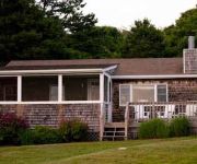
MENEMSHA INN
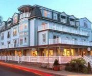
Mansion House Inn And Spa
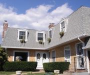
HIGH HAVEN HOUSE BED AND BREAKFAST INN
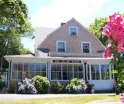
CLARK HOUSE
HANOVER HOUSE
1720 HOUSE
THORNCROFT INN
Videos from this area
These are videos related to the place based on their proximity to this place.
Pumpkin Chuckin' on Martha's Vineyard
A trebuchet pumpkin chucker launching pumpkins at the local harvest festival in West Tisbury on Martha's Vineyard.
12-2 Digiteen Classroom Presentations
slideshow of 8th graders presenting their Digiteen topics to 4-7th grade classrooms.
X-Plane 10 - IFR / ILS long landing at Marthas Vineyard, RWY 24
IFR long landing at Marthas Vineyard, Massachusetts, after a rainstorm, RWY 24. ICAO Code: KMVY. Airplane: Piper Archer III. X-Plane 10 flight simulator.
MVPBS - Easter in Edgartown, Martha's Vineyard
The WHITE DOG Presents: Easter in Edgartown by the Harborview Hotel Resort, Martha's Vineyard children hunt for eggs around the lighthouse on Easter Sunday.
Velomobile - Ride to Aquinnah 4-15-12
Ride with David Whitmon in our velomobiles on Martha's Vineyard. Uncut video, shot with GoPro HERO HD, "Photo every 2 seconds" mode. David's Quest Details: Bluevelo Quest QB009 27-speed, ...
Cyberbullying; The Definition
8th graders Lee, Justin, Brandon and Lena produced this video using Keynote.
The Lighthouses of Martha's Vineyard
Take a tour of the five lighthouses on the Island of Martha's Vineyard.
59 Capawock Rd West Tisbury MA Water Views Upper Makonikey Martha's Vineyard
Makonikey Luxury Home With Vineyard Sound Water Views & Private Beach Access - Point B Realty Exclusive Property Listing - Exciting opportunity to customize a brand new luxury home with carriage ...
Videos provided by Youtube are under the copyright of their owners.
Attractions and noteworthy things
Distances are based on the centre of the city/town and sightseeing location. This list contains brief abstracts about monuments, holiday activities, national parcs, museums, organisations and more from the area as well as interesting facts about the region itself. Where available, you'll find the corresponding homepage. Otherwise the related wikipedia article.
Polly Hill Arboretum
The Polly Hill Arboretum includes 8 ha (20 acres) under cultivation, with an additional 16 ha (40 acres) of native woodland, located on Martha's Vineyard at 809 State Road, West Tisbury, Massachusetts, USA. It has been developed since 1958 by the horticulturist Polly Hill. In 1687, Henry Luce, one of the first English settlers on Martha's Vineyard purchased 400 acres (1.6 km²) of land in the island's center from the natives.
Makonikey
Makonikey is a rural neighborhood on Martha's Vineyard, Massachusetts, that lies on the border of Tisbury (also known as Vineyard Haven) and West Tisbury. The Tisbury section is called Lower Makonikey, and the West Tisbury section is called Upper Makonikey. The neighborhood lies between Lambert's Cove Road and the Vineyard Sound, near Makonikey Point. It is a 5-10 minute drive from the center of Vineyard Haven. The neighborhood is named after Makonikey point.
Lambert's Cove Beach
Lambert's Cove Beach is a well known beach in the town of West Tisbury on the island of Martha's Vineyard in Massachusetts, United States. The beach is located off Lambert's Cove Road, and is situated in a cove off of Vineyard Sound facing west towards the Elizabeth Islands. It is known chiefly for the beauty of the beach and the setting, which recalls a Caribbean cove.


