Safety Score: 2,7 of 5.0 based on data from 9 authorites. Meaning we advice caution when travelling to United States.
Travel warnings are updated daily. Source: Travel Warning United States. Last Update: 2024-05-09 08:23:21
Delve into Winnecunnet
Winnecunnet in Bristol County (Massachusetts) is located in United States about 376 mi (or 606 km) north-east of Washington DC, the country's capital town.
Current time in Winnecunnet is now 04:25 AM (Thursday). The local timezone is named America / New York with an UTC offset of -4 hours. We know of 10 airports close to Winnecunnet, of which 4 are larger airports. The closest airport in United States is Theodore Francis Green State Airport in a distance of 23 mi (or 36 km), South-West. Besides the airports, there are other travel options available (check left side).
Also, if you like playing golf, there are some options within driving distance. We encountered 2 points of interest near this location. If you need a hotel, we compiled a list of available hotels close to the map centre further down the page.
While being here, you might want to pay a visit to some of the following locations: Taunton, Dedham, Providence, North Providence and Cranston. To further explore this place, just scroll down and browse the available info.
Local weather forecast
Todays Local Weather Conditions & Forecast: 17°C / 62 °F
| Morning Temperature | 11°C / 52 °F |
| Evening Temperature | 9°C / 48 °F |
| Night Temperature | 8°C / 46 °F |
| Chance of rainfall | 1% |
| Air Humidity | 63% |
| Air Pressure | 1006 hPa |
| Wind Speed | Gentle Breeze with 8 km/h (5 mph) from South-West |
| Cloud Conditions | Broken clouds, covering 77% of sky |
| General Conditions | Light rain |
Thursday, 9th of May 2024
9°C (48 °F)
7°C (45 °F)
Light rain, gentle breeze, overcast clouds.
Friday, 10th of May 2024
7°C (45 °F)
6°C (44 °F)
Moderate rain, gentle breeze, overcast clouds.
Saturday, 11th of May 2024
11°C (51 °F)
7°C (45 °F)
Light rain, calm, overcast clouds.
Hotels and Places to Stay
Residence Inn Boston Brockton
Hampton Inn Raynham-Taunton
Holiday Inn TAUNTON-FOXBORO AREA
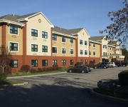
Extended Stay America Foxboro Norton
Quality Inn Raynham
Videos from this area
These are videos related to the place based on their proximity to this place.
Cleaning Services Easton MA - 978.712.8611 - The Maids
Looking for Cleaning Services in Easton MA? With our 22-Step Healthy Touch Deep Cleaning System, we provide you and your family with the healthiest living environment possible! Want A Free...
5 Emerson Drive, Easton, MA
Contemporary colonial on private, professionally landscaped lot. This home was built to entertain yet affords plenty of privacy. Set back from the road and surrounded by conservation land,...
Bay Circuit Trail Easton MA: Hockomock Swamp Wildlife Management Area Part 1.
The Hockomock is one of the few potential wilderness areas in eastern Massachusetts with an array of legends. The Bay Circuit Trail rides a power line access road along its northern edge....
Bay Circuit Trail Easton MA: Wheaton Farm Part 2.
This covers the forested core. http://www.easton.ma.us/Directory/concomm/Conservation%20Management%20Areas%20Brochure.pdf http://www.baycircuit.org/Map11.pdf ...
Bay Circuit Trail Easton MA: Wheaton Farm Part 1.
The forest, meadow and wetland weave of Wheaton Farm makes the bridge to the Hockomock Swamp.
Rim Repair Wheel Repair Easton MA (617) 396-3300
http://wheelfixgurus.com/massachusetts-md Call (617) 396-3300 For Service Click on our link and find the best wheel repair and rim repair in Easton MA. We have years of experience and specialty...
Norton Rail Trail June 2014 virtual cycling bike training
No audio. http://nortonrailtrail.weebly.com/ From the website linked above: "The Norton Rail-Trail is a proposed extension of the World War II Memorial Trail in Mansfield, MA through the...
Norton vs Dover-Sherborn Boys soccer game played on 11/3/14 at Wheaton College
Highlights of the Norton vs Dover-Sherborn boys soccer game played on 11/3/14 at Wheaton College in Norton Center. Norton won on double OT 1-0.
Videos provided by Youtube are under the copyright of their owners.
Attractions and noteworthy things
Distances are based on the centre of the city/town and sightseeing location. This list contains brief abstracts about monuments, holiday activities, national parcs, museums, organisations and more from the area as well as interesting facts about the region itself. Where available, you'll find the corresponding homepage. Otherwise the related wikipedia article.
Watson Pond
Watson Pond is a small freshwater lake within Watson Pond State Park, in Taunton, Massachusetts, USA. The lake is connected to Lake Sabbatia and much of its coastline is forested. There are several residential homes located on the lake's coastline. The lake is open to the public for swimming and ice fishing. Since 1991 the Watson Pond has been listed as part of the Canoe River Aquifer Area of Critical Environmental Concern by the Commonwealth of Massachusetts.
Winnecunnet Pond
See also Winnacunnet (disambiguation). Winnecunnet Pond 240px Location Norton, Massachusetts, USA Coordinates coord}}{{#coordinates:41|58|15|N|71|07|55|W|type:waterbody_region:US_source:gnis primary name= }} Primary inflows Canoe River, Mulberry Brook Primary outflows Snake River (Mill River) Basin countries United States Surface area 148 acres Average depth 6 ft Max.
King Phillip's Cave (Massachusetts)
King Phillip's Cave is a cave in Norton, Massachusetts near Lake Winnecunnett. It may be accessed from Stone Run Drive off Plain Street near Bay Road and sits on a 7-acre parcel of land owned by the Land Preservation Society, an independent non-profit conservation organization chartered in 1970 by the State of Massachusetts.
North Taunton, Massachusetts
North Taunton is an unofficial neighborhood in the city of Taunton, Massachusetts. It is not a census-designated area, but is considered by local residents as a municipally designated populated region of the city.
Paul A. Dever State School
The Paul A. Dever State School, also known as the Myles Standish School for the Mentally Retarded is a former state school located in Taunton, Massachusetts, at the former site of Camp Myles Standish. It was turned into a school for the mentally disabled in 1959. At this time, the name was changed to the Paul A. Dever State School, after the Governor of the Commonwealth of Massachusetts from 1949–1953, Paul A. Dever.


