Safety Score: 2,7 of 5.0 based on data from 9 authorites. Meaning we advice caution when travelling to United States.
Travel warnings are updated daily. Source: Travel Warning United States. Last Update: 2024-05-15 08:00:47
Delve into Algers Corner
Algers Corner in Bristol County (Massachusetts) is located in United States about 380 mi (or 612 km) north-east of Washington DC, the country's capital town.
Current time in Algers Corner is now 03:44 AM (Thursday). The local timezone is named America / New York with an UTC offset of -4 hours. We know of 10 airports close to Algers Corner, of which 4 are larger airports. The closest airport in United States is New Bedford Regional Airport in a distance of 24 mi (or 38 km), South. Besides the airports, there are other travel options available (check left side).
Also, if you like playing golf, there are some options within driving distance. We encountered 2 points of interest near this location. If you need a hotel, we compiled a list of available hotels close to the map centre further down the page.
While being here, you might want to pay a visit to some of the following locations: Taunton, Dedham, Boston, Providence and North Providence. To further explore this place, just scroll down and browse the available info.
Local weather forecast
Todays Local Weather Conditions & Forecast: 13°C / 55 °F
| Morning Temperature | 13°C / 55 °F |
| Evening Temperature | 14°C / 57 °F |
| Night Temperature | 10°C / 51 °F |
| Chance of rainfall | 16% |
| Air Humidity | 93% |
| Air Pressure | 1011 hPa |
| Wind Speed | Moderate breeze with 9 km/h (6 mph) from South-West |
| Cloud Conditions | Overcast clouds, covering 100% of sky |
| General Conditions | Moderate rain |
Thursday, 16th of May 2024
20°C (67 °F)
10°C (49 °F)
Scattered clouds, gentle breeze.
Friday, 17th of May 2024
19°C (66 °F)
9°C (49 °F)
Overcast clouds, gentle breeze.
Saturday, 18th of May 2024
14°C (58 °F)
10°C (50 °F)
Overcast clouds, gentle breeze.
Hotels and Places to Stay
Holiday Inn Express BROCKTON - BOSTON
Residence Inn Boston Brockton
Residence Inn Boston Bridgewater
MA Brockton Country Inn and Suites by Radisson
Best Western Carlton House
Holiday Inn TAUNTON-FOXBORO AREA
MA Motel 6 Brockton
Rodeway Inn Brockton
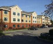
Extended Stay America Foxboro Norton
SUPER 8 MOTEL - BROCKTON
Videos from this area
These are videos related to the place based on their proximity to this place.
Bay Circuit Trail Easton MA: Hockomock Swamp Wildlife Management Area Part 1.
The Hockomock is one of the few potential wilderness areas in eastern Massachusetts with an array of legends. The Bay Circuit Trail rides a power line access road along its northern edge....
Easton Indoor Farmers Market 2013
Every Saturday from 10-2 pm. Located at the Simpson Springs Bottling Company at 719 Washington Street, South Easton, MA. Near Brockton, Stoughton, Sharon, Mansfield, Norton, Taunton, West ...
Easton Indoor Farmers Market - 1st Day
http://velmas.org - We check out the Easton Indoor Farmers Market at the Simpson Spring Company in Easton, MA. 719 Washington Street (Route 138) South Easton. Saturdays 10-2 pm.
2014-05-15 Driving down Rote 24 to Rte 138 South in Raynham
On my way to taunton high School for the softball game driving down Route 24 to Route 106 then down Route 138.
2014-06-24 In transit from West Brockton To Taunton (1/2)
Yours truly here headed down to the Sandbar Grille in Taunton Center down Pearl Street which turns into Turnpike Street towards route 138 in West Brockton/Easton and Raynham.
Hill climbing on Quads
George on 400ex in West Bridgewater, Mass. 12/28/08 doing a hill climb! While johnboy learns to do the Boston crab nice save!!
Snow storm East Bridgewater,Ma. 12/31/08
Update 11:30am snowing strong still the snow stopped at 8pm that evening we got a lot of snow!
2014-06-24 Driving home from the Sandbar Grille in Taunton
Yours truly returning home after spending the evening at the Taunton Sandbar Grille on 64 Weir St, Taunton Center. This segment was taken while cruising on Route 24 northbound.
20140928151548 Driving from jamies in Whitman to Ruby Tuesday in Taunton
Driving from Jamies in Whitman to hang out at Ruby Tuesday in Taunton.
2014-05-04 144809 Driving from Jamie's to North Taunton
Going from Jamies restaurant in Whitman after my weekly brunch to Ruby Tuesday in Taunton.
Videos provided by Youtube are under the copyright of their owners.
Attractions and noteworthy things
Distances are based on the centre of the city/town and sightseeing location. This list contains brief abstracts about monuments, holiday activities, national parcs, museums, organisations and more from the area as well as interesting facts about the region itself. Where available, you'll find the corresponding homepage. Otherwise the related wikipedia article.
Hockomock Swamp
The Hockomock Swamp is a vast wetland encompassing much of the northern part of southeastern Massachusetts. This 6,000-acre land is considered the second largest wetland in the state. It acts as a natural flood control mechanism for the region.
WWDP
WWDP is a television station in the United States, serving the Boston, Massachusetts market. The station broadcasts on digital VHF channel 10. It is licensed to Norwell, Massachusetts, airs home shopping programs from ShopNBC, and is owned by ValueVision Media.
Lake Nippenicket
Lake Nippenicket, known locally as The Nip, is a freshwater lake in the town of Bridgewater, Massachusetts, and immediately adjacent to Raynham, Massachusetts. The lake borders a tiny portion of Route 104, and is near the junction of I-495 and Route 24. Lake Nippenicket is part of the Taunton River Watershed, emptying into the Town River and into the Taunton River, and a good-size portion of it is included with the Hockomock Swamp Wildlife Management Area.
WXBR
WXBR is a radio station that broadcasts a brokered news and talk format from studios in Brockton, Massachusetts to Greater Boston, Southeastern Massachusetts, South Shore and Providence County, Rhode Island. Its transmitter is located in West Bridgewater, Massachusetts. The station is licensed to Azure Media based in Miami Gardens, Florida.
Raynham Park (MBTA station)
Raynham Park is a future railroad station on the MBTA Commuter Rail's Providence/Stoughton Line located in Raynham, Massachusetts. It is being built as part of the state's effort to extend rail service to Fall River and New Bedford.


