Safety Score: 2,7 of 5.0 based on data from 9 authorites. Meaning we advice caution when travelling to United States.
Travel warnings are updated daily. Source: Travel Warning United States. Last Update: 2024-05-16 08:19:50
Delve into Tahanto Beach
Tahanto Beach in Barnstable County (Massachusetts) is a city located in United States about 390 mi (or 627 km) north-east of Washington DC, the country's capital town.
Current time in Tahanto Beach is now 08:51 AM (Thursday). The local timezone is named America / New York with an UTC offset of -4 hours. We know of 11 airports closer to Tahanto Beach, of which 4 are larger airports. The closest airport in United States is New Bedford Regional Airport in a distance of 17 mi (or 28 km), West. Besides the airports, there are other travel options available (check left side).
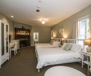
Also, if you like playing golf, there are some options within driving distance. We saw 1 points of interest near this location. In need of a room? We compiled a list of available hotels close to the map centre further down the page.
Since you are here already, you might want to pay a visit to some of the following locations: Barnstable, Edgartown, Taunton, Nantucket and Dedham. To further explore this place, just scroll down and browse the available info.
Local weather forecast
Todays Local Weather Conditions & Forecast: 13°C / 55 °F
| Morning Temperature | 13°C / 55 °F |
| Evening Temperature | 12°C / 54 °F |
| Night Temperature | 12°C / 53 °F |
| Chance of rainfall | 6% |
| Air Humidity | 86% |
| Air Pressure | 1010 hPa |
| Wind Speed | Moderate breeze with 12 km/h (7 mph) from South-West |
| Cloud Conditions | Overcast clouds, covering 100% of sky |
| General Conditions | Moderate rain |
Thursday, 16th of May 2024
19°C (66 °F)
11°C (52 °F)
Sky is clear, gentle breeze, clear sky.
Friday, 17th of May 2024
17°C (63 °F)
10°C (50 °F)
Overcast clouds, gentle breeze.
Saturday, 18th of May 2024
14°C (57 °F)
11°C (52 °F)
Overcast clouds, gentle breeze.
Hotels and Places to Stay
Wood Duck Inn
Sea Crest Beach Hotel
Alexander Hamilton House Cape Cod
Inn on Onset Bay
Atlantic Motel
All Seasons Inn and Suites
Quality Inn Bourne
Rosewood Motel
Videos from this area
These are videos related to the place based on their proximity to this place.
Sell your Damaged and Used Car in Monument Beach, MA
We buy Junk, Unwanted, Damaged, Old, Wrecked, Burned Cars, Trucks, Vans, Suvs and surrounding area! We Pay the MOST Cash For Junk Cars. Call us @ 1-(800)-289...
Going Past Massachusetts Maritime Academy
Going past Mass Maritime on our Cape Cod Circumnavigation trip.
In My Footsteps: Cape Cod - Mashnee Island
The 12th video in the In My Footsteps: Cape Cod series features an island that's not an island but used to be an island. Located on the west coast of Cape Cod, Mashnee Island is a little out...
Mass. Maritime Windmill
On a breezy February day, I decided to see how loud one of these things really is. So I pulled up just below the Massachusetts Maritime Academy wind turbine and took this.
Helicopter on the Parade Field & Flying Around Mass Maritime
A helicopter for the FAA was at Mass Maritime today, doing surveying for a new experimental low-power RADAR system to automatically operate the aviation warning lights on top of the wind turbine.
Cape Cod Canal west end waves
53 foot sailboat exiting Cape Cod Canal with 4+ knots of current flowing against 20+ knots of wind blowing up Buzzards Bay.
NPBA and the Seaport Inn & Marina Annual Poker Run
The NPBA and the Seaport Inn & Marina announce the 2nd annual Buzzard's Bay Poker Run on September 4, 2010 in Fairhaven, MA. Contact Billy Frenz at (203) 532-1312 .or.
Videos provided by Youtube are under the copyright of their owners.
Attractions and noteworthy things
Distances are based on the centre of the city/town and sightseeing location. This list contains brief abstracts about monuments, holiday activities, national parcs, museums, organisations and more from the area as well as interesting facts about the region itself. Where available, you'll find the corresponding homepage. Otherwise the related wikipedia article.
Monument Beach, Massachusetts
Monument Beach is a census-designated place (CDP) in the town of Bourne in Barnstable County, Massachusetts, United States. The population was 2,438 at the 2000 census.
Pocasset, Massachusetts
Pocasset is a census-designated place (CDP) in the town of Bourne in Barnstable County, Massachusetts, United States, located on Buzzards Bay. The population was 2,671 at the 2000 census.
Bassetts Island
Bassetts Island is a propeller-shaped island within Pocasset Harbor and Red Brook Harbor, in Bourne, Massachusetts, USA. The island is geographically separated into four portions, the central, northeast, southeast, and the western. The island is inhabited (perhaps only seasonally); there is one house on the western portion and five houses on the northeast portion. Also, there is a minor path that runs throughout the island, except for most of its southern portion.
Monument Beach (Bourne, Massachusetts)
Monument Beach, Massachusetts, overlooks the Cape Cod Canal and Monument Beach Marina. This beach is very popular with windsurfers. It also features a wooden raft for swimmers to rest and sunbathe on. Lifeguards are present, and there is also a snack bar, volleyball net and bathhouse on the premises.
Wings Neck
Wings Neck is a peninsula that juts out into Buzzards Bay on the south side of the Cape Cod Canal, in Bourne, Massachusetts, USA. The southwestern tip of the neck is home to the Wings Neck Lighthouse, which operated from 1889 to 1945 (now a private residence).
Monument Beach Train Station
The Monument Beach Train Station is located on the Shore Road in Monument Beach, Massachusetts.
Pocasset Train Station
The Pocasset Train Station was located on the Barlows Landing Road in Pocasset, Massachusetts.
Barnstable County Hospital
Barnstable County Hospital was a hospital operated by Barnstable County, Massachusetts which was operational from the late 1800s to 1995. It was located in Pocasset, a village in Bourne. It was used after its closing as a medical examiner's office until 1999, when it was finally closed for good. The hospital was the location of the autopsy of John F. Kennedy Jr. , his wife, and her sister after their deaths.


