Safety Score: 2,7 of 5.0 based on data from 9 authorites. Meaning we advice caution when travelling to United States.
Travel warnings are updated daily. Source: Travel Warning United States. Last Update: 2024-05-16 08:19:50
Delve into Hatchville
Hatchville in Barnstable County (Massachusetts) is located in United States about 390 mi (or 628 km) north-east of Washington DC, the country's capital town.
Current time in Hatchville is now 04:37 AM (Thursday). The local timezone is named America / New York with an UTC offset of -4 hours. We know of 11 airports close to Hatchville, of which 4 are larger airports. The closest airport in United States is Barnstable Municipal Boardman Polando Field in a distance of 15 mi (or 24 km), East. Besides the airports, there are other travel options available (check left side).
Also, if you like playing golf, there are some options within driving distance. We encountered 1 points of interest near this location. If you need a hotel, we compiled a list of available hotels close to the map centre further down the page.
While being here, you might want to pay a visit to some of the following locations: Edgartown, Barnstable, Nantucket, Taunton and Dedham. To further explore this place, just scroll down and browse the available info.
Local weather forecast
Todays Local Weather Conditions & Forecast: 13°C / 55 °F
| Morning Temperature | 13°C / 55 °F |
| Evening Temperature | 13°C / 55 °F |
| Night Temperature | 13°C / 55 °F |
| Chance of rainfall | 4% |
| Air Humidity | 86% |
| Air Pressure | 1010 hPa |
| Wind Speed | Fresh Breeze with 14 km/h (9 mph) from South-West |
| Cloud Conditions | Overcast clouds, covering 100% of sky |
| General Conditions | Light rain |
Thursday, 16th of May 2024
16°C (60 °F)
11°C (52 °F)
Sky is clear, moderate breeze, clear sky.
Friday, 17th of May 2024
15°C (59 °F)
10°C (50 °F)
Overcast clouds, gentle breeze.
Saturday, 18th of May 2024
12°C (54 °F)
11°C (51 °F)
Overcast clouds, gentle breeze.
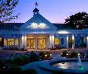
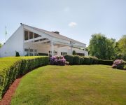
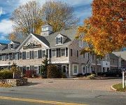
Hotels and Places to Stay
Alexander Hamilton House Cape Cod
Captain Tom Lawrence House Inn
Wood Duck Inn
South Cape Resort
Sea Crest Beach Hotel
Holiday Inn CAPE COD-FALMOUTH
The Coonamessett Inn
INN ON THE SQUARE
The Palmer House Inn
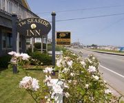
The Seaside Inn
Videos from this area
These are videos related to the place based on their proximity to this place.
Mashpee Cape Cod ranch with golf course view
Striking open floor plan 3 BR ranch with cathedral ceilings, A/C, wood floors & 2 car garage on Quashnet Valley golf course.
Carlo Wiseman, Trio for 2 Flutes and Cello, I Allegro
Trio for 2 Flutes and Cello, by Carlo Wiseman, I, Allegro, Recorded on January 22, 2011, Mashpee Senior Center, Mashpee, MA.
Carlo Wiseman, Trio for 2 Flutes and Cello, III Allegro
Em & M's Trio, Trio for 2 Flutes and Cello, by Carlo Wiseman, III, Allegro. Recorded on January 22, 2011, Mashpee Senior Center, Mashpee, MA.
East Falmouth Vacation Rental
4 bedrooms,2 full bathrooms,sleep 8 Secluded modern home on lake, private beach for swimming and boating, water on 3 sides, gourmet kitchen, grand piano, sun room, flag-stone terrace, lawn...
POND FRONT WITH SANDY BEACH
For more details click here: http://www.visualtour.com/showvt.asp?t=2969989 17 Veronica Lane East Falmouth, MA 02536 $485000, 3 bed, 3.0 bath, 1348 SF, MLS# 21300090 Looking for POND ...
Dibuja depoca a Mikaku City Actors THE GIRL VIRTUAL AZUL XDB
Dibuja depoca a Mikaku City Actors THE GIRL VIRTUAL AZUL XDB.
Dibuja depoca a Mikaku City Actors THE BOY XDB
TODO LOS ANIMES DEL 2014 AQUI DESCARGALOS EN FULL HD ilymotion.com/user/TomoyoCardCaptor/1 ilymotion.com/user/TomoyoCardCaptor/1.
Dibuja depoca a Mikaku City Actors THE GIRL BLACK XDB
TODO LOS ANIMES DEL 2014 AQUI DESCARGALOS EN FULL HD ilymotion.com/user/TomoyoCardCaptor/1 ilymotion.com/user/TomoyoCardCaptor/1.
Videos provided by Youtube are under the copyright of their owners.
Attractions and noteworthy things
Distances are based on the centre of the city/town and sightseeing location. This list contains brief abstracts about monuments, holiday activities, national parcs, museums, organisations and more from the area as well as interesting facts about the region itself. Where available, you'll find the corresponding homepage. Otherwise the related wikipedia article.
Otis Air National Guard Base
Otis Air National Guard Base is an Air National Guard installation located within the Massachusetts Military Reservation (MMR), a military training facility, located on the western portion of Cape Cod, in western Barnstable County, Massachusetts, United States. It was previously known as Otis Air Force Base prior to its transfer from the active duty Air Force to the Air National Guard. In the community, it is also known as Otis Air Base or more commonly by its old name, Otis Air Force Base.
Falmouth High School (Massachusetts)
Falmouth High School (FHS) is a public high school located in the town of Falmouth, Massachusetts. The school serves roughly 1,000 students in grades 9-12. Over the past few years, Falmouth High School has gone through major renovations. Up until 1973, the school was named Lawrence High School and located at what is now Lawrence Junior High School. Falmouth High School is located at 874 Gifford Street Ext. The school's mascot is the Clippers and the school colors are Maroon & White.
Cape Cod Air Show & Open House
The Cape Cod Airshow & Open House was an airshow held in August of every odd numbered year at Otis Air National Guard Base in Falmouth, Massachusetts. It most recently was run in 2007 after a six year hiatus. The show in 2003 was canceled because of Operation Iraqi Freedom and the show in 2005 was canceled for unknown reasons.
Otis Air Force Base Hospital
Otis Air Force Base Hospital was a former hospital at Otis Air Force Base. With the closure of the base in 1973, the hospital closed. It was the site of the birth of Patrick Bouvier Kennedy. The hospital consisted of a series of connected one-story buildings. The buildings were torn down in the early 1970s.
Camp Edwards Train Station
The Camp Edwards Train Station was located on the Weaver Street in Camp Edwards. The station was torn down after the Korean War because of the disuse of Camp Edwards, a disuse which may very well have led to its virtual shut down in the early 1970s.
Barnstable County Fairgrounds
The Barnstable County Fairgrounds is a facility located in Falmouth, Massachusetts. It is home to the annual Barnstable County Fair as well as numerous trade shows and community events, such as the Naukabout Music Festival.
Camp Edwards Heliport
Camp Edwards Heliport is a private use heliport located at Camp Edwards, a U.S. Army facility in Barnstable County, Massachusetts, United States. The airport is located three nautical miles north of the central business district of Bourne, Massachusetts. It is owned by the Massachusetts Army National Guard.
Upper Cape Regional Transfer Station
The Upper Cape Regional Transfer Station (UCRTS) is a municipal waste transfer facility located at Massachusetts Military Reservation on Cape Cod. The facility is within the town limits of Falmouth, but on state-owned land at the southern end of the military reservation, and is about a mile west of the Falmouth entrance gate. It is one of two truck-to-rail trash transfer facilities on Cape Cod, with the other in Yarmouth.


