Safety Score: 2,7 of 5.0 based on data from 9 authorites. Meaning we advice caution when travelling to United States.
Travel warnings are updated daily. Source: Travel Warning United States. Last Update: 2024-05-02 08:23:34
Delve into Limaburg
Limaburg in Boone County (Kentucky) is a city located in United States about 411 mi (or 661 km) west of Washington DC, the country's capital town.
Current time in Limaburg is now 03:32 AM (Friday). The local timezone is named America / New York with an UTC offset of -4 hours. We know of 8 airports closer to Limaburg, of which 5 are larger airports. The closest airport in United States is Cincinnati Northern Kentucky International Airport in a distance of 2 mi (or 4 km), North-East. Besides the airports, there are other travel options available (check left side).
Also, if you like playing golf, there are some options within driving distance. We saw 9 points of interest near this location. In need of a room? We compiled a list of available hotels close to the map centre further down the page.
Since you are here already, you might want to pay a visit to some of the following locations: Burlington, Lawrenceburg, Rising Sun, Cincinnati and Newport. To further explore this place, just scroll down and browse the available info.
Local weather forecast
Todays Local Weather Conditions & Forecast: 18°C / 64 °F
| Morning Temperature | 17°C / 63 °F |
| Evening Temperature | 18°C / 65 °F |
| Night Temperature | 16°C / 61 °F |
| Chance of rainfall | 7% |
| Air Humidity | 98% |
| Air Pressure | 1013 hPa |
| Wind Speed | Light breeze with 5 km/h (3 mph) from South-East |
| Cloud Conditions | Overcast clouds, covering 100% of sky |
| General Conditions | Moderate rain |
Friday, 3rd of May 2024
19°C (67 °F)
17°C (62 °F)
Light rain, light breeze, overcast clouds.
Saturday, 4th of May 2024
21°C (70 °F)
17°C (63 °F)
Light rain, gentle breeze, overcast clouds.
Sunday, 5th of May 2024
19°C (66 °F)
17°C (62 °F)
Moderate rain, light breeze, overcast clouds.
Hotels and Places to Stay
DoubleTree by Hilton Cincinnati Airport
Hilton Cincinnati Airport
Homewood Suites by Hilton Cincinnati Airport South-Florence
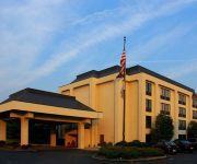
Hampton Inn Cincinnati-Airport South
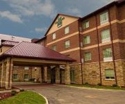
Holiday Inn FLORENCE
Ashley Quarters Hotel
Courtyard Cincinnati Airport South/Florence
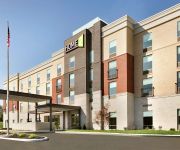
Home2 Suites By Hilton Florence Cincinnati Airport South
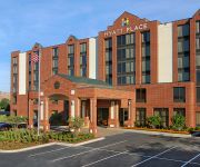
Hyatt Place Cincinnati Airport Florence
La Quinta Inn and Suites Cincinnati Airport Florence
Videos from this area
These are videos related to the place based on their proximity to this place.
Burlington, KY Sullivan Memorial Pull Friday 2012 Bad Attitude Two Wheel Drive
Bad Attitude super modified two wheel drive truck at the 2012 Sullivan Memorial Pull on Friday night.
Burlington Historic Home
For more details click here: http://www.visualtour.com/showvt.asp?t=2837848 6199 East Bend Rd. Burlington, KY 41005 $499900, 4 bed, 2.0 bath, 5000 SF, MLS# 409948 1838 Built Two-Story home...
Burlington, KY Sullivan Memorial Pull Saturday 2012 Bad Attitude Two Wheel Drive
Bad Attitude super modified two wheel drive truck at the 2012 Sullivan Memorial Pull on Saturday night.
Family farm -Sept 2008
Burlington Kentucky. Aggressive forward flight. Align t-rex 450 SEV2 stock ESC and motor, 335mm wood blades, Thunder Power 2200mah 3S, Spektrum AR6200 RX, KT&C camera model ...
Kiger Murder Trial: Re-enactment, part 5 of 5
The Boone County Historical Society reenact the Kiger murder trial. The reenactment took place at the Boone County Courthouse in Burlington, KY in July 2005. Part of the Boone County Historical...
7370 Ridge Edge Ct, Florence, KY 41042
7370 Ridge Edge Ct Florence, KY Jane Ashcraft-West RE/MAX Affiliates http://www.realestatebook.com/homes/listing/101-3002510856/refer=FP42A Maintenance-free lifestyle allowing more time for...
Chinese Lion Dance in MidValley's FoodJunction (Opening Ceremony)
This is just part of the opening ceremony I took from FoodJunction's opening.
Mary Ingles Re-enactment, part 2 of 2
Mary Ingles was portrayed by Joyce Baer. The program was presented at Main Branch of the Boone County Public Library on Oct. 22, 2008. Part of the Boone County Historical Society Lecture Series.
Creation of Big Bone Park, part 1 of 4
Bruce Ferguson and Asa Rouse present the history of the creation of Big Bone Lick State Park in Boone County, Kentucky. Part of the Boone County Historical Society Lecture Series.
Mary Ingles Re-enactment, part 1 of 2
Mary Ingles was portrayed by Joyce Baer. The program was presented at the Main Branch of the Boone County Public Library on Oct. 22, 2008. Part of the Boone County Historical Society Lecture ...
Videos provided by Youtube are under the copyright of their owners.
Attractions and noteworthy things
Distances are based on the centre of the city/town and sightseeing location. This list contains brief abstracts about monuments, holiday activities, national parcs, museums, organisations and more from the area as well as interesting facts about the region itself. Where available, you'll find the corresponding homepage. Otherwise the related wikipedia article.
Oakbrook, Kentucky
Oakbrook is a census-designated place (CDP) in Boone County, Kentucky, United States. The population was 7,726 at the 2000 census.
Cincinnati/Northern Kentucky International Airport
Cincinnati/Northern Kentucky International Airport, sometimes called the Greater Cincinnati Airport, is a Class B international airport located in Hebron, Kentucky, United States and serves the Greater Cincinnati metropolitan area. Despite being located in Boone County, the airport operations are governed by the neighboring Kenton County Airport Board. The airport's code, CVG, comes from the nearest major city at the time of its opening, Covington, Kentucky.
Air Canada Flight 797
Air Canada Flight 797 was a scheduled trans-border flight that flew on a Dallas/Fort Worth-Toronto-Montreal route. On 2 June 1983, the aircraft developed an in-flight fire behind the washroom that spread between the outer skin and the inner decor panels, filling the plane with toxic smoke. The spreading fire also burned through crucial electrical cables that knocked out most of the instrumentation in the cockpit, forcing the plane to divert to an alternative landing field.
Air Tahoma Flight 185
Air Tahoma Flight 185 was a scheduled cargo flight from Memphis to the Cincinnati/Northern Kentucky International Airport conducted by Air Tahoma as part of a contract to freight parcels for courier firm DHL. On August 13, 2004, the flight crashed during approach to landing just one mile short of the runway. The Convair 580, which is a twin engine turboprop, was destroyed upon impact. The first officer, Ray Gelwicks, 36, was killed and the captain received minor injuries.
TWA Flight 159
Trans World Airlines (TWA) Flight 159 was a regularly scheduled passenger flight from New York to Los Angeles, California with a stopover in Cincinnati/Northern Kentucky International Airport, Kentucky that crashed after an aborted takeoff from Cincinnati on 6 November 1967. The Boeing 707 attempted to abort takeoff when the copilot became concerned that the aircraft had collided with a disabled DC-9 on the runway. The aircraft overran the runway, struck an embankment, and caught fire.
Conner High School
Conner High School is a 9-12 grade public school located in Hebron, Kentucky. Conner is part of a larger campus that includes Conner Middle School and Goodridge Elementary. The Boone County Area Technology Center (formerly Boone County Vocational School) also sits on the same campus. Under matinence(school, not webpage) Conner is accredited by the Commission of Secondary Schools of the Southern Association of Colleges and Schools and by the State of Kentucky.
Florence Y'all Water Tower
The Florence Y'all Water Tower is an approximately 1 million US gallons water tower owned by the city of Florence, Kentucky that stands between the Florence Mall and interstate highways 75 and 71. where it is seen by millions of interstate motorists annually. Originally painted with the words "FLORENCE MALL" in giant letters, legal questions were raised, and a change was mandated. The solution was to change the "M" to a "Y" followed by an apostrophe.
Florence Mall
Florence Mall is an enclosed shopping mall in Florence, Kentucky, USA. The mall, opened in 1976, comprises more than 100 stores, including four anchor stores as well as a food court. The mall is managed by General Growth Properties of Chicago, Illinois, and is noted for an adjacent water tower which is painted with the phrase "Florence Y'all", which originally said "Florence Mall" (see section below).


