Safety Score: 2,7 of 5.0 based on data from 9 authorites. Meaning we advice caution when travelling to United States.
Travel warnings are updated daily. Source: Travel Warning United States. Last Update: 2024-07-26 08:00:33
Delve into Foster Village
Foster Village in Honolulu County (Hawaii) is located in United States about 4,830 mi (or 7,773 km) west of Washington DC, the country's capital town.
Current time in Foster Village is now 03:51 PM (Friday). The local timezone is named Pacific / Honolulu with an UTC offset of -10 hours. We know of 8 airports close to Foster Village, of which one is a larger airport. The closest airport in United States is Honolulu International Airport in a distance of 3 mi (or 5 km), South. Besides the airports, there are other travel options available (check left side).
Also, if you like playing golf, there are some options within driving distance. We encountered 2 points of interest near this location. If you need a hotel, we compiled a list of available hotels close to the map centre further down the page.
While being here, you might want to pay a visit to some of the following locations: Honolulu, Waimanalo, Wailuku, Lihue and Hilo. To further explore this place, just scroll down and browse the available info.
Local weather forecast
Todays Local Weather Conditions & Forecast: 26°C / 79 °F
| Morning Temperature | 23°C / 74 °F |
| Evening Temperature | 25°C / 77 °F |
| Night Temperature | 24°C / 75 °F |
| Chance of rainfall | 0% |
| Air Humidity | 65% |
| Air Pressure | 1017 hPa |
| Wind Speed | Fresh Breeze with 15 km/h (9 mph) from West |
| Cloud Conditions | Broken clouds, covering 70% of sky |
| General Conditions | Light rain |
Saturday, 27th of July 2024
26°C (80 °F)
24°C (75 °F)
Light rain, fresh breeze, scattered clouds.
Sunday, 28th of July 2024
26°C (79 °F)
24°C (75 °F)
Light rain, moderate breeze, overcast clouds.
Monday, 29th of July 2024
26°C (79 °F)
24°C (75 °F)
Light rain, moderate breeze, overcast clouds.
Hotels and Places to Stay
PRINCE WAIKIKI
ALA MOANA HOTEL
PRIORITY SUITES OF HAWAII
Airport Honolulu Hotel
Pacific Marina Inn Airport Hotel
Reach Beyond Rainforest Homestay
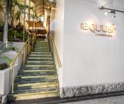
an Ascend Hotel Collection Member The Equus
Marina Tower Waikiki
BEST WESTERN THE PLAZA HOTEL
Aston at the Executive Centre
Videos from this area
These are videos related to the place based on their proximity to this place.
NIGHT ON FIRE | Aiea HS Wind Ensemble | 2015 South POB
SUBSCRIBE to our videos: http://www.youtube.com/subscription_center?add_user=band1 Recorded at the 39th Annual Central District Band Festival South Parade of Bands on February 27, 2015.
CARDINAL OVERTURE | Aiea Intermediate School Band | 2015 South POB
SUBSCRIBE to our videos: http://www.youtube.com/subscription_center?add_user=band1 Recorded at the 39th Annual Central District Band Festival South Parade of Bands on February 27, 2015.
2012 Aiea High School Stadium Graduation -- Video 01 - Calling Out Tony's Name
Info for Seniors - Updated 4/26/12 *Aiea High School Class of 2012 Graduation Commencement Ceremony When: Friday May 25, 2012 Where: Aloha Stadium Time: 6pm - 8pm The following items are.
Rick - SCCA Hawaii Region - August 16, 2009
Angry Eyes!! After two spins in a row, then a super slow run just to make sure I got a clean time, overdrove again and hammered the throttle in frustration! LOL Enjoy me having a bad day...
Pearl City Charger Marching Band 2003 part 2
The Pearl City High School Charger Marching Band performing at the Rainbow Invitational Marching Festival November 10, 2003 at Aloha Stadium. Program: 1. Gladiator Finale 2. Temptation...
Halawa Summer Fun 2013 Harlem Shake
what happens when staff and kids have too much time on their hands...lol.
SCCA Hawaii Region AutoX Race 1, Run 2 - SSM Class - Julian Price - 07152012
yeee - the camera is clear!!
UFO HAWAII FOSTER VILLAGE
WHAT IS IT THAT I FILMED. I AM MOST CERTIAN THEY HAVE NOT BEEN HERE FOR A LONG TIME.
Driving from 99 Halawa Valley Street, ... to John A. Burns Freeway, Ka...
Experience the drive live @ http://scenicblues.com Route along :- John A. Burns Freeway, Aiea, HI 96701, USA.
Videos provided by Youtube are under the copyright of their owners.
Attractions and noteworthy things
Distances are based on the centre of the city/town and sightseeing location. This list contains brief abstracts about monuments, holiday activities, national parcs, museums, organisations and more from the area as well as interesting facts about the region itself. Where available, you'll find the corresponding homepage. Otherwise the related wikipedia article.
Aiea, Hawaii
Aiea is a census-designated place (CDP) located in the City and County of Honolulu, Hawaii, United States. As of the 2010 Census, the CDP had a total population of 9,338.
Halawa, Hawaii
Halawa may also refer to the food halva, or a famous valley and stream system on the island of Molokai. Halawa is a census-designated place (CDP) in the ‘Ewa District of Honolulu County, Hawaii, United States. Halawa Stream branches into two valleys: North and South Halawa; North Halawa is the larger stream and fluvial feature. Their confluence is within the H-3/H-201 highways exchange. Most of Halawa Valley is undeveloped. As of the 2010 Census, the CDP had a population of 14,014.
Aloha Stadium
Aloha Stadium also known as Hawaiian Airlines Field at Aloha Stadium is a stadium located in Halawa, Hawaii, located just outside Honolulu. Aloha Stadium is currently home to the University of Hawaiʻi Warriors football team. It hosts the NCAA's Hawai'i Bowl, and has also been home to the National Football League's Pro Bowl since 1980 (except in 2010) and the NCAA's Hula Bowl from 1975 to 1997 and again in 2006.
Salt Lake, Hawaii
Salt Lake is a suburban neighborhood of Honolulu, Hawaii on the island of O‘ahu. The area is also known as Āliamanu after a nearby crater, although Salt Lake itself is in a crater called Ālia pa‘akai — meaning "salt pond" in the Hawaiian language. The Salt Lake community was developed in the 1960s during a construction boom, providing residents with an expansive view of downtown Honolulu and the sugarcane plantations of the central plain of O‘ahu.
Admiral Clarey Bridge
Admiral Clarey Bridge, also known as the Ford Island Bridge, is a floating concrete drawbridge providing access to Ford Island, a United States Navy installation situated in the middle of Pearl Harbor. The causeway bridge was completed in 1998, opening on April 15th of that year, and is named the Admiral Clarey Bridge after former Admiral Bernard A. Clarey. The bridge has a total length of 4,700 ft, including a 930 ft pontoon section that can be retracted to allow water traffic to pass through.
Admiral Arthur W. Radford High School
Admiral Arthur W. Radford High School, known as Radford High School, is a public high school in the City and County of Honolulu, Hawaii, adjacent to the Halawa CDP.
Pearl Harbor Elementary School
Pearl Harbor Elementary School is a public, coeducational grade school of the Hawai'i State Department of Education that serves around 637 students in grades K-6. The ethnicity is 56% Asian and 25% White. It is located on Moanalua Ridge, Honolulu, Hawaii, USA. Pearl Harbor is within the Radford Complex in the Central Oahu District of Hawaii State Department of Education.
Aloha Jewish Chapel
Aloha Jewish Chapel was built in 1975 on the grounds of Joint Base Pearl Harbor-Hickam in Honolulu, Hawaii. It was designed by Vladimir Ossipoff as the first free-standing Jewish chapel built by the United States government exclusively for Jewish worship. (The Commodore Levy Chapel, Naval Station Norfolk, is the Navy's oldest Jewish Chapel, but it is part of a larger Chapel complex. ) The congregation raised money for and purchased a new Torah scroll, which was dedicated on October 26, 2008.


