Safety Score: 2,7 of 5.0 based on data from 9 authorites. Meaning we advice caution when travelling to United States.
Travel warnings are updated daily. Source: Travel Warning United States. Last Update: 2024-05-11 07:34:58
Touring Ramona Park
The district Ramona Park of Monterey Park in Los Angeles County (California) is a subburb located in United States about 2,287 mi west of Washington DC, the country's capital place.
Need some hints on where to stay? We compiled a list of available hotels close to the map centre further down the page.
Being here already, you might want to pay a visit to some of the following locations: Los Angeles, Orange, Santa Ana, Riverside and San Bernardino. To further explore this place, just scroll down and browse the available info.
Local weather forecast
Todays Local Weather Conditions & Forecast: 26°C / 79 °F
| Morning Temperature | 17°C / 62 °F |
| Evening Temperature | 25°C / 77 °F |
| Night Temperature | 20°C / 68 °F |
| Chance of rainfall | 0% |
| Air Humidity | 35% |
| Air Pressure | 1012 hPa |
| Wind Speed | Gentle Breeze with 7 km/h (5 mph) from North-East |
| Cloud Conditions | Clear sky, covering 0% of sky |
| General Conditions | Sky is clear |
Monday, 13th of May 2024
25°C (78 °F)
18°C (65 °F)
Sky is clear, gentle breeze, clear sky.
Tuesday, 14th of May 2024
22°C (72 °F)
16°C (62 °F)
Sky is clear, gentle breeze, clear sky.
Wednesday, 15th of May 2024
20°C (68 °F)
16°C (61 °F)
Broken clouds, gentle breeze.
Hotels and Places to Stay
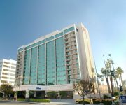
Hilton Pasadena
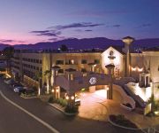
Arroyo Vista Inn
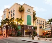
DoubleTree by Hilton Los Angeles - Rosemead
Hilton Los Angeles-San Gabriel
Pasadena The Langham
Fairfield Inn & Suites Los Angeles Rosemead
Holiday Inn EL MONTE - LOS ANGELES
Hilton Garden Inn Los Angeles Montebello
Titta Inn
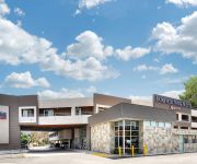
Budget Inn - El Monte
Videos from this area
These are videos related to the place based on their proximity to this place.
Shaolin Kung Fu at the Alhambra Chinese New Year Festival 2015
Shaolin monks Shi Yanxu and Shi Yanyi and students from the Shaolin Temple Cultural Center USA (STCC) perform at the Alhambra Lunar New Year Street Festival, February 21st 2015.
2007 Mercedes-Benz CLK-Class Used Cars Alhambra CA
http://www.apexautonet.net This 2007 Mercedes-Benz CLK-Class is available from Apex Autonet, Inc.. For details, call us at (626)570-1188.
2000 Toyota MR2 Spyder Used Cars Alhambra CA
http://www.sapphireautogroup.com This 2000 Toyota MR2 Spyder is available from Sapphire Auto Group. For details, call us at 626-570-9459.
2009 BMW X5 Used Cars Alhambra CA
http://www.apexautonet.net This 2009 BMW X5 is available from Apex Autonet, Inc.. For details, call us at (626)570-1188.
2004 Aston Martin V12 Vanquish Used Cars Alhambra CA
http://www.sapphireautogroup.com This 2004 Aston Martin V12 Vanquish is available from Sapphire Auto Group. For details, call us at 626-570-9459.
2010 Mercedes-Benz S-Class Hybrid Used Cars Alhambra CA
http://www.apexautonet.net This 2010 Mercedes-Benz S-Class Hybrid is available from Apex Autonet, Inc.. For details, call us at (626)570-1188.
1993 Mazda B-Series Used Cars Alhambra CA
http://www.apexautonet.net This 1993 Mazda B-Series is available from Apex Autonet, Inc.. For details, call us at (626)570-1188.
WEAPON BRANDISHING CALIFORNIA DRIVING SCHOOL MONTEREY PARK INSTRUCTOR VIOLATES CALIFORNIA 417 P.C.
You'll watch as this driving instructor (badge #20) removes a baton out of the trunk of the CALIFORNIA DRIVING SCHOOL vehicle and throws his hands in the air as an act of a challenge. Off...
Chinese 2015 New Year Festival in Monterey Park (1/4)
Lunar New Year Festival in Monterey Park, California. Date: Feb 7-8, 2015.
Chinese 2015 New Year Festival in Monterey Park (2/4)
Lunar New Year Festival in Monterey Park, California. Date: Feb 7-8, 2015.
Videos provided by Youtube are under the copyright of their owners.
Attractions and noteworthy things
Distances are based on the centre of the city/town and sightseeing location. This list contains brief abstracts about monuments, holiday activities, national parcs, museums, organisations and more from the area as well as interesting facts about the region itself. Where available, you'll find the corresponding homepage. Otherwise the related wikipedia article.
Monterey Park, California
Monterey Park is a city in Los Angeles County, California, United States, 10 miles east of downtown Los Angeles. The city's motto is "Pride in the past, Faith in the future".
Rosemead, California
Rosemead is a city in Los Angeles County, California, United States. As of the 2010 census, it had a population of 53,764. Rosemead is part of a cluster of cities, along with Arcadia, Temple City, Monterey Park, San Marino, and San Gabriel, in the west San Gabriel Valley with a growing Asian population.
San Gabriel, California
San Gabriel is a city in Los Angeles County, California, United States. It is named after the Mission San Gabriel Arcángel, founded by Junipero Serra. The city grew outward from the mission and in 1852 became the original township of Los Angeles County. San Gabriel was incorporated in 1913. The city's motto is "A city with a Mission" and it is often called the "Birthplace" of the Los Angeles metropolitan area. At the 2010 census, the population was 39,718.
South San Gabriel, California
South San Gabriel is a census-designated place (CDP) in Los Angeles County, California, United States. The population was 8,070 at the 2010 census, up from 7,595 at the 2000 census.
South Pasadena, California
South Pasadena is a city in Los Angeles County, California, United States. As of the 2010 census, it had a population of 25,619, up from 24,292 at the 2000 census. It is located in the West San Gabriel Valley. It is 3.42 square miles in area and lies between the much larger City of Pasadena, of which it was once a part, and the metropolis of Los Angeles. South Pasadena is the oldest self-builder of floats in the historic Tournament of Roses Parade.
Alhambra High School (Alhambra, California)
Alhambra High School is a public high school in Alhambra, California, USA. The school was established in 1898 and is in the Alhambra High School District. It administers one of the most extensive high school and adult education programs in California, offering hundreds of academic, cultural, and recreational courses, day and evening, many located on the Alhambra High School grounds. In 2005, it was given a California Distinguished Schools award.
East Los Angeles College
East Los Angeles College (ELAC) is a community college of the Los Angeles Community College District in the Los Angeles suburb of Monterey Park. Fourteen communities comprise its primary service area. With an enrollment of 34,697 students, ELAC is the largest campus in the Los Angeles Community College District. It was located in northeastern East Los Angeles before that part of unincorporated East Los Angeles was annexed by Monterey Park in the early 1970s.
Don Bosco Technical Institute
Don Bosco Technical Institute (commonly called "Bosco Tech") is an all-male high school in Rosemead, California, combining college-preparatory academic courses and technological education (technology programs are listed below). The academic curriculum allows students to meet or go beyond the admission requirements of the Universities of California, the California State Universities and most other four-year colleges and universities throughout the country.
Weingart Stadium
Weingart Stadium (formerly ELAC Stadium) is a 20,355-seat multipurpose stadium located at East Los Angeles College, in Monterey Park, California. It was built in 1951 at a cost of $3.1 million, and following renovations in 1984 it was renamed after philanthropist Ben Weingart. Also, in 1984 it hosted all Olympic field hockey matches. US Field Hockey played a home game here in 1990. The Los Angeles Salsa soccer club called Weingart home in the early 1990s.
Los Angeles County Department of Public Works
The Los Angeles County Department of Public Works (LACDPW) is responsible for the construction and operation of Los Angeles County's roads, building safety, sewerage, and flood control.
Alliant International University
Alliant International University is a private, non-profit higher education institution based in San Diego, California. The university is also known synonymously as Alliant. It offers programs in six California campuses and three international campuses in. Its enrollment is approximately 4000 students, of whom 95% are post-graduate.
Mark Keppel High School
Mark Keppel High School is a four-year California Distinguished School located in the city of Alhambra, California in the Alhambra Unified School District. The school is on the southern edge of Alhambra, adjacent to the City of Monterey Park, and borders the Interstate 10 Freeway. Mark Keppel serves students from portions of Alhambra, Monterey Park, and Rosemead.
San Gabriel High School
San Gabriel High School is a public high school located around the border of San Gabriel, California and Alhambra, California. It is one of the three high schools in the Alhambra Unified School District. It traditionally served students residing in San Gabriel although the balance was shifted in 1994 when San Gabriel Unified School District separated itself from Alhambra Unified. Upon separation, SGUSD opened Gabrielino High School to serve its students.
Gabrielino High School
Gabrielino High School (abbreviated GHS) is a public high school located on San Gabriel Boulevard in San Gabriel, California, 10 miles east of downtown Los Angeles, serving the 9th to 12th grades. It was established in 1994, and is one of two high schools in the San Gabriel Unified School District. Del Mar High School, a continuation high school, is the second. Gabrielino High School is accredited by Western Association of Schools and Colleges (WASC).
South Pasadena High School
South Pasadena High School (SPHS or "South Pas") is the one public high school serving grades 9-12 in the city of South Pasadena, California. With the South Pasadena Middle School and three elementary schools (Arroyo Vista, Marengo, and Monterey Hills) it makes up the South Pasadena Unified School District. Established in 1906, it is the first and only public high school in South Pasadena. The campus is situated on the west side of the city on Fremont Avenue.
Ramona Convent Secondary School
Ramona Convent Secondary School is a private, Catholic, college preparatory school for girls grades 7-12. Established in 1889 by the Sisters of the Holy Names, Ramona is one of the oldest continually operating schools in the same location in California and has graduated over 8,300 students. Today, more than 5,600 alumnae located throughout the world serve their communities both professionally and personally.
San Gabriel Mission High School
San Gabriel Mission High School, the "school with a mission," is an all-girls Catholic College Preparatory high school located on the grounds of the fourth mission of California, which was founded in 1771 by the Franciscan Padres and often used by Father Junipero Serra as his headquarters. It is located in the Roman Catholic Archdiocese of Los Angeles.
KIEV (AM)
KIEV is a radio station call sign associated with a construction permit for 1500 AM in Culver City, California serving the Los Angeles area. The construction permit is held by Royce International Broadcasting and was issued on March 27, 2001. The station is not currently on the air. A Travelers' Information Station licensed to the City of Beverly Hills operates on 1500 AM. During the week of Memorial Day 2008, KIEV sent out test signals to measure the strength of its signal.
Wilmar, California
Wilmar was the former name of a then-unincorporated district of San Gabriel Township in the San Gabriel Valley, about eight miles east of the center of Los Angeles. Wilmar was combined with the unincorporated communities of Garvey (to the east of Wilmar) and Potrero Heights (to the south of Wilmar) to become the unincorporated community of South San Gabriel in the early 1950s.
Jisan Research Institute
The Jisan Research Institute (JRI) is a nonprofit organization located in Alhambra, California. The Institute, founded in 1995 by Dr. Sanza T. Kazadi, is the only professional research laboratory for kids. The laboratory serves children between the ages of 13 and 18 and young adults enrolled in community colleges. The laboratory's primary focus is teaching kids how to do science by giving them unsolved problems to work through.
Rancho La Merced
Rancho La Merced was a 2,363-acre Mexican land grant in present day Los Angeles County, California given in 1844 by Governor Manuel Micheltorena to Casilda Soto de Lobo. The name means "Mercy of God". The northwest section of Montebello and the southeastern part of Monterey Park now occupy the area of what was Rancho La Merced.
Operating Industries Inc., Landfill
The former Operating Industries Inc. Landfill is a Superfund site located in Monterey Park, California at 900 N Potrero Grande Drive. From 1948 to 1984, the landfill accepted 30 million tons of solid municipal waste and 300 million US gallons of liquid chemicals. Accumulating over time, the chemical waste polluted the air, leached into groundwater, and posed a fire hazard, spurring severely critical public health complaints.
Garfield Medical Center
Garfield Medical Center is a 210-bed general medical and surgical hospital located in Monterey Park, California. In the most recent year with available data, the hospital had 11,586 admissions, 21,621 emergency room visits, 1,949 annual inpatient surgeries and 2,602 outpatient surgeries. Garfield Medical Center is accredited by the Joint Commission (JC). The hospital first opened in 1921.
Sally Tanner
Sally Tanner (born 1926) represented California's 60th District in the California State Assembly from 1979 to 1992. Her legislative career encompassed environmental issues, including serving as chair of the Environmental Safety and Toxic Materials Committee. On consumer issues, Tanner was the author of a consumer protection act that came to be colloquially referred to as the California Lemon Law.
Brightwood Elementary School (Monterey Park, California)
Brightwood Elementary School is a school in the Alhambra Unified School District. The current principal is Mrs. Amy Tambara, and the vice principal is Mrs. Florence Goh. Brightwood Elementary is within the borders of Monterey Park, California. Its address is 1701 Brightwood Street, Monterey Park, California, 91754. Brightwood Elementary School is a public school. {{#invoke:Coordinates|coord}}{{#coordinates:34|02|45|N|118|09|09|W|type:edu_region:US-CA_source:GNIS-239685 |primary |name= }}


