Safety Score: 2,7 of 5.0 based on data from 9 authorites. Meaning we advice caution when travelling to United States.
Travel warnings are updated daily. Source: Travel Warning United States. Last Update: 2024-05-10 08:04:54
Delve into Sierra Vista
The district Sierra Vista of Alhambra in Los Angeles County (California) is a subburb in United States about 2,288 mi west of Washington DC, the country's capital town.
If you need a hotel, we compiled a list of available hotels close to the map centre further down the page.
While being here, you might want to pay a visit to some of the following locations: Los Angeles, Orange, Santa Ana, Riverside and San Bernardino. To further explore this place, just scroll down and browse the available info.
Local weather forecast
Todays Local Weather Conditions & Forecast: 27°C / 81 °F
| Morning Temperature | 17°C / 62 °F |
| Evening Temperature | 25°C / 76 °F |
| Night Temperature | 20°C / 68 °F |
| Chance of rainfall | 0% |
| Air Humidity | 27% |
| Air Pressure | 1012 hPa |
| Wind Speed | Gentle Breeze with 8 km/h (5 mph) from North-East |
| Cloud Conditions | Clear sky, covering 0% of sky |
| General Conditions | Sky is clear |
Sunday, 12th of May 2024
27°C (80 °F)
20°C (69 °F)
Sky is clear, gentle breeze, clear sky.
Monday, 13th of May 2024
24°C (76 °F)
18°C (64 °F)
Sky is clear, gentle breeze, clear sky.
Tuesday, 14th of May 2024
22°C (72 °F)
16°C (61 °F)
Sky is clear, gentle breeze, clear sky.
Hotels and Places to Stay
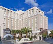
The Westin Pasadena
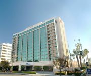
Hilton Pasadena
Arroyo Vista Inn
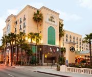
Hilton Los Angeles-San Gabriel
Dusitd2 Hotel Constance Pasadena
Pasadena The Langham
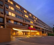
Sheraton Pasadena Hotel
Oakwood at City Place
OAKWOOD AT TRIO
Residence Inn Los Angeles Pasadena/Old Town
Videos from this area
These are videos related to the place based on their proximity to this place.
South Pasadena Restaurants -Bistro De La Gare Discount- Best Restaurants In South Pasadena CA
Get Your DISCOUNT HERE: http://goo.gl/aiDuri The Bistro De La Gare is one of the best restaurants in South Pasadena - we proudly serve wonderful French cuisine! We are a French restaurant...
Bistro De La Gare REVIEWS - South Pasadena, CA Restaurants Reviews
Bistro De La Gare REVIEWS - South Pasadena, CA Restaurants Reviews Reviewed Bistro De La Gare is a top reviewed restaurant in South Pasadena, CA. This video shows some of...
2001 Mitsubishi Montero Sport Used Cars Alhambra CA
http://www.auto888.com This 2001 Mitsubishi Montero Sport is available from Auto Source Leasing. For details, call us at 626-293-7388.
Alhambra firefighters fight fire on Front and Date
Alhambra firefighters extinguished Thursday morning a residential fire on the corner of Date Avenue and Front Street. Video courtesy of Luz Dominguez.
Stefanos Polyzoides on Mission Meridian Village
Stefanos Polyzoides discusses housing design in the context of neighborhoods, with Mission Meridian Village in South Pasadena as his backdrop.
2014 XC - Rio Hondo League Meet 1 - Girls Varsity
Rio Hondo League Meet #1 Girl's Varsity 3 Mile race held September 25, 2014 at Lacy Park in San Marino, CA. Conditions - temperatures high 80s, thick grass course.
2014 XC - League Meet #2 (all 5 races)
Video contains all 5 races from the second Rio Hondo League meet held at Hahamongna Park in La Canada on October 16, 2014. San Marino won the men's varsity while La Canada took the women's.
2014 XC - Rio Hondo League Meet #1 Men's Varsity
Rio Hondo League Meet #1 Men's Varsity 3 Mile race held September 25, 2014 at Lacy Park in San Marino, CA. Conditions - temperatures high 80s, thick grass course.
2014 XC - Rio Hondo League Meet 1 Girls JV
Rio Hondo League Meet #1 Girl's JV 3 Mile race held September 25, 2014 at Lacy Park in San Marino, CA. Conditions - temperatures high 80s, thick grass course.
XC 2014 - Rio Hondo League Meet 1 - JV Boys
Rio Hondo League Meet #1 Junior Varsity Boys 3 Mile race held September 25, 2014 at Lacy Park in San Marino, CA. Conditions - temperatures high 80s, thick grass course.
Videos provided by Youtube are under the copyright of their owners.
Attractions and noteworthy things
Distances are based on the centre of the city/town and sightseeing location. This list contains brief abstracts about monuments, holiday activities, national parcs, museums, organisations and more from the area as well as interesting facts about the region itself. Where available, you'll find the corresponding homepage. Otherwise the related wikipedia article.
South Pasadena, California
South Pasadena is a city in Los Angeles County, California, United States. As of the 2010 census, it had a population of 25,619, up from 24,292 at the 2000 census. It is located in the West San Gabriel Valley. It is 3.42 square miles in area and lies between the much larger City of Pasadena, of which it was once a part, and the metropolis of Los Angeles. South Pasadena is the oldest self-builder of floats in the historic Tournament of Roses Parade.
Alhambra High School (Alhambra, California)
Alhambra High School is a public high school in Alhambra, California, USA. The school was established in 1898 and is in the Alhambra High School District. It administers one of the most extensive high school and adult education programs in California, offering hundreds of academic, cultural, and recreational courses, day and evening, many located on the Alhambra High School grounds. In 2005, it was given a California Distinguished Schools award.
California State University, Los Angeles
California State University, Los Angeles (also known as Cal State L.A. , CSULA, or CSLA) is a public comprehensive university, part of the California State University (CSU) system. The campus is located in the eastern region of Los Angeles, California, United States, in the University Hills district, facing the San Gabriel Mountains, at the center of Los Angeles metropolitan area just five miles (8 km) east of Downtown Los Angeles.
University Hills, Los Angeles
University Hills is a district on the East Side of Los Angeles, California. It is the site of California State University, Los Angeles.
KMPC
KMPC (1540 AM, "Radio Korea", 라디오코리아) is a radio station based in Los Angeles, California and is owned by P&Y Broadcasting Licensee, LLC. Radio Korea is a division of the [Radio Korea Media Group. The station airs Korean-language programming. It broadcasts news, information, and entertainment for the largest Korean-American community in the United States, and the largest Korean community outside of Korea.
El Sereno, Los Angeles
El Sereno is a community in Eastern Los Angeles, California. El Sereno sits atop the Monterey Hills that separate the Los Angeles Basin from the San Gabriel Valley, and is the easternmost district in the city of Los Angeles. It is bordered by Monterey Hills and South Pasadena on the north, Alhambra on the east, University Hills on the southeast, City Terrace on the south, Boyle Heights on the southwest, Lincoln Heights on the west, and Montecito Heights on the northwest.
Los Angeles County Department of Public Works
The Los Angeles County Department of Public Works (LACDPW) is responsible for the construction and operation of Los Angeles County's roads, building safety, sewerage, and flood control.
Monterey Hills, Los Angeles
Monterey Hills is a small, diverse, middle-class community within the city of Los Angeles, California located about 4 miles ENE of downtown Los Angeles and about 3 miles from Pasadena off of the 110 Freeway. It is surrounded by El Sereno to the southeast, Hermon to the east, Montecito Heights to the southwest and the independent city of South Pasadena to the northeast. Monterey Hills is part of the Arroyo Seco Neighborhood Council (ASNC).
Alliant International University
Alliant International University is a private, non-profit higher education institution based in San Diego, California. The university is also known synonymously as Alliant. It offers programs in six California campuses and three international campuses in. Its enrollment is approximately 4000 students, of whom 95% are post-graduate.
Arroyo Seco bicycle path
The Arroyo Seco bicycle path is an approximately 2 miles long Class I bicycle path in Los Angeles, California. The path connects Montecito Heights Recreation Center, Ernest E. Debs Regional Park, and Hermon Park in the Highland Park district, and runs parallel to State Route 110, and ends at San Pascual Stables in South Pasadena.
Hermon, Los Angeles
Hermon is a small district in the city of Los Angeles, California. It is situated in a half square-mile valley bordered by the Arroyo Seco and the historic 110 freeway to the west, Monterey Hills to the south, and South Pasadena to the north and east. The community has been part of Los Angeles since 1912, but has retained its own unique identity.
South Pasadena High School
South Pasadena High School (SPHS or "South Pas") is the one public high school serving grades 9-12 in the city of South Pasadena, California. With the South Pasadena Middle School and three elementary schools (Arroyo Vista, Marengo, and Monterey Hills) it makes up the South Pasadena Unified School District. Established in 1906, it is the first and only public high school in South Pasadena. The campus is situated on the west side of the city on Fremont Avenue.
Los Angeles County High School for the Arts
Los Angeles County High School for the Arts is a Visual and Performing Arts high school located on the campus of California State University, Los Angeles in Los Angeles, California, United States. Founded in 1984, the public, tuition-free school offers both college preparatory courses and conservatory style training. Though it shares facilities with the university, the two schools' activities are usually separate. It is operated by the Los Angeles County Office of Education.
Ramona Convent Secondary School
Ramona Convent Secondary School is a private, Catholic, college preparatory school for girls grades 7-12. Established in 1889 by the Sisters of the Holy Names, Ramona is one of the oldest continually operating schools in the same location in California and has graduated over 8,300 students. Today, more than 5,600 alumnae located throughout the world serve their communities both professionally and personally.
Cal State LA Studios
Cal State LA Studios is the production area of the Department of Television, Film, and Media Studies at California State University, Los Angeles, the only CSU campus in the Los Angeles basin. Bachelor of Arts degrees are offered in Telecommunications and Film, Broadcast Journalism and Animation.
Cal State LA (train station)
Cal State LA (officially Cal State Los Angeles) is a Metrolink station serving the San Bernardino Line and also the El Monte Busway for the Metro Silver Line and other bus rapid transit services. Local bus services operate from outside the station. The Silver Line station is heavy used by Cal State LA students.
Jisan Research Institute
The Jisan Research Institute (JRI) is a nonprofit organization located in Alhambra, California. The Institute, founded in 1995 by Dr. Sanza T. Kazadi, is the only professional research laboratory for kids. The laboratory serves children between the ages of 13 and 18 and young adults enrolled in community colleges. The laboratory's primary focus is teaching kids how to do science by giving them unsolved problems to work through.
Garvanza, Los Angeles
Garvanza is a neighborhood in northeast Los Angeles. It is generally considered a subdistrict of Highland Park. It is named for the garbanzo beans that once flourished there. Garvanza was annexed by the city in 1899. The two bridges which connect Los Angeles to South Pasadena originate in Garvanza.
Cawston Ostrich Farm
Cawston Ostrich Farm, located in South Pasadena, California, United States was opened in 1886 by Edwin Cawston. It was America's first ostrich farm and was located in the Arroyo Seco Valley just three miles (5 km) north of downtown Los Angeles and occupied nine acres.
Rancho Huerta de Cuati
Rancho Huerta de Cuati was a 127-acre Mexican land grant in the San Rafael Hills area of present day Los Angeles County, California given in 1838 by governor Juan Alvarado to Victoria Reid. The name means "Garden of the Cuati" in Spanish. The rancho included present day Alhambra, San Marino, South Pasadena, and Pasadena -- and Lake Wilson (now San Marino's Lacey Park).
Glenarm Power Plant
The Glenarm Power Plant is an Art Deco style power plant in Pasadena, California. The site contains a steam plant, B-3, and 4 gas turbine generating units, GT-1 through GT-4. The plant is bisected by the Metro Gold Line rails and is bordered on the east by the northern terminus of the Pasadena Freeway and Blair International Baccalaureate School.
Eagle's Nest Arena
Eagle's Nest Arena is an indoor arena located on the California State University, Los Angeles campus. It plays host to the basketball and volleyball teams for the Golden Eagles, is 94 feet long, 80 feet wide, and can handle two basketball and three volleyball courts. Seating 3,200 at full capacity, it hosted the judo competitions for the 1984 Summer Olympics.
The Langham Huntington, Pasadena
The Langham Huntington, Pasadena is a luxury resort hotel located in Pasadena, California.
Los Angeles International Charter High School
Los Angeles International Charter High School is a charter school in Hermon, Los Angeles, California, near Highland Park. It occupies the campus of the former Pacific Christian High School.
Rose Hill Park, Los Angeles
Rose Hill Park is the name of a park and a playground in the community of El Sereno. It is also used to refer to the neighborhood surrounding the park and playground. The area is in ZIP code 90032.


