Safety Score: 2,7 of 5.0 based on data from 9 authorites. Meaning we advice caution when travelling to United States.
Travel warnings are updated daily. Source: Travel Warning United States. Last Update: 2024-04-28 08:22:10
Explore Mohave Valley
Mohave Valley in Mohave County (Arizona) with it's 2,616 inhabitants is located in United States about 2,078 mi (or 3,344 km) west of Washington DC, the country's capital.
Local time in Mohave Valley is now 03:35 PM (Sunday). The local timezone is named America / Phoenix with an UTC offset of -7 hours. We know of 10 airports in the wider vicinity of Mohave Valley, of which 3 are larger airports. The closest airport in United States is Laughlin Bullhead International Airport in a distance of 16 mi (or 25 km), North. Besides the airports, there are other travel options available (check left side).
Also, if you like golfing, there are multiple options in driving distance. If you need a place to sleep, we compiled a list of available hotels close to the map centre further down the page.
Depending on your travel schedule, you might want to pay a visit to some of the following locations: Kingman, Parker, Las Vegas, Prescott and Yuma. To further explore this place, just scroll down and browse the available info.
Local weather forecast
Todays Local Weather Conditions & Forecast: 28°C / 82 °F
| Morning Temperature | 19°C / 66 °F |
| Evening Temperature | 30°C / 86 °F |
| Night Temperature | 25°C / 77 °F |
| Chance of rainfall | 0% |
| Air Humidity | 14% |
| Air Pressure | 1012 hPa |
| Wind Speed | Gentle Breeze with 6 km/h (3 mph) from North-West |
| Cloud Conditions | Clear sky, covering 0% of sky |
| General Conditions | Sky is clear |
Sunday, 28th of April 2024
31°C (87 °F)
26°C (78 °F)
Sky is clear, fresh breeze, clear sky.
Monday, 29th of April 2024
32°C (89 °F)
27°C (80 °F)
Sky is clear, moderate breeze, clear sky.
Tuesday, 30th of April 2024
29°C (84 °F)
22°C (72 °F)
Sky is clear, high wind, near gale, clear sky.
Hotels and Places to Stay
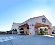
BEST WESTERN COLORADO RIVER INN-NEEDLES
RIO DEL SOL INN NEEDLES
AVI RESORT AND CASINO
River Valley Inn
Best Motel
Desert Mirage Inn & Suites
Budget Inn of Needles
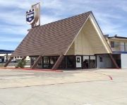
KNIGHTS INN NEEDLES
Videos from this area
These are videos related to the place based on their proximity to this place.
Fire in Mohave Valley
Large brush fire in Mohave Valley, Sunday, June 10, 2012. Hwy 95 and Jerome Rd., south of El Rio Country Club.
CampgroundViews.com - Moon River Resort Mohave Valley Arizona AZ
http://www.CampgroundViews.com takes user submitted videos combined with professional editing to provide tent and RV campers with a first person view of a campground or RV park. Moon River...
CampgroundViews.com - Spirit Mountain RV Park Mohave Valley Arizona AZ
http://www.CampgroundViews.com takes user submitted videos combined with professional editing to provide tent and RV campers with a first person view of a campground or RV park. Spirit Mountain.
CampgroundViews.com - Blackstone RV Park Mohave Valley Arizona AZ
http://www.CampgroundViews.com takes user submitted videos combined with professional editing to provide tent and RV campers with a first person view of a campground or RV park. Blackstone...
Flying at C.R.A.P.S.
This is me flying my home-built delta-wing blue-foam etc.-etc. Oct. 6, 07 at C.R.A.P.S. flying field in Mohave Valley, Az.
FiberMat: The Most Advanced Pavement Preservation Process
Sully-Miller Contracting Co. has taken FiberMat and the Pavement Preservation Industry to a whole new level. By utilizing High-Definition Video integrated with GPS, Sully-Miller captures the...
Harvest Bible Church 3rd Anniversary Show
Take a look into our 3rd Anniversary Celebration! God is so faithful!
US Route 95 northbound drive to Needles, California, Interstate 40 westbound back to US 95, GP050018
US Route 95 northbound drive to Needles, California, Interstate 40 westbound back to Route 95, 18 November 2013, GP050018.
Videos provided by Youtube are under the copyright of their owners.
Attractions and noteworthy things
Distances are based on the centre of the city/town and sightseeing location. This list contains brief abstracts about monuments, holiday activities, national parcs, museums, organisations and more from the area as well as interesting facts about the region itself. Where available, you'll find the corresponding homepage. Otherwise the related wikipedia article.
Mesquite Creek, Arizona
Mesquite Creek is a census-designated place (CDP) in Mohave County, Arizona, United States. The population was 205 at the 2000 census.
Mohave Valley, Arizona
Mohave Valley ('Amat' 'Analy Uuhwely in Mojave) is a census-designated place (CDP) in Mohave County, Arizona, United States. The population was 13,694 at the 2000 census. It is geographically connected to Needles, California, Fort Mohave, Arizona, and Bullhead City, Arizona.
Mojave Ranch Estates, Arizona
Mojave Ranch Estates is a census-designated place (CDP) in Mohave County, Arizona, United States. The population was 28 at the 2000 census.
Willow Valley, Arizona
Willow Valley is a census-designated place (CDP) in Mohave County, Arizona, United States. The population was 585 at the 2000 census.
Fort Mojave Indian Reservation
The Fort Mojave Indian Reservation is an Indian reservation along the Colorado River, currently encompassing 23,669 acres (96 km²) in Arizona, 12,633 acres (51 km²) in California, and 5,582 acres (23 km²) in Nevada. The reservation was originally established in 1870 and is now home to approximately 1,100 members of the Mohave Tribe of Native Americans. Occupancy on Fort Mojave Indian Reservation lands, unlike that of many other Indian reservations in Arizona, is less than 50% Native American.
Mohave Valley
The Mohave Valley is a small valley, mostly on the east shore of the south-flowing Colorado River in northwest Arizona; the valley borders southeast California's San Bernardino County; also, the north of the valley borders extreme southeast Clark County, Nevada. The valley is in southwest Mohave County, Arizona and is a region at the intersection of the southeast Mojave and northwest Sonoran Deserts.
River Valley High School (Mohave Valley, Arizona)
River Valley High School is a high school located in Mohave Valley, Arizona. It is part of the Colorado River Union High School District.


