Safety Score: 3,5 of 5.0 based on data from 9 authorites. Meaning please reconsider your need to travel to Turkey.
Travel warnings are updated daily. Source: Travel Warning Turkey. Last Update: 2024-05-05 08:24:42
Delve into Sultançiftliği Köyü
The district Sultançiftliği Köyü of Sultangazi in İstanbul is a subburb in Turkey about 225 mi west of Ankara, the country's capital town.
If you need a hotel, we compiled a list of available hotels close to the map centre further down the page.
While being here, you might want to pay a visit to some of the following locations: Mahmutbey, Kemerburgaz, Istanbul, UEmraniye and Bueyuekcekmece. To further explore this place, just scroll down and browse the available info.
Local weather forecast
Todays Local Weather Conditions & Forecast: 17°C / 63 °F
| Morning Temperature | 12°C / 54 °F |
| Evening Temperature | 16°C / 60 °F |
| Night Temperature | 12°C / 53 °F |
| Chance of rainfall | 0% |
| Air Humidity | 46% |
| Air Pressure | 1016 hPa |
| Wind Speed | Moderate breeze with 12 km/h (8 mph) from South-West |
| Cloud Conditions | Clear sky, covering 1% of sky |
| General Conditions | Light rain |
Monday, 6th of May 2024
16°C (61 °F)
14°C (57 °F)
Sky is clear, light breeze, clear sky.
Tuesday, 7th of May 2024
17°C (63 °F)
16°C (61 °F)
Sky is clear, light breeze, clear sky.
Wednesday, 8th of May 2024
21°C (69 °F)
20°C (67 °F)
Broken clouds, gentle breeze.
Hotels and Places to Stay
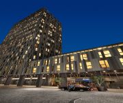
Divan Suites Istanbul GPlus Airport
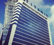
Titanic Business Bayrampasa
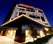
Ramada Plaza Istanbul Tekstilkent
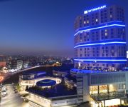
Wyndham Grand Istanbul Europe
Qua Hotel
Clarion Hotel Istanbul Mahmutbey
Holiday Inn ISTANBUL AIRPORT
Retaj Royale Istanbul
Wish More Hotel Istanbul
Golden Tulip Bayrampasa
Videos from this area
These are videos related to the place based on their proximity to this place.
Döngel @ Şehr-i Istanbul - Bölüm 1
Bölüm - 1 - Döngel İstanbul tayfasının, "İstanbullu olmayanları istanbullu yapma" çalışmaları çerçevesinde gerçekleştirilmiş bir İstanbul ziyareti/eğlencesi... Kısaca...
CİCİ AMBALAJ SULTANGAZİ
ESKİ EDİRNE ASFALTI NO:641/B (CAMİ DURAĞI) SULTANGAZİ/İSTANBUL TEL:0212 475 44 09 CEP: 0533 770 73 66 CEP: 0533 3347428 2.Cİ ŞUBEMİZ: SULTANÇİFTLİĞİ MAHALLESİ 20. SOKAK ...
Hizmet İlim ve İrfan Derneği Esentepe Fatih USTAOSMANOĞLU
Sultangazi esentepe mah. Hzimet ilim ve İrfan derneği 14.03.2014 tarihli Fatih USTAOSMANOĞLU nun Sohbetinin ikinci bölümü.
Hizmet ilim ve irfan derneği esentepe
sultangazi esentepe mahallesi hizmet ilim ve irfan derneği 2013-2014 ilim için yarışalım Ödül Merasimi.
Esentepe Hizmet ilim ve İrfan Derneği Fatih USTAOSMANOĞLU bölüm1
Sultangazi Esentepe Mah. Hizmet İlim ve İrfan Derneği 14.03.2014 tarihli sohbetinin 1. bölümü.
Esentepe Hizmet İlim ve İrfan Derneği
Refik KOCAMAN hocamızın 07.03.2014 tarihinde derneğimizdeki sohbetidir.
Bayrampaşa Belediye Başkanlığı Aday adayı Sedat Akbay
Dün bayrampaşada ve ak parti ilçe teşkilatında yer yerinden oynadı.bayrampaşanın ve rumelilerin sevilen güzel insanı SEDAT AKBAY kalabalık basın ordusuyla rumelili hemşerileriyle...
BAŞBAKAN RECEP TAYYİP ERDOĞAN SULTANGAZİ BELEDİYESİ HİZMET BİNASI AÇILIŞ TÖREN
BAŞBAKAN RECEP TAYYİP ERDOĞAN SULTANGAZİ BELEDİYESİ HİZMET BİNASI AÇILIŞ TÖRENİ 31.05.2014 14:00.
Sultangazi Hırsızlık,Data Guvenlik,Sultangazi,Alarm,Kamera,Data Bilişim
Sultangazi Hırsızlık,Data Guvenlik,Sultangazi,Alarm,Kamera,Data Bilişim,Alarm Sistemleri,Güvenlik Sistemleri http://www.dataguvenlik.web.tr.
Videos provided by Youtube are under the copyright of their owners.
Attractions and noteworthy things
Distances are based on the centre of the city/town and sightseeing location. This list contains brief abstracts about monuments, holiday activities, national parcs, museums, organisations and more from the area as well as interesting facts about the region itself. Where available, you'll find the corresponding homepage. Otherwise the related wikipedia article.
Istanbul Province
Istanbul Province is a province located in north-west Turkey. It has an area of 5,343.02 km² and a population of 13,255,685. The population was 10,018,735 in 2000. It is surrounded by the provinces of Tekirdağ to the west, Kocaeli to the east, the Black Sea to the northern part and the Sea of Marmara to the south. The Bosphorus (Boğaziçi) Strait divides the province in two parts: the European side and the Asian side.
Blachernae
Blachernae was a suburb in the northwestern section of Constantinople, the capital city of the Byzantine Empire. It was the site of a water source and a number of prominent churches were built there, most notably the great Church of St. Mary of Blachernae (Panagia Blacherniotissa), built by Empress Pulcheria in circa 450, expanded by Emperor Leo I (r. 457–474) and renovated by Emperor Justinian I (r. 527–565) in the 6th century.
Chora Church
The Church of the Holy Saviour in Chora (Turkish Kariye Müzesi, Kariye Camii, or Kariye Kilisesi — the Chora Museum, Mosque or Church) is considered to be one of the most beautiful surviving examples of a Byzantine church. The church is situated in Istanbul, in the Edirnekapı neighborhood, which lies in the western part of the municipality of Fatih. In the 16th century, during the Ottoman era, the church was converted into a mosque and, finally, it became a museum in 1948.
Güngören M.Yahya Baş Stadium
Güngören M. Yahya Baş Stadyumu is a multi-purpose stadium in the Güngören district of Istanbul, Turkey. It is currently used mostly for football matches and is the home stadium of Istanbulspor AS. The stadium holds 10,500 people.
Eyüp Sultan Mosque
The Eyüp Sultan Mosque (Turkish: Eyüp Sultan Camii) is situated in the district of Eyüp on the European side of Istanbul, near the Golden Horn, outside the Walls of Constantinople. Built in 1458, it was the first mosque constructed by the Ottoman Turks following the Conquest of Constantinople in 1453. The mosque rises next to the place where Abu Ayyub al-Ansari, the standard-bearer of the Islamic prophet Muhammad, is said to have been buried during the Arab assault on Constantinople in 670.
Palace of the Porphyrogenitus
The Palace of the Porphyrogenitus (Greek: τὰ βασίλεια τοῦ Πορφυρογεννήτου), known in Turkish as the Tekfur Sarayı ("Palace of the Sovereign"), is a late 13th-century Byzantine palace in the north-western part of the old city of Constantinople. An annex of the greater palace complex of Blachernae, it is the only Byzantine palace to survive in the city, and one of the few relatively intact examples of late Byzantine secular architecture in the world.
Tekstilkent Plaza
Koza Plaza, located in Istanbul, Turkey, is Europe's largest wholesale retail facility of textiles.
Defterdar Mosque
The Defterdar Mosque, or in long form the Defterdar Mahmut Efendi Mosque (Turkish: Defterdar Camii, Defterdar Mahmut Efendi Camii), is a historical mosque located in Eyüp, Istanbul, Turkey. It was commissioned by Defterdar Nazlı Mahmut Efendi (c. 1500-1546) and built by architect Mimar Sinan in 1542 ("defterdar" was the head of the financial department in Ottoman Empire).
Bağcılar Olympic Sport Hall
Bağcılar Olympic Sport Hall (Turkish: Bağcılar Olimpik Spor Salonu) is a multi-purpose indoor sports complex with Olympic standards located in Bağcılar district of Istanbul, Turkey. Its construction began in 1998 and the sport hall was inaugurated on March 20, 2001 in presence of the Belgian action films actor and former martial arts sportsman Jean Claude Van Damme. The sports complex is owned by the Metropolitan Municipality of Istanbul.
Atik Mustafa Pasha Mosque
Atik Mustafa Pasha Mosque (Turkish: Atik Mustafa Paşa Camii; also named Hazreti Cabir Camii) is a former Eastern Orthodox church in Istanbul, converted into a mosque by the Ottomans. The dedication of the church is obscure. For a long time it has been identified with the church of Saints Peter and Mark, but without any proof. Now it seems more probable that the church is to be identified with Saint Thekla of the Palace of Blachernae .
Tokat Gaziosmanpaşa Stadium
Tokat Gaziosmanpaşa Stadium (Turkish: Tokat Gaziosmanpaşa Stadyumu) is a multi-use stadium in Tokat, Turkey. It is currently used mostly for football matches and is the home stadium of Tokatspor. The stadium holds 7,500 people and opened in 1984.
Ayvansaray, Istanbul
Ayvansaray is a neighborhood in Istanbul, Turkey. It is part of the district of Fatih and part of the walled city. It lies between the southern shore of the Golden Horn, the Blachernae section of the Walls, and the neighborhoods of Balat and Edirnekapı. It corresponds to the old quarter of Blachernae. The name Ayvansaray ("High Palace") hearkens back to the Palace of Alexios I Komnenos (now disappeared), which was part of the complex of Blachernae.
Mihrimah Mosque
The Mihrimah Sultan Mosque (Turkish: 'Mihrimah Sultan Camii') is an Ottoman mosque located in the Edirnekapı neighborhood near the Byzantine land walls of Istanbul, Turkey. Located on the peak of the Sixth Hill near the highest point of the city, the mosque is a prominent landmark in Istanbul.
Edirnekapı Martyr's Cemetery
The Edirnekapı Martyr's Cemetery is a burial ground located in the neighborhood of Edirnekapı, in the European part of Istanbul, Turkey. It consists of an old, historical part and a modern one.
Zal Mahmud Pasha Mosque
The Zal Mahmud Pasha Mosque (Turkish: Zal Mahmut Paşa Camii) is an old Ottoman mosque located near the Eyüp Sultan Mosque in the Eyüp district of Istanbul, Turkey.
TurkuaZoo
The TurkuaZoo is a public aquarium located in Bayrampaşa in Istanbul, Turkey. It is the first public aquarium in Turkey, and was the largest aquarium in Europe when it opened in 2009. In addition to being a major tourist attraction for Istanbul, the aquarium is a centre for marine research and conservation.
Philopatium
Philopatium or Philopation was the name of a palace and region outside the walls of the Byzantine capital Constantinople, known for its parks and gardens. According to 11th-century accounts, it was located north of Constantinople, just outside the Blachernae walls. Competing accounts place it seaward of the Golden Gate. The place was loved by Justinian and Theodora, and served as a spring or summer retreat for the Byzantine emperors after them.
Prison of Anemas
The so-called Prison of Anemas is a large Byzantine building attached to the walls of the city of Constantinople. It is traditionally identified with the prisons named after Michael Anemas, a Byzantine general who rose in unsuccessful revolt against Emperor Alexios I Komnenos (r. 1081–1118) and was the first person to be imprisoned there. The prison features prominently in the last centuries of the Byzantine Empire, when four Byzantine emperors were imprisoned there.
Sütlüce, Istanbul
Sütlüce is a neighborhood in the Beyoğlu district of Istanbul, Turkey, located at the eastern bank of Golden Horn across Eyüp. Istanbul's main slaughterhouse was situated in Sütlüce. The facility, which caused great air and water pollution to the natural environment at Golden Horn, was abandoned in 1984 after 61 years of service. In accordance with the city's urban redevelopment plan and following the establishment of Miniatürk, SantralIstanbul and Rahmi M.
Başakşehir
Başakşehir is one of the 39 second-level districts in Greater İstanbul, İstanbul Province, Turkey.
Edirnekapı, Istanbul
Edirnekapı is a neighborhood of Istanbul, Turkey. It is part of the district of Fatih and belongs to the walled city. It corresponds roughly to the central part of the sixth Hill of Istanbul, which is the highest point of the walled city. It lies south of the Blachernae section of the Walls and of the neighborhood of Ayvansaray, north-west of Karagümrük and west of Salmatomruk. The quarter corresponds to the Byzantine quarter of Deuteron.
Kasim Aga Mosque, Istanbul
Kasim Ağa Mosque (Turkish: Kasım Ağa Mescidi; also Kâsım Bey Mescidi, where mescit is the Turkish word for a small mosque) is a former Byzantine building converted into a mosque by the Ottomans in Istanbul, Turkey. Neither surveying during the last restoration nor medieval sources have made it possible to find a satisfactory answer as to its origin and possible dedication.
Toklu Dede Mosque
Toklu Dede Mosque (Turkish: Toklu Dede Mescidi, where mescit is the Turkish word for a small mosque), was an Ottoman mosque in Istanbul, Turkey. The building was originally a Byzantine Eastern Orthodox church of unknown dedication. It was almost completely destroyed in 1929.
Esenler Bus Terminal
Esenler Bus Terminal, a.k.a. Grand Istanbul Bus Terminal (Turkish: Büyük İstanbul Otogarı), is the central and largest bus terminal for intercity bus service in İstanbul, Turkey. Although the terminal is located in Bayrampaşa district it is named after Esenler district, which is closer.
Istanbul Kemerburgaz University
Istanbul Kemerburgaz University is a foundation university established 2008 in İstanbul, Turkey. The university is accepted its first students in 2011 and started education in the 2011-12 education term.


