Safety Score: 3,3 of 5.0 based on data from 9 authorites. Meaning please reconsider your need to travel to Netherlands.
Travel warnings are updated daily. Source: Travel Warning Netherlands. Last Update: 2024-04-27 08:23:39
Discover Noordeinde
Noordeinde in Gemeente Nieuwkoop (South Holland) is a place in Netherlands about 13 mi (or 22 km) south of Amsterdam, the country's capital city.
Current time in Noordeinde is now 06:39 PM (Saturday). The local timezone is named Europe / Amsterdam with an UTC offset of 2 hours. We know of 9 airports near Noordeinde, of which 4 are larger airports. The closest airport in Netherlands is Amsterdam Airport Schiphol in a distance of 8 mi (or 13 km), North. Besides the airports, there are other travel options available (check left side).
There are several Unesco world heritage sites nearby. The closest heritage site in Netherlands is Seventeenth-Century Canal Ring Area of Amsterdam inside the Singelgracht in a distance of 13 mi (or 21 km), North. We encountered 6 points of interest in the vicinity of this place. If you need a hotel, we compiled a list of available hotels close to the map centre further down the page.
While being here, you might want to pay a visit to some of the following locations: Amsterdam, Haarlem, Heemskerk, Utrecht and Heiloo. To further explore this place, just scroll down and browse the available info.
Local weather forecast
Todays Local Weather Conditions & Forecast: 10°C / 51 °F
| Morning Temperature | 6°C / 43 °F |
| Evening Temperature | 15°C / 59 °F |
| Night Temperature | 12°C / 54 °F |
| Chance of rainfall | 5% |
| Air Humidity | 92% |
| Air Pressure | 1006 hPa |
| Wind Speed | Gentle Breeze with 9 km/h (5 mph) from North |
| Cloud Conditions | Broken clouds, covering 84% of sky |
| General Conditions | Moderate rain |
Sunday, 28th of April 2024
12°C (54 °F)
9°C (48 °F)
Light rain, fresh breeze, broken clouds.
Monday, 29th of April 2024
16°C (60 °F)
11°C (52 °F)
Light rain, gentle breeze, broken clouds.
Tuesday, 30th of April 2024
15°C (59 °F)
14°C (58 °F)
Moderate rain, gentle breeze, overcast clouds.
Hotels and Places to Stay
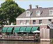
Het Rechthuis
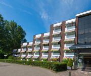
Best Western Plus Amedia Amsterdam Airport
Radisson Blu Hotel Amsterdam Airport
Grand Hotel Amstelveen
Van der Valk Hotel Schiphol A4
Huis ter Lucht
Best Western Amsterdam Airport Hotel Uithoorn
Park Inn by Radisson Amsterdam Airport Schiphol
ZoetWater
Videos from this area
These are videos related to the place based on their proximity to this place.
Reghthuys en -toren; één van de thema's in Nieuwkoop
Dit is één van de films die vervaardigd zijn door RTV Hollands Midden voor de drieluiktentoonstelling "Nieuwkoop: 13 kernen, 1 gemeente", opgezet door de stichting Zet Nieuwkoop op de Kaart!...
Rietsnijden; één van de thema's in Nieuwkoop
Dit is één van de films die vervaardigd zijn door RTV Hollands Midden voor de drieluiktentoonstelling "Nieuwkoop: 13 kernen, 1 gemeente", opgezet door de stichting Zet Nieuwkoop op de Kaart!...
Longboarding: Following The River At Sunset (HD)
Hello, This film was made in Vrouwenakker the Netherlands. Filmed by: Job, Dion and Skip Job: prowler Dion: pintail Skip: pintail We hope you liked our vid, Please like and subscribe! ...
Noodweer in Kudelstaart 12-07-2010
http://www.cross-multimedia.nl Noodweer (windhoos) in Kudelstaart. 12 Juli 2010. Het begon met een druk verschil, daarna zag ik een aantal witte wolken snel voorbij komen en van vorm veranderen...
ILS landing at Amsterdam Schiphol
ILS landing at Amsterdam Schiphol EHAM - Boeing 737-700, POLISH LOT livery -FLIGHTGEAR.
kerstmusical maranathaschool nieuwkoop 2010 deel 1
kerst musical maranatha school nieuwkoop 2010 deel 1.
Veenbonkencup 2009
Met 33 wedstrijd 16M2 gaat de Titanen strijd om de felbegeerde Veenbonkencup 2009 van start!
Videos provided by Youtube are under the copyright of their owners.
Attractions and noteworthy things
Distances are based on the centre of the city/town and sightseeing location. This list contains brief abstracts about monuments, holiday activities, national parcs, museums, organisations and more from the area as well as interesting facts about the region itself. Where available, you'll find the corresponding homepage. Otherwise the related wikipedia article.
Liemeer
' is a former municipality in the western Netherlands, in the province of South Holland. It was merged into the municipality of Nieuwkoop on January 1, 2007. The municipality covered an area of 30.98 km² of which 0.76 km² is water. Its population was 6962 in November 2006. Liemeer consisted of the communities Nieuwveen, Noorden, Vrouwenakker, and Zevenhoven.
De Hoef, Utrecht
De Hoef is a village in the Dutch province of Utrecht. It is a part of the municipality of De Ronde Venen, and lies about 13 km northeast of Alphen aan den Rijn. On 1 January 2005, it had 928 inhabitants (500 male, 428 female). Flowing through the village is a meandering river called "de Kromme Mijdrecht", the width of which varies between about 8 and 35 metres. On average, it is used by about two freight ships per day, but in summer the river is full of pleasure boats.
Kudelstaart
Kudelstaart is a town in the Dutch province of North Holland. It is a part of the municipality of Aalsmeer, and lies about 10 km southeast of Hoofddorp. In 2001, the town of Kudelstaart had 5,889 inhabitants. The built-up area of the town was 0.96 km², and contained 2203 residences. The statistical area "Kudelstaart", which also can include the peripheral parts of the village, as well as the surrounding countryside, had a population of around 6,530.
Calslagen
Calslagen is a hamlet in the Dutch province of North Holland. It is a part of the municipality of Aalsmeer, and lies about 9 km south of Hoofddorp. Until 1854, Calslagen (then spelled "Kalslagen") was a separate municipality, under the name of Kalslagen en Bilderdam. The statistical area "Calslagen", which covers the hamlet and a large part of the lake area Westeinderplassen, has a population of around 550.
Kalslagen en Bilderdam
Kalslagen en Bilderdam is a former municipality in the Dutch province of North Holland. It existed between 1817 and 1854, and was sometimes simply called Kalslagen. The municipality covered the hamlet of Calslagen and a number of polders to the south, including part of the hamlet of Bilderdam. In 1854, the municipality was divided between Aalsmeer, Uithoorn, and Leimuiden; the hamlet Calslagen itself became a part of the municipality Aalsmeer.


