Safety Score: 3,3 of 5.0 based on data from 9 authorites. Meaning please reconsider your need to travel to Netherlands.
Travel warnings are updated daily. Source: Travel Warning Netherlands. Last Update: 2024-05-02 08:23:34
Discover Maarssenbroek
The district Maarssenbroek of Maarssen in Stichtse Vecht (Provincie Utrecht) is a subburb in Netherlands about 18 mi south of Amsterdam, the country's capital city.
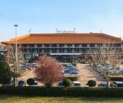
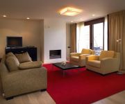
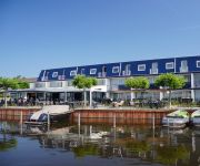
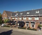
If you need a hotel, we compiled a list of available hotels close to the map centre further down the page.
While being here, you might want to pay a visit to some of the following locations: Utrecht, Amsterdam, Haarlem, 's-Hertogenbosch and Heemskerk. To further explore this place, just scroll down and browse the available info.
Local weather forecast
Todays Local Weather Conditions & Forecast: 23°C / 74 °F
| Morning Temperature | 15°C / 59 °F |
| Evening Temperature | 18°C / 64 °F |
| Night Temperature | 12°C / 54 °F |
| Chance of rainfall | 11% |
| Air Humidity | 60% |
| Air Pressure | 997 hPa |
| Wind Speed | Gentle Breeze with 9 km/h (5 mph) from East |
| Cloud Conditions | Scattered clouds, covering 34% of sky |
| General Conditions | Moderate rain |
Friday, 3rd of May 2024
11°C (51 °F)
8°C (47 °F)
Moderate rain, moderate breeze, overcast clouds.
Saturday, 4th of May 2024
15°C (60 °F)
8°C (46 °F)
Light rain, gentle breeze, overcast clouds.
Sunday, 5th of May 2024
14°C (58 °F)
9°C (47 °F)
Light rain, light breeze, overcast clouds.
Hotels and Places to Stay
Carlton President
Breukelen Van der Valk
Hotelsuites de Driesprong
Fletcher Hotel Restaurant Loosdrecht-Amsterdam
Najade Resort
Park Plaza Utrecht
NH Utrecht
Van der Valk Hotel Utrecht
Het Wapen van Harmelen
ibis Utrecht
Videos from this area
These are videos related to the place based on their proximity to this place.
Kuorballers LDODK jouwe winst út hannen tsjin OVVO Maarssen
De kuorballers fan LDODK hawwe sneon in riante k&ans op in oerwinning yn de kuorbal league lizze litten. Yn de útwedstriid tsjin OVVO út Maarssen wiene de Gordyksters oant healwei de twadde...
Maarssen With Assgier & Chibi (4.19.14 - Day 1388)
Venturing out to Maarssen, joined by Chibi and Assgier. After enjoying drinks on a nice terrace, a quest for dinner begins. This proves to be quite a challenge! Daily videos: Amsterdam, The...
Speech Mark Rutte op Voorjaarscongres VVD in Maarssen
Onze VVD Gennep raadsleden Janine van Hulsteijn en Holger Rodoe waren op 24 en 25 mei aanwezig bij het VVD congres. Hier de speech van minister-president Rutte tijdens het congres.
Carnaval in Maarssen, Dansmariekes bij de Pionier de Knarrenburcht
Carnaval in Maarssen 2015 bij KBS de Pionier , de Knarrenbrucht 2015. De dansmariekes geven een wervelende voorstelling.
Bicycle trip: Herengracht in Maarssen to Diependaalsedijk in Maarssen. [ZUUOZMMNLHRLVDD Part 5/11]
This is part 5 (of 11) of the bicycle trip Zeist - De Uithof - Utrecht - Oud Zuilen - Maarssen - Muyeveld - Nieuw Loosdrecht - Hollandsche Rading - Lage Vuursche - Den Dolder [or 'ZUUOZMMNLHRLVDD' ...
KONINGINNEDAG 2012 MAARSSEN OFFICIAL AFTERMOVIE
Official aftermovie, Q-Day, Maarssen, 2012, Bier, Bitches.
Bicycle trip: Diependaalsedijk in Maarssen to Nieuweweg in Tienhoven. [ZUUOZMMNLHRLVDD Part 6/11]
This is part 6 (of 11) of the bicycle trip Zeist - De Uithof - Utrecht - Oud Zuilen - Maarssen - Muyeveld - Nieuw Loosdrecht - Hollandsche Rading - Lage Vuursche - Den Dolder [or 'ZUUOZMMNLHRLVDD' ...
DSGN4U 3D-animatie: Monumentale woning Maarssen Dorp
http://www.DSGN4U.nl Onze 3D interieuradvies animaties zijn op een hoog realistisch niveau. U krijgt op deze manier een duidelijk beeld van uw nieuwe interieur en verrassingen achteraf zijn...
Kleindieren in Maarssen
Kleindierenfokkersvereniging Rijn en Vechtstreek,hield haar jaarlijks tentoonstelling bij Andy's dierensuper. in Maarssen.
Videos provided by Youtube are under the copyright of their owners.
Attractions and noteworthy things
Distances are based on the centre of the city/town and sightseeing location. This list contains brief abstracts about monuments, holiday activities, national parcs, museums, organisations and more from the area as well as interesting facts about the region itself. Where available, you'll find the corresponding homepage. Otherwise the related wikipedia article.
Amsterdam–Rhine Canal
The Amsterdam–Rhine Canal or Amsterdam-Rijnkanaal is a canal in the Netherlands that was built to connect the port city of Amsterdam to the main shipping artery of the Rhine. Its course follows a generally southeasterly direction as it goes through the city of Utrecht towards Wijk bij Duurstede where it intersects the Lek branch of the Rhine and then continues on to the Waal river near Tiel, with a branch, the Lek Canal, to the Lek near Nieuwegein.
Loosdrecht
Loosdrecht is a village in the municipality of Wijdemeren, North Holland, Netherlands. Loosdrecht consists of two small villages, Nieuw- (new) and Oud- (old) Loosdrecht. Nieuw Loosdrecht is a densely populated urbanization; Oud-Loosdrecht consists mainly of lakeside villas. Until 2002 Loosdrecht was a separate municipality in the province of Utrecht, covering the villages of Oud-Loosdrecht and Nieuw-Loosdrecht, and the hamlets Breukeleveen, Muyeveld, and Boomhoek.
Harmelen train disaster
The Harmelen train disaster was the worst railway accident in the history of the Netherlands. Harmelen, in the central Netherlands, is the location of a railway junction where a branch to Amsterdam leaves the Rotterdam to Utrecht line.
Nyenrode Business University
Nyenrode Business Universiteit, also spelled as Nijenrode, is a Dutch business school and the only private university in the Netherlands. Founded in 1946, it is located on a large estate in the town of Breukelen, between Amsterdam and Utrecht.
Leidsche Rijn
Leidsche Rijn is a neighbourhood under construction west of Utrecht in the central Netherlands. The whole project consists of two city parts, namely Leidsche Rijn and Vleuten-De Meern. The neighbourhood is expected to be completed in 2025 and will have approximately 80,000 inhabitants. By 2007 the neighbourhoods of Veldhuizen, Parkwijk, Langerak and large parts of Terwijde were already occupied. During construction several archeological remains were discovered.
Vleuten-De Meern
Vleuten-De Meern is a former municipality in the Dutch province of Utrecht. It was created in a merger of Haarzuilens, Veldhuizen, Vleuten and a part of Oudenrijn in 1954, and existed until 2001, when it was merged with Utrecht to become a city part of it.
Loenen aan de Vecht
Loenen (aan de Vecht) is a town in the Dutch province of Utrecht. It was the main town in the former municipality of Loenen. Since 2011 it has made part of the new formed municipality of Stichtse Vecht. It lies about 10 km west of Hilversum. In 2001, the village of Loenen aan de Vecht had 3234 inhabitants. The built-up area of the town was 0.59 km², and contained 1328 residences.
Oud-Loosdrecht
Oud-Loosdrecht is a town in the Dutch province of North Holland. It is a part of the municipality of Wijdemeren, and lies about 6 km west of Hilversum. In 2001, the town of Oud-Loosdrecht had 471 inhabitants. The built-up area of the town was 0.08 km², and contained 193 residences. The statistical district "Oud-Loosdrecht", which covers the village and the surrounding countryside, has a population of around 1770.
Oog in Al
Oog in Al is a residential area in the west of the city of Utrecht in the Netherlands. The Amsterdam-Rhine Canal, the Merwede Canal and the Leidse Rijn canal form the area's limits, rendering it a man-made island in the shape of a triangle. From the 12th century, the area of present-day Oog in Al was part of the 'Trechter Weide', the communal meadow of the city of Utrecht.
Breukelen-Nijenrode
Breukelen-Nijenrode is a former municipality in the Dutch province of Utrecht. The municipality was formed in 1815, when the municipality of Breukelen was split into two parts. Breukelen-Nijenrode covered the western part of the former municipality, including the center of the village of Breukelen itself. It was named after the Nijenrode Castle, which lies south of the village.
Breukelen-Sint Pieters
Breukelen-Sint Pieters is a former municipality in the Dutch province of Utrecht. The municipality was formed in 1815, when the municipality of Breukelen was split into two parts. Breukelen-Sint Pieters covered the eastern part of the former municipality, including the village of Breukeleveen. In 1949, the municipalities of Breukelen-Nijenrode and merged again, to form the municipality of Breukelen.
Laagnieuwkoop
Laagnieuwkoop is a hamlet in the Dutch municipality of Stichtse Vecht. Between 1815 and 1942, Laagnieuwkoop was a separate municipality, consisting of the village, the nearby hamlet of Gieltjesdorp, and Zuideinde (the south end of Portengen).
Maarssenbroek
Maarssenbroek is a former village in the Dutch province of Utrecht. It is nowadays one of the twelve districts in the municipality of Stichtse Vecht. It is with around 23.400 inhabitants the most populated district in Stichtse Vecht. It lies on the west side of the Amsterdam-Rhine Canal. Between 1815 and 1857, Maarssenbroek was a separate municipality. Maarssenbroek is divided into thirteen residential areas with names picked from plant types and animal species as listed below.
Maarsseveen
Maarsseveen is a former village in the Dutch province of Utrecht. It was located on the east bank of the Vecht River, opposite the village of Maarssen, and has now been completely absorbed by that town. It makes part of the municipality of Stichtse Vecht. From 1815 to 1949, Maarsseveen was a separate municipality. Apart from the village itself, the municipality covered the polder Maarsseveen, and the village of Oud-Maarsseveen.
Loenen-Kronenburg
Loenen-Kronenburg was a Dutch municipality from 1817 to '19. Its former territory is now part of Loenen in the province of Utrecht. From 1814 to '17, the municipality of Loenen lay partly in the province of Holland and partly that of Utrecht. In 1817 the portion in Holland became the separate municipality of Loenen-Kronenburg. In 1819, the boundaries of the province of Utrecht were enlarged to encompass Loenen-Kronenburg, which was subsequentlyTemplate:When? merged back into Loenen.
Veldhuizen
Veldhuizen is a hamlet in the Dutch province of Utrecht. It is located in the municipality of Utrecht, south of De Meern. It is also the name of a new neighbourhood of Utrecht, built close to the hamlet. Veldhuizen was a separate municipality between 1818 and 1954, when it became a part of Vleuten-De Meern.
Ruwiel
Ruwiel is a former municipality in the Dutch province of Utrecht. It existed from 1818 to 1964, when it was merged with Breukelen.
Portengen
Portengen is a hamlet in the Dutch province of Utrecht. It is located in the municipality of Stichtse Vecht, 1 km northeast of Kockengen. Portengen was a separate municipality from 1818 to 1857, when it was merged with Breukelen-Nijenrode.
Oudenrijn
Oudenrijn is a hamlet in the Dutch province of Utrecht. It is located in the municipality of Utrecht, in the western part of the city, surrounded by the new neighbourhoods of Leidsche Rijn. Oudenrijn was a separate municipality from 1818 to 1954, when it was divided between the municipalities of Utrecht and Vleuten-De Meern. Oudenrijn is mainly known for the highway interchange Oudenrijn.
Breukeleveen
Breukeleveen is a hamlet in the Dutch province of North Holland. It is located in the municipality of Wijdemeren, and lies southwest of Loosdrecht. The hamlet consists of a single street between two lakes. At the north end, it borders the hamlet of Muyeveld, and on the south end it borders Tienhoven in the province of Utrecht. The hamlet is named after the nearby town of Breukelen.
Het Zand, Utrecht
Het Zand is a hamlet in the Dutch province of Utrecht, in the municipality of Utrecht.
Kanaleneiland
Kanaleneiland is a district within the Southwest section of the Dutch city of Utrecht. It was created in the massive expansion of the city in the 1960s. Today it is listed as one of 40 "problem neighborhoods" that require extra attention by the Dutch Ministry of Housing. Kanaleneiland's residents have low levels of employment, health, and education.
Gunterstein
Gunterstein is a castle in Breukelen, on the river Vecht, that was the former home of the rich Dutch widow Magdalena Poulle (1626–1699). She bought the property and associated title after the former castle and stronghold was destroyed by the French in the rampjaar 1672.
Wilgenplas
Restaurant Wilgenplas was a restaurant located in Maarssen, in the Netherlands. It was a fine dining restaurant that was awarded one Michelin star in the periods 1972-1973 and 1988-2005. During the second star-period, head chef was Hennie van der Veer Restaurant De Wilgenplas closed down in 2000, due to bankruptcy. At present, restaurant De Heeren van Maarssen is located here.
Tante Koosje
Tante Koosje is a restaurant located in Loenen aan de Vecht in the Netherlands. It is a fine dining restaurant that was awarded one Michelin star in the period 1998-2003 and 2006-2012. Gault Millau awarded the restaurant 14 out of 20 points. Head chef of Tante Koosje is Roland Veldhuijzen. In 2007, he managed to retain the star awarded to Sidney Heinze in 2006. The building is a Rijksmonument.


!['Bicycle trip: Herengracht in Maarssen to Diependaalsedijk in Maarssen. [ZUUOZMMNLHRLVDD Part 5/11]' preview picture of video 'Bicycle trip: Herengracht in Maarssen to Diependaalsedijk in Maarssen. [ZUUOZMMNLHRLVDD Part 5/11]'](https://img.youtube.com/vi/-isDvfT89MI/mqdefault.jpg)


!['Bicycle trip: Diependaalsedijk in Maarssen to Nieuweweg in Tienhoven. [ZUUOZMMNLHRLVDD Part 6/11]' preview picture of video 'Bicycle trip: Diependaalsedijk in Maarssen to Nieuweweg in Tienhoven. [ZUUOZMMNLHRLVDD Part 6/11]'](https://img.youtube.com/vi/ZOwRxy8eH3w/mqdefault.jpg)


