Safety Score: 3,3 of 5.0 based on data from 9 authorites. Meaning please reconsider your need to travel to Netherlands.
Travel warnings are updated daily. Source: Travel Warning Netherlands. Last Update: 2024-05-03 08:06:06
Delve into De Biezen
The district De Biezen of Vianen in Gemeente Vianen (Provincie Utrecht) is a district located in Netherlands about 29 mi south of Amsterdam, the country's capital town.
In need of a room? We compiled a list of available hotels close to the map centre further down the page.
Since you are here already, you might want to pay a visit to some of the following locations: Utrecht, 's-Hertogenbosch, Amsterdam, Haarlem and Lelystad. To further explore this place, just scroll down and browse the available info.
Local weather forecast
Todays Local Weather Conditions & Forecast: 10°C / 50 °F
| Morning Temperature | 12°C / 53 °F |
| Evening Temperature | 11°C / 52 °F |
| Night Temperature | 8°C / 47 °F |
| Chance of rainfall | 5% |
| Air Humidity | 94% |
| Air Pressure | 1009 hPa |
| Wind Speed | Moderate breeze with 12 km/h (8 mph) from North-East |
| Cloud Conditions | Overcast clouds, covering 100% of sky |
| General Conditions | Moderate rain |
Saturday, 4th of May 2024
14°C (57 °F)
10°C (49 °F)
Light rain, gentle breeze, overcast clouds.
Sunday, 5th of May 2024
16°C (60 °F)
10°C (50 °F)
Light rain, gentle breeze, overcast clouds.
Monday, 6th of May 2024
14°C (58 °F)
12°C (53 °F)
Moderate rain, gentle breeze, overcast clouds.
Hotels and Places to Stay
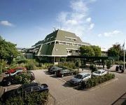
Van der Valk Hotel Vianen
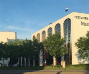
Fletcher Hotel Utrecht Nieuwegein
Van der Valk Hotel Houten
Van der Valk Hotel Utrecht
Epping
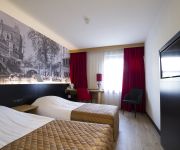
Bastion Hotel Utrecht
Videos from this area
These are videos related to the place based on their proximity to this place.
Paardenmarkt en kermis Vianen 2012
Paardenmarkt Vianen - 10 oktober 2012 Kermis Vianen - 9-13 oktober 2012 - Summer party polyp - Terror - Gone in 60 seconds - Maimi trip - Booster Maxxx J.J. de Voer voor meer informatie...
Sneeuwval 27 december 2014 (Vianen, Utrecht)
Voor het eerst in bijna 2 jaar viel er weer eens sneeuw in midden en zuid Nederland. In delen van Brabant viel er op 27 december lokaal meer dan 15 cm sneeuw. In Vianen (Utrecht) moesten we...
Crossley O-120 dieselmotor in gemaal de Biezen Vianen
Very nice running engine at de Biezen (Vianen near Utrecht Holland). 45/51 bhp at 260 rpm. It is pumping 60.000 liters of water per minute.
Indoorvliegen bij MVC Woerden bij sportcentrum Helsdingenin Vianen
Indoorvliegen bij MVC Woerden bij sportcentrum Helsdingenin Vianen.
Workshop smeden - 21 april 2012 - Vianen
Op zaterdag 21 april 2012 werd door de ZWO-groep een Plantjesmarkt en workshops georganiseerd in en rond De Hoeksteen. Van de workshop smeden waarin Gerwin onder leiding van Adriaan een ...
Sinterklaashuis Vianen 2014
Sinetrklaashuis Vianen 2014 mede mogelijk gemaakt door www.stardrift-verhuur.nl.
Paardenmarkt Vianen
De Paardenmarkt in Vianen is hét jaarlijkse evenement in de regio voor paardenliefhebbers, maar ook van oudsher een moment om elkaar te ontmoeten. Om de dag door te brengen rondom de ring,...
Just - Sweet child o mine @ Stadshof Live Vianen
Dit was ons finalenummer van een te gekke avond met een geweldig publiek!!! Met dank aan Stadshof Live Vianen en Stichting Scato, die geheel vrijwillig voor ons het geluid deden!
Zwarte Pieten Groove met groep 1 en 2 de Wegwijzer Vianen 5 december 2013 tijdens Sinterklaasfeest
Groep 1 en 2 danst op de Zwarte Pieten Groove op basisschool de Wegwijzer in Vianen tijdens het Sinterklaasfeest op 5 december 2013.
Videos provided by Youtube are under the copyright of their owners.
Attractions and noteworthy things
Distances are based on the centre of the city/town and sightseeing location. This list contains brief abstracts about monuments, holiday activities, national parcs, museums, organisations and more from the area as well as interesting facts about the region itself. Where available, you'll find the corresponding homepage. Otherwise the related wikipedia article.
Hagestein
Hagestein is a small city in the municipality of Vianen, Utrecht, Netherlands, on the Lek River, about 2 km east of Vianen. It received city rights in 1382. Hagestein was a separate municipality between 1818 and 1986, when it merged with Vianen. Until then, it was a part of the province of South Holland.
Mediumwave transmitter Lopik
The Mediumwave transmitter Lopik is a medium wave broadcasting facility near Lopik in the Netherlands. It works on 675 kHz and uses as aerial a 196 metre high guyed steel framework mast, which was built in 1938 and which is insulated against ground. Until April 21, 2004 there was a smaller guyed steel framework mast for the mediumwave frequency 1332 kHz. This mast should not be confused with the nearby Gerbrandy tower, which is used for FM- and TV-broadcasting.
Everdingen
Everdingen is a former municipality in the Netherlands. Together with Zijderveld and Hagestein, it has been part of Vianen municipality since 1986. It enjoys a strategic position on the Lekdijk to the south of the river Lek. The eastern limits of Everdingen are marked by the Diefdijk, which also marks the municipal and provincial boundaries. Fort Everdingen was built nearby during the 19th century as a part of the Hollandse Waterlinie.
Lunetten
Lunetten is a neighbourhood in the southeastern part of the city of Utrecht, that has approximately 12,000 inhabitants. It is mainly a residential area, since there is no significant industry present. Lunetten was constructed as an urban experiment mostly during the 1970s and 80s. It was designed and planned by a combination of students of architecture and urban planning and the then foreseen future inhabitants.
Vreeswijk
Vreeswijk is a former village and municipality in the Dutch province of Utrecht. The municipality merged with Jutphaas in 1971, and is now the southern half of the town of Nieuwegein. The former village was located on the Lek River, near where it is crossed by the Merwede Canal. The old village centre around the locks has been preserved reasonably well. This lock is said to be the oldest example of a pound lock in Europe.
Jutphaas
Jutphaas is a former village and municipality in the province of Utrecht in the Netherlands. The municipality merged with Vreeswijk in 1971, and is now the northern half of the town of Nieuwegein. The former village was located on the Merwedekanaal, and some of the buildings can still be found there, surrounded by the suburbs of Nieuwegein.
Oud-Wulven
Oud-Wulven is a hamlet in the Dutch province of Utrecht. It is located just north of the village of Houten, and is part of that municipality. Oud-Wulven was originally a heerlijkheid (fiefdom). In 1545 it was combined with the neighbouring heerlijkheid Waaijen. "Oud-Wulven en Waaijen" remained a separate entity until 1811, when it merged into Houten.
Heemstede, Utrecht
Heemstede is a hamlet in the central Netherlands. It is located 3 km west of Houten, Utrecht. The hamlet is known for Heemstede Castle (1645). Until 1812, Heemstede was a separate heerlijkheid. Between 1818 and 1857 it was a part of Oud-Wulven, until that municipality merged with Houten. The area had 75 inhabitants around 1850.
Meerkerk
Meerkerk is a town in the Dutch province of South Holland. It is a part of the municipality of Zederik, and lies about 9 km north of Gorinchem. In 2001, the town of Meerkerk had 2281 inhabitants. The built-up area of the town was 0.71 km², and contained 818 residences. The statistical area "Meerkerk", which also can include the surrounding countryside, has a population of around 2310.
Hei- en Boeicop
Hei- en Boeicop is a small village in the Dutch province of South Holland. It is a part of the municipality of Zederik, and lies about 9 km south of IJsselstein. The statistical area "Hei- en Boeicop", which also can include the surrounding countryside, has a population of around 940. The village consists of a long row of houses on two sides of a small canal. The canal separates the Polder Boeicop to the north from the Polder Heicop to the south.
Leerbroek
Leerbroek is a village in the Dutch province of South Holland. It is a part of the municipality of Zederik, and lies about 9 km northeast of Gorinchem. In 2004, the village of Leerbroek had 1560 inhabitants. The built-up area of the village was 0.096 km, and contained 197 residences. The statistical area "Leerbroek", which also can include the surrounding countryside, has a population of around 980.
Lexmond
Lexmond is a town in the Dutch province of South Holland. It is a part of the municipality of Zederik, and lies about 7 km south of IJsselstein. In 2001, the town of Lexmond had 1296 inhabitants. The built-up area of the town was 0.24 km², and contained 518 residences. The statistical area "Lexmond", which also can include the surrounding countryside, has a population of around 1780. Lexmond was a separate municipality until 1986, when it became part of Zederik.
Achterdijk, South Holland
Achterdijk is a hamlet in the Dutch province of South Holland. It is a part of the municipality of Zederik, and lies about 7 km northeast of Gorinchem. The statistical area "Achterdijk", which consists of the hamlet and the surrounding countryside, has a population of around 210. The name of the hamlet means "Back Dike"; it refers to the dike between Leerdam and Arkel.
Rhenoy
Rhenoy is a village in the Dutch province of Gelderland. It is a part of the municipality of Geldermalsen and is situated about 13 km east of Gorinchem, between Geldermalsen and Leerdam. The village has just over 670 inhabitants. In 2001 it had 510 inhabitants. The name of the village is probably derived from Rhenus (Rhine). The built-up area of the town was 0.17 km² and contained 201 residences.
Oog in Al
Oog in Al is a residential area in the west of the city of Utrecht in the Netherlands. The Amsterdam-Rhine Canal, the Merwede Canal and the Leidse Rijn canal form the area's limits, rendering it a man-made island in the shape of a triangle. From the 12th century, the area of present-day Oog in Al was part of the 'Trechter Weide', the communal meadow of the city of Utrecht.
Tolsteeg
Tolsteeg is a neighbourhood in the south of the Dutch city of Utrecht. Tolsteeg was a separate municipality between 1818 and 1823, when it was merged with Utrecht.
Schonauwen
Schonauwen is a former castle in the Dutch province of Utrecht. It is located on the southern outskirts of the town of Houten, surrounded by new buildings. Until the end of the 18th century, Schonauwen was a separate heerlijkheid (fiefdom). When the country was divided into municipalities by the French, Schonauwen was added to the municipality of Houten, but it became a separate municipality in 1818. In 1857 it was merged back into Houten.
Christelijk Gymnasium Utrecht
The Christelijk Gymnasium Utrecht is a Dutch grammar school in Utrecht, in the Netherlands. It was founded in 1897. The Koni or West is building of the school, located on the Koningsbergerstraat in Lombok, which explains its nickname Koni. The school is located in the building of a former secondary school, the De Bruijne Lyceum. The Diac or Oost is the former building. It is located in the city centre, on the Oudegracht and near the Ledig Erf and the Twijnstraat.
Vijfheerenlanden
Vijfheerenlanden, literally "land with five Lords" is an area in the provinces of South Holland and (since 2002) Utrecht in the Netherlands. The area also borders on two other Dutch provinces: Gelderland to the east, and North Brabant to the south. On its western border is the Alblasserwaard, an area in South Holland, and on its eastern border the Tielerwaard, an area in Gelderland.
Zijderveld
Zijderveld is a village in the Dutch province of Utrecht (province). It is located about 6 km northeast of Leerdam, in the municipality of Vianen.
Schoonrewoerd
Schoonrewoerd is a village in the western Netherlands. It is located in the municipality of Leerdam, South Holland, about 25 km south of Utrecht. Leerdammer cheese is produced in Schoonrewoerd. It was a separate municipality until 1986, when it became part of Leerdam.
Anna van Rijn College
Anna van Rijn College is a secondary school in the village of Nieuwegein. The school consists out of three different entities at three different locations teaching all forms of Dutch secondary education. The current director is drs. A.G. Popma.
Kanaleneiland
Kanaleneiland is a district within the Southwest section of the Dutch city of Utrecht. It was created in the massive expansion of the city in the 1960s. Today it is listed as one of 40 "problem neighborhoods" that require extra attention by the Dutch Ministry of Housing. Kanaleneiland's residents have low levels of employment, health, and education.
Fectio
Fectio was a Roman castellum in the province Germania Inferior established in the year 4 or 5 AD. It was located at the place where the river Vecht (Fectio) branched off from the Rhine, leading to Lake Flevo, which was later to become the Zuiderzee. This was near the modern village of Vechten in the municipality Bunnik, Utrecht, Netherlands. Under emperor Claudius, Fectio became part of the Limes Germanicus.
Vaartse Rijn
The Vaartse Rijn is a canal connecting the city of Utrecht with Nieuwegein and the Lek river in the Dutch province of Utrecht. The Vaartse Rijn was formerly a major shipping route between Utrecht and the Rhine basin.


