Safety Score: 3,3 of 5.0 based on data from 9 authorites. Meaning please reconsider your need to travel to Netherlands.
Travel warnings are updated daily. Source: Travel Warning Netherlands. Last Update: 2024-05-02 08:23:34
Discover Fransegat
The district Fransegat of Veenendaal in Gemeente Veenendaal (Provincie Utrecht) is a subburb in Netherlands about 37 mi south-east of Amsterdam, the country's capital city.
If you need a hotel, we compiled a list of available hotels close to the map centre further down the page.
While being here, you might want to pay a visit to some of the following locations: Arnhem, 's-Hertogenbosch, Utrecht, Lelystad and Kranenburg. To further explore this place, just scroll down and browse the available info.
Local weather forecast
Todays Local Weather Conditions & Forecast: 10°C / 50 °F
| Morning Temperature | 12°C / 53 °F |
| Evening Temperature | 10°C / 50 °F |
| Night Temperature | 8°C / 47 °F |
| Chance of rainfall | 3% |
| Air Humidity | 95% |
| Air Pressure | 1008 hPa |
| Wind Speed | Moderate breeze with 12 km/h (7 mph) from North-East |
| Cloud Conditions | Overcast clouds, covering 100% of sky |
| General Conditions | Moderate rain |
Saturday, 4th of May 2024
14°C (58 °F)
9°C (49 °F)
Light rain, light breeze, overcast clouds.
Sunday, 5th of May 2024
14°C (58 °F)
10°C (49 °F)
Light rain, gentle breeze, overcast clouds.
Monday, 6th of May 2024
17°C (62 °F)
12°C (54 °F)
Light rain, gentle breeze, overcast clouds.
Hotels and Places to Stay
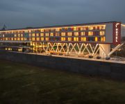
Van der Valk Hotel Veenendaal
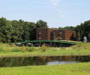
Hampshire Boshotel Overberg
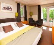
t Paviljoen
Parkhotel Hugo de Vries
Videos from this area
These are videos related to the place based on their proximity to this place.
Veenendaal Verleidt Simon
De film gaat over Simon. Simon is 23 jaar, woont nog thuis, heeft een vriendin maar heeft amper tijd voor haar vanwege de vele uren die hij dagelijks aan zijn werk besteedt. Overdag zit hij...
3FM Serious Request welkom in Veenendaal
bijlage bij bidbook van Veenendaal voor de ontvangst van 3FM Serious Request in 2016 Headhunterz - Once Again [Revealed Recordings] OUT NOW! http://hwl.dj/OnceAgain-BP ...
De Reünie te Veenendaal - Multivision 3D animatie
3D animatie van het project De Reünie te Veenendaal i.o.v.: VolkerWessels Vastgoed.
Zeepkistenrace Veenendaal, 5 mei 2010
Terug van weggeweest: de oer-Hollandse zeepkistenrace! 19 deelnemers zorgden met hun zelfgemaakte zeepkisten op 5 mei voor een waar spektakel in Veenendaal. Hier een foto-impressie.
Marmernl Trading Veenendaal Nederland, Marmer, travertin, Graniet,rosso Verona, Karia Black, Saros,
Marmernl Trading Veenendaal Nederland, Botticino, Bianca Carrara, beige marmer, turks hardsteen, hardsteen, zwart marmer, wit marmer, Emparador, Noche, medium travertin, geel travertin, rood...
Sing-in 150913 Pniëlkerk Veenendaal Opwekking 501 Laat Uw vrede heersen
Sing-in 150913 Pniëlkerk Veenendaal Opwekking 501 Laat Uw vrede heersen Wie vertrouwen op de Heer zijn als de berg Sion.
Sing-in Pniëlkerk Veenendaal Opwekking 414 U zond Uw zoon
Sing-in Pniëlkerk Opwekking 414 U zond Uw zoon.
U&I box voor War Child 2013 Veenendaal
Radio 538 was in Veenendaal voor War Child er is alleen in Veennedaal al € 45.000 opgehaald waar van € 8000.- met de U&I box Totaal is er 1,2 miljoen op gehaald voor de kind soldaten.
Videos provided by Youtube are under the copyright of their owners.
Attractions and noteworthy things
Distances are based on the centre of the city/town and sightseeing location. This list contains brief abstracts about monuments, holiday activities, national parcs, museums, organisations and more from the area as well as interesting facts about the region itself. Where available, you'll find the corresponding homepage. Otherwise the related wikipedia article.
Amerongen
Amerongen is a village in the central Netherlands on the border of the Utrecht Hill Ridge. It lies about 7 km south west of Veenendaal (10.5 km by road). The landscape rises from the flat water meadows of the Nederrijn (Lower Rhine) to the Utrecht Hill Ridge ("Utrechtse Heuvelrug"). The highest point in the western Netherlands is located 2 km east of the village. The Amerongense Berg (Amerongen Mountain) has a height of 69 metres above sea level.
Leersum
Leersum is a town in the Dutch province of Utrecht. It is a part of the municipality of Utrechtse Heuvelrug, and lies about 9 km west of Veenendaal. In 2001, the town of Leersum had 6013 inhabitants. The built-up area of the town was 1.44 km², and contained 2465 residences. Until 2006, there was a separate municipality Leersum, covering both the village of Leersum and Darthuizen.
Betuwe
The Betuwe (from batawjō, "good island", from Germanic bat- "good, excellent" and awjō "island, land near water") is an area in the Netherlands in the province of Gelderland.
De Glind
De Glind is a small village near Barneveld in the middle of Netherlands, in the province Gelderland. De Glind Digitaal Website
Lunteren
Lunteren is a place in Gelderland Province, Netherlands. It has a railway station and the train travels between Amersfoort and Ede. It is known also because of three Conference Centres in the vicinity, like Het Bosgoed, which hosting especially academic conferences and De Werelt Congress Hotel. It is also known because of the Geographical Center of the Netherlands, located northeast of the village. Lunteren was a separate municipality until 1818, when it was merged with Ede.
De Klomp
De Klomp is a location in the municipality of Ede, with a railway station called "Veenendaal-De Klomp railway station". It is located in the Dutch province of Gelderland.
Overberg, Netherlands
Overberg is a small village in the Dutch province of Utrecht. It is a part of the municipality of Utrechtse Heuvelrug. It is located on both sides of the Utrecht-Rhenen railway line, but has no station. It is around 5 km west of the centre of Veenendaal, and 25 km east of the city of Utrecht.
De Mars
De Mars is a hamlet in the Dutch province of Gelderland. It is a part of the municipality of Buren, and lies about 8 km south of Veenendaal. The area belonging to De Mars was originally located north of the Rhine river. However, the river bed now runs along a new route north of De Mars. The statistical area "De Mars", which also can include the surrounding countryside, has a population of around 270.
Eck en Wiel
Eck en Wiel is a village in the Dutch province of Gelderland. It is a part of the municipality of Buren, and lies about 9 km southwest of Veenendaal. In 2001, the village of Eck en Wiel had 820 inhabitants in the built-up area. The built-up area of the town was 0.18 km², and contained 324 residences. The statistical area "Eck en Wiel", which also can include the peripheral parts of the village, as well as the surrounding countryside, has a population of around 1720.
Ingen, Netherlands
Ingen is a town in the Dutch province of Gelderland. It is a part of the municipality of Buren, and lies about 9 km southwest of Veenendaal. Before 1999 the town was part of the municipality Lienden from 1818 till 1999. The houses are widely spread into a bowl form. The houses link to the townships De Ganzert and Eck en Wiel in the West.
Lienden
Lienden is a town in the Dutch province of Gelderland. It is a part of the municipality of Buren, and lies about 9 km south of Veenendaal. Lienden was a separate municipality until 1999, when it was merged with Buren. In 2007, the town of Lienden had 6230 inhabitants. The built-up area of the town was 0.81 km², and contained 1147 residences.
Ommeren
Ommeren is a town in the Dutch province of Gelderland. It is a part of the municipality of Buren, and lies about 9 km northeast of Tiel. In 2001, the town of Ommeren had 180 inhabitants. The built-up area of the town was 0.047 km², and contained 72 residences. The statistical area "Ommeren", which also can include the peripheral parts of the village, as well as the surrounding countryside, has a population of around 460.
Kesteren
Kesteren is a town in the Dutch province of Gelderland. It is a part of the municipality of Neder-Betuwe, and lies about 8 km southwest of Wageningen. Kesteren was a separate municipality until 2002, when it merged with Dodewaard and Echteld. The new municipality was first called "Kesteren", but changed its name to Neder-Betuwe in 2003. In 2009, the town of Kesteren had 5017 inhabitants. The built-up area of the town was 0.9573 km², and contains 1540 residences.
Echteld
Echteld is a village in the Dutch province of Gelderland. It is a part of the municipality of Neder-Betuwe, and lies about 6 km east of Tiel. Echteld was a separate municipality between 1818 and 2002, when it was merged with Kesteren. Before 1818, the municipality was called Ochten, after a neighbouring village. In 2001, the village of Echteld had 514 inhabitants. The built-up area of the village was 0.15 km², and contained 207 residences.
Groenhorst College
The Groenhorst College is an education centre that has 11 locations in the centre of Netherlands: Almere, Barneveld, Bilthoven, Dronten, Ede (2 locations, including the management), Emmeloord (2 locations), Lelystad, Maartensdijk, Nijkerk and Velp. It offers several 'green' high school programmes, apprenticeship programmes on nutrition and nature & environment, education for adults, and several courses.
Grebbe line
The Grebbe Line was a forward defence line of the Dutch Water Line, based on inundation. The Grebbe Line ran from the Grebbeberg in Rhenen northwards until the IJsselmeer.
Lagerwey Wind
Lagerwey Wind BV is a Dutch company. It is located in Barneveld and is focussed on the design of modern direct drive wind turbines. In 2009 the first L82-2MW was put into operation in Germany, followed by India. In 2012 2 units of the L93-2.6MW were put in operation in Lelystad (the Netherlands). More units are planned. The models that can be delivered now are: L82-2.0MW L93-1.5MW L93-2.6MW L100-2.5MW L100-3.0MW
Battle of the Grebbeberg
The Battle of the Grebbeberg (Dutch: Slag om de Grebbeberg) was a major engagement during the Battle of the Netherlands, which was a part of the World War II Operation Fall Gelb in 1940.
Lukkien Heliport
Lukkien Heliport or Ede heliport is a small private heliport on top of the office building of Lukkien, a Dutch producer of marketing communication services (advertising). It is located in the middle of the country alongside the A12 motorway just south-west of Ede, The Netherlands. As it is a private facility, explicit permission is needed to use the heliport. The main user of the facility is the owner to ferry clients to and from Amsterdam Schiphol Airport or other locations.
Cunerakerk
The Cunerakerk is the main church of Rhenen, Netherlands. The church is large because in the Middle Ages it was an important pilgrimage. In the church were stored the relics of the Saint Cunera since the 8th century. The tower has a height of 81.8 meters.
Christelijke Hogeschool Ede
The Christelijke Hogeschool Ede (in English Christian University of Applied Sciences is added to the Dutch name; abbreviation remains CHE) is a Dutch vocational university, based in Ede in the central Netherlands. The CHE has a clear Christian basis: the Bible as norm and source of inspiration.
Castle Amerongen
The Castle Amerongen was built in 1673 on the site of a previous stronghold that had been burned in 1672 by the French.
Military War Cemetery Grebbeberg
Military War Cemetery Grebbeberg is a graveyard where 799 military personnel and 1 civilian were buried, who died during the invasion of the Netherlands by the Germans in May 1940. The cemetery is located on the Grebbeberg near Rhenen. More than 400 of the military interred here fell during the Battle of the Grebbeberg.
Doesburgermolen
The Doesburgermolen is a post mill in the hamlet of Doesburgerbuurt in the community of Ede, Netherlands It is considered to be the oldest post mill in the Netherlands; in its present form it was probably build around 1630. It underwent a major restoration around 1970. The mill is operated by volunteers and is still used for grinding grain.
De Zwaan, Lienden
De Zwaan (The Swan) is a tower mill in Lienden, the Netherlands, which is in working order. The mill was built in 1644 and is listed as a Rijksmonument, number 25834.


