Safety Score: 3,3 of 5.0 based on data from 9 authorites. Meaning please reconsider your need to travel to Netherlands.
Travel warnings are updated daily. Source: Travel Warning Netherlands. Last Update: 2024-05-14 08:25:02
Delve into Varik
Varik in Gemeente Neerijnen (Provincie Gelderland) with it's 895 habitants is a town located in Netherlands about 43 mi (or 69 km) south-east of Amsterdam, the country's capital town.
Time in Varik is now 12:57 PM (Tuesday). The local timezone is named Europe / Amsterdam with an UTC offset of 2 hours. We know of 10 airports closer to Varik, of which 5 are larger airports. The closest airport in Netherlands is Eindhoven Airport in a distance of 26 mi (or 42 km), South. Besides the airports, there are other travel options available (check left side).
There are several Unesco world heritage sites nearby. The closest heritage site in Netherlands is Rietveld Schröderhuis (Rietveld Schröder House) in a distance of 20 mi (or 33 km), North-West. We saw 7 points of interest near this location. In need of a room? We compiled a list of available hotels close to the map centre further down the page.
Since you are here already, you might want to pay a visit to some of the following locations: 's-Hertogenbosch, Utrecht, Heeze, Arnhem and Kranenburg. To further explore this place, just scroll down and browse the available info.
Local weather forecast
Todays Local Weather Conditions & Forecast: 24°C / 75 °F
| Morning Temperature | 14°C / 58 °F |
| Evening Temperature | 17°C / 63 °F |
| Night Temperature | 14°C / 58 °F |
| Chance of rainfall | 2% |
| Air Humidity | 61% |
| Air Pressure | 1005 hPa |
| Wind Speed | Moderate breeze with 12 km/h (7 mph) from North-West |
| Cloud Conditions | Clear sky, covering 7% of sky |
| General Conditions | Moderate rain |
Wednesday, 15th of May 2024
18°C (64 °F)
12°C (54 °F)
Light rain, gentle breeze, overcast clouds.
Thursday, 16th of May 2024
16°C (60 °F)
13°C (55 °F)
Moderate rain, gentle breeze, overcast clouds.
Friday, 17th of May 2024
17°C (63 °F)
13°C (55 °F)
Moderate rain, gentle breeze, overcast clouds.
Hotels and Places to Stay
Van der Valk Hotel Tiel
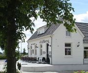
Oud Maren Hotel - Brasserie
Videos from this area
These are videos related to the place based on their proximity to this place.
1958 Heerewaarden
Dorpsfilm uit 1958 van Heerewaarden, deze films zijn tot stand gekomen in het kader van de Filmactie opgezet door J.W.L. Adolfs uit Enschede in de jaren 1949-1970. Deze film heeft geen geluid.
Lithse Ham Cross 2014 (MTB)
Registratie van de MTB-wedstrijd van de Lithse Ham Cross op 1 februari 2014. http://www.tclith.nl 1. Erik Dekker 2. Rick van den Hanenberg 3. Johan de Rouw 4. Dennis de Bijl 5. Wannes Maris...
1952 Heerewaarden.
Dorpsfilm uit 1952 van Heerewaarden, deze films zijn tot stand gekomen in het kader van de Filmactie opgezet door J.W.L. Adolfs uit Enschede in de jaren 1949-1970. Deze film heeft geen geluid.
30 april 2008 - Circus Fantasia in Heerewaarden
Op 30 april 2008 verzorgde vele vrijwilligers van verenigingen een erg leuke koninginnendag in Heerewaarden met als thema Circus. Kitty Hagen, Gilberto da Silva Virgílio en de medewerkers...
Showdance afsluiting 1010 Heerewaarden
Showdance tijdens de nieuwsjaarsreceptie en afsluiting van het feestjaar 1010 Heerewaarden die op zaterdag 5 januari werd verzorgd door showdancegroep o.l.v. Tatjana Maszchkow.
A Lazy Sunday Afternoon on the water
A short boat trip in the Alem area (NL), where Waal and Maas rivers meet. Shows a view on the St. Andries Lock which connects the two rivers.
Binnenvaartschip Wendy-Dau vaart uit sluis Sint Andries
Sluis St. Andries in het echt zien? Leuk arrangement: http://www.brandweerauto.nu/uitje-land-van-maas-en-waal-bedrijfsuitje-dagje-uit.html Binnenvaartschip Wendy-Dau uit Zwijndrecht vaart...
A walk in the Dutch Sahara
Walking the dogs in a wetlands area located between the Maas and Waal rivers in the Netherlands. This is my first home-made 3D video!
Videos provided by Youtube are under the copyright of their owners.
Attractions and noteworthy things
Distances are based on the centre of the city/town and sightseeing location. This list contains brief abstracts about monuments, holiday activities, national parcs, museums, organisations and more from the area as well as interesting facts about the region itself. Where available, you'll find the corresponding homepage. Otherwise the related wikipedia article.
Kessel, North Brabant
Kessel is a village in the southern Netherlands. It is located in Lith, North Brabant about 12 km northeast of 's-Hertogenbosch on the river Maas. Kessel was a separate municipality until 1821, when it became a part of Alem, Maren en Kessel.
Maren, Netherlands
Maren is a village in the Dutch province of North Brabant. It is located in the municipality of Lith, about 10 km northeast of 's-Hertogenbosch. Maren was a separate municipality until 1821, when it became part of Alem, Maren en Kessel.


