Safety Score: 3,6 of 5.0 based on data from 9 authorites. Meaning please reconsider your need to travel to Mexico.
Travel warnings are updated daily. Source: Travel Warning Mexico. Last Update: 2024-05-04 08:22:41
Delve into Ampliación Adolfo López Mateos
The district Ampliación Adolfo López Mateos of in Ciudad de México is a district located in Mexico a little east of Mexico City, the country's capital town.
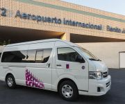
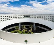
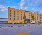
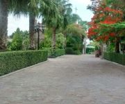
In need of a room? We compiled a list of available hotels close to the map centre further down the page.
Since you are here already, you might want to pay a visit to some of the following locations: Mexico City, Nezahualcoyotl, Los Reyes Acaquilpan, Chicoloapan and Texcoco. To further explore this place, just scroll down and browse the available info.
Local weather forecast
Todays Local Weather Conditions & Forecast: 29°C / 84 °F
| Morning Temperature | 21°C / 70 °F |
| Evening Temperature | 30°C / 86 °F |
| Night Temperature | 22°C / 72 °F |
| Chance of rainfall | 2% |
| Air Humidity | 17% |
| Air Pressure | 1010 hPa |
| Wind Speed | Moderate breeze with 9 km/h (6 mph) from West |
| Cloud Conditions | Clear sky, covering 3% of sky |
| General Conditions | Moderate rain |
Monday, 6th of May 2024
29°C (85 °F)
26°C (78 °F)
Scattered clouds, moderate breeze.
Tuesday, 7th of May 2024
30°C (85 °F)
26°C (79 °F)
Scattered clouds, moderate breeze.
Wednesday, 8th of May 2024
30°C (87 °F)
25°C (78 °F)
Light rain, moderate breeze, few clouds.
Hotels and Places to Stay
Camino Real Aeropuerto México
RAMADA AEROPUERTO MEXICO
NH Collection México City Airport T2
Krystal Urban Aeropuerto
FIESTA INN CENTRO HISTORICO
City Express Cd Mex Central Ab
FIESTA INN PLAZA CENTRAL AEROPUERTO
HOTEL EX HACIENDA VALENCIA
FIESTA INN AEROPUERTO CD. DE MEXICO
Courtyard Mexico City Revolucion
Videos from this area
These are videos related to the place based on their proximity to this place.
Peña Nieto - Nezahualcóyotl, Estado de México 28 abril 2012
VOTA POR TODOS LOS CANDIDATOS A SENADORES Y DIPUTADOS FEDERALES DEL PARTIDO REVOLUCIONARIO INSTITUCIONAL Y DE LA COALICIÓN COMPROMISO POR MÉXICO Enrique ...
Approach and landing MEXICO CITY on CO 737-800 from Houston
Landing 5R at MEX , full downwind and approach Continental 737-824 from Houston CO 424 11-18-09 N26215 1HR 48MIN.
Mexico City Autodromo Skatepark
LOW RESOLUTION PREVIEW ONLY. DVD COMING SOON!!! A day at a skatepark in Mexico City, which is right next to a racetrack used for NASCAR and A1 Gran Prix races with a 50000 capacity pro ...
Quiero Casa Calle 7 Iztacalco
Departamentos de 2 recámaras, baño completo, cocina, estancia/comedor, cuarto de lavado, salón de usos múltiples, sala deportiva, azotea de uso exclusivo, caseta de vigilancia, en la Colonia...
United Express ERJ-145 departing Mexico City
United Express flight 4669 Embraer ERJ-145 takeoff from Mexico City on a flight to Houston, Texas. Gotta love that scenery!!!
Mexicana - Airbus A319 - Landing at Mexico City International Airport
Mexicana Flight 903 for Los Angeles arriving at Mexico City on runway 05R. Filmed from seat 17F. Threshold is about 3000ft from the end, and captain used the entire runway to land, and making...
Quiero Casa Los Alamos III (Iztacalco) – Departamentos de 2 recámaras
Proyecto de departamentos de 2 recámaras, baño completo, salón de usos múltiples, lagunos modelos cuentan con balcón, a sólo 3 calles del metro Puebla, conoce el proyecto completo en...
Landing in Mexico City (HD)
Mexicana Flight 849 landig at MEX on Sep 1, 2009. Taken from seat 14A. (Shorter version)
Videos provided by Youtube are under the copyright of their owners.
Attractions and noteworthy things
Distances are based on the centre of the city/town and sightseeing location. This list contains brief abstracts about monuments, holiday activities, national parcs, museums, organisations and more from the area as well as interesting facts about the region itself. Where available, you'll find the corresponding homepage. Otherwise the related wikipedia article.
Metro Pantitlán
Metro Pantitlán is a station on the Mexico City Metro. It is located in the Iztacalco borough, to the east of downtown Mexico City city centre. The architects were Aurelio Nuño Morales and Isaac Broid. The station logo is the silhouette of two flags; this is because Pantitlán means "between flags" in the Aztec language Nahuatl. Pantitlán station is the most important transfer station on the Mexico City Metro.
Metro Zaragoza
Metro Zaragoza is a station on the Mexico City Metro. It is located in the Colonia 4 arboles and Colonia Puebla neighbourhoods of Venustiano Carranza borough, to the east of downtown Mexico City. It is on Line 1. It is named after General Ignacio Zaragoza and the nearby Avenida Ignacio Zaragoza, and the station logo depicts this Mexican military genius – the hero of the Battle of Puebla – astride his horse.
Metro Mixiuhca
Metro Mixiuhca is a metro station along Line 9 of the Mexico City Metro serving the Colonia Jardín Balbuena and Colonia Magdalena Mixiuhca districts in the Venustiano Carranza borough of Mexico City, Mexico. The station's icon is a silhouette of a woman holding a newborn baby. In the Nahuatl language mixiuhca means "place of births". The origin of this name comes from one of the Aztecs' migration stories.
Metro Boulevard Puerto Aéreo
Boulevard Puerto Aéreo is a station on the Mexico City Metro. It is located in the northeast of Mexico City, near the western perimeter of the Benito Juárez International Airport. It lies alongs Line 1. The station logo depicts the nearby avenue with the same name, Boulevard Puerto Aéreo. The station was opened on 5 September 1969. This station was formerly known as Metro Aeropuerto, and its logo was an aeroplane.
Metro Terminal Aérea
Metro Terminal Aérea is a station along Line 5 of the Mexico City Metro. It is located in the Venustiano Carranza borough of Mexico City. It serves the Colonia Peñón de los Baños and Colonia Moctezuma 2ª sección neighbourhoods. The station's logo – a commercial airliner and control tower – and its name are on account of its proximity to the check-in areas of Benito Juárez International Airport Terminal 1. It was opened on 19 December 1981. This station has a travel agency and a mural.
Autódromo Hermanos Rodríguez
The Autódromo Hermanos Rodríguez ("Rodríguez Brothers Racetrack") is a 4.421 km race track in Mexico City, Mexico, named for the famous racing drivers Ricardo and Pedro Rodríguez. The circuit got its name shortly after it opened when Ricardo Rodríguez died in practice for the non-Championship 1962 Mexican Grand Prix. Ricardo's brother Pedro also lost his life behind the wheel years later.
Metro Moctezuma
Metro Moctezuma is a station on Line 1 the Mexico City Metro. It is located in the Colonia Moctezuma and Colonia Balbuena neighborhoods of the Venustiano Carranza borough, to the northeast of the centre of Mexico City. The station logo portrays a stylised drawing of the feathered headdress of Moctezuma II Xocoyotzin, the penultimate Aztec emperor, for whom the station is named.
Metro Balbuena
Metro Balbuena is a station along Line 1 of the Mexico City Metro. It is located in the Venustiano Carranza borough, to the northeast of the centre of Mexico City and serves the Colonia Jardin Balbuena and Colonia Moctezuma neighborhoods. The station logo depicts the flowers of the neighborhood Jardín Balbuena ("Balbuena's Garden"), named after Bernardo de Balbuena (1568–1627), a Spanish poet who wrote the famous poem "La Grandeza Mexicana". The station was opened on 5 September 1969.
Metro Gómez Farías
Gómez Farías is a station on Line 1 of the Mexico City Metro. It is located in the Colonia Federal and Colonia Gómez Farías neighborhoods of Venustiano Carranza borough, to the northeast of downtown Mexico City. The station logo represents the Mexican Constitution of 1857. Its name is in honour of Valentín Gómez Farías, one of the individuals who drafted that document. The station was opened on 5 September 1969.
Metro Oceanía
Oceanía is a station on the Mexico City Metro. It is located in Mexico City's Venustiano Carranza borough, to the northeast of the city centre. It's a transfer station for Metro Lines 5 and B. It stands on the corner of Avenida Oceanía and Avenida Río Consulado, which is part of the Circuito Interior inner ring-road. The station logo is a kangaroo – an example of the fauna of Oceania.
Metro Deportivo Oceanía
Deportivo Oceanía is a surface metro station in Gustavo A. Madero borough, in México City Mexico. Its represented by a koala clinging to a soccer ball. This metro station is named after nearby Deportivo Oceanía sports center, located north of the city; it offers many sports activities, like Tae Kwon Do, Volleyball, Soccer, with low fares, from $26.00 México Peso to $40. Deportivo Oceanía has facilities for the handicapped, and its located near Avenida 608 avenue.
Palacio de los Deportes
Palacio de los Deportes (English: Palace of Sports) is an indoor arena, located in Mexico City, Mexico, within the sports complex Magdalena Mixhuca Sports City, near the Mexico City International Airport and in front of the Foro Sol, in which sports and artistic events are also celebrated. It is operated by Grupo CIE. The arena seats 17,800, for football and the overall capacity is approximately 20,000.
Foro Sol
Foro Sol (English: Sun Forum) is a sports and concert venue built in 1993 inside the Autódromo Hermanos Rodríguez in eastern Mexico City. It is located 10 minutes away from the Mexico City International Airport and is operated by Grupo CIE. The venue was originally built for staging large music concerts. Initially called the Autódromo, it could accommodate up to 50,000 people.
Metro Hangares
Metro Hangares is a surface metro station along Line 5 of the Mexico City Metro. It is located near the intersection of Fuerza Aérea Mexicana and Correos y Telégrafos in the Colonia Federal neighborhood of the Venustiano Carranza, D.F. borough of Mexico City. Its logo represents a hangar, several of which are inside the nearby Mexico City International Airport.
Metro Velódromo
Metro Velódromo is a metro station located on Line 9 of the Mexico City Metro. It is named after the nearby Agustín Melgar Olympic Velodrome, or bicycle-racing venue, built for the 1968 Summer Olympics that were held in Mexico City. Velódromo is an elevated station built at the portion of Line 9 that branches away from Viaducto Río de La Piedad to follow Eje 3 Sur (Avenida Morelos) when travelling west toward Metro Tacubaya. The station opened on 26 August 1987.
Metro Ciudad Deportiva
Metro Ciudad Deportiva (Spanish: Estación Ciudad Deportiva) is a metro station along Line 9 of the Mexico City Metro. It is named for the nearby the Magdalena Mixhuca Sports City. Magdalena Mixuhca Sports City was enlarged in 1967 as part of the project to create the venues needed for the 1968 Summer Olympics.
Metro Puebla
Metro Puebla is a station on the Mexico City Metro. It is located in the Puebla district of the Iztacalco delegation of Mexico City; both the area it is located in and the station are named for the nearby city of Puebla. The station logo represents some angels, as the city is commonly called The City of Angels. The station is elevated, and has two entrances on opposite sides of the avenue. Street vendors occupy the areas around the station entrances and a bus depot is underneath the metro Line.
Metro Agrícola Oriental
Metro Agrícola Oriental (Spanish: Estación Agrícola Oriental) is a metro station on Line A of the Mexico City Metro system. It opened on 12 August 1991 as did the other stations along the rest of Line A. The logo for the station represents two spikes of wheat. It is an at grade station in the median of Calzada General Ignacio Zaragoza near the intersection of Calle 1 in Colonia Agrícola Oriental of Iztacalco borough. It lies to the east of the Autódromo Hermanos Rodríguez.
Metro Canal de San Juan
Canal de San Juan is a station along Line A of the Mexico City Metro. The logo for the station depicts the bow of an Aztec canoe travelling through a canal. The station was opened on 12 August 1991.
Metro Tepalcates
Tepalcates is a station on the Mexico City Metro. It is located in the Iztapalapa borough, to the east of downtown Mexico City. It is on Line A. It is also the eastern terminus of Metrobús line 2. The station was opened on 12 August 1991. The logo of the station depicts a side view of a pre Hispanic pottery bowl of the types made in Puebla and Tlaxcala. The name tepalcates is Nahuatl for clay or pottery items.
Metro Ricardo Flores Magón
Ricardo Flores Magón is an elevated station on Line B of the Mexico City Metro system. The logo for the station shows a portrait of Ricardo Flores Magón. The station was opened on 15 December 1999.
Metro Romero Rubio
Romero Rubio is an elevated station on Line B of the Mexico City Metro system. The station serves the Colonia Moctezuma 2a Sección and Colonia Romero Rubio neighborhoods of Venustiano Carranza borough in Mexico City. The logo for the station is a bust of Manuel Romero Rubio who was Secretary of the Interior under President Porfirio Díaz and a founding member of the Científicos – a group of advisors to the President. The station was opened on 15 December 1999.
Western Airlines Flight 2605
On October 31, 1979, Western Airlines Flight 2605, a McDonnell Douglas DC-10-10 flying from Los Angeles to Mexico City, landed on a closed runway at Benito Juarez International Airport in early morning fog and burst into flames after striking a parked truck. 72 of the 89 people aboard, including 11 of 13 crew, were killed. The DC-10-10 had been assigned runway 23R but landed on the closed twin runway 23L.
Magdalena Mixhuca Sports City
The Magdalena Mixhuca Sports City is an Olympic Park which was used during the 1968 Summer Olympics. Found in the area of Mexico City known as the Magdalena mixhuca, the Park continues to serve as a venue for cultural, social, and sport events such as events of worship. The Park is administrated by the Government of City. It contains numerous sports venues, most importantly the Sport Palace and it has hosted important events, most prominently the 1968 Summer Olympics.
Agustín Melgar Olympic Velodrome
The Agustín Melgar Olympic Velodrome is a velodrome located in the Magdalena Mixhuca Sports City sports complex located in Mexico City, Mexico. It hosted the track cycling events for the 1968 Summer Olympics.


