Discover Berg
The district Berg of Leihof in Berg (Mersch) is a district in Luxembourg about 14 mi north of Luxembourg, the country's capital city.
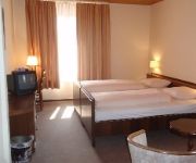
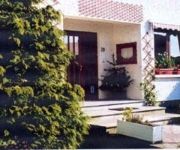
Looking for a place to stay? we compiled a list of available hotels close to the map centre further down the page.
When in this area, you might want to pay a visit to some of the following locations: Schieren, Bissen, Ettelbruck, Erpeldange and Niederfeulen. To further explore this place, just scroll down and browse the available info.
Local weather forecast
Todays Local Weather Conditions & Forecast: 23°C / 74 °F
| Morning Temperature | 12°C / 54 °F |
| Evening Temperature | 23°C / 74 °F |
| Night Temperature | 15°C / 59 °F |
| Chance of rainfall | 4% |
| Air Humidity | 61% |
| Air Pressure | 1003 hPa |
| Wind Speed | Gentle Breeze with 9 km/h (5 mph) from West |
| Cloud Conditions | Scattered clouds, covering 44% of sky |
| General Conditions | Moderate rain |
Thursday, 2nd of May 2024
13°C (55 °F)
9°C (48 °F)
Moderate rain, moderate breeze, overcast clouds.
Friday, 3rd of May 2024
12°C (54 °F)
8°C (46 °F)
Light rain, moderate breeze, overcast clouds.
Saturday, 4th of May 2024
14°C (58 °F)
8°C (46 °F)
Light rain, moderate breeze, overcast clouds.
Hotels and Places to Stay
Dahm
du Parc
Hostellerie Val Fleuri
Videos from this area
These are videos related to the place based on their proximity to this place.
Luxembourg City in White, Black and Red
Luxembourg City is the Capital of the Grand Duchy of Luxembourg. The town has about 107.247 inhabitants, which call their homtown usually only "D'Stad" ("The Town"). Climate and biodiversity...
Luxemburgo City + Castelo de Vianden - LilouTrip
Quer saber como foi o meu dia em Luxemburgo? E ter uma ideia de como é um castelo por dentro? Assista! Veja também: LilouTrip - Amsterdam: http://youtu.be/ozjtgC-SkCk LilouTrip - Bélgica:...
Eyefly Trip - maiden flight
Maiden flight of my eyefly.info mini quad: "TRIP". Just quickly filmed with the iphone, tried to stay in frame the best i could... First Impressions: Naze32 is nice and stable out of the box,...
A Tour of Luxembourg | Matt and Cath's Road Trip
We explored some of the little towns in Luxembourg (but didn't actually go to the capital... oops) and climbed lots of hills, towers and castles. Next up on the road trip is Frankfurt!
Gopro-Holiday Edit
Edited with sony vegas pro and filmed with the gopro HD hero 3 black edition.The spots are in Luxembourg.
Grouss Botz
http://groussbotz.lu Do you want to be part of the Luxembourg Spring Clean up that is happening across many communes in the country? Have a look at the video and see more at www.groussbotz.lu....
150 Joer eisebunn zu Lëtzebuerg - 25. Januari 2009: D'Nostalgie um zuch: 2 - Diesel (cab ride)
The first event for the 150th anniversary of the Luxembourgian railways was held on Januari 25, 2009: Commuter trips on the Attert line between Ettelbruck and Bissen with steam locomotive 5519...
Passage à niveau dans Ettelbrück-Schieren (Luxembourg)
http://www.paypro.nl/producten/Eboek_Stap_Voor_Stap_Een_Modelspoorbaan_Bouwen__INTRODUCTIEAANBOD/14159/34567 Level crossing in the village Ettelbrück-Schieren in Luxembourg.
Videos provided by Youtube are under the copyright of their owners.
Attractions and noteworthy things
Distances are based on the centre of the city/town and sightseeing location. This list contains brief abstracts about monuments, holiday activities, national parcs, museums, organisations and more from the area as well as interesting facts about the region itself. Where available, you'll find the corresponding homepage. Otherwise the related wikipedia article.
Alzette
The Alzette is a river with a length of 73 kilometers in France and Luxembourg. It is a right tributary of the Sauer. It rises in Thil near the town Villerupt in the Meurthe-et-Moselle département, France. It crosses the border with Luxembourg after a few kilometres. At Lameschmillen it is joined by the Mess. It flows through the Luxembourgish towns Esch-sur-Alzette, Luxembourg City and Mersch, and empties into the Sauer near Ettelbruck. The Sauer is a tributary to the Moselle.
Ettelbruck
Ettelbruck is a commune with city status in central Luxembourg, with a population of approximately 7,500. As of 2005, the town of Ettelbruck itself, which lies in the east of the commune, has a population of 6,191. The town of Warken and Grentzingen are also within the commune. Until 1850, both Erpeldange Schieren were part of the Ettelbruck commune as well, but both towns were detached from Ettelbruck by law on 1 July 1850.
Bissen
Bissen is a commune and town in central Luxembourg, in the canton of Mersch. It is situated on the river Attert. As of 2010, the town of Bissen, which lies in the east of the commune, has a population of 2,871. Bissen is home to a steel factory, operated by Arcelor, the world's second-largest steel manufacturer.
Attert (river)
The Attert is a river flowing through Belgium and Luxembourg, left tributary of the Alzette. Its length is 38 km, of which 32 km are in Luxembourg, and 6 km in Belgium. Its source is in Nobressart, north-west of Arlon, in the Belgian province Luxembourg. It flows into the river Alzette at Colmar-Berg. It flows through the village of Attert in Belgium, and the towns of Redange, Useldange, Boevange-sur-Attert, and Bissen in Luxembourg.
Erpeldange
Erpeldange is a commune and small town in north-eastern Luxembourg. It lies along the river Sauer, between Ettelbruck and Diekirch. It is part of the canton of Diekirch, which is part of the district of Diekirch. As of 2001, the town of Erpeldange, which lies in the centre of the commune, has a population of 818.
Feulen
Feulen is a commune in central Luxembourg. It is part of the canton of Diekirch, which is part of the district of Diekirch. The commune's administrative centre is Niederfeulen. Towns within the commune include Niederfeulen and Oberfeulen.
Schieren
Schieren is a commune and town in central Luxembourg. It is part of the canton of Diekirch, which is part of the district of Diekirch. As of 2001, the town of Schieren, which lies in the west of the commune, has a population of 1,358. Schieren was formed on 1 July 1850, when it was detached from the commune of Ettelbruck, along with the commune of Erpeldange. The law forming Schieren was passed on 22 January 1850. In 1894, Schieren established a fire station with five volunteer firefighters.
Colmar-Berg
Colmar-Berg is a commune and town in central Luxembourg, in the canton of Mersch. It is situated at the confluence of the rivers Attert and Alzette. As of 2005, the town of Colmar-Berg, which lies in the east of the commune, has a population of 1,711. Colmar-Berg is the site of the Grand Duke of Luxembourg's principal residence, Berg Castle. It is also the site of a Goodyear tyre factory. The commune was known as simply 'Berg' until 25 March 1991.
Wark (river)
The Wark is a river flowing through Luxembourg, joining the Alzette at Ettelbruck. It flows through the towns of Mertzig, Feulen, Welscheid and Warken.
Ingeldorf
Ingeldorf is a small town in the commune of Erpeldange, in central Luxembourg. As of 2005, the town has a population of 805.
Warken
Warken is a town in the commune of Ettelbruck, in central Luxembourg. As of 2007, the town has a population of 1,670 and lies near the Wark River. Warken is a part of Ettelbruck and is split in five departments: Cité Bourschterbach, Cité Warkdall, Cité Breechen. rue de Welscheid and rue de Buerden.
Berg, Luxembourg
Berg is a village in the commune of Betzdorf, in eastern Luxembourg. As of 2001, the village had a population of 88. It is the administrative centre of Betzdorf commune.
Berg Castle
Berg Castle, also called Colmar-Berg, is the principal residence of the Grand Duke of Luxembourg. It is situated in the town of Colmar-Berg, in central Luxembourg, near the confluence of the Alzette and the Attert, two of Luxembourg's most important rivers.
Moesdorf
Moesdorf is a small town in the commune of Mersch, in central Luxembourg. As of 2005, the town has a population of 335.
Pettingen
Pettingen is a village in the commune of Mersch, in central Luxembourg. As of 2005, the village has a population of 198. Pettingen Castle in the centre of the village is one of the best preserved fortified castles in the country.
Reckange
Reckange is a small town in the commune of Mersch, in central Luxembourg. As of 2005, the town has a population of 587.
Cruchten
Cruchten is a small village in the commune of Nommern, in central Luxembourg. As of 2005, the village has a population of 389.
Niederfeulen
Niederfeulen is a small town in the commune of Feulen, in central Luxembourg. As of 2005, the town has a population of 1,092. currently population grow to 1321,male-female ratio is 1025 female per 1000 male.
Stade Am Deich
Stade Am Deich is a football stadium in Ettelbruck, in central Luxembourg. It is currently the home stadium of FC Etzella Ettelbruck. The stadium has a capacity of about 2,020.
Ettelbruck railway station
Ettelbruck railway station is a railway station serving Ettelbruck, in central Luxembourg. It is operated by Chemins de Fer Luxembourgeois, the state-owned railway company. The station is situated on Line 10, which connects Luxembourg City to the centre and north of the country. Ettelbruck is a junction, with the main line heading further northwards, towards Gouvy and Wiltz, and a branch line connecting to Diekirch.
Cruchten railway station
Cruchten railway station is a railway station serving the town of Cruchten, in the commune of Nommern, in central Luxembourg. It is operated by Chemins de Fer Luxembourgeois, the state-owned railway company. The station is situated on Line 10, which connects Luxembourg City to the centre and north of the country.
Colmar-Berg railway station
Colmar-Berg railway station is a railway station serving Colmar-Berg, in central Luxembourg. It is operated by Chemins de Fer Luxembourgeois, the state-owned railway company. The station is situated on Line 10, which connects Luxembourg City to the centre and north of the country.
Schieren railway station
Schieren railway station is a railway station serving Schieren, in central Luxembourg. It is operated by Chemins de Fer Luxembourgeois, the state-owned railway company. The station is situated on Line 10, which connects Luxembourg City to the centre and north of the country.
Pettingen Castle
Pettingen Castle (French: Château de Pettange) is located in the village of Pettingen some 4 km north of Mersch in central Luxembourg. It is one of the best preserved fortified castles in the country.
Erpeldange Castle
Erpeldange Castle, located in the town of the same name in north-eastern Luxembourg, now houses the administrative offices for the Commune of Erpeldange, with its grounds open to the public. It has a history dating back to the 13th century.


