Delve into Figtree
The district Figtree of Wollongong in Wollongong (New South Wales) is a subburb in Australia about 114 mi north-east of Canberra, the country's capital town.
If you need a hotel, we compiled a list of available hotels close to the map centre further down the page.
While being here, you might want to pay a visit to some of the following locations: Parramatta, Sydney, Katoomba, Canberra and . To further explore this place, just scroll down and browse the available info.
Local weather forecast
Todays Local Weather Conditions & Forecast: 16°C / 62 °F
| Morning Temperature | 12°C / 54 °F |
| Evening Temperature | 15°C / 60 °F |
| Night Temperature | 15°C / 59 °F |
| Chance of rainfall | 0% |
| Air Humidity | 63% |
| Air Pressure | 1030 hPa |
| Wind Speed | Moderate breeze with 11 km/h (7 mph) from North |
| Cloud Conditions | Scattered clouds, covering 32% of sky |
| General Conditions | Light rain |
Thursday, 2nd of May 2024
17°C (63 °F)
14°C (57 °F)
Light rain, moderate breeze, scattered clouds.
Friday, 3rd of May 2024
17°C (63 °F)
13°C (55 °F)
Overcast clouds, moderate breeze.
Saturday, 4th of May 2024
18°C (64 °F)
14°C (57 °F)
Overcast clouds, moderate breeze.
Hotels and Places to Stay
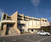
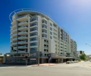
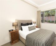
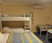
SAGE HOTEL WOLLONGONG F.K.A CHIFLEY
QUEST WOLLONGONG
BEST WESTERN CITY SANDS
Adina Wollongong
BELMORE ALL SUITE HOTEL
Novotel Wollongong Northbeach
Flinders Motel
Normandie Motel and Function Centre
Boat Harbour Motel
Beach Park Motel
Videos from this area
These are videos related to the place based on their proximity to this place.
Dyson Airblade V hand dryer at Wollongong Station
Quick demonstation of the Dyson Airblade V. Found in Wollongong station.
Segression The Thickening Live At The Grand Hotel Wollongong 16 5 2014
These videos are of Segression playing at the Grand Hotel Wollongong. these are from a band that i enjoy i hope you enjoy and share around. I HAVE PERMISSION TO HAVE THESE VIDEOS AND ...
Steam Loco 3265 Hunter leaving Wollongong after Cockatoo Run
Recently restored 32 class steam locomotive 3265 "Hunter" leaving Wollongong back to Sydney about 6pm on Sunday 4th October, 2009 after completing the Cockatoo Run to Moss Vale and back. The ...
Activate
The Activate project is a partnership between the Port Kembla Community Centre and Coomaditchie United Aboriginal Corporation to engage local residents in the protection, restoration and celebratio.
Scotty jaggerman Deez - I Take Drugs
Scotty 'jaggerman' Deez - I Take Drugs Recorded in 2005, NSW Australia. Video put together Feb. 2014 for more Scotty jaggerman Deez songs: https://soundcloud.com/scottyjaggermandeez.
Videos provided by Youtube are under the copyright of their owners.
Attractions and noteworthy things
Distances are based on the centre of the city/town and sightseeing location. This list contains brief abstracts about monuments, holiday activities, national parcs, museums, organisations and more from the area as well as interesting facts about the region itself. Where available, you'll find the corresponding homepage. Otherwise the related wikipedia article.
Wollongong
Wollongong is a seaside city located in the Illawarra region of New South Wales, Australia. Wollongong lies on the narrow coastal strip between the Illawarra Escarpment and the Pacific Ocean, 82 kilometres (51 mi) south of Sydney. Wollongong's Statistical District has a population of 292,190, making Wollongong the third largest city in New South Wales after Sydney and Newcastle, and the ninth largest city in Australia.
University of Wollongong
The University of Wollongong also simply known as UOW is a public university located in the coastal city of Wollongong, New South Wales, Australia, approximately 80 kilometres south of Sydney. As of 2012, the university had a total of 30,516 students enrolled, including 11,440 international students from more than 140 countries. The University of Wollongong marked the University's 60th Founding Anniversary in 2011.
MacCabe Park
MacCabe Park is a small park located in the City of Wollongong, Australia. It is commonly misspelt McCabe Park, though the sign has since been changed to its correct name. In 1855 a land grant was made to Governor Brown, the present site of the park. It contains a playground at the north east corner of the rectangular area covered by the park, the local youth centre is in the north west side, and a sculpture called "Nike" is found in this area amidst a garden area.
Nan Tien Temple
Nan Tien Temple is a Buddhist temple complex located in the industrial suburb of Berkeley, on the southern outskirts of the Australian city of Wollongong, approximately 80 km south of Sydney. Nan Tien is a Chinese term which means "southern paradise". Nan Tien is one of the branch temples of the Taiwanese Fo Guang Shan Buddhist order, founded in 1967 by Hsing Yun, which has over 120 branches worldwide. The temple is one of the largest Buddhist temples in the southern hemisphere.
Unanderra, New South Wales
Unanderra is a suburb of Wollongong in New South Wales, Australia. It is located approximately 10 km south-west of the Wollongong CBD. It is bordered to the west by Farmborough, Cordeaux Heights and Farmborough Heights in the Mount Kembla foothills, the north by Figtree, the east by Berkeley and Flagstaff Hill, site of the Nan Tien Temple, and the south by Kembla Grange. Unanderra is both a residential suburb, mostly to the west of the Princes Highway and industrial, to the east.
Wollongong Botanic Garden
The Wollongong Botanic Garden is located in the Wollongong suburb of Keiraville at the foot of Mount Keira in New South Wales, Australia. It is the local botanical gardens of the Illawarra and was opened in September 1970. http://www. hoskins. id. au/nextgen/showphoto. php?personID=2293I&tree=hoskinsfamily&ordernum=1 The garden is co-located with the historic Gleniffer Brae house, used for functions and the Wollongong Conservatorium of Music.
Unanderra railway station
Unanderra railway station is located on the South Coast (Illawarra) railway line in the Wollongong suburb of Unanderra, New South Wales, Australia. It is served by 'intercity' trains of CityRail's South Coast line. Opened in 1887, the station consists of an island platform with access via an overbridge across the rail tracks. The station marks the end of the double track section of the South Coast line, and the junction with the Unanderra-Moss Vale railway line is located to the south.
Wollongong railway station
Wollongong Station is a railway station on the South Coast Line of the CityRail outer suburban network, serving the central business district of the Illawarra region's major centre of Wollongong. The station consists of two side platforms for through trains with two non-electrified dock platforms for terminating services from the south.
Coniston railway station, New South Wales
Coniston is a CityRail railway station on the South Coast railway line. It serves the suburb of Coniston which is a suburb of Wollongong, at the western end of the Port Kembla industrial area. The station is the junction for the Port Kembla branch of the South Coast line. The station has two side platforms. The station is served by about one to two trains per hour for most of the time, with additional trains at weekday peak hours.
Lysaghts railway station
Lysaghts is a CityRail railway station on the Port Kembla branch of the South Coast railway line in Australia. It is a workers only station serving BlueScope Steel Springhill Works to the west and the Flat Products Area of Port Kembla Steelworks to the east. Access from the station to these properties is restricted to employees only by security gates. The station has two side platforms, connected by an overhead footbridge.
Cringila railway station
Cringila is a CityRail railway station on the Port Kembla branch of the South Coast railway line. It serves the Wollongong suburb of Cringila. The station has an island platform. The northern access from the platform provides access to BlueScope Steel Port Kembla Steelworks via a secured gate. The southern access is from Five Island Road. It is served by approximately one train per hour, usually a local service to Thirroul, but with extra direct trains to and from Sydney in the peak hours.
City of Wollongong
The City of Wollongong is a local government area in the Illawarra region of New South Wales, Australia. The area is situated adjacent to the Tasman Sea, the Southern Freeway and the South Coast railway line.
Coniston, New South Wales
Coniston is a suburb of Wollongong in New South Wales. Coniston has one public primary school, east of the railway, and its main street is Gladstone Avenue which is the business center of the suburb. The suburb has a beach, Coniston Beach, to the east of Wollongong Golf Course, and Coniston railway station is in the suburb's business centre. Coniston has a pub, Gilmore's Hotel Coniston which is a drinking establishment.
North Wollongong, New South Wales
North Wollongong is the immediate northern coastal suburb of Wollongong, New South Wales, Australia. North Wollongong is used to refer to the northern area of Wollongong as well as North Wollongong by locals, despite the official suburb not including the northern apartment areas of Wollongong and North Beach, known as North Wollongong.
Mount Nebo (New South Wales)
Mount Nebo is a tall hill, part of the Illawarra escarpment foothills on the edge of the suburban fringe of the city of Wollongong, New South Wales. Its summit (252 metres above sea level), is reached by a steep road (O'Brien's Road) from the suburb of Figtree. O'Brien's Road is unusual in that it was built as a private toll road in the early 19th century to connect Sydney and the Illawarra. O'Briens Road began at the locally famous fig tree that gave the name to Figtree.
The Illawarra Grammar School
The Illawarra Grammar School (TIGS) is an independent, Anglican, co-educational day school located at Mangerton in the Illawarra region of New South Wales, Australia. The school currently caters for about 1100 students from pre-preparatory school to Year 12.
Mangerton, New South Wales
Mangerton is an inner western suburb of the coastal city of Wollongong, New South Wales, Australia. Mount Mangerton is the name of the hill on which Mangerton resides mostly. The hill is part of the Mangerton hill mass which also incorporates Mount Saint Thomas, a lower peak, south of Mangerton, see Coniston. The suburb is mostly residential with the exception of a convenience store in its southwestern area and a couple of specialty stores beside it.
Cordeaux Heights, New South Wales
Cordeaux Heights is a suburb in the city of Wollongong, New South Wales, Australia. It is situated on the eastern foothills of Mount Kembla as is its southern neighbour Farmborough Heights. Its northern boundary of housing is along Cordeaux Road which goes to Mount Kembla Village. Cordeaux Heights has a few shops.
Figtree, New South Wales
Figtree is an inner western suburb of Wollongong, New South Wales, Australia. It is southwest of West Wollongong and connected to Wollongong by the Princes Highway and The Avenue. At the junction of the highway and The Avenue is Westfield Figtree, a two storey indoor shopping centre with a Woolworths, Coles and Kmart. The shopping centre was opened in 1965. The second story is used by a couple of businesses and a second storey to its carpark facilities.
West Wollongong, New South Wales
West Wollongong is the innermost western suburb of the coastal city of Wollongong, New South Wales, Australia. It is mainly a residential area, serviced by a small commercial strip with a music store, chicken shop, electric goods store and carpet store along the Princes Highway with several petrol stations, two restaurants, a liquor store, a chemist and a flower shop.
Westfield Figtree
Westfield Figtree is a major shopping centre, located in Figtree, a suburb of Wollongong, New South Wales, Australia.
John Crehan Park
John Crehan Park is a multi-use stadium in the southern part of Wollongong, Australia. The stadium is on Merret Avenue, Cringila. It is currently used mostly for football matches. It is the home of New South Wales Premier League side Wollongong FC and Illawarra Premier League side Cringila Lions. It was once the temporary home ground of the Rockdale Ilinden Football Club as their regular home ground was disrupted by near-by construction.
Drummond Battery
Drummond Battery was a counter bombardment battery at Port Kembla, New South Wales, Australia during World War II. Constructed in 1942 to provide protection for Port Kembla from enemy shipping and submarines. Two BL 9.2 inch Mk X gun emplacements with related underground facilities were constructed near Drummond, Wollongong.
Gwynneville, New South Wales
Gwynneville is an inner city suburb of Wollongong, New South Wales, Australia located approximately 2 km north west of the city centre. It was originally named Gwynne Ville after the Gwynne family who owned the property. It was sold it two large lots, both of which were subdivided. The first area, owned by Mr John Gwynne, consisted of 86 allotments, and went to auction on the 3rd of March 1886.
Figtree High School
Figtree High School is a comprehensive public high school located on Gibsons Road in Figtree, a suburb of Wollongong, New South Wales, Australia.


