Discover Lake Heights
The district Lake Heights of Wollongong in Wollongong (New South Wales) with it's 2,922 citizens Lake Heights is a district in Australia about 113 mi north-east of Canberra, the country's capital city.
Looking for a place to stay? we compiled a list of available hotels close to the map centre further down the page.
When in this area, you might want to pay a visit to some of the following locations: Parramatta, Sydney, Katoomba, Canberra and . To further explore this place, just scroll down and browse the available info.
Local weather forecast
Todays Local Weather Conditions & Forecast: 16°C / 62 °F
| Morning Temperature | 12°C / 54 °F |
| Evening Temperature | 15°C / 60 °F |
| Night Temperature | 15°C / 59 °F |
| Chance of rainfall | 0% |
| Air Humidity | 63% |
| Air Pressure | 1030 hPa |
| Wind Speed | Moderate breeze with 11 km/h (7 mph) from North |
| Cloud Conditions | Scattered clouds, covering 32% of sky |
| General Conditions | Light rain |
Thursday, 2nd of May 2024
17°C (63 °F)
14°C (57 °F)
Light rain, moderate breeze, scattered clouds.
Friday, 3rd of May 2024
17°C (63 °F)
13°C (55 °F)
Overcast clouds, moderate breeze.
Saturday, 4th of May 2024
18°C (64 °F)
14°C (57 °F)
Overcast clouds, moderate breeze.
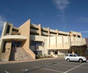
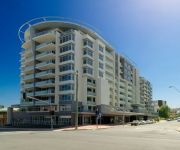
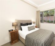
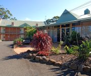
Hotels and Places to Stay
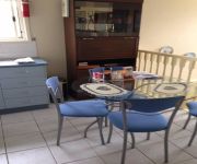
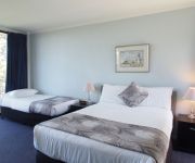
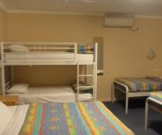
SAGE HOTEL WOLLONGONG F.K.A CHIFLEY
BEST WESTERN CITY SANDS
QUEST WOLLONGONG
Adina Wollongong
BELMORE ALL SUITE HOTEL
Novotel Wollongong Northbeach
Comfort Inn Fairways
Lake Illawarra Bed and Breakfast
Boat Harbour Motel
Flinders Motel
Videos from this area
These are videos related to the place based on their proximity to this place.
Finding the Flow - by Doug Prosser (a digital story from the Lake Illawarra MAP Project)
SYNOPSIS: Dougs passion for the Lake has taken him on a journey spanning many years and countless volunteer hours. SCRIPT: Someone once said Volunteering is not a choice, it's a responsibility.
Tugboat, Port Kembla Harbour, Port Kembla, N.S.W., Australia. 28th Sept 2013.
This film clip is of a Port Kembla tugboat on a gusty September day heading towards H.T.M.S. Krabi in preparation to leave Port Kembla harbour. 2013-09-27, 09:43 Arrival approx, Port Kembla,...
H.T.M.S. Krabi, Port Kembla Harbour, Port Kembla, N.S.W., Australia, 28th Sept 2013.
Port Kembla Harbour tugboats manoeuvering H.T.M.S. Krabi for departure from Port Kembla Harbour. 2013-09-27, 09:43 Arrival approx, Port Kembla, H.T.M.S. Krabi. 2013-09-28, 15:30 Depart approx,.
H.T.M.S. Krabi, Port Kembla Harbour, Port Kembla, N.S.W., Australia. 28th Sept 2013.
Tugboats getting H.T.M.S. Krabi, ready for departure from Port Kembla Harbour. 2013-09-27, 09:43 Arrival approx, Port Kembla, H.T.M.S. Krabi. 2013-09-28, 15:30 Depart approx, Port Kembla,...
H.T.M.S. Krabi, Port Kembla Harbour, Port Kembla, N.S.W., Australia. 28th Sept 2013.
This film clip is of H.T.M.S. Krabi in Port Kembla Harbour about 40 minutes before departure. 2013-09-27, 09:43 Arrival approx, Port Kembla, H.T.M.S. Krabi. 2013-09-28, 15:30 Depart approx,...
Hill 60, Port Kembla, N.S.W., Australia. 20th October 2013.
This film clip was taken approx 7:00am, Hill 60, Port Kembla, N.S.W., Australia. Due to bushfires burning near the Southern Highlands, smoke, haze, the smell of burning and a bright orange...
Orchid Ace departs Port Kembla
The pure car and truck carrier Orchid Ace makes a night departure from Port Kembla Harbour in NSW on May 14, 2009. It has the capacity to carry 6400 units of standard passenger cars.
Hill 60, Port Kembla, N.S.W., Australia. 20th October 2013.
This video clip was taken approx. 7:00am, Hill 60, Port Kembla, N.S.W., Australia. Due to bushfires burning near the Southern Highlands, smoke, haze, the smell of burning and a bright orange...
Focas se divertindo (Seals playing) Port Kembla - Australia
2 focas pescando e se divertindo na entrada do porto em Port Kembla - Wollongong, Austrália. Feito por MESKKLITO em 24/08/2008.
Videos provided by Youtube are under the copyright of their owners.
Attractions and noteworthy things
Distances are based on the centre of the city/town and sightseeing location. This list contains brief abstracts about monuments, holiday activities, national parcs, museums, organisations and more from the area as well as interesting facts about the region itself. Where available, you'll find the corresponding homepage. Otherwise the related wikipedia article.
Lake Illawarra
Lake Illawarra is a large coastal lagoon located in the city of Wollongong about 100 km south of Sydney, New South Wales. The lake receives runoff from the Illawarra escarpment through Macquarie Rivulet and Mullet Creek, and has a narrow tidal entrance to the sea at Windang. It is shallow with an average depth of two to three metres. The reason is shallow is because of infilling by sand which has been eroded from the surrounding catchments.
Illawarra
Illawarra 270pxLake Illawarra - Heart of the Region Population: 456,724(2011) Coordinates: coord}}{{#coordinates:34.5|S|150.9|E|type:adm2nd_region:AU-NSW primary name= }} LGA: Wollongong City, Shellharbour City, Kiama Municipality, Shoalhaven City State/territory electorate(s): Wollongong, Kiera, Shellharbour, Heathcote, Kiama Federal Division(s): Cunningham, Throsby, Gilmore Localities around Illawarra: Macarthur Southern Sydney Southern Highlands Illawarra Pacific Ocean South Coast Illawarra is a region in the Australian state of New South Wales.
Port Kembla, New South Wales
Port Kembla is a suburb of Wollongong 8 km south of the CBD and part of the Illawarra region of New South Wales. The suburb comprises a seaport, industrial complex (one of the largest in Australia), a small harbour foreshore nature reserve, and a small commercial sector. It is situated on the tip of Red Point, first sighted by Captain James Cook in 1770. The name "Kembla" is Aboriginal word meaning "plenty wildfowl".
Nan Tien Temple
Nan Tien Temple is a Buddhist temple complex located in the industrial suburb of Berkeley, on the southern outskirts of the Australian city of Wollongong, approximately 80 km south of Sydney. Nan Tien is a Chinese term which means "southern paradise". Nan Tien is one of the branch temples of the Taiwanese Fo Guang Shan Buddhist order, founded in 1967 by Hsing Yun, which has over 120 branches worldwide. The temple is one of the largest Buddhist temples in the southern hemisphere.
Unanderra, New South Wales
Unanderra is a suburb of Wollongong in New South Wales, Australia. It is located approximately 10 km south-west of the Wollongong CBD. It is bordered to the west by Farmborough, Cordeaux Heights and Farmborough Heights in the Mount Kembla foothills, the north by Figtree, the east by Berkeley and Flagstaff Hill, site of the Nan Tien Temple, and the south by Kembla Grange. Unanderra is both a residential suburb, mostly to the west of the Princes Highway and industrial, to the east.
Windang, New South Wales
Windang is a suburb of Wollongong in New South Wales on the southern tip of the peninsula guarding the ocean entrance to Lake Illawarra. Windang is popular for its fishing, prawning, boating, windsurfing and yachting. Windang is about 103 km south of Sydney, approximately 20 minutes drive south of the Wollongong CBD and about seven minutes from Shellharbour city. Windang has a carnival which comes every year near Lake Illawarra.
Unanderra railway station
Unanderra railway station is located on the South Coast (Illawarra) railway line in the Wollongong suburb of Unanderra, New South Wales, Australia. It is served by 'intercity' trains of CityRail's South Coast line. Opened in 1887, the station consists of an island platform with access via an overbridge across the rail tracks. The station marks the end of the double track section of the South Coast line, and the junction with the Unanderra-Moss Vale railway line is located to the south.
Coniston railway station, New South Wales
Coniston is a CityRail railway station on the South Coast railway line. It serves the suburb of Coniston which is a suburb of Wollongong, at the western end of the Port Kembla industrial area. The station is the junction for the Port Kembla branch of the South Coast line. The station has two side platforms. The station is served by about one to two trains per hour for most of the time, with additional trains at weekday peak hours.
Lysaghts railway station
Lysaghts is a CityRail railway station on the Port Kembla branch of the South Coast railway line in Australia. It is a workers only station serving BlueScope Steel Springhill Works to the west and the Flat Products Area of Port Kembla Steelworks to the east. Access from the station to these properties is restricted to employees only by security gates. The station has two side platforms, connected by an overhead footbridge.
Cringila railway station
Cringila is a CityRail railway station on the Port Kembla branch of the South Coast railway line. It serves the Wollongong suburb of Cringila. The station has an island platform. The northern access from the platform provides access to BlueScope Steel Port Kembla Steelworks via a secured gate. The southern access is from Five Island Road. It is served by approximately one train per hour, usually a local service to Thirroul, but with extra direct trains to and from Sydney in the peak hours.
Port Kembla North railway station
Port Kembla North is a CityRail railway station on the Port Kembla branch of the South Coast railway line. It serves the industrial area of the suburb of Port Kembla to the south-east of Wollongong. The northern access is connected to the BlueScope Steel Steelworks close to the coke ovens. The station has a single platform on a single line. It is served by approximately one train per hour, usually a local service to Thirroul, but with extra direct trains to and from Sydney in the peak hours.
Port Kembla railway station
Port Kembla is a CityRail railway station on the Port Kembla branch of the South Coast railway line. It is the terminus of the branch line, and serves the residential area of the suburb of the same name. The station has one side platform, used for terminating trains. It is served by approximately one train per hour, usually a local service to Thirroul, but extra direct trains to and from Sydney are provided in the peak hours.
Red Point (Port Kembla)
Red Point is a coastal headland at Port Kembla in New South Wales, Australia. Martin Islet lies just off the point. The point was named by Captain Cook when he passed there on 25 April 1770 (ship's date), for "some part of the Land about it appeared of that Colour".
Warrawong, New South Wales
Warrawong is a suburb of Wollongong, in the Illawarra region of New South Wales, Australia. It is situated on the northeast corner of Lake Illawarra. Warrawong is home to Westfield Warrawong, one of three major regional shopping centres. Other facilities include the Port Kembla Hospital, Hoyts cinemas and the Gala cinemas.
Cringila, New South Wales
Cringila is a densely populated southern suburb in the city of Wollongong, New South Wales, Australia, about 4 km along Springhill Road. The suburb is bounded by Berkeley, Unanderra, Lake Heights and Warrawong. The suburb is planned on a north-south residential/commercial strip and the east west streets that adjoin it, making a rectangular pattern. From the hilltops fine views of Lake Illawarra to the south and Port Kembla steelworks and industries to the north are had.
Westfield Warrawong
Westfield Warrawong is a major shopping centre located in Warrawong, a suburb of Wollongong. With a retail floor area of 57,582 m, it is currently the largest shopping centre in the Illawarra region.
John Crehan Park
John Crehan Park is a multi-use stadium in the southern part of Wollongong, Australia. The stadium is on Merret Avenue, Cringila. It is currently used mostly for football matches. It is the home of New South Wales Premier League side Wollongong FC and Illawarra Premier League side Cringila Lions. It was once the temporary home ground of the Rockdale Ilinden Football Club as their regular home ground was disrupted by near-by construction.
Illowra Battery
Illowra Battery was an Australian Army coastal battery at Port Kembla, New South Wales, Australia during World War II. It was also known as Hill 60 Battery.
Breakwater Battery
Breakwater Battery, was a coastal defence battery at Port Kembla, New South Wales, Australia during World War II. Constructed in 1939 to provide protection for Port Kembla from enemy shipping and submarines. Two 6 inch Mk XI gun emplacements with related underground facilities were constructed near the southern breakwater at Port Kembla. The battery and observation post (now a military museum) were key structures of the command centre for Fortress Kembla during World War II.
Drummond Battery
Drummond Battery was a counter bombardment battery at Port Kembla, New South Wales, Australia during World War II. Constructed in 1942 to provide protection for Port Kembla from enemy shipping and submarines. Two BL 9.2 inch Mk X gun emplacements with related underground facilities were constructed near Drummond, Wollongong.
Kemblawarra, New South Wales
Kemblawarra is a residential, commercial and light industrial area of Wollongong, New South Wales, Australia. It is officially designated an urban place, and comprises the southern part of Port Kembla.
Primbee, New South Wales
Primbee is a small suburb of Wollongong, New South Wales, Australia. It is located on the northern spit separating Lake Illawarra and the Pacific Ocean. Primbee is close to Windang and Warrawong in the Illawarra.
Berkeley, New South Wales
Berkeley is a suburb of Wollongong, New South Wales. The suburb is located in Wollongong's southern suburbs, on the northern shore of Lake Illawarra. Historically a farming community situated between the hills and Lake Illawarra, Berkeley became one of the Illawarra's solutions to a public housing shortage in the early years. Subsequently several public housing developments commenced and most of these are still in existence today in certain parts of the suburb.
Australian steamer Adele
Adele was a steel screw steamer that was built in 1906 as a yacht. She was twice commissioned into the Royal Australian Navy (RAN), firstly as HMAS Franklin and later as HMAS Adele. She was wrecked at Port Kembla, New South Wales on 7 May 1943.
Lake Heights, New South Wales
Lake Heights is a coastal suburb east of Berkeley in the Wollongong LGA.


