Delve into Coniston
The district Coniston of in Wollongong (New South Wales) with it's 1,881 habitants Coniston is a subburb in Australia about 115 mi north-east of Canberra, the country's capital town.
If you need a hotel, we compiled a list of available hotels close to the map centre further down the page.
While being here, you might want to pay a visit to some of the following locations: Parramatta, Sydney, Katoomba, Canberra and . To further explore this place, just scroll down and browse the available info.
Local weather forecast
Todays Local Weather Conditions & Forecast: 16°C / 62 °F
| Morning Temperature | 13°C / 56 °F |
| Evening Temperature | 15°C / 59 °F |
| Night Temperature | 15°C / 59 °F |
| Chance of rainfall | 1% |
| Air Humidity | 62% |
| Air Pressure | 1030 hPa |
| Wind Speed | Moderate breeze with 12 km/h (7 mph) from North |
| Cloud Conditions | Clear sky, covering 4% of sky |
| General Conditions | Light rain |
Thursday, 2nd of May 2024
15°C (59 °F)
15°C (58 °F)
Light rain, moderate breeze, overcast clouds.
Friday, 3rd of May 2024
17°C (62 °F)
15°C (59 °F)
Light rain, moderate breeze, scattered clouds.
Saturday, 4th of May 2024
17°C (62 °F)
16°C (60 °F)
Moderate rain, moderate breeze, overcast clouds.
Hotels and Places to Stay
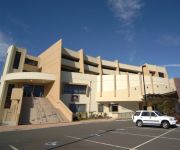
SAGE HOTEL WOLLONGONG F.K.A CHIFLEY
BEST WESTERN CITY SANDS
QUEST WOLLONGONG
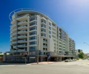
Adina Wollongong
BELMORE ALL SUITE HOTEL
Novotel Wollongong Northbeach
Boat Harbour Motel
Flinders Motel
Normandie Motel and Function Centre
Beach Park Motel
Videos from this area
These are videos related to the place based on their proximity to this place.
Wollongong virtual 3D city model - aero3Dpro
http://aero3dpro.com.au Large scale virtual 3D city model of Wollongong, NSW, Australia generated using aerial photogrammetry techniques.
Wollongong, New South Wales, Australia
Wollongong is a city in the Illawarra region of New South Wales. Heading south, Wollongong starts where Sydney finishes. It is the third largest city in the state behind Sydney and Newcastle...
My Skydive the beach, Wollongong, tandem jump 22/2/2015
For my 40th birthday I got a tandem skydive over Wollongong woooo hoooo!!!!
Dyson Airblade V hand dryer at Wollongong Station
Quick demonstation of the Dyson Airblade V. Found in Wollongong station.
me skydiving over the beach Wollongong for my 14th birthday
me skydiving over the beach Wollongong for my 14th birthday it was so much fun!!!!!!!!!!!!
Wollongong Sunrise Timelapse
I was playing with a D7000 shooting frames using triggertrap on my phone. This is the result.
Figtree Physie - Wollongong ColorRun 2014
Our Open Senior dance class entered a team into the 2014 Wollongong ColourRun and used to opportunity to raise funds for the NSW Cancer Council. We raised over $2700... and had a blast ...
Plumbers Wollongong | 02 8607 8588 Call Now! Best Priced Plumber in Wollongong!
Best Priced Plumbers in Wollongong! Call 02 8607 8588 Fully Qualified 24/7 SERVICE! We look forward to hearing from you and helping with any plumbing problems that you may have anytime! Need.
PBR Wollongong Invitational - 2012
Highlights from the Professional Bull Riding (PBR) Wollongong Invitational. 10th. November 2012 WIN Entertainment Centre, Wollongong, Australia.
Videos provided by Youtube are under the copyright of their owners.
Attractions and noteworthy things
Distances are based on the centre of the city/town and sightseeing location. This list contains brief abstracts about monuments, holiday activities, national parcs, museums, organisations and more from the area as well as interesting facts about the region itself. Where available, you'll find the corresponding homepage. Otherwise the related wikipedia article.
Wollongong
Wollongong is a seaside city located in the Illawarra region of New South Wales, Australia. Wollongong lies on the narrow coastal strip between the Illawarra Escarpment and the Pacific Ocean, 82 kilometres (51 mi) south of Sydney. Wollongong's Statistical District has a population of 292,190, making Wollongong the third largest city in New South Wales after Sydney and Newcastle, and the ninth largest city in Australia.
Port Kembla, New South Wales
Port Kembla is a suburb of Wollongong 8 km south of the CBD and part of the Illawarra region of New South Wales. The suburb comprises a seaport, industrial complex (one of the largest in Australia), a small harbour foreshore nature reserve, and a small commercial sector. It is situated on the tip of Red Point, first sighted by Captain James Cook in 1770. The name "Kembla" is Aboriginal word meaning "plenty wildfowl".
MacCabe Park
MacCabe Park is a small park located in the City of Wollongong, Australia. It is commonly misspelt McCabe Park, though the sign has since been changed to its correct name. In 1855 a land grant was made to Governor Brown, the present site of the park. It contains a playground at the north east corner of the rectangular area covered by the park, the local youth centre is in the north west side, and a sculpture called "Nike" is found in this area amidst a garden area.
Wollongong railway station
Wollongong Station is a railway station on the South Coast Line of the CityRail outer suburban network, serving the central business district of the Illawarra region's major centre of Wollongong. The station consists of two side platforms for through trains with two non-electrified dock platforms for terminating services from the south.
Wollongong Showground
Wollongong Showground is a rectangular multi-purpose stadium located in the city of Wollongong, New South Wales, Australia. The stadium was officially opened in 1911. From 1982 until 1998 it played host to every home match for the Illawarra Steelers NRL team. It is now used as one home ground of the St George Illawarra Dragons rugby league side.
Coniston railway station, New South Wales
Coniston is a CityRail railway station on the South Coast railway line. It serves the suburb of Coniston which is a suburb of Wollongong, at the western end of the Port Kembla industrial area. The station is the junction for the Port Kembla branch of the South Coast line. The station has two side platforms. The station is served by about one to two trains per hour for most of the time, with additional trains at weekday peak hours.
Lysaghts railway station
Lysaghts is a CityRail railway station on the Port Kembla branch of the South Coast railway line in Australia. It is a workers only station serving BlueScope Steel Springhill Works to the west and the Flat Products Area of Port Kembla Steelworks to the east. Access from the station to these properties is restricted to employees only by security gates. The station has two side platforms, connected by an overhead footbridge.
Cringila railway station
Cringila is a CityRail railway station on the Port Kembla branch of the South Coast railway line. It serves the Wollongong suburb of Cringila. The station has an island platform. The northern access from the platform provides access to BlueScope Steel Port Kembla Steelworks via a secured gate. The southern access is from Five Island Road. It is served by approximately one train per hour, usually a local service to Thirroul, but with extra direct trains to and from Sydney in the peak hours.
Port Kembla North railway station
Port Kembla North is a CityRail railway station on the Port Kembla branch of the South Coast railway line. It serves the industrial area of the suburb of Port Kembla to the south-east of Wollongong. The northern access is connected to the BlueScope Steel Steelworks close to the coke ovens. The station has a single platform on a single line. It is served by approximately one train per hour, usually a local service to Thirroul, but with extra direct trains to and from Sydney in the peak hours.
Port Kembla railway station
Port Kembla is a CityRail railway station on the Port Kembla branch of the South Coast railway line. It is the terminus of the branch line, and serves the residential area of the suburb of the same name. The station has one side platform, used for terminating trains. It is served by approximately one train per hour, usually a local service to Thirroul, but extra direct trains to and from Sydney are provided in the peak hours.
City of Wollongong
The City of Wollongong is a local government area in the Illawarra region of New South Wales, Australia. The area is situated adjacent to the Tasman Sea, the Southern Freeway and the South Coast railway line.
Coniston, New South Wales
Coniston is a suburb of Wollongong in New South Wales. Coniston has one public primary school, east of the railway, and its main street is Gladstone Avenue which is the business center of the suburb. The suburb has a beach, Coniston Beach, to the east of Wollongong Golf Course, and Coniston railway station is in the suburb's business centre. Coniston has a pub, Gilmore's Hotel Coniston which is a drinking establishment.
Wollongong Central
Wollongong Central is a major shopping centre in the Illawarra region, located in the CBD of Wollongong, New South Wales approximately 90 kilometres south of Sydney. It is operated and managed by Australian property investment company, General Property Trust (GPT). It is of local importance and is used by much of the Illawarra community as a social and shopping centre. It is situated in the western half of the Crown Street Mall.
North Wollongong, New South Wales
North Wollongong is the immediate northern coastal suburb of Wollongong, New South Wales, Australia. North Wollongong is used to refer to the northern area of Wollongong as well as North Wollongong by locals, despite the official suburb not including the northern apartment areas of Wollongong and North Beach, known as North Wollongong.
The Illawarra Grammar School
The Illawarra Grammar School (TIGS) is an independent, Anglican, co-educational day school located at Mangerton in the Illawarra region of New South Wales, Australia. The school currently caters for about 1100 students from pre-preparatory school to Year 12.
WIN Entertainment Centre
WIN Entertainment Centre (formally Wollongong Entertainment Centre and commonly WEC) is a multi-purpose indoor arena, located in downtown Wollongong, New South Wales, Australia. The WEC opened on 5 September 1998 with a concert by Bob Dylan and Patti Smith; 4,935 people attended the event. Dylan performed at the venue again in 2011 performing to a crowd of 3,214 people.
Cringila, New South Wales
Cringila is a densely populated southern suburb in the city of Wollongong, New South Wales, Australia, about 4 km along Springhill Road. The suburb is bounded by Berkeley, Unanderra, Lake Heights and Warrawong. The suburb is planned on a north-south residential/commercial strip and the east west streets that adjoin it, making a rectangular pattern. From the hilltops fine views of Lake Illawarra to the south and Port Kembla steelworks and industries to the north are had.
Roman Catholic Diocese of Wollongong
The Roman Catholic Diocese of Wollongong is a suffragan Latin rite diocese of the Archdiocese of Sydney, established in 1951, covering the Illawarra and Southern Highlands regions of New South Wales, Australia. St Francis Xavier's Cathedral, Wollongong is the seat of the Roman Catholic Bishop of Wollongong, currently the Most Reverend Peter Ingham.
Mangerton, New South Wales
Mangerton is an inner western suburb of the coastal city of Wollongong, New South Wales, Australia. Mount Mangerton is the name of the hill on which Mangerton resides mostly. The hill is part of the Mangerton hill mass which also incorporates Mount Saint Thomas, a lower peak, south of Mangerton, see Coniston. The suburb is mostly residential with the exception of a convenience store in its southwestern area and a couple of specialty stores beside it.
Westfield Figtree
Westfield Figtree is a major shopping centre, located in Figtree, a suburb of Wollongong, New South Wales, Australia.
John Crehan Park
John Crehan Park is a multi-use stadium in the southern part of Wollongong, Australia. The stadium is on Merret Avenue, Cringila. It is currently used mostly for football matches. It is the home of New South Wales Premier League side Wollongong FC and Illawarra Premier League side Cringila Lions. It was once the temporary home ground of the Rockdale Ilinden Football Club as their regular home ground was disrupted by near-by construction.
Drummond Battery
Drummond Battery was a counter bombardment battery at Port Kembla, New South Wales, Australia during World War II. Constructed in 1942 to provide protection for Port Kembla from enemy shipping and submarines. Two BL 9.2 inch Mk X gun emplacements with related underground facilities were constructed near Drummond, Wollongong.
Gwynneville, New South Wales
Gwynneville is an inner city suburb of Wollongong, New South Wales, Australia located approximately 2 km north west of the city centre. It was originally named Gwynne Ville after the Gwynne family who owned the property. It was sold it two large lots, both of which were subdivided. The first area, owned by Mr John Gwynne, consisted of 86 allotments, and went to auction on the 3rd of March 1886.
Figtree High School
Figtree High School is a comprehensive public high school located on Gibsons Road in Figtree, a suburb of Wollongong, New South Wales, Australia.
St Francis Xavier's Cathedral, Wollongong
The Cathedral Saint Francis Xavier, Wollongong, New South Wales, Australia, is the seat of the Roman Catholic Bishop of the Diocese of Wollongong, presently the Most Reverend Peter Ingham. The Cathedral is the oldest church of any denomination in the Illawarra region.


